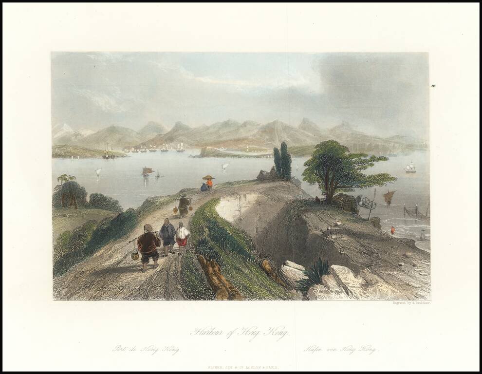
This is an attractive antique view of Hong Kong harbour, drawn by an Englishman in the first half of the 19th century. The view shows the harbour in the distance, framed by tall mountains. In the foreground, merchants and peasants dressed in...
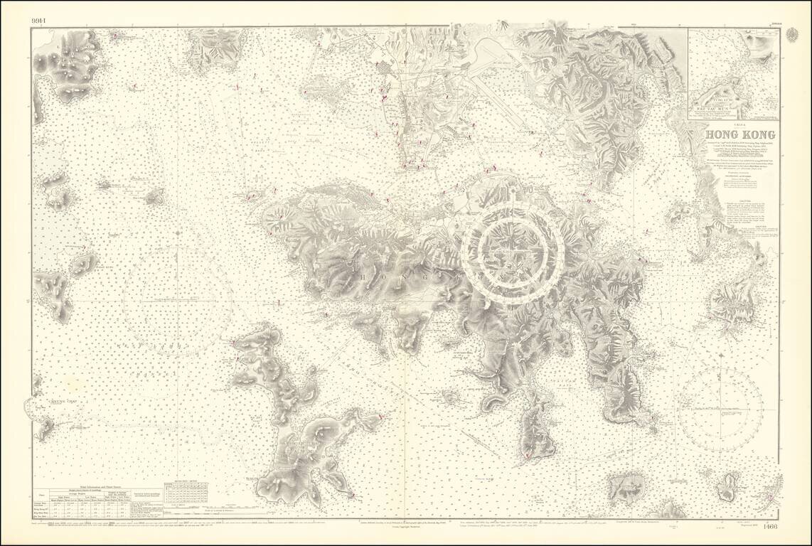
An Exceptional Post-World War II Chart of Hong Kong and Environs -- The First British survey of Hong Kong Harbor, updated to 1953 / 1964 Remarkably detailed British Admiralty Sea Chart of Hong Kong, first published in 1843, based upon the surveys of...
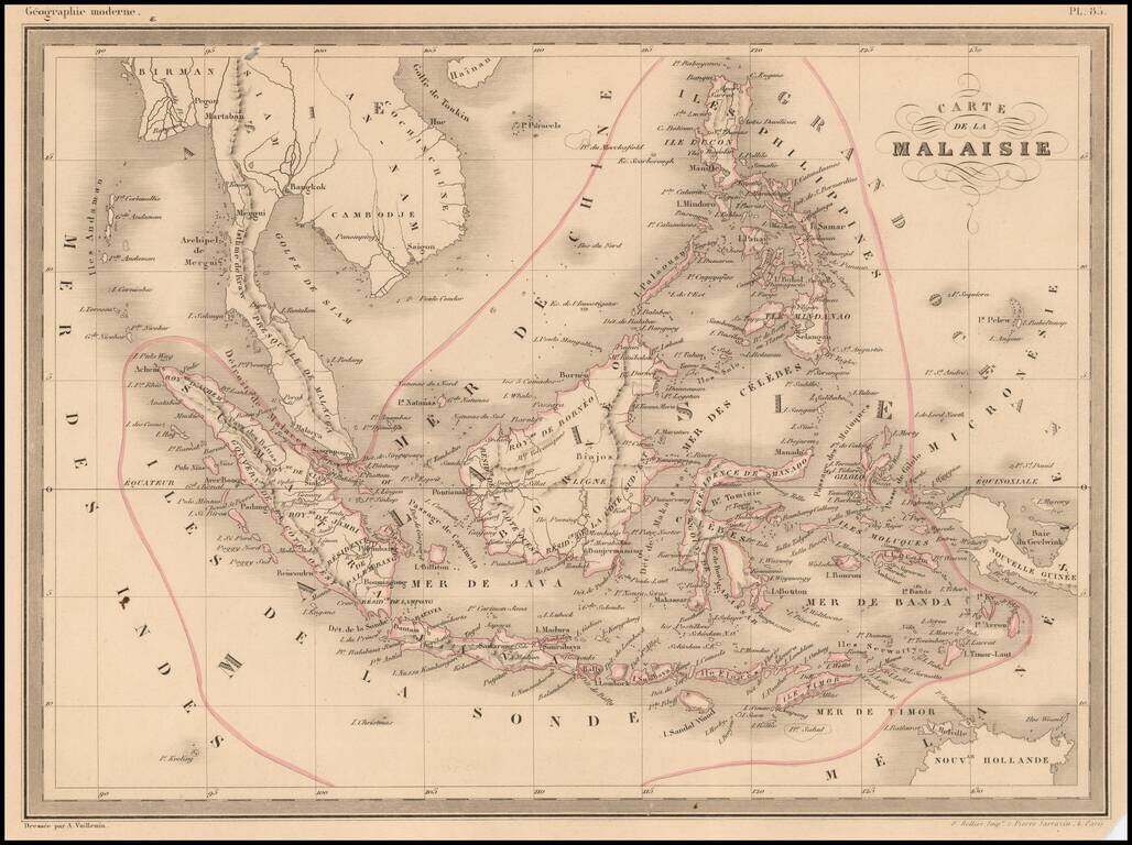
Fine lithographed map of South East Asia by A Vuillemin. Includes Malaysia, the Philippines, Indonesia, Singapore and Java.
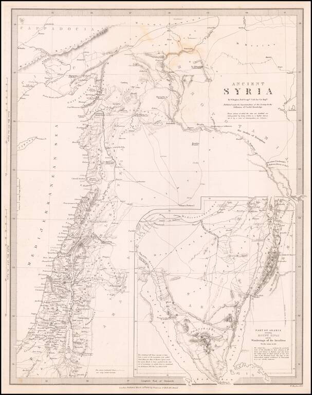
![[Ottoman Province of Syria] Map of Syria Ancient and Modern . . . 1843](/map/small/68463.jpg)
The Ottoman Province of Syria Scarce separately published map of Syria, published in London by John Wyld. Published at a time when the region was under the control of the Ottoman Empire, "Modern and Ancient" Syria extends to the modern regions of...
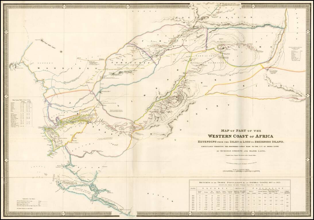
Rare separately issued map of a part of West Africa, showing Sierra Leone and the Southwestern Part of Guinea, published in London by James Wyld. Wyld's map presents one of the most detailed treatments of the country of Sierra Leon to appear on a...
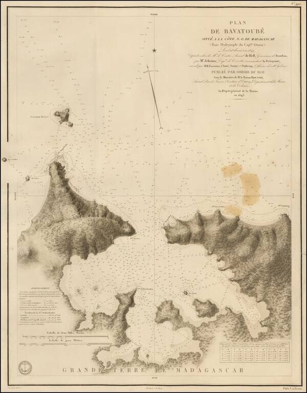
Rare French sea chart of Bavatoube (also known as Dalrymple Bay) on the northeast coastline of Madagascar. The Bay is about 20 miles east of Nosy Iranja and 40 miles west of Noy Ambariovato and Hell-Ville.
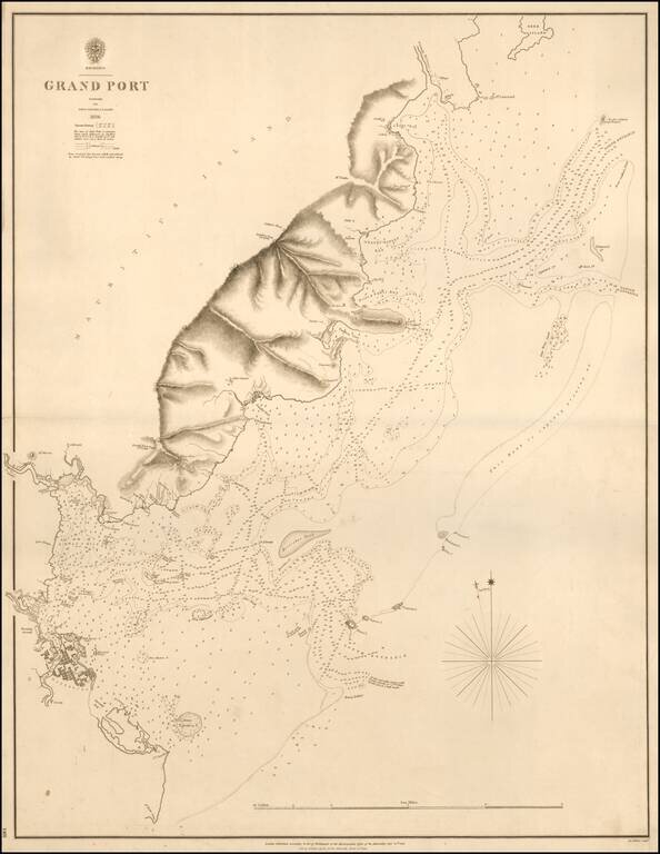
A Rare Chart of Mauritius by its Surveyor General Rare separately published sea chart of Grand Port, Mauritius, published in 1843 by the British Admiralty. The map is based upon the surveys led by John Augustus Lloyd in 1836. The map is centered on...
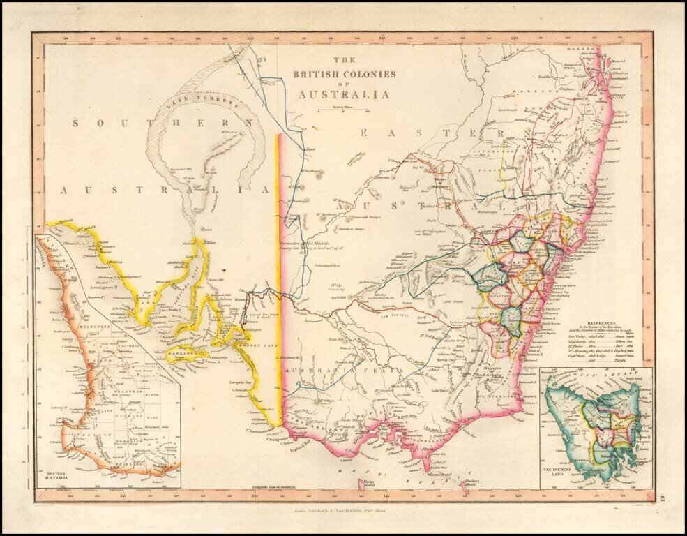
With a Massive Inland Lake Torrens Fine map of Southeastern Australia, illustrrating the British Colonies on the Continent. The map shows the region shortly before the discovey of gold would create a massive rush of fortunate seekers into the...
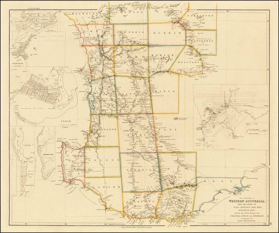
Early state of John Arrowsmith's map of Western Australia. The map shows the Colony of Western Australia, along inset maps of Perth, Guildford, Freemantle, Augusta and Kelmscott. The map was printed from 1839 until 1863 in eight states, tracking the...
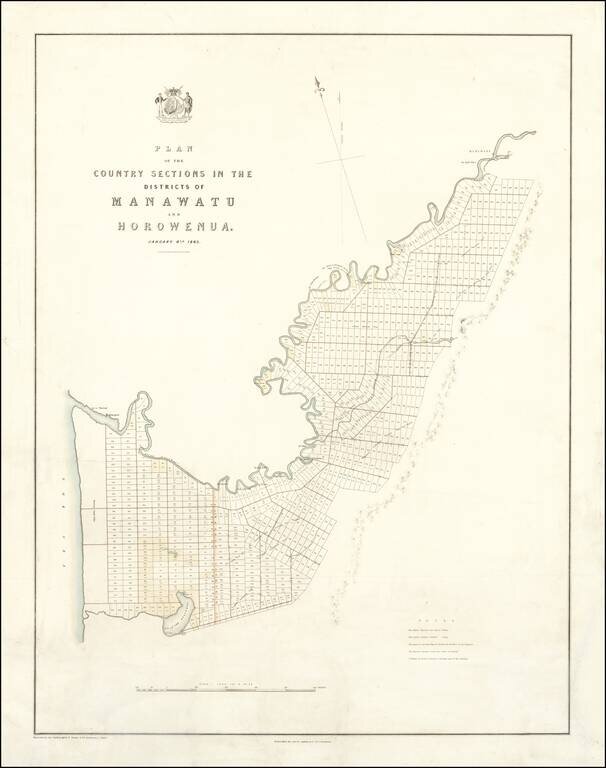
Promoting Emigration and Selling Land on the North Island -- Made for the New Zealand Company Fine, rare map of the Manawatu and Horowhenua Districts in the Manawatū-Whanganui region of the North Island, published for the New Zealand Company, one of...