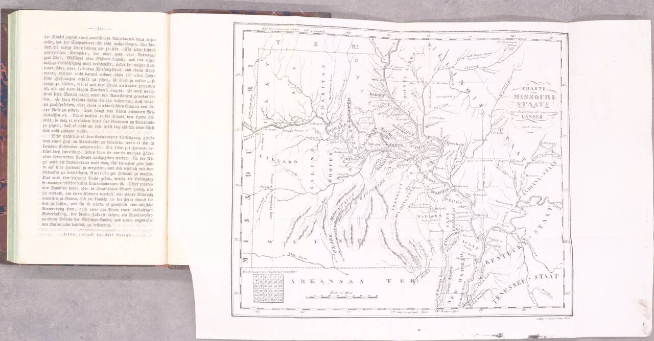
The Beginning of German Immigration to Missouri. Second and best edition. Gottfried Duden was among the first German immigrants to Missouri, having traveled there in 1824. He established a farm in the Missouri River valley between St. Louis and...
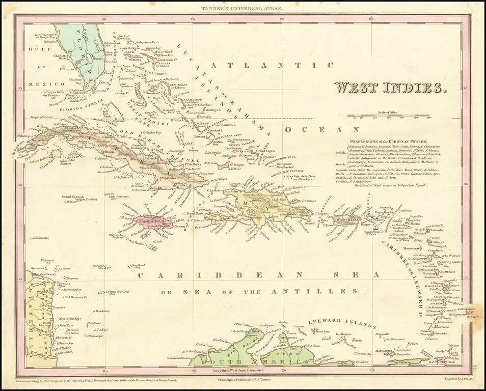
Detailed and attractive map of the southern portion of Florida and the Caribbean from the first edition of Tanner's Universal Atlas. The map shows the various European Powers possessions, including Spanish, British, French, Dutch, Danish and Swedish,...
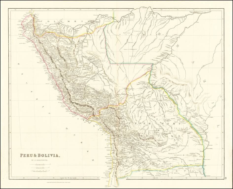
A marvelous highly detailed map of Peru and Bolivia, colored by regions. Arrowsmith's map is perhaps the single most detailed atlas map of the period.
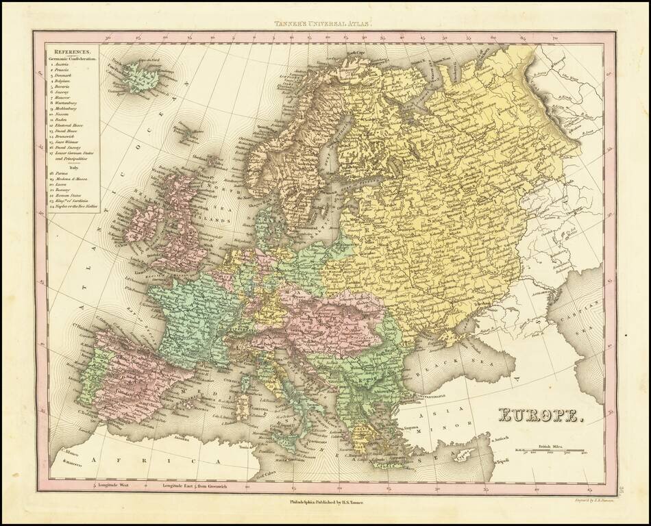
Detailed map of Europe colored by countries. Large key shows the various parts of the Germanic Confederation and Italy. This map is from an early edition of Tanner's New Universal Atlas, first issued in 1834. The Atlas would become the most popular...
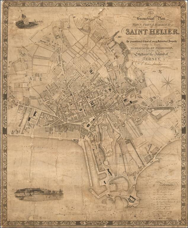
The First Large Scale Map of Saint Helier. Rare early map of Saint Helier on Jersey, the largest of the Channel Islands in the English Channel. The map was engraved by C. Coble of 6 Church Terrace, St Pancras, 13 Paternoster Row, London. The map...
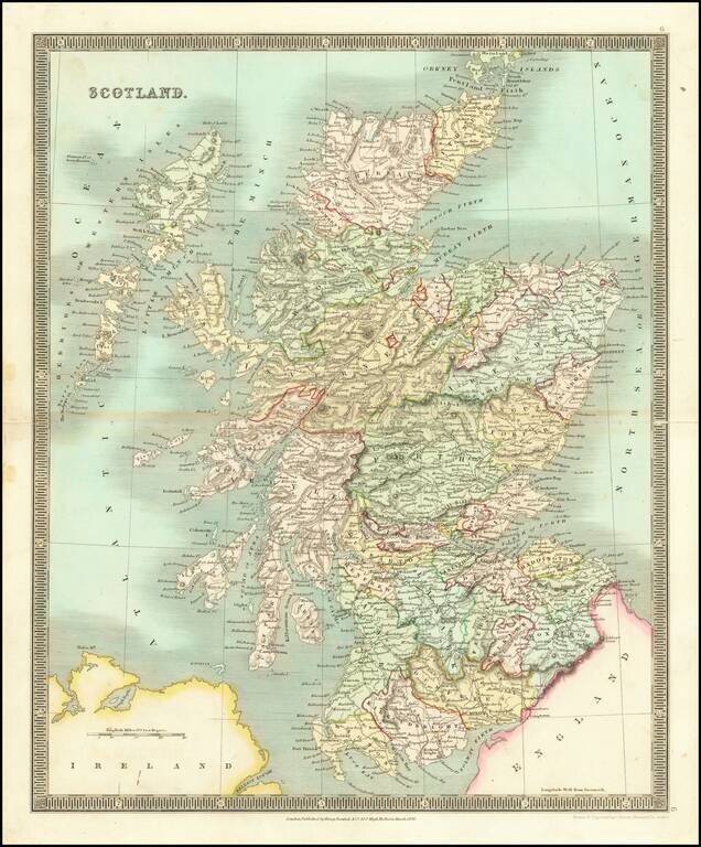
Striking early map of Scotland, published by Henry Teesdale. The map is colored by counties, and shows towns, roads, mountains, rivers and other details.
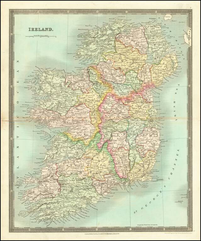
Striking early map of Ireland, published by Henry Teesdale. The map is colored by counties, and shows towns, roads, mountains, rivers and other details.
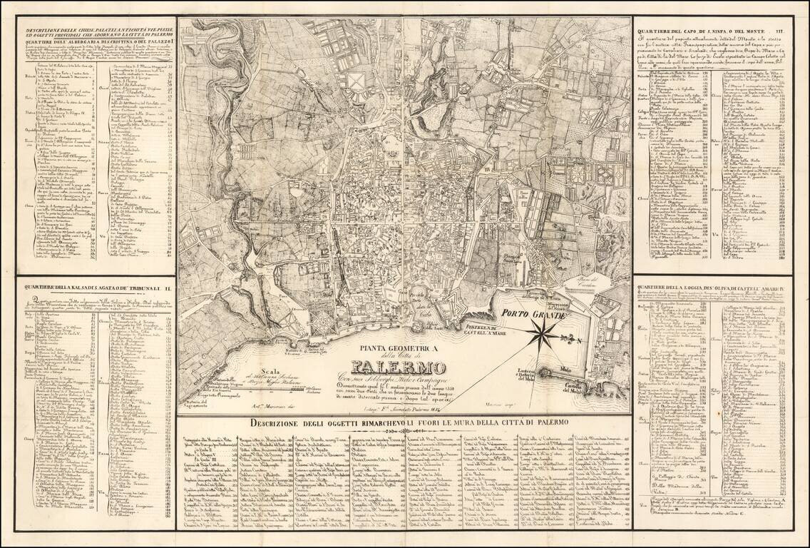
Detailed Map of Palermo, published in Palermo Large map of the city of Palermo and its surroundings, designed by A. Musucemi, lithographed by F. Sconduto in Palermo in 1838 and printed by Mercurio. The map is accompanied by a table of references of...
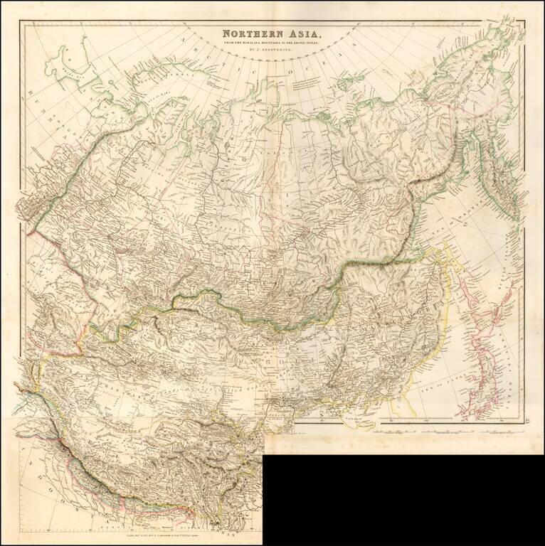
Striking example of Arrowsmith's rare map the region North of the Himalayas. A highly detailed map of Northern Asia, taking in Mongolia, Tibet, Bhutan, Tartary, Siberia and Manchuria. Part of Japan engraved also. The map provides a highly detailed...
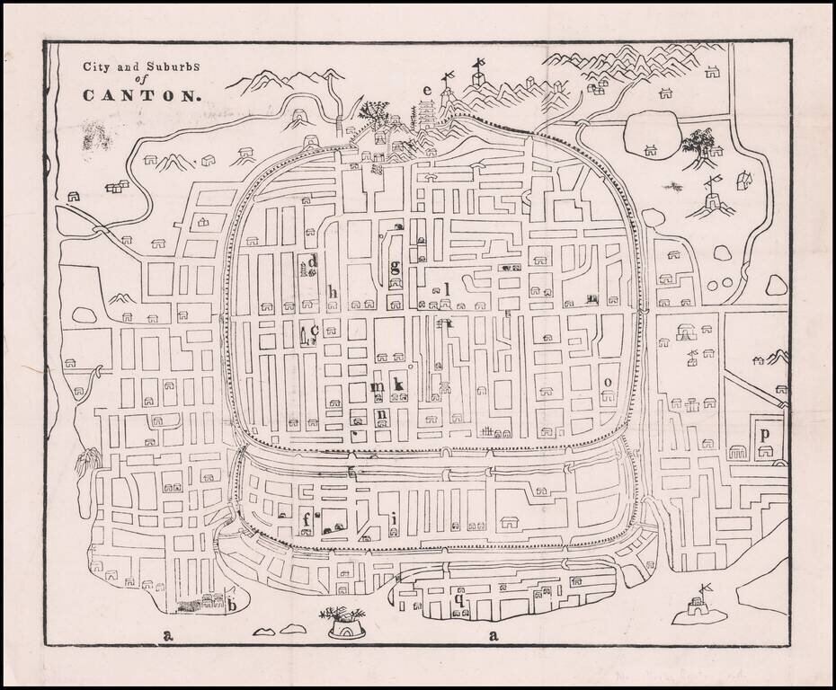
Early Missionary Map of Canton (Guangzhou), Published in Canton in the First Major Journal of Sinology Fine woodblock map of Canton showing the city’s street plan, waterways, and important buildings and sites. The plan was based on a Chinese map and...
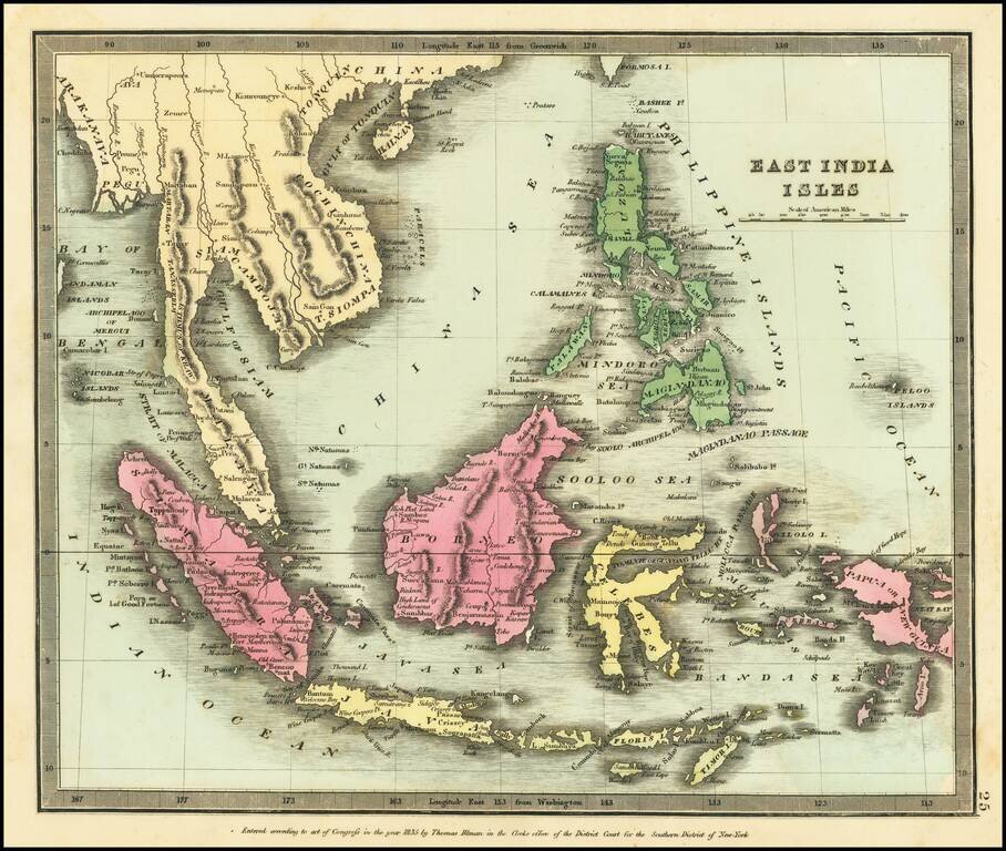
Nice wash color example of David Burr's map of Southeast Asia and the Philippines Burr's Atlas was perhaps the most elegant American commercially published atlas of its time, utilizing wonderful wash colors and elegant engraving style. Burr studied...
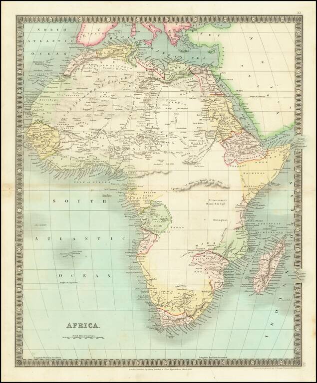
Scarce map of the African Continent, published by Teesdale in London. The map shows a knowledge of the coastal regions and some interior knowledge, but most of the interior is still largely unexplored.
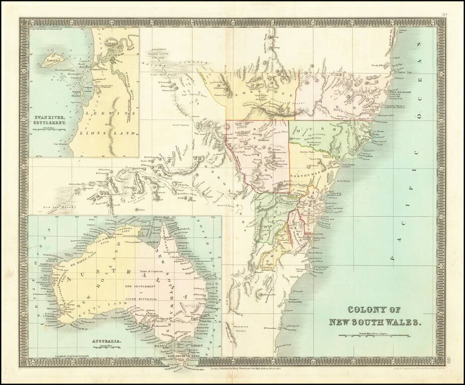
Detailed engraved map New South Wales, issued by Henry Teesdale in London in 1834. The map includes a number of early counties. Includes a large inset of the Swan River Settlement and a map of Australia.