Map size in jpg-format: 21.3413MiB
Click to open in high resolution (open in new tab).
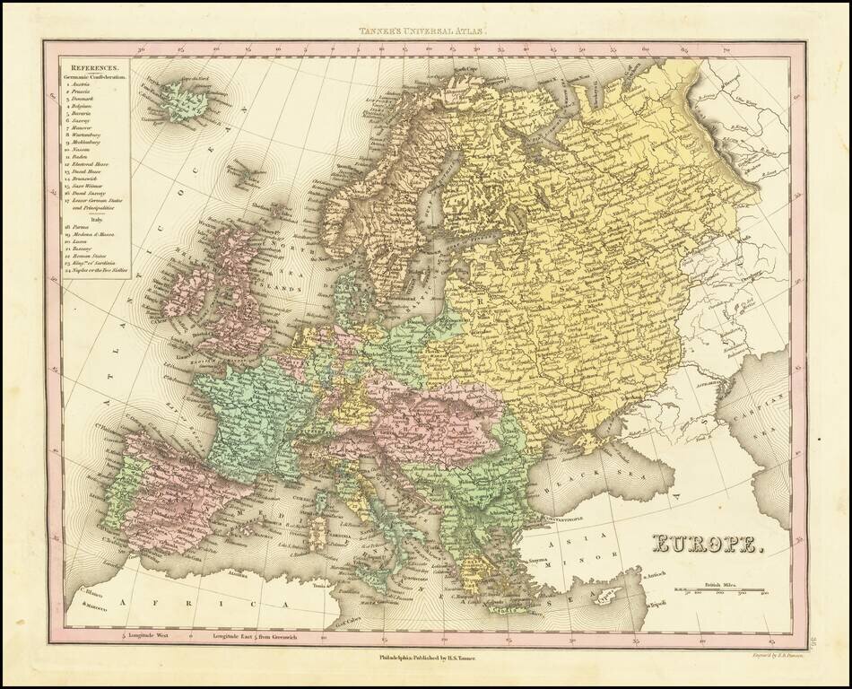
Detailed map of Europe colored by countries.
Large key shows the various parts of the Germanic Confederation and Italy.
This map is from an early edition of Tanner's New Universal Atlas, first issued in 1834. The Atlas would become the most popular American Atlas between 1834 and 1860, published annually, first by Tanner and later by Mitchell, Cowperthwait, and DeSilver. Tanner's career as a mapmaker began in the early 19th Century. He had a hand in publishing many of the most important American maps of the first half of the 19th Century. His business was carried on by his son Thomas and Henry Carey and flourished until the middle of the 19th Century.
If you are a student, write to us in telegram: @antiquemaps and indicate what material you need and for what work you need a map in high detail. We are ready to provide material on special terms. For students only!

![[Eastern Hemisphere Globe Gores] (Nova et integra universi Orbis descriptio)](/map/small/54480.jpg)
![[Signed Political Satire Artwork] Vietnam ... Vietnam ... Vietnam ...](/map/small/68726.jpg)