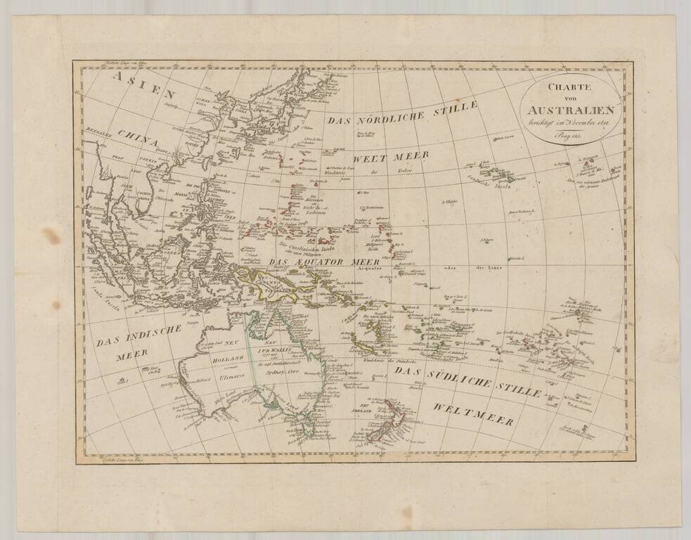
Fine map of Oceana, issued shortly after Krusenstern's voyage to the region. Includes a reference to Australia as Ulimaroa and many other early annotations and place names. Australia is shown as divided between New South Wales and New Holland. The...
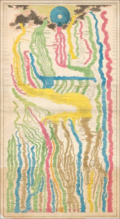
Large and beautiful hand-colored engraved map of time, on three sheets, joined. The chart derives from that of Frederic Strass (a common source for these so-called "time maps"). The initial peoples on the chart are Italians, Greeks, the people of Asia...

A Dane Eyes the East Coast of Britain. First edition of this very rare Danish atlas of the North Sea. Paul de Löwenörn (1751-1826) was a Danish mariner, later Adjutant-General, Captain-Lieutenant, and Director of the Royal Danish Marine Archives,...
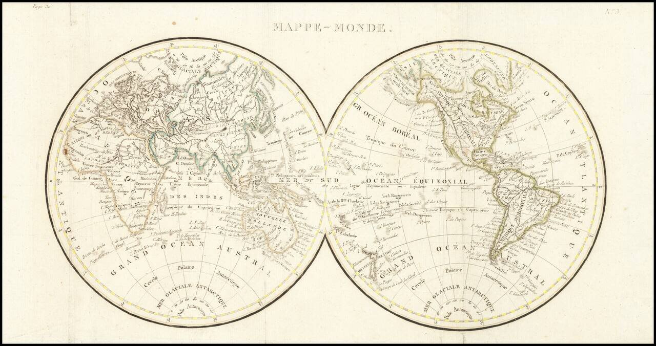
Double hemisphere map of the world, issued early in the 19th Century. We date the map based upon the configuration of the Rocky Mountains, which is in the style of Alexander von Humboldt and the presence of the Bass Strait, between Tasmania and the...
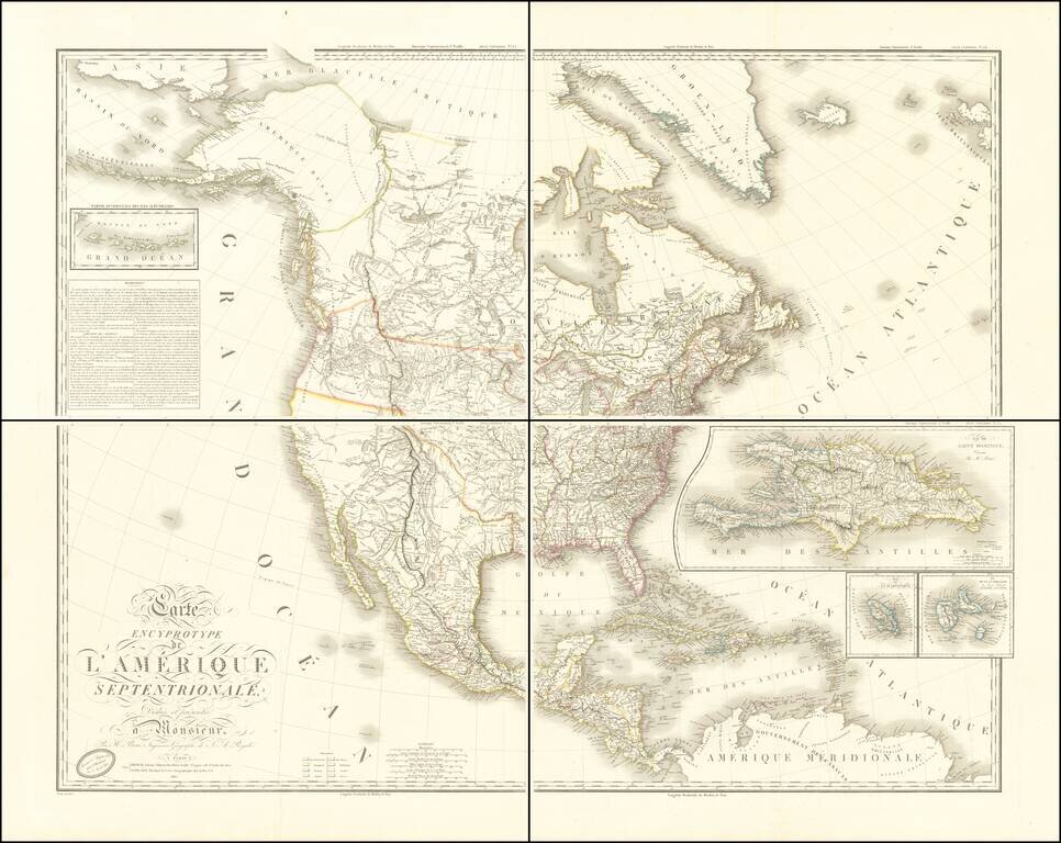
Adams-Onís Treaty Edition of Brué's Important Map of North America Fine example of Brué's impressive four-sheet map of North America, published only two months after the signing of the Adams-Onís Treaty in February 1819 and one of the first...
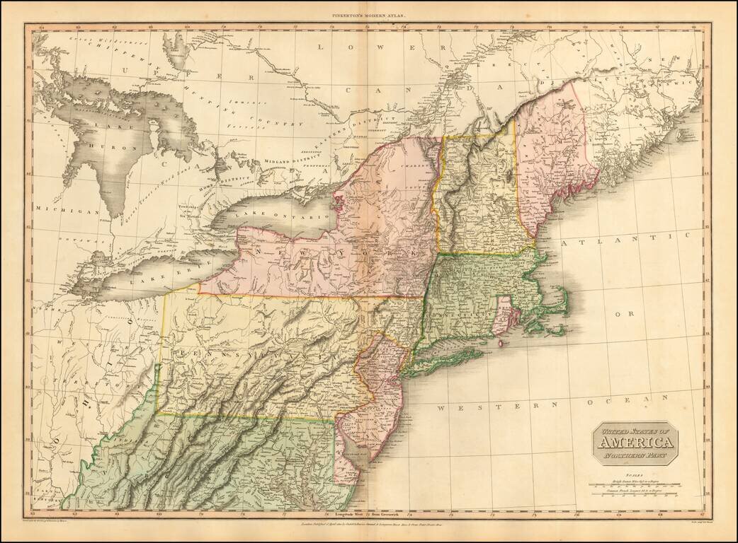
Fine large format map of the Northeast, at the end of the War of 1812, published by Pinkerton. Large detailed map of the Northeastern United States, from the District of Main to Michigan, Ohio, Virginia and Delaware, including most of the Upper...
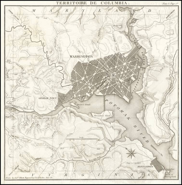
Rare Map of the District of Columbia, "Drawn by Andw. Ellicott" and "Engraved by P.A.F. Tardieu" in Paris. Scarce French edition of Tardieu's detailed map of the Territory of Columbia, showing the extent of the entire Territory, along with an early...
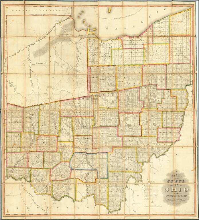
The First Great Map of Ohio Fine example of the Hough & Bourne map of Ohio, published in Chillicothe, Ohio, prepared by John Melish and printed by Benjamin Tanner in Philadelphia in 1815. Hough & Bourne's map of Ohio is the second large...
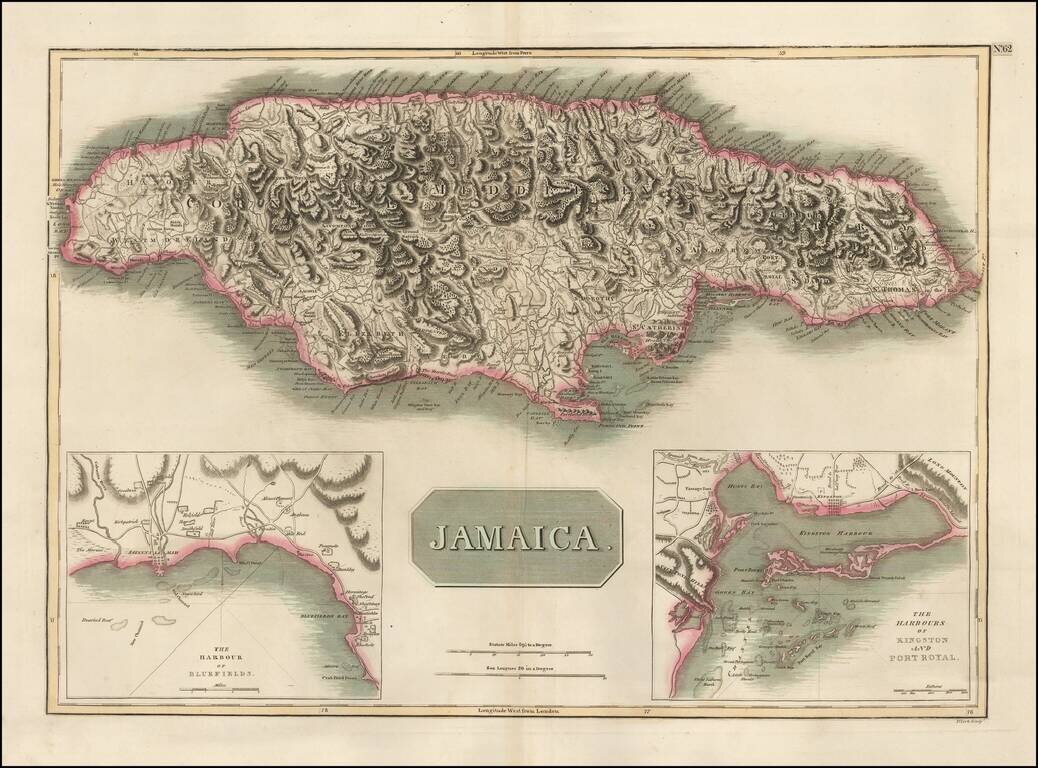
Detailed map of Jamaica, based upon Jefferys map of 1775. Includes large insets of the Harbors of Kingston and Port Royal and of Bluefields. Gorgeous topographical details. One of the best large format English maps of the period.
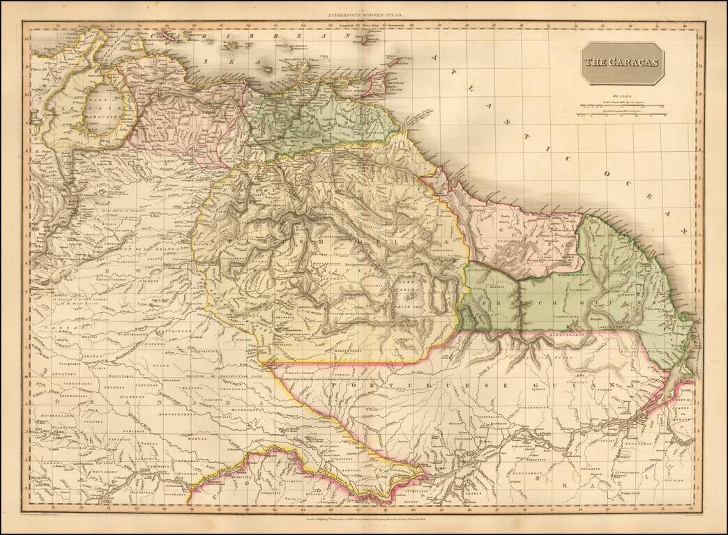
One of the Earliest Maps To Show An Independent Venezuela Highly detailed map of Venezuela, Columbia and part of Brazil, extending south to cover most of the Amazon and its tributaries, during this fascinating revolutionary period in South...
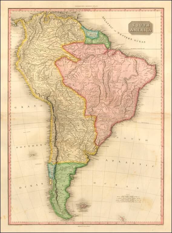
Striking and highly detailed map of South America, at the beginning of the major period of political upheaval on the Continent. The map was produced immediately after Alexander Von Humboldt's visit, which spawned so much interest in the exploration...

Nice example of this finely executed map of the East Coast of Brazil, prepared to illustrate the expedition of Prince Maximillian of Wied-Neuwied. Neuwied, was a German explorer, ethnologist and naturalist. He led a pioneering expedition to southeast...
![Scotland (Northern Part) [and] Scotland (Southern Part)](/map/small/53210.jpg)
Large and highly detailed two sheet map of Scotland, published in London by Pinkerton. One of the best large format atlas maps of the period.
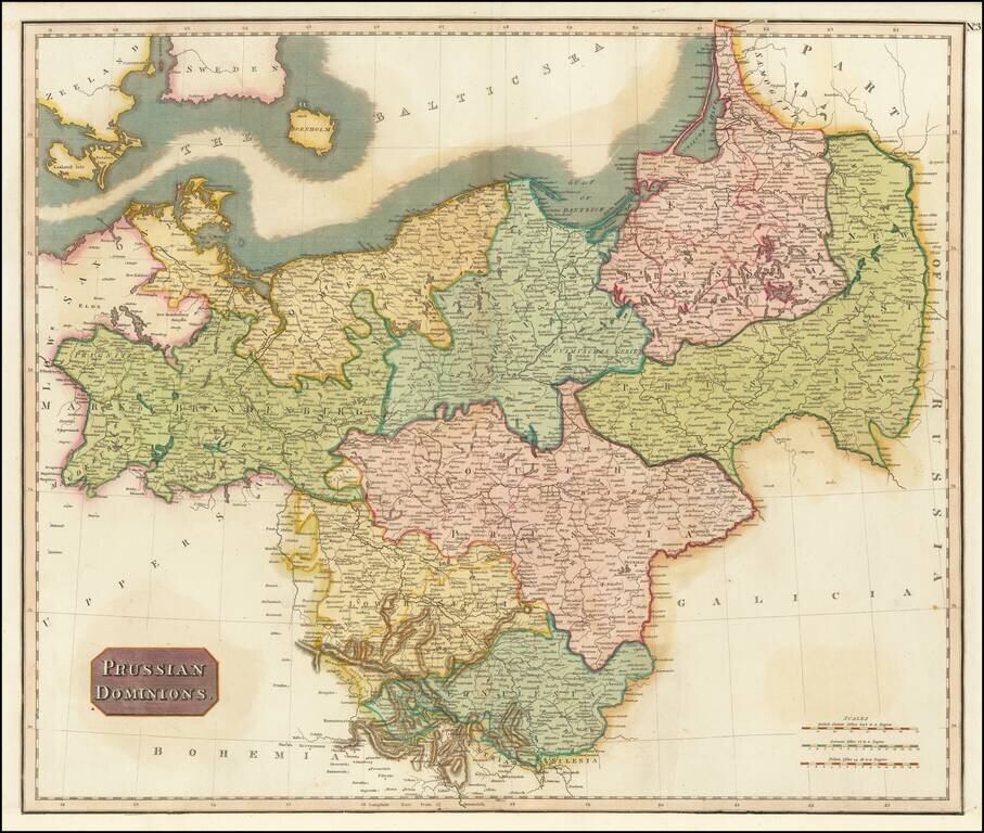
Detailed map of the Prussian Dominions, including parts of the former Kingdom of Poland. Colored by provinces. Excellent detail. One of the best large format English atlas maps of the period. Pinkerton's maps reflect the fine copperplate engraving...
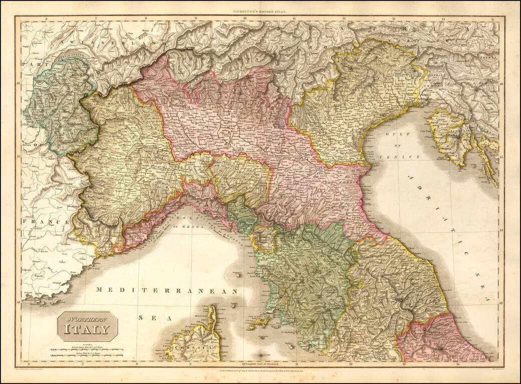
Detailed map of Northern Italy. Colored by provinces. Excellent detail. One of the best large format English atlas maps of the period. Pinkerton's maps reflect the fine copperplate engraving work being done in Britain at the beginning of the 19th...
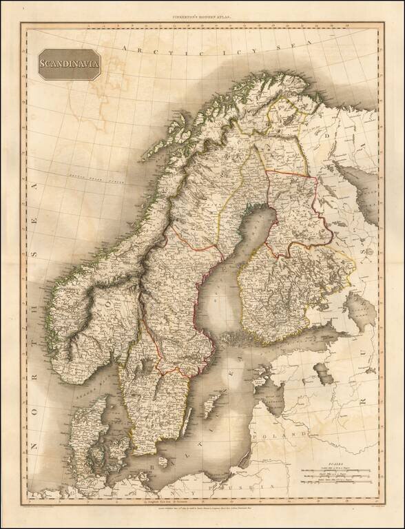
Detailed map of Scandinavia. Excellent detail. One of the best large format English atlas maps of the period. Pinkerton's maps reflect the fine copperplate engraving work being done in Britain at the beginning of the 19th Century, with remarkable...