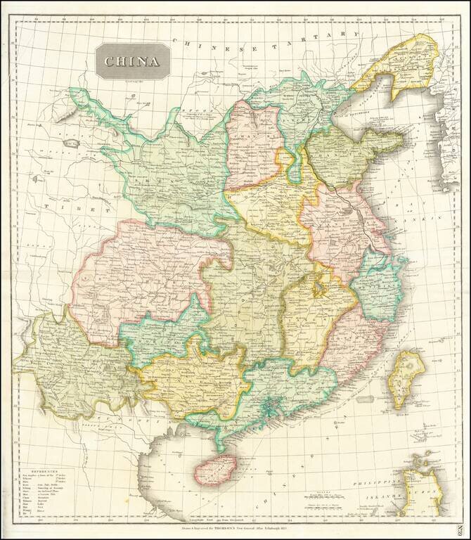
Striking large format map of China, colored by provinces. Shows towns, rivers, roads, the Grand Canal, islands, mountains, etc. The Tract of the Hindoostan & Lion with the British Embassy to China is shown.
![[Manuscript] Chart of the passage to the East of Banka laid down from Observations in the Ship Vansittart, by Cap. Lestock Wilson (locating famous ship wrecks in the Gaspar Strait!)](/map/small/49898.jpg)
Manuscript Sea Chart By Daniel Ross, Locating Numerous Shipwrecks in the Gaspar Strait Extremely rare chart of the strait on the east side of Banka (between Banka and Gaspar Island), site of a number of British, Chinese, Portuguese and American...
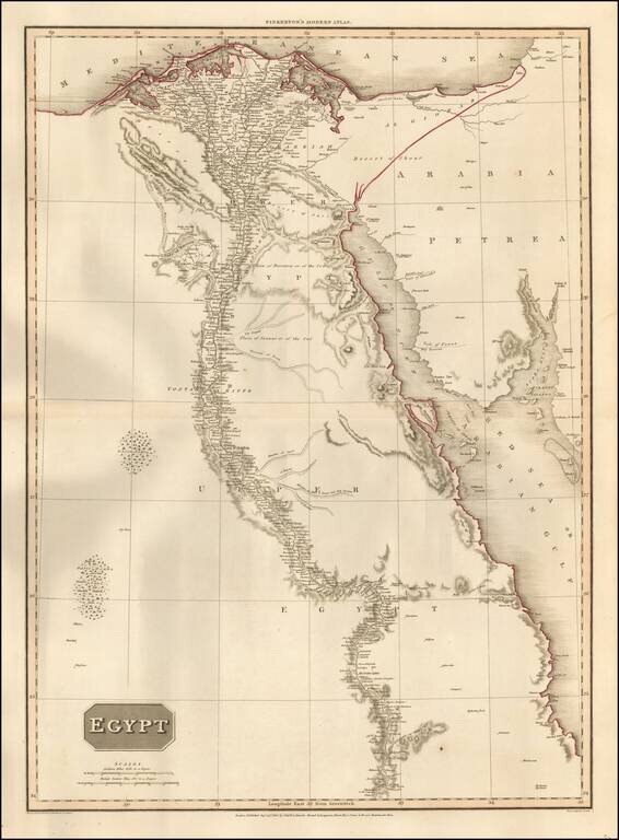
Highly detailed map of Egypt, following the Nile as far south as Asouan and Shelalat and including the Oasis of Magna, Oasis of Parva and other remarkable fine details. Includes the Gulf of Suez, Red Sea and Gulf of Acaba. One of the best regional...
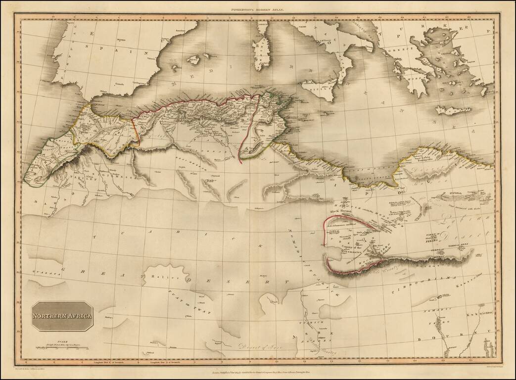
Highly detailed map, extending from Morocco to Libya and south to the Great Desert. The map shows Nomadic tribes and a nice treatment of the western Mediterranean from Gibralter to Greece, centered on Sicily and Sardinia. Highly detailed regional map,...
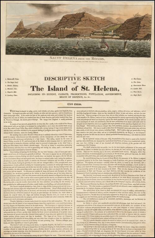
Rare early broadside describing St. Helena, published in London and Devon in 1815 by the Wallis family. The broadside is dated August 8, 1815, approximately 2 months prior to the arrival on the island of Napoleon Bonaparte, who would remain there in...
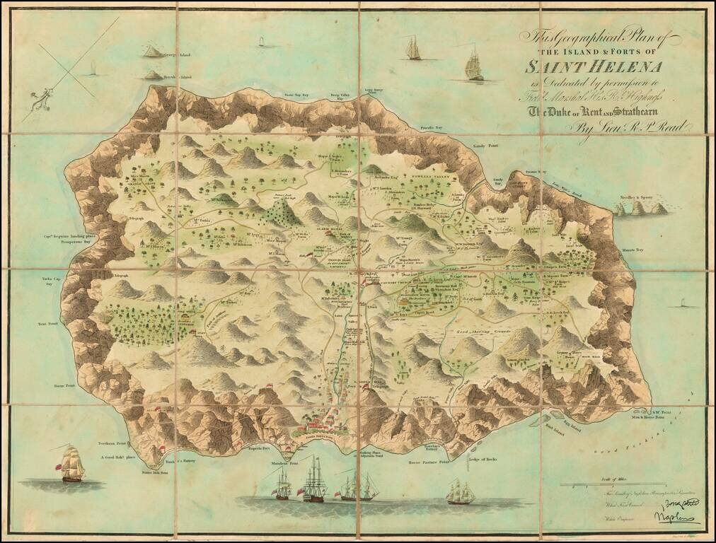
Finely colored example of Liuetenant Read's map of St. Helena, published shortly after Napoleon Bonaparte's first (and second) exile. Napoleon I's exile on the island of St Helena has contributed greatly to a heightened interest among he British...
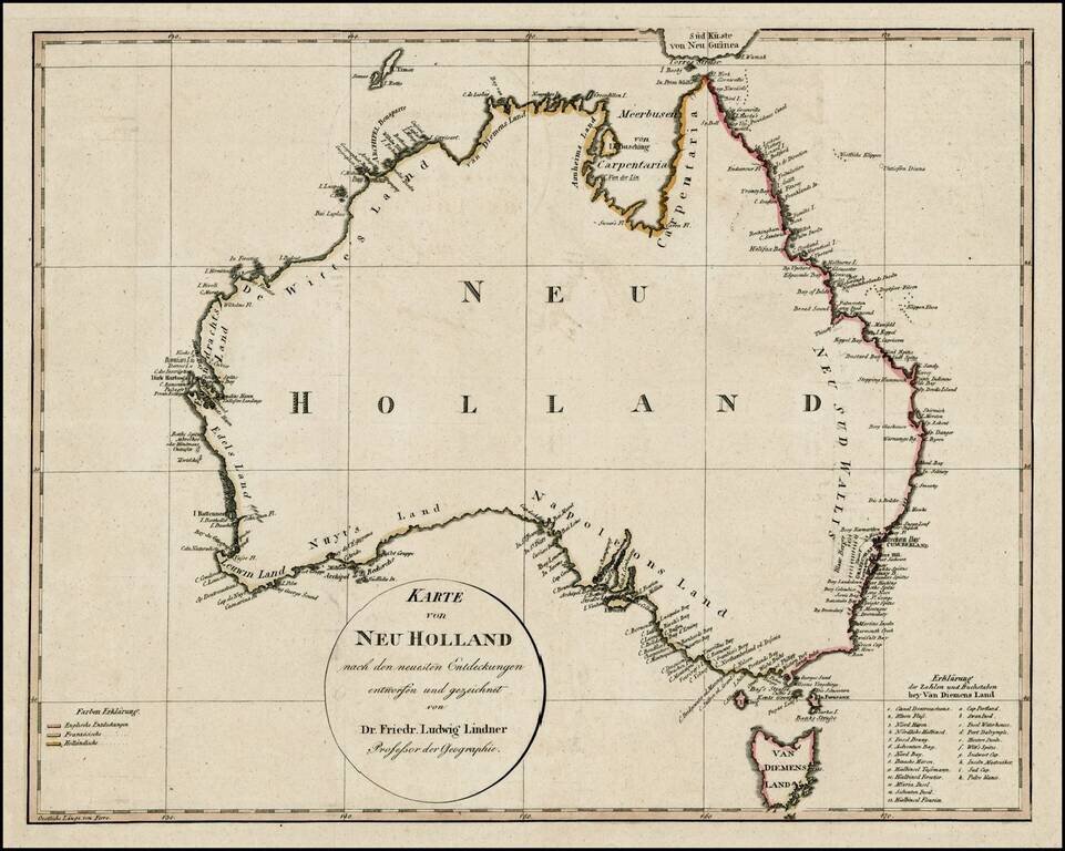
An early map of Australia showing a completed coastline, Bass Strait and the discoveries of both Baudin and Flinders. The coloring on the coasts is coded to denote the discoveries made by the English, French and Dutch. The map identifies most of...