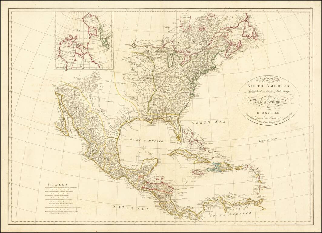
A marvelous map of North America, based upon D'Anville's 4 sheet map. The map names Tecas, but the entire Northwest is noted as parts unknown. Many place names, Indian tribes, and forts located. Good detail of watershed: the Colorado is here called...
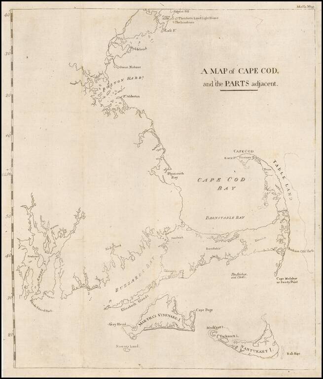
The first map printed in America to focus on the area around Cape Cod and illustrating an early attempt to create a canal from Barnstable Bay to Buzzard Bay. This rare map appeared in the Massachusetts Magazine, published by one of America's most...
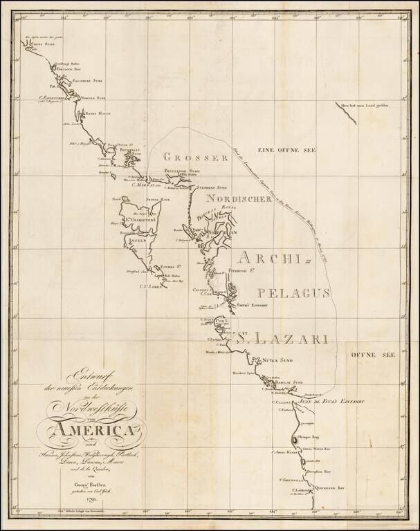
Rare chart of the Northwest coast of America, centered on Queen Charlotte's Island, from Georg Foster's Geschichte der Reisen, die seit Cook an der Nordwest…Amerika. Rare chart of the Northwest Coast of America, illustrating the experiences of Georg...
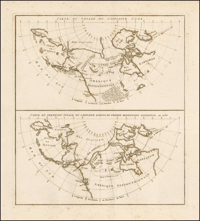
Rare pair of maps on a single sheet, showing the results of various real and apocryphal explorations in the Arctic Regions and the Northwest Coast of America, which appeared in the atlas volume of Jean Benjamin de LaBorde's Histoire Abrégée de la Mer...
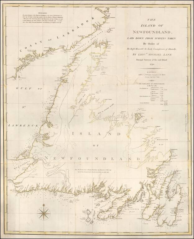
Rare separately issued chart of Newfoundland, published in London by William Faden in 1791. Faden's chart covers the entire island of Newfoundland along with a portion of the coast of Labrador bordering the Gulf of St. Lawrence. There is fine detail...
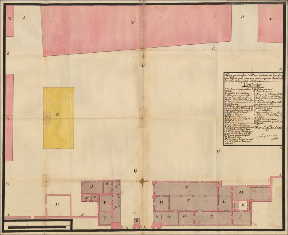
Manuscript Plan of Veracruz's Plaza Contaduria, the Accounting Place of Empire This is a plan of one of Veracruz's plazas. This particular plaza, Contaduria, was used to monitor commerce, as Veracruz was the most important port in New Spain. The plan...
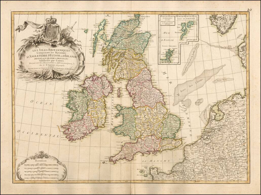
Fine large format map of the British Isles, with a large inset of the Orkades and Shetlands. The map includes a fine ornate cartouche and coat of arms, with the various countries colored by regions and counties. This large format Janvier map is quite...
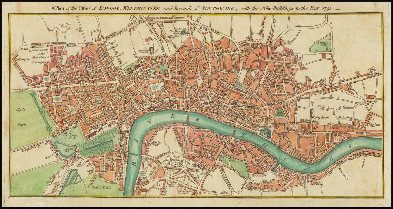
A detailed antique engraved plan of London published in London 1791. The map appeared in Kearsleys’ Stranger’s Guide, or Companion through London and Westminster, and the Country Round: Containing a Description of the Situation, Antiquity, and...
![[Riga & Environs]. Der Rigische Kreis / Le Cercle de Riga](/map/small/69148.jpg)
Rare 18th Century map of the area around Riga, published in Berlin by Carl Jack. The map was published for the Atlas von Liefland, oder von den beyden Gouvernementern u. Herzogthümern Lief- und Ehstland, und der Provinz Oesel - entworfen nach...
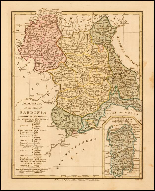
Detailed map of the Kingdom of Sardinia, with a large inset of the Island of Sardinia. Includes Savoy, Aosa, Novarese, Canavese, the Province of Turin, Province of Pignerol, Marquesat of Susa, Province of Alba, Province of Coni, States of Genoa,...
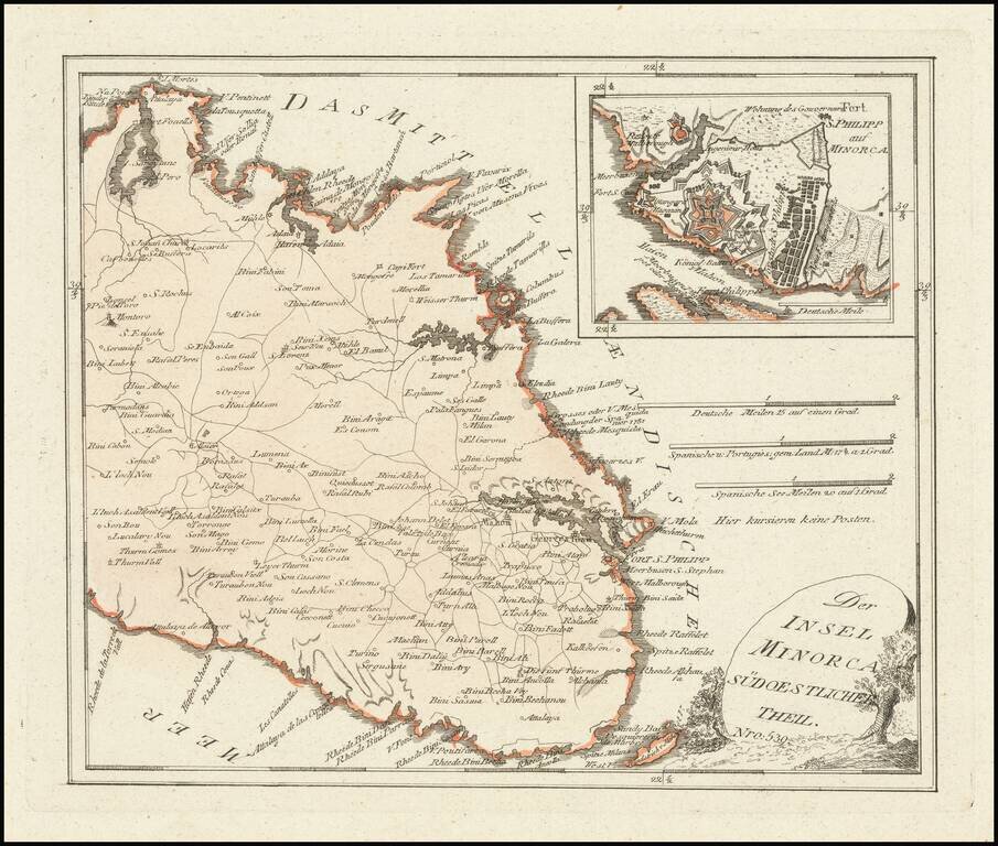
Scarce map of the Eastern part of Menorca, published by Franz Joseph Johann Von Reilly in Vienna. Includes a large inset of Mahon and Port Philip.
![[Andhra Pradesh] Map of the Roads From Nellore to the Passes of Rampore and Samisserum and to Ongole by Caolin Mackenzie, Practr. Engineer 1788 . . .](/map/small/62194.jpg)
Scarce road showing roads in the modern region of Andhra Pradesh, India, which appeared in the Oriental Repertory No. 1, published in 1791. The Oriental Repertory was a publication of the East India Company, detailing its activities and information in...
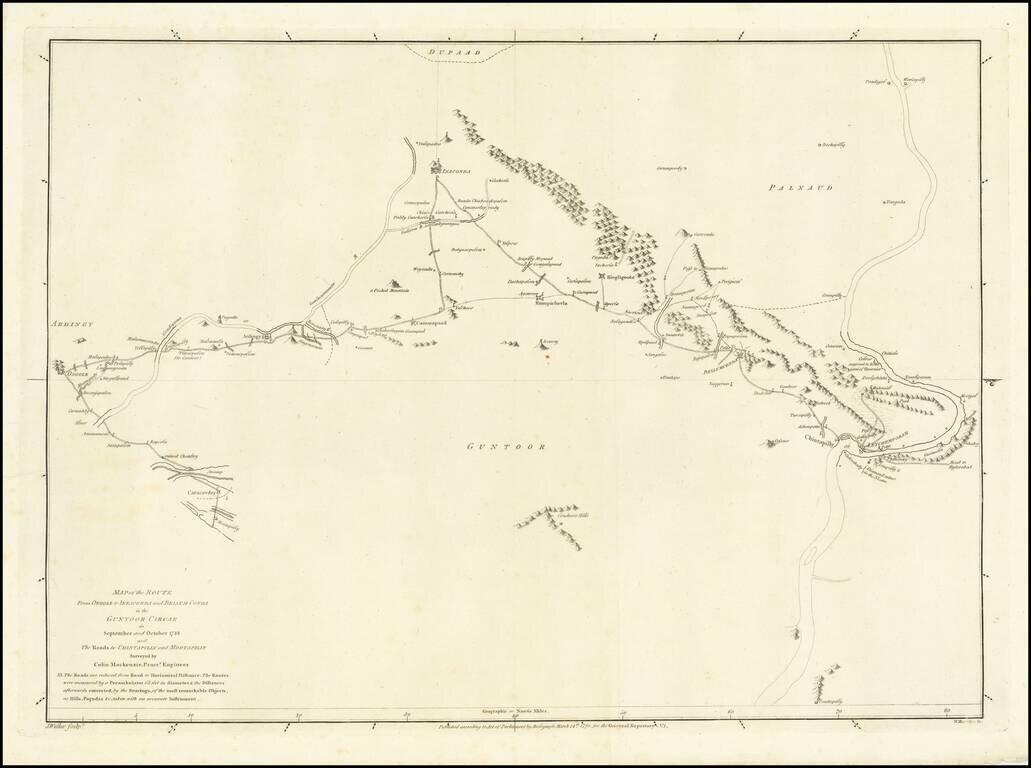
Scarce road showing roads in the modern region of Andhra Pradesh, India, which appeared in the Oriental Repertory No. 1, published in 1791. The Oriental Repertory was a publication of the East India Company, detailing its activities and information in...
![[Christopher Columbus] Cristoval Colon Almirante Mayor Del Mar Occeano, Virrey y Governador General de las Yndias, su Descubridor y Conquistador.](/map/small/33405.jpg)
Rare portrait of Christopher Columbus as a young man. The origin of this image is very curious. As noted in the 1893 exhibition Catalog "The Discoverer of the New World as represented in portraits, monuments, statues, medals and paintings," (Columbus...