logo

1791. Les Isles Britanniques Comprenant les Royaumes D'Angleterre D'Ecosse et D'Irlande, Divises en Grandes Provinces Subdivise par Comptes . . . 1791

  • Les Isles Britanniques Comprenant les Royaumes D'Angleterre D'Ecosse et D'Irlande, Divises en Grandes Provinces Subdivise par Comptes . . . 1791

Les Isles Britanniques Comprenant les Royaumes D'Angleterre D'Ecosse et D'Irlande, Divises en Grandes Provinces Subdivise par Comptes . . . 1791 information:

Year of creation: 
Resolution size (pixels): 
 2432x1814 px
Disk Size: 
 1.36597MiB
Number of pages: 
 1
Place: 
 Paris
Author: 

Print information. Print size (Width x height in inches):
Printing at 72 dpi 
  33.78 х 25.19
Printing at 150 dpi 
 16.21 х 12.09
Printing at 300 dpi 
 8.11 х 6.05

An example of detailing the file of this map of in a printable high-resolution:

Click to open in high resolution (open in new tab).
Attention! this is just the central piece (central area 960x960 px) of the map file!
This is an example, so that you can see and study the level of detail of a given map. The entire Map will be fully available after payment!

Les Isles Britanniques Comprenant les Royaumes D'Angleterre D'Ecosse et D'Irlande, Divises en Grandes Provinces Subdivise par Comptes . . . 1791

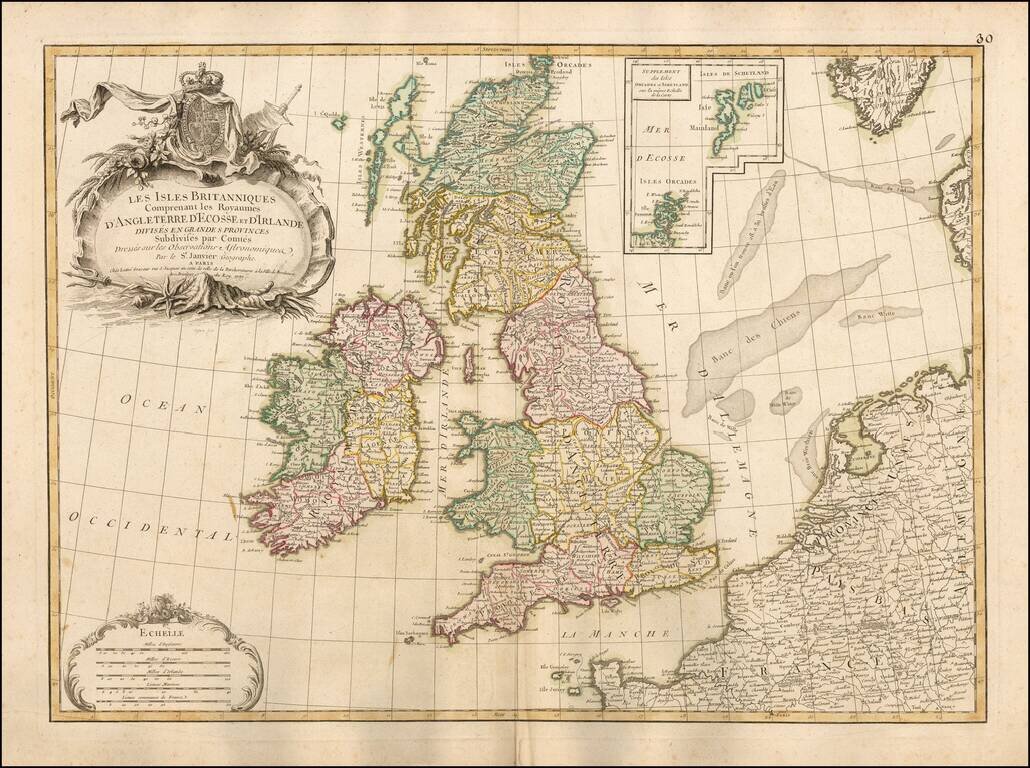
Fine large format map of the British Isles, with a large inset of the Orkades and Shetlands.

The map includes a fine ornate cartouche and coat of arms, with the various countries colored by regions and counties.

This large format Janvier map is quite scarce on the market.


Special conditions for students!

If you are a student, write to us in telegram: @antiquemaps and indicate what material you need and for what work you need a map in high detail. We are ready to provide material on special terms. For students only!

Item information:

Year of creation:
Size:
2432x1814 px
Disk:
1.36597MiB
Number of pages:
1
Place:
Paris
Author:
Jean Janvier.
$9.99

Related item