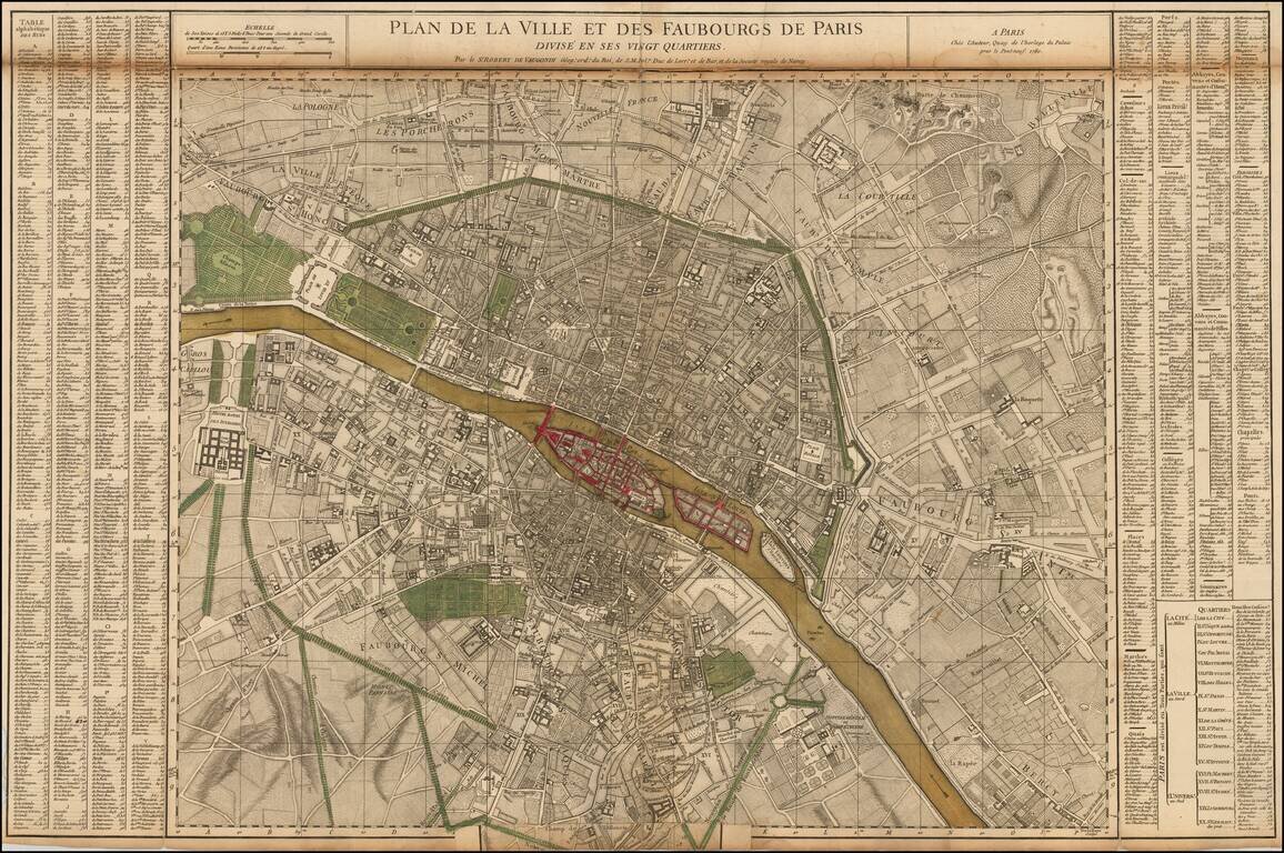
Nice example of the first state of De Vaugondy's 2 sheet map of Paris. Includes symbols showing the limits of the City at the time of Philippe Auguste, Charles V and Charles VI, and Louis XIII (based upon the map of Gomboust). Inset at the sides...
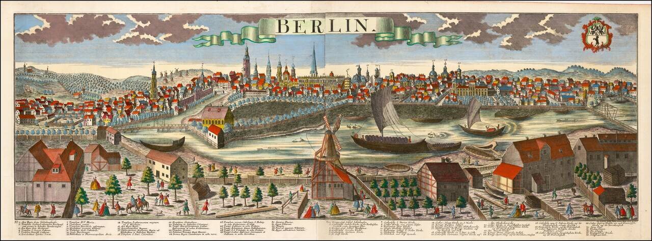
Striking large format view of Berlin, showing the town with the river in the foreground and the town beyond. Includes a key locatng 34 places on the view. The present example also bears the name of Johann Friedrich Probst.
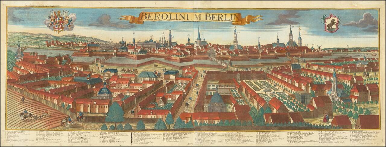
Fine panoramic view of Berlin, engraved by Balthasar Probst in Augsburg. The view includes keys in Latin and German, identifying 50 places, along with two coats of arms in the sky.
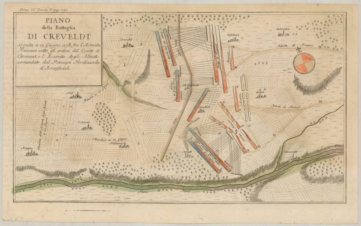
Scarce Italian language battle plan of the Battle of Krefeld, fought in Krefeld, present-day North Rhine-Westphalia on June 23, 1758, during the Seven Years War. The Hanoverian army led by Ferdinand, brother of the duke of Brunswick, had driven the...
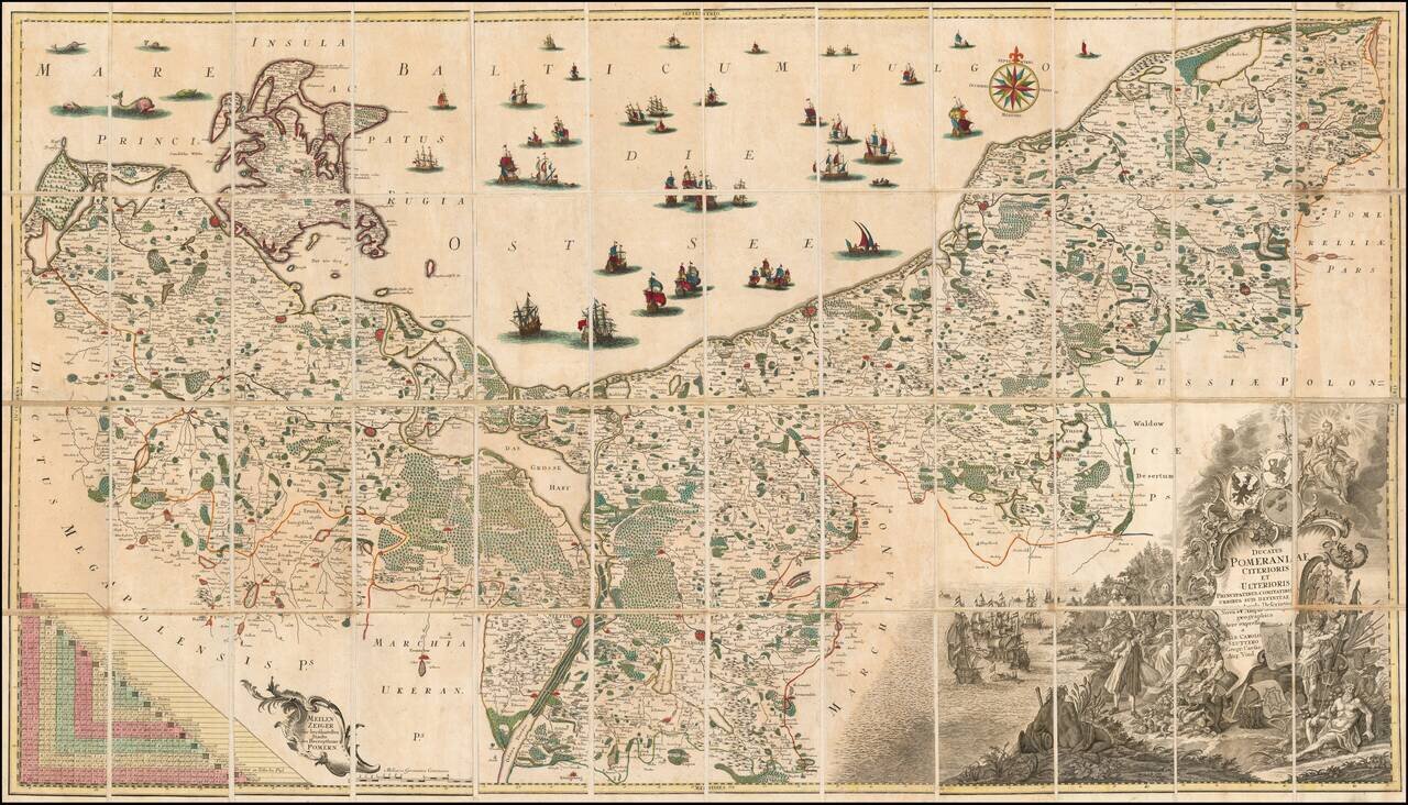
Fine example of the first state of Albrecht Carl Seutter's 6-sheet map of Pomerania, first published in about 1760. Seutter's map was based upon the so-called 'Lubin Map' and was created by the Rostock scholar, Eilhard Lubin, on behalf of the Duke...
![[Austria] Nova Mappa Archiducatus Austriae Superioris Ditiones in suos Quadrantes divisas conspectui sistens . . . .](/map/small/62749.jpg)
Highly detailed regional map, centered on the course of the Danube River, from Ips to Braunau. Also shows Salzburg, Rachstats, Rottenman, Loeben, Waiddhofen, Zwetl, Weitra and Passau. Ornate cartouche.
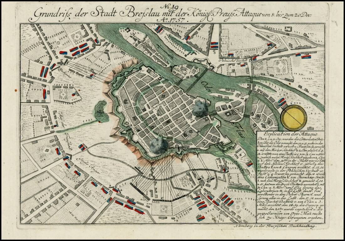
Detailed view of the Battle fought at Breslau during the 7 years war. The city fell to Austria in November 1757, before being retaken by PRussian forces the following month.
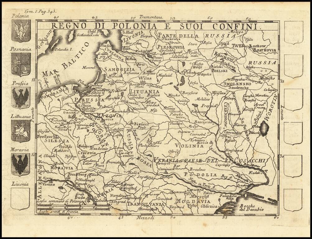
Rare map of Poland, with 5 coats of arms and 7 more blank escutcheons.
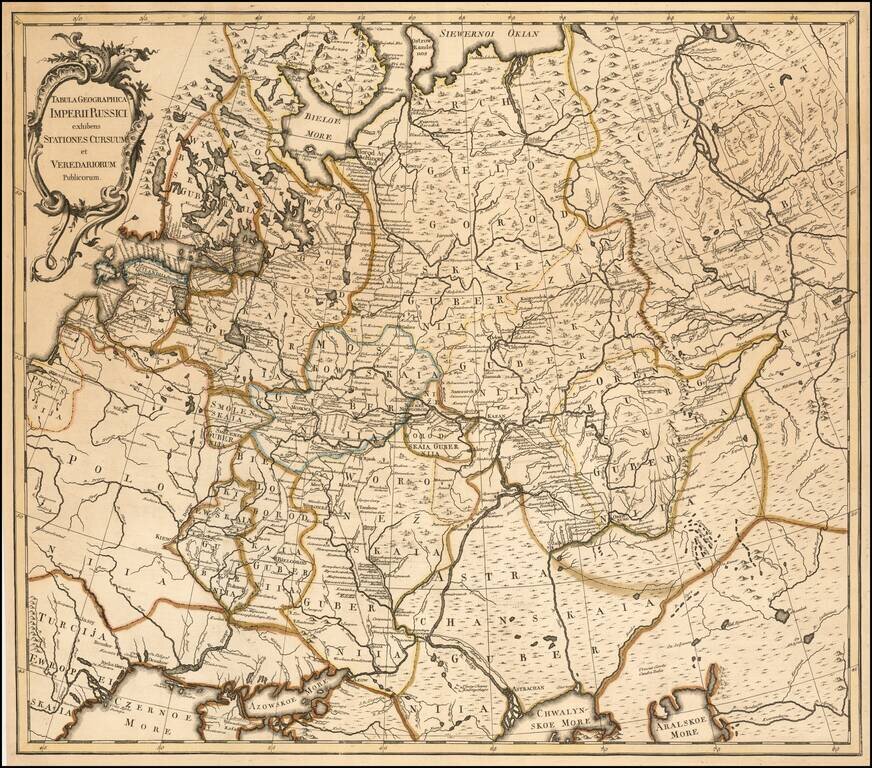
A Russian Published Map of the Russian Empire Important map of the Russian Empire, published in St. Petersburg by Johannes Treskot Treskot & Schmidt's survey of Russia was the next major survey following the work of Joseph Nicolas De L'Isle....
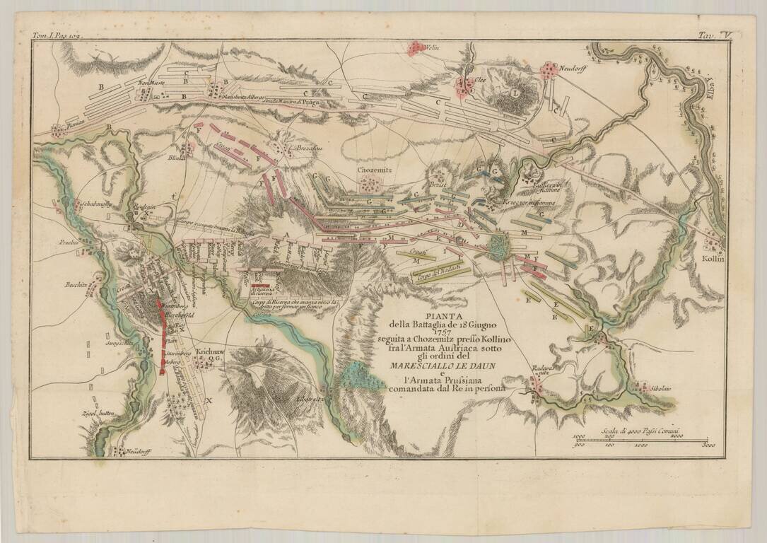
Detailed Italian language battle plan of the Battle of Kolin, fought to the east of Prague on July 18, 1757, during the Seven Years War. The Battle of Kolín saw 44,000 Austrians under Count von Daun, defeat 32,000 Prussians under Frederick the...
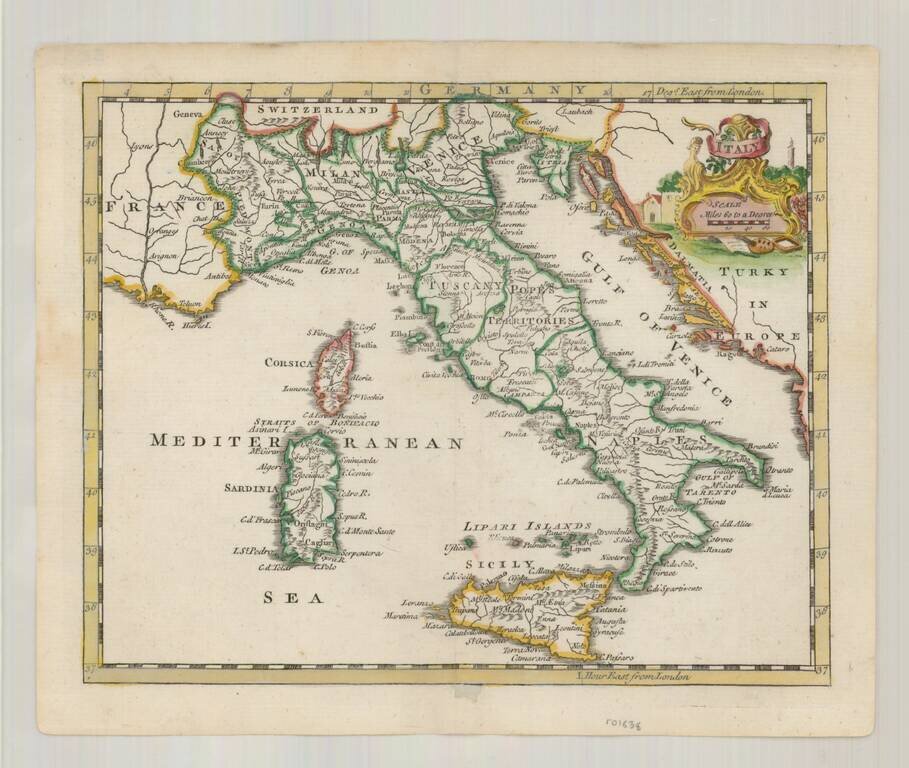
Detailed map of Italy, Sicily, Corsica and Sardinia, and the Gulf of Venice, showing the many kingdoms which then comprised the country. Shows, towns, mountains, rivers, lakes, islands, etc. A charming mid 18th Century English map with decorative...
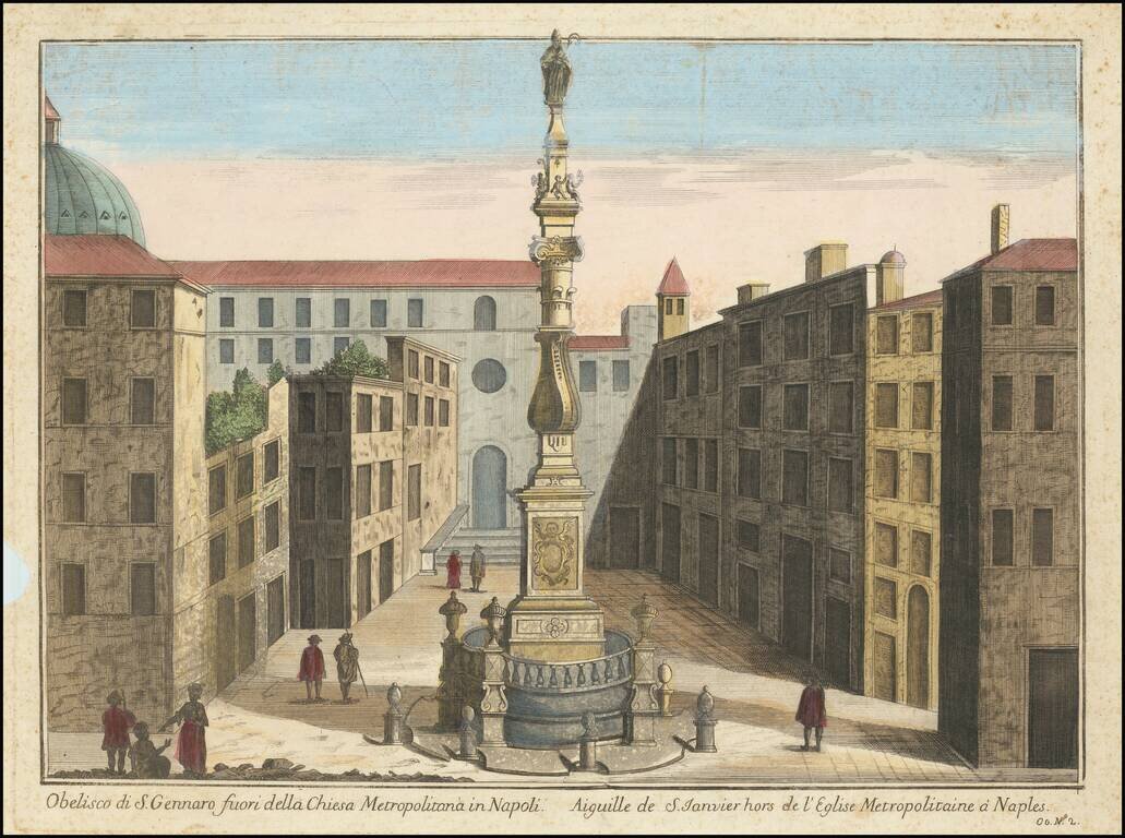
Nice early image of the Obelisk of San Gennaro in Naples. The Obelisk of San Gennaro (begun 1636, completed 1650) is located in the square dedicated to Cardinal Sisto Riario Sforza. It is the work of Cosimo Fanzago, perhaps the greatest architect of...
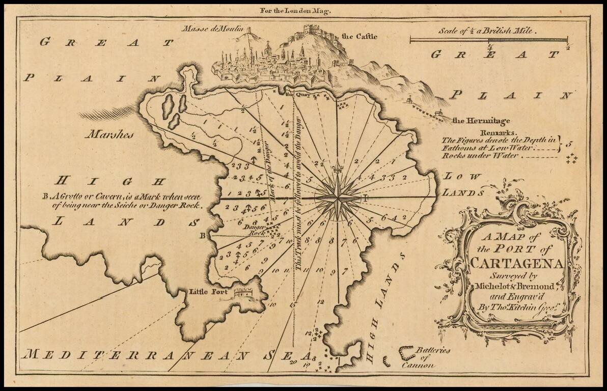
Detailed map of the port of Cartagena, Spain, published in the London Magazine. Cartagena was, at the time, one of the most important ports for the Spanish Royal Navy.
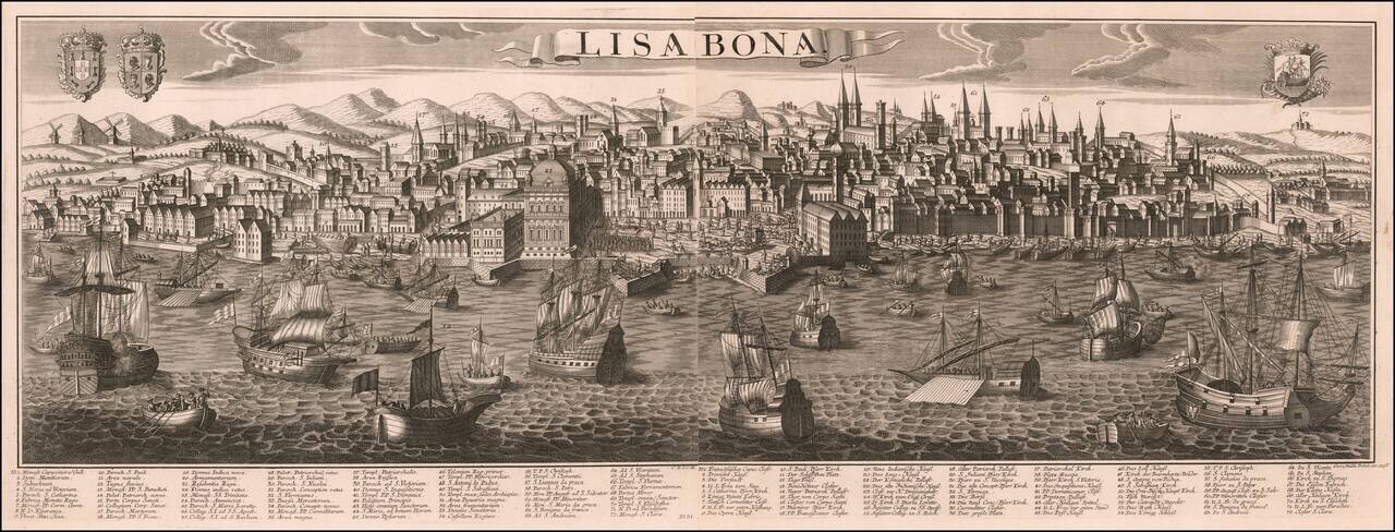
George Balthasar Probst's large engraved view of Lisbon, on two sheets joined. The view demonstrates Probst's characteristic attractive engraving, with its busy harbor scene in the foreground giving way to a complex urban matrix further back. The map...
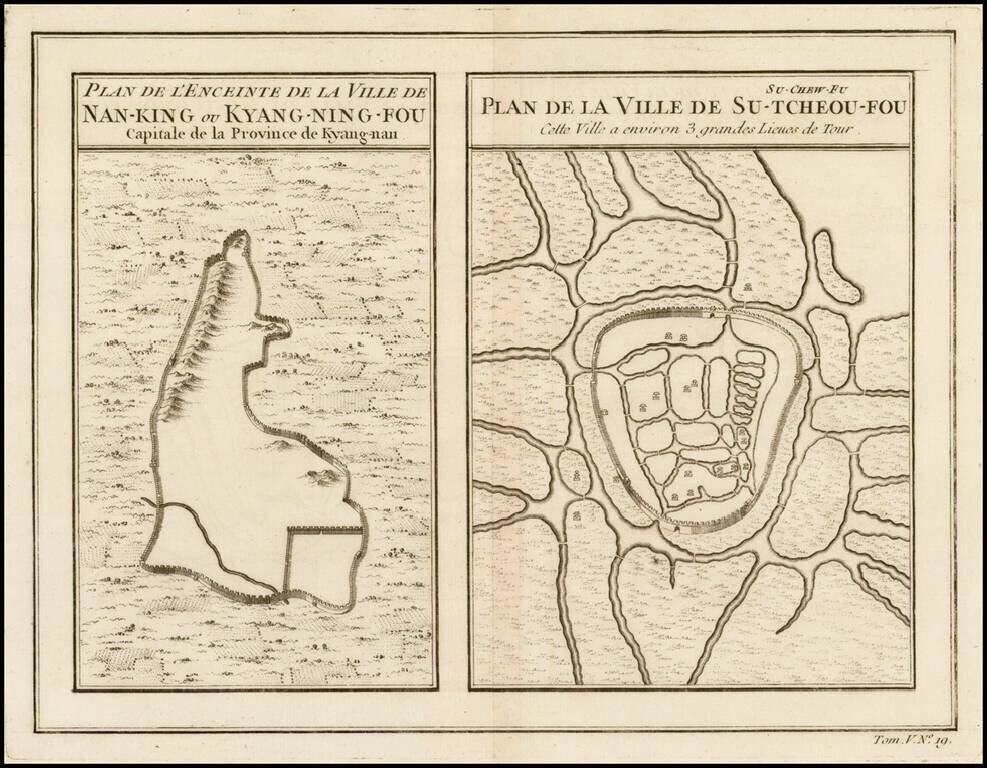
Two maps on a single sheet, depicting major Chinese cities. The plan on the left shows Nanking and its fortifications. The plan on the right shows Su-Tcheou-Fou or Su-Chew-Fu.
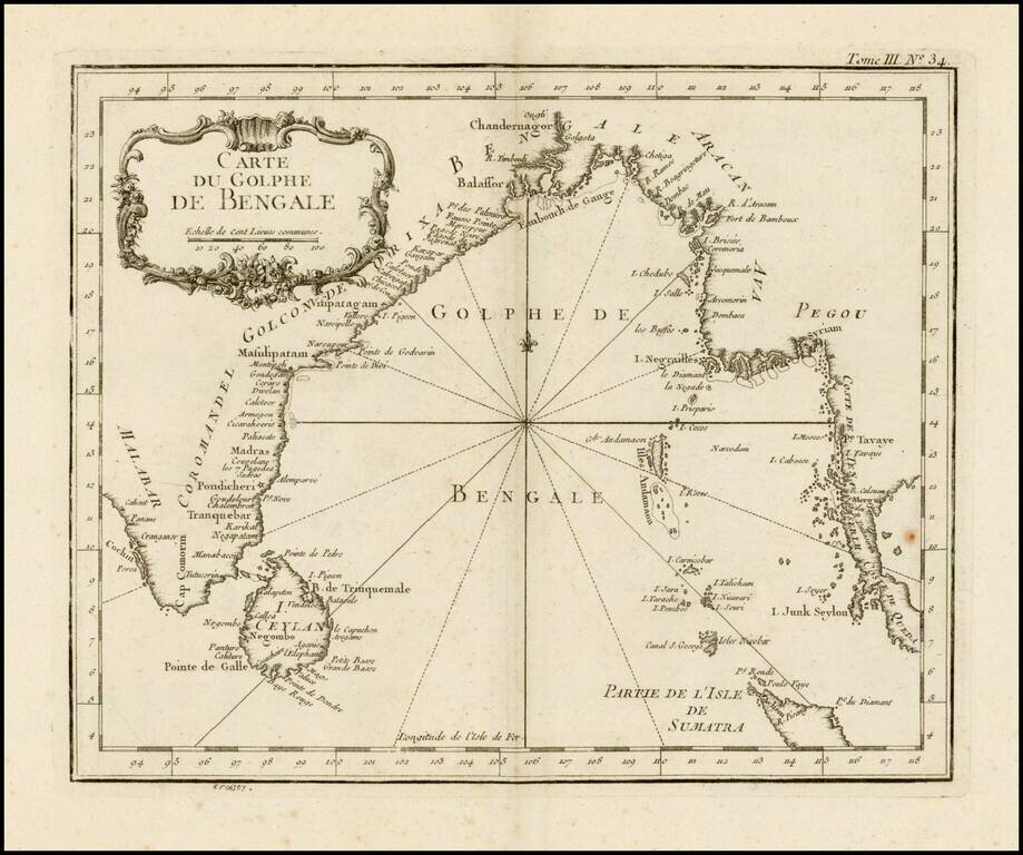
Scarce larger format edition of Bellin's detailed regional map of the Gulf of Bengal and the lower Ganges River. This larger format edition has a different cartouche and lacks the compass rose in the center.