![America [Manuscript Map Showing the Sea of the West!]](/map/small/41297dm.jpg)
Decorative manuscript map of America, illustrating the mythical Sea of the West, apparently prepared in Italy. The map includes a marvelously precise hand and wonderful detail, with fine wash colors.
![[Western Hemisphere]](/map/small/70708rd.jpg)
Finely-Drawn Eighteenth-Century Manuscript Map of the Western Hemisphere Carefully-constructed, single-hemisphere manuscript map of the Americas, signed by Michael Rampf. Oceans, continents, and cartographic elements such as the equator, tropics, and...
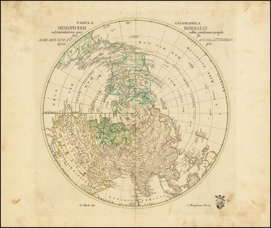
Scarce map of the Northern Hemisphere, published in Berlin by noted mathematician Leonhard von Euler. The most notable cartographic feature is the large Sea of the West, flanked a note regarding the supposed discovery of the Straits of Juan de Fuca in...
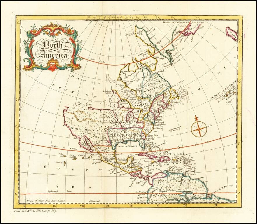
Decorative map of North America, published during the French & Indian War. The map provides a very large inaccurate depiction of the Great Lakes, along with a disembodied river and lake system in the west. There is no northwest coast of America....
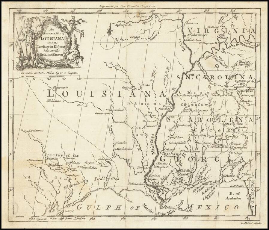
The "Territory In Dispute East" of The Mississippi River Rare map centered on the Mississippi River, showing the "Territory in Dispute" between France and England. The map is centered on the Mississippi River valley and the Gulf Coast, showing the...
![Nuovo Messico appartiene alla Spagna [with] A. Luisiana Inglese B. Luisiana Francese](/map/small/7075.jpg)
Extremely rare pair of miniature maps on one sheet, from a miniature Italian Atlas. The first example we have ever seen. The upper map extends from Baja California and the Pacific to Texas, centered on the Rio Grande. Full of very curious place names....
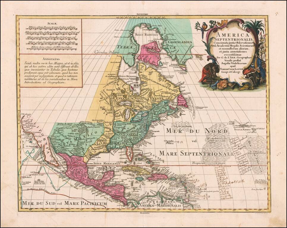
Striking Map of North America Based on De L’Isle’s Foundational Map of North America--With Manuscript Annotations! Lotter’s rendition of De L'Isle's highly important map of North America (1700), which was the first map to correctly place the...
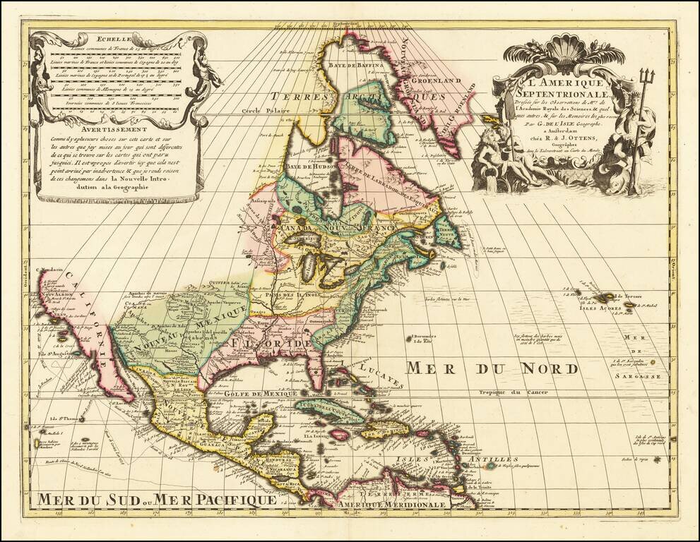
Dutch edition of Guillaume De L'Isle's Highly Important Map of North America Finely colored example of the Ottens edition this seminal map of North America. In its initial 1700 publication, it was the first to correctly place the mouth of the...

Scarce Leipzig edition of Bellin's excellent map of Hudson's Bay, Labrador, Hudson's Straits and neighboring regions originally issued in Bellin's Histoire General des Voyages. Includes numerous bays, islands, rivers, mountains and notes regarding...
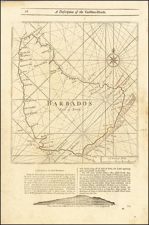
Detailed coastal map of the Island of Barbados, from Mount & Page's English Pilot, Fourth Book. The map includes a number of bays, harbors and other coastal feature, with sailing directions and a profile view below and on the verso.
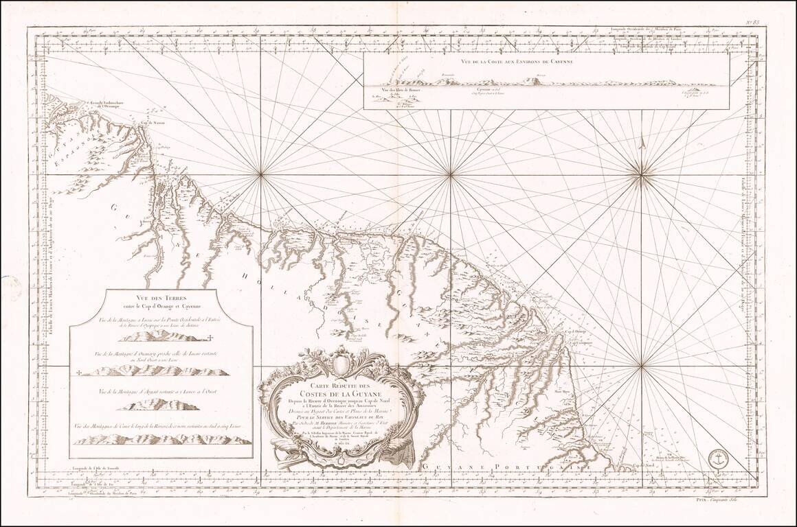
Antique Sea Chart of the Coast of Guyana, French Guiana, Suriname and the Brazilian State of Amapa Finely executed French sea chart of a portion of the northeast Coast of South America, from the mouth of the Orinoco River to the mouth of the Amazon...
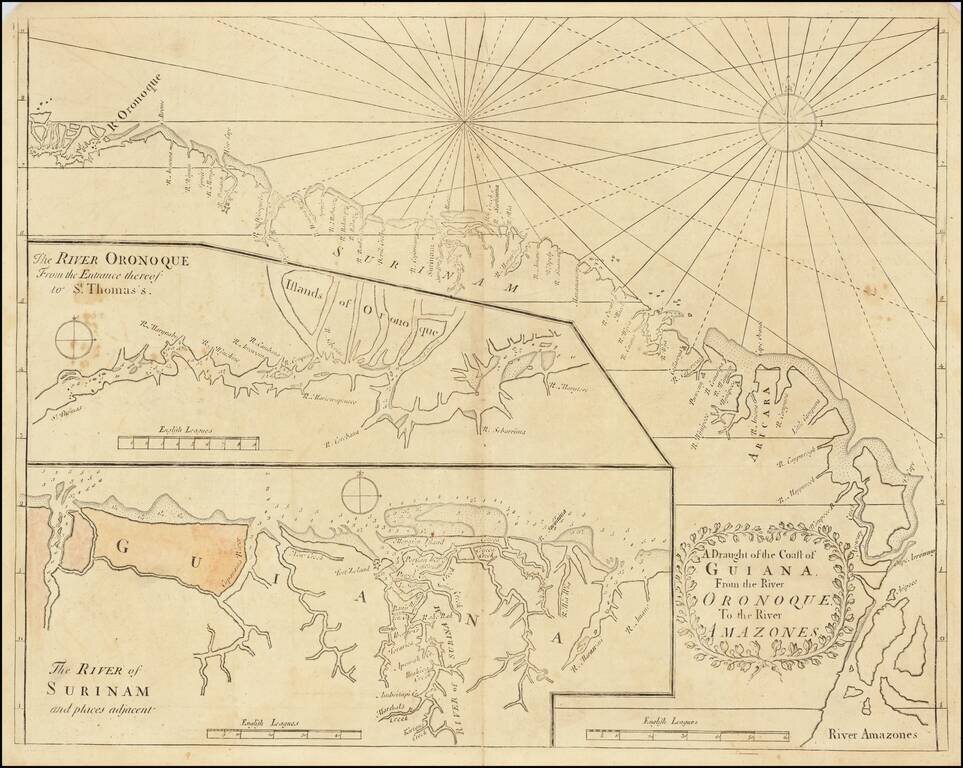
English Sea Chart of The Coast of South America, from the Orinoco River to the Amazon River. Early English sea chart of a portion of the northeastern coast of South America, centered on Guyana, Suriname and French Guiana. The map includes two inset...
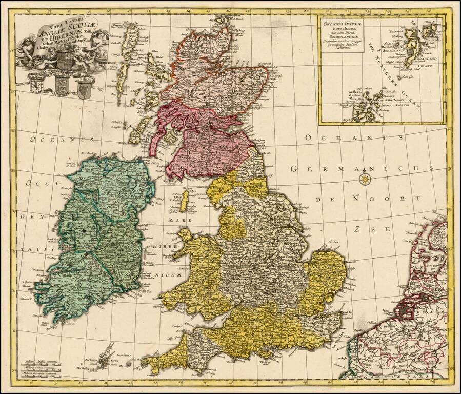
Rare map of the British Isles, published by Johann Michael Probst in Augsburg. Includes a decorative allegorical cartouche and 4 coats of arms.
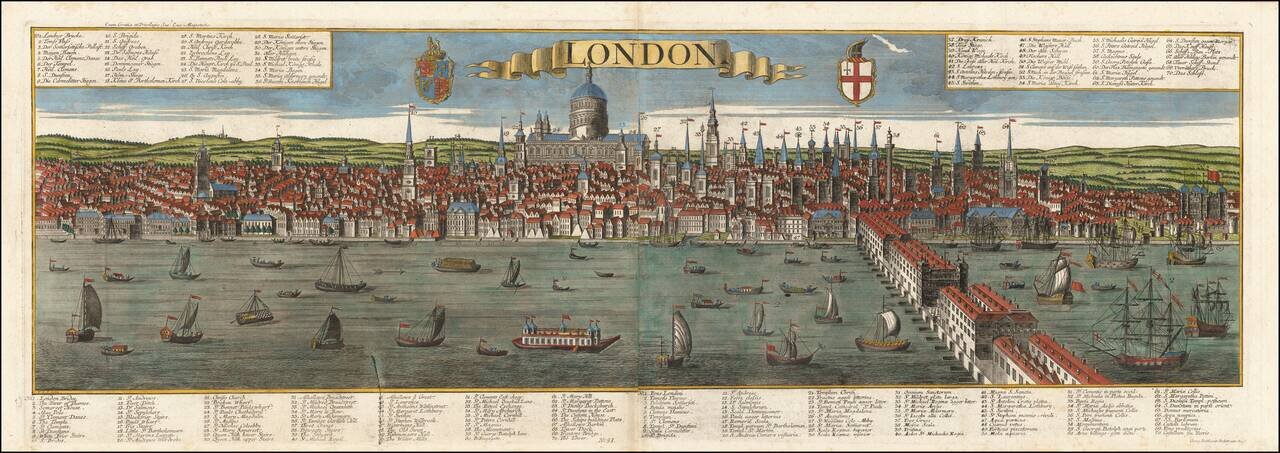
Striking panoramic view of London, published in Augsburg by the Probst family. Highly detailed 18th century post-fire panorama of London as seen from the south bank of the Thames River, looking toward the St. Paul’s Cathedral, engraved by Friedrich...
![Plan of Baynards Castle Ward & Faringdon Ward, Within. Divided into Parishes, from a New Survey [with] Plan of Candlewick and Langborn Wards. Divided into Parishes, from a New Survey](/map/small/70263.jpg)
Interesting pair of ward maps of London, published in 1760. Landmark locations include St. Paul's Cathedral and Blackfriar's Bridge.
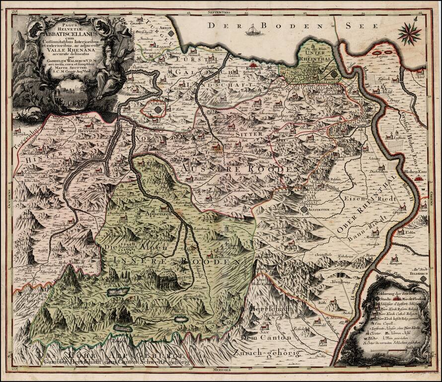
Scarce regional map of Switzerland showing the Cantons south of the Boden See. Includes St. Gallen, Appenzell, Altstatten, Hohen and Hochst on the Rhine River.