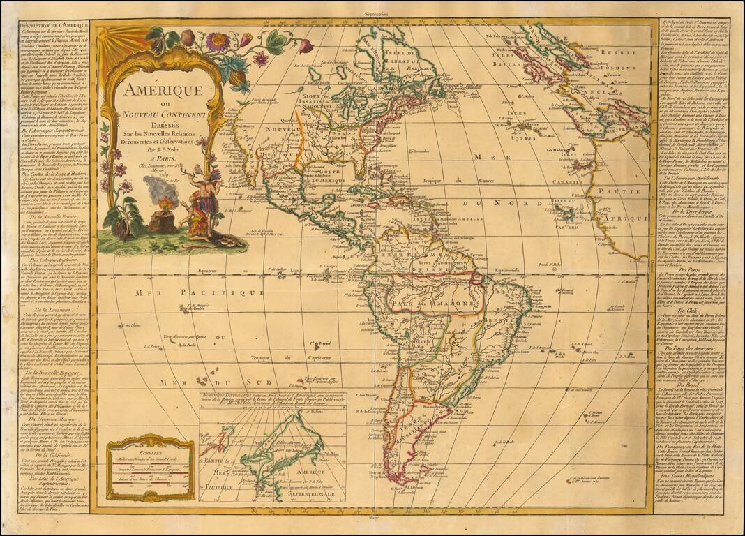
Decorative map of America, published in Paris by Daumont, based upon work of Johann Baptist Nolin. A fine early example of the map, which includes a large inset map showing the "New Discoveries" in the Northwest part of America, most notably the...
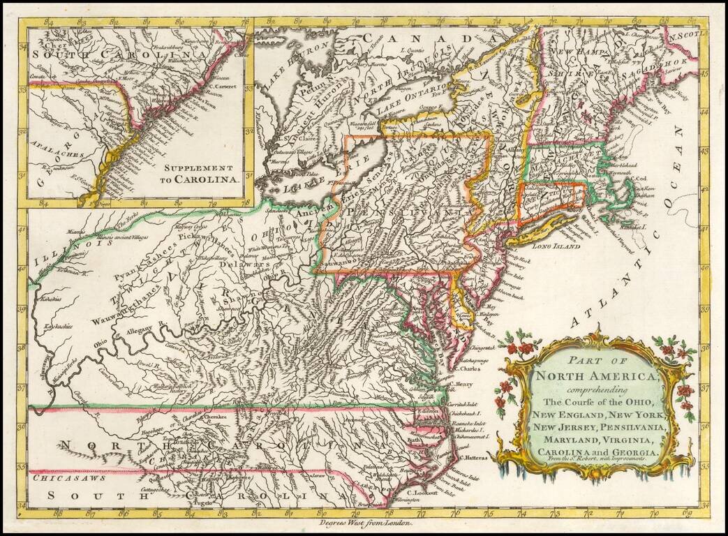
Detailed map of the British Colonies in North America during the French & Indian War. The map is based on Robert de Vaugondy's folio map of the same period and is filled with detail of early settlement, Indian villages and topography. The colonies...
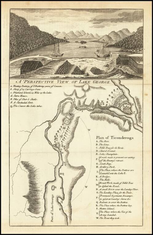
Fine view of Lake George and Fort Ticonderoga, with a map identifying important points of interest.
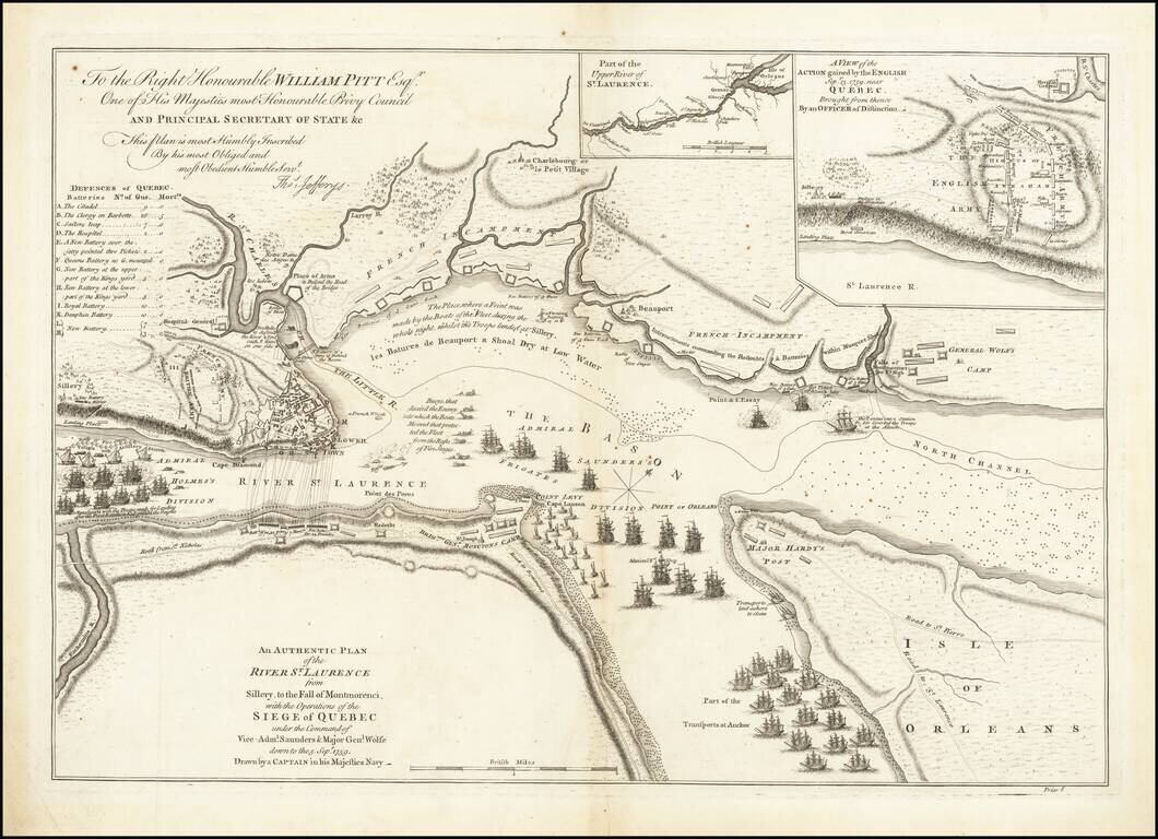
Battle Plan of the Siege of Quebec Striking example of the first State of Jefferys' map of the siege of Quebec of 1759, widely considered to be the most important single printed military map in Canadian history. Drawn by an officer of the Royal Navy,...
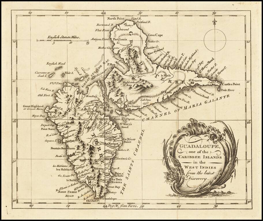
Detailed map of Guadalupe, showing towns, harbors, bays, rivers, lakes, and a host of other details. Decorative cartouche and compass rose.
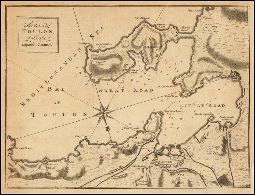
Engraved folding map showing the Bay of Toulon and surrounding defenses, published in the Gentleman's Magazine. The Gentleman's magazine was one of the foremost periodicals of its time, and was routinely consulted by the English public for its coverage...
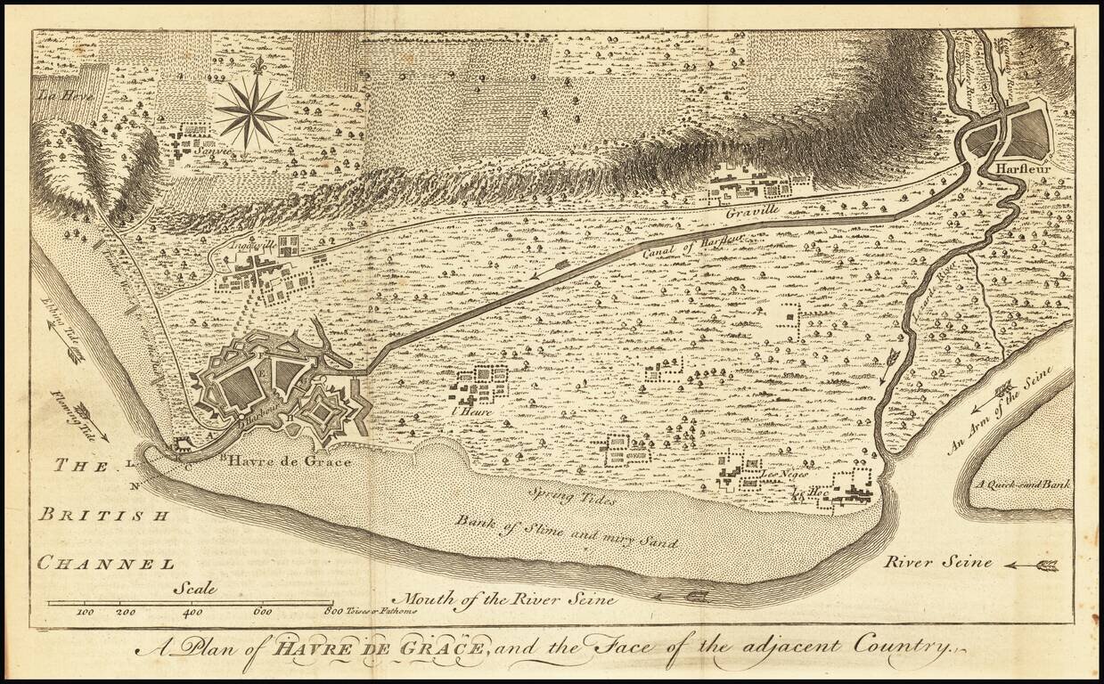
Detailed map of the area around Havre de Grace on the Seine River, along with the Canal of Harfleur and surrounding roads, rivers and town.
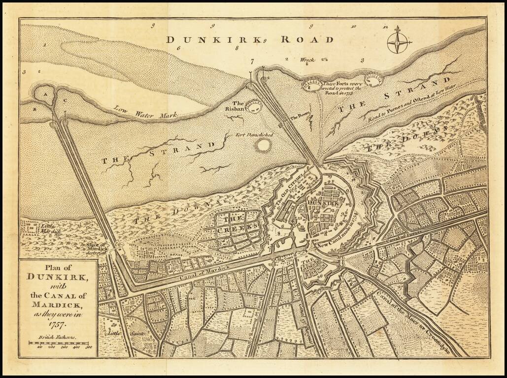
Detailed plan of the city of Dunkirk, including fortifications, town plan, roads, farms, rivers and canals. The map appeared in the Universal Magazine.
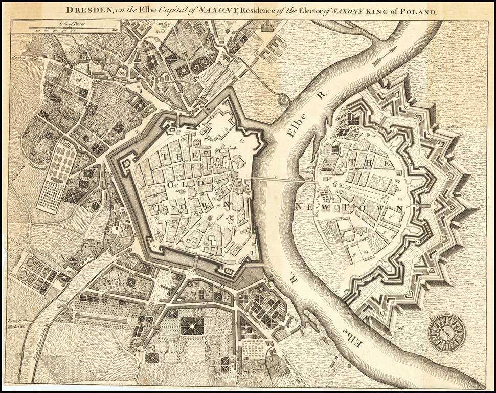
Fine early plan of Dresden was published in the supplement to the December 1759 issue of Universal Magazine, and accompanied an article on the city, with a focus on the treasures held within the Grünes Gewölb (Green Vault), a museum that holds the...
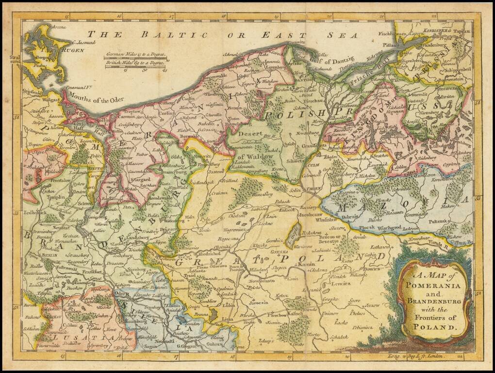
An attractive map of Poland and Northeastern Germany, with great detail of the small villages, forests, rivers, lakes and roads. Covers most of northern Poland with a bit of Germany, including Berlin and Frankfurt on the Oder River.
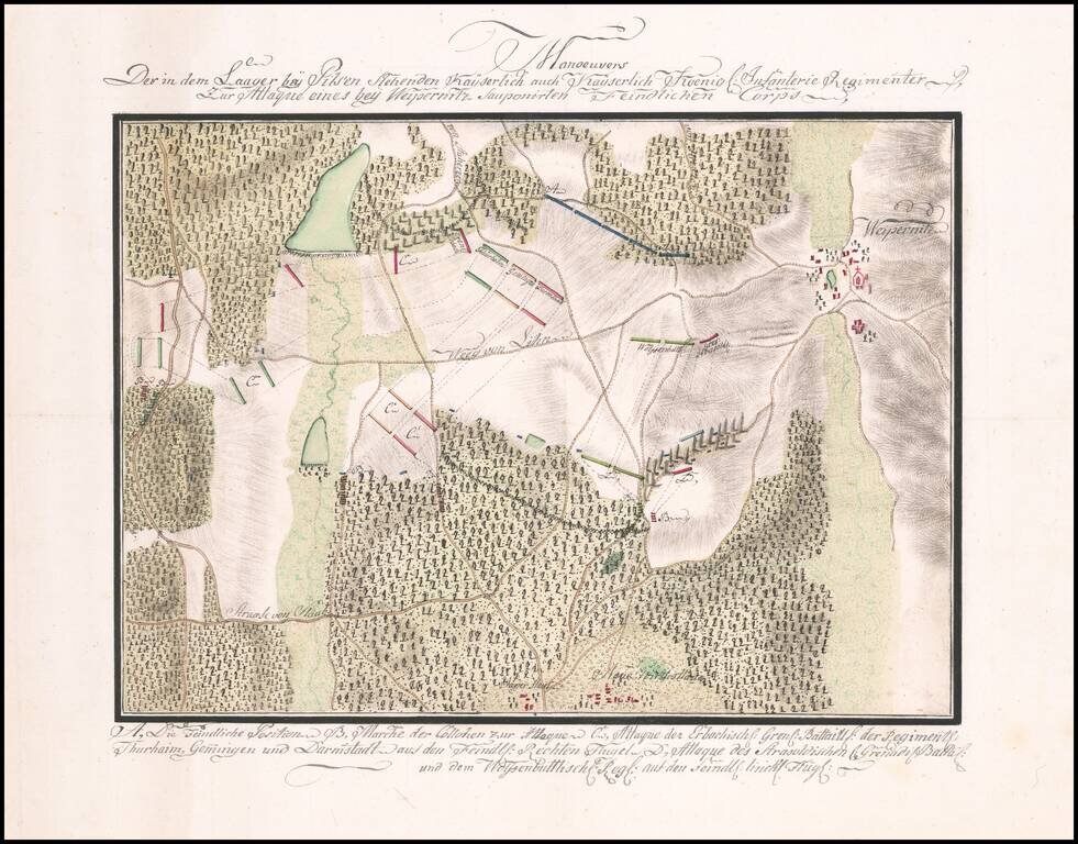
Manuscript Battle Plan of the area around Vejprnice, Czechia. Finely executed battle plan showing the troop positions to the west of the town of Weipernitz (Vejprnice), about 4 miles west of Pilsen (Plzen) in the northern part of the Czech Republic....
![[China Sea / Luzon / Hong Kong / Canton / Formosa] Bogt Toncqin](/map/small/64690.jpg)
Manuscript Sea Chart of the Coasts of China, Luzon and Vietnam Drawn by the Chief Mapmaker of the Dutch East India Company in Batavia (Jakarta) Striking and unique survival in the hand of Gerrit de Haan, the chief mapmaker of the Dutch East India...