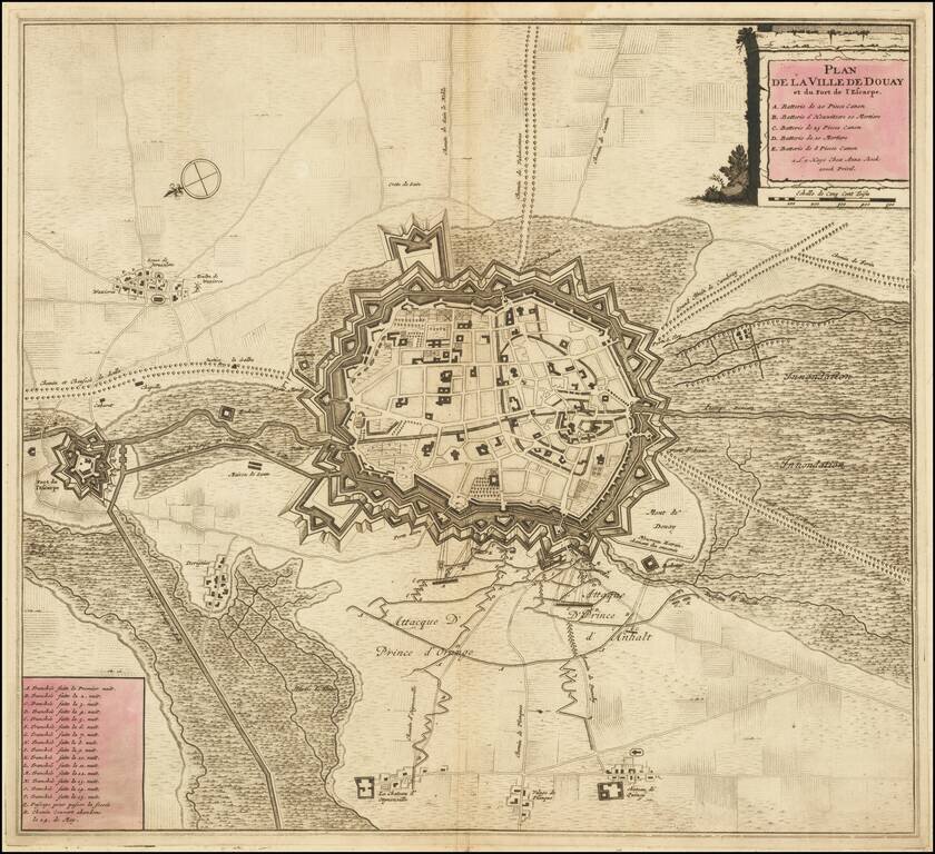
Striking example of Anna Beek's plan of Douay and the neighboring Fort D'Escape. The map focuses on the town fortifications and also includes details of the town plan, and neighboring fields and details.
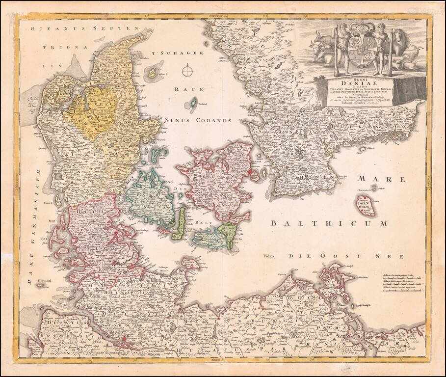
Fine dark impression of Homann's map of Denmark, Slesvig-Holstein and contiguous parts of Germany. Striking large cartouche includes elaborate coat of arms.
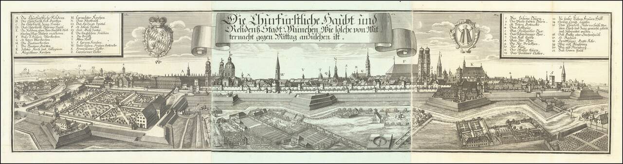
Very decorative and large panoramic view of Munich, published by Michael Wening. The city is shown surrounded by a massive palisade, glacis, mote, and walls. Inside, large buildings, churches, gardens, etc. can be seen. Landmarks inside and outside...
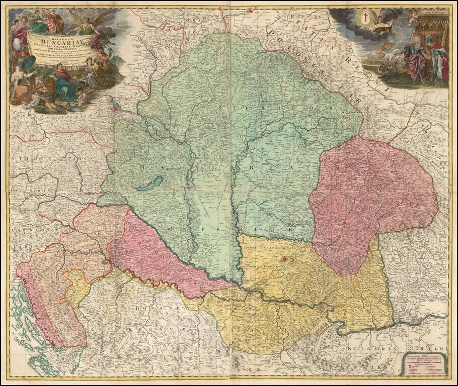
Fine Example of J.B. Homann's Wall Map of Hungary, Detailed early 18th century map of the region between Dalmatia, Serbia, Transylvania and Poland, centered on the Kingdom of Hungary Includes two decorative cartouches, the one at the right showing...
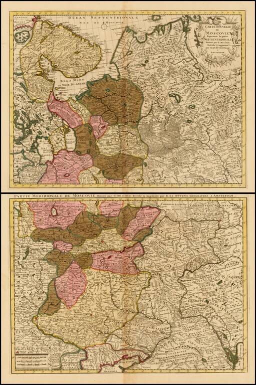
Attractive and detailed map of Russia and part of Ukraine, including decorative cartouche.
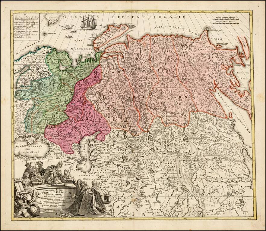
Striking large format map of Imperial Russia, at the beginning of the period when Russia was aggressively exploring the Pacific Ocean and Arctic Seas. Highly detailed map of the Russian Empire and northern China covering the region from Finland and...
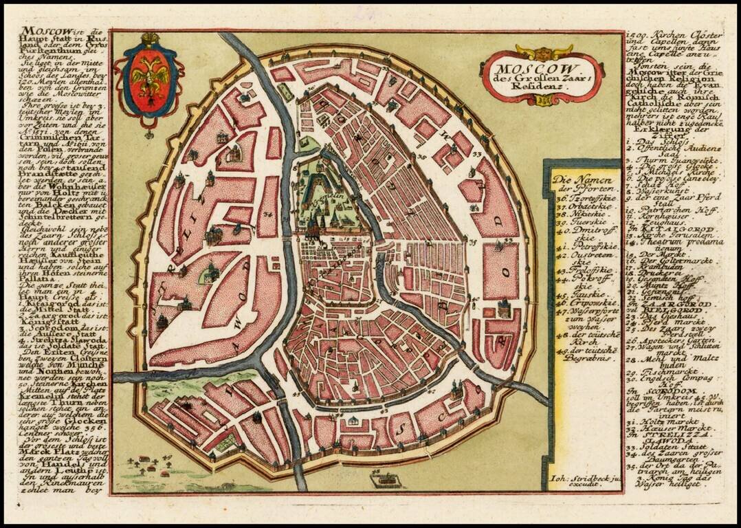
Finely detailed plan of Moscow, with extensive keys on either side of the map, identifying important places. Includes title cartouche and coat of arms.
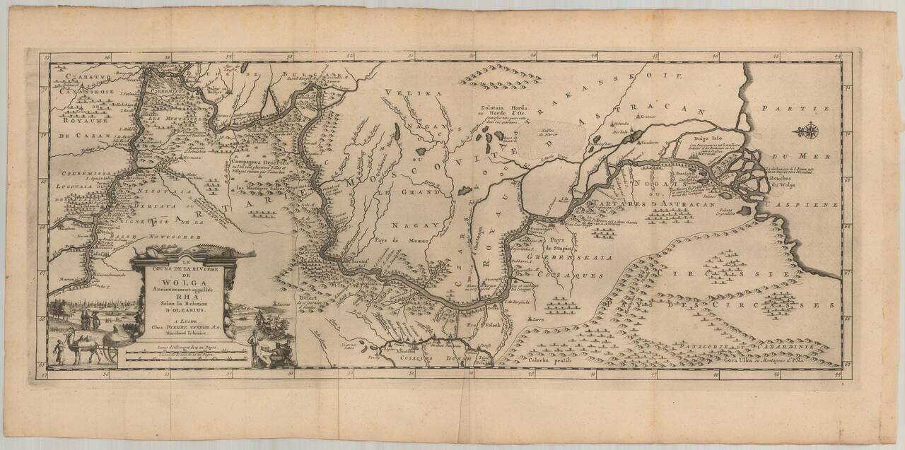
Nice example of Olearius' map of the Volga River, which first appeared in of Olearius' Relation du voyage d'Oléarius Adam en Moscovie, Tartarie, et Perse avec celui de I.A. De Mandelslo aux Indes Orientales - traduit de l'Allemand et augmenté par A....
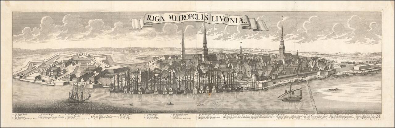
An Important Early View of Riga Striking example of this spectacular panoramic view of Riga, based upon the work of Friedrich Bernhard Werner (1690-1776). This is the first of several of Werner's views of Riga, which would be issued with revisions...
![[Daugavgriva] Die Haupt Vestung Dunamunder Schanz Welche die Saxen Anno 1700. Augustusburg nandten, aber Ao. 1701. auff Discretion wider auffgeben miessen.](/map/small/60087.jpg)
This is a small and well-engraved map of the fortress of Daugavgriva, located at the mouth of the Daugava River, just downstream from Riga. The map shows the fortress alongside an attractive title cartouche. An inset shows the region, including Riga,...
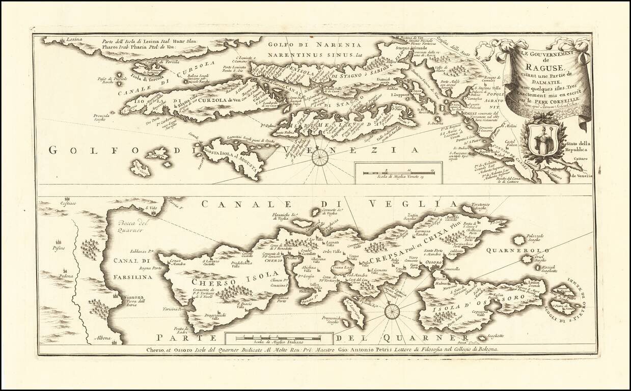
Rare map of the Republic of Ragusa on the Dalmatian coast around Dubrovnik, published in Amsterdam by Peter Schenk Junior. The map covers the area from Kotor to the island Korcula, Hvar and Island Cres and Losinj, with a part of the Istrian coast...
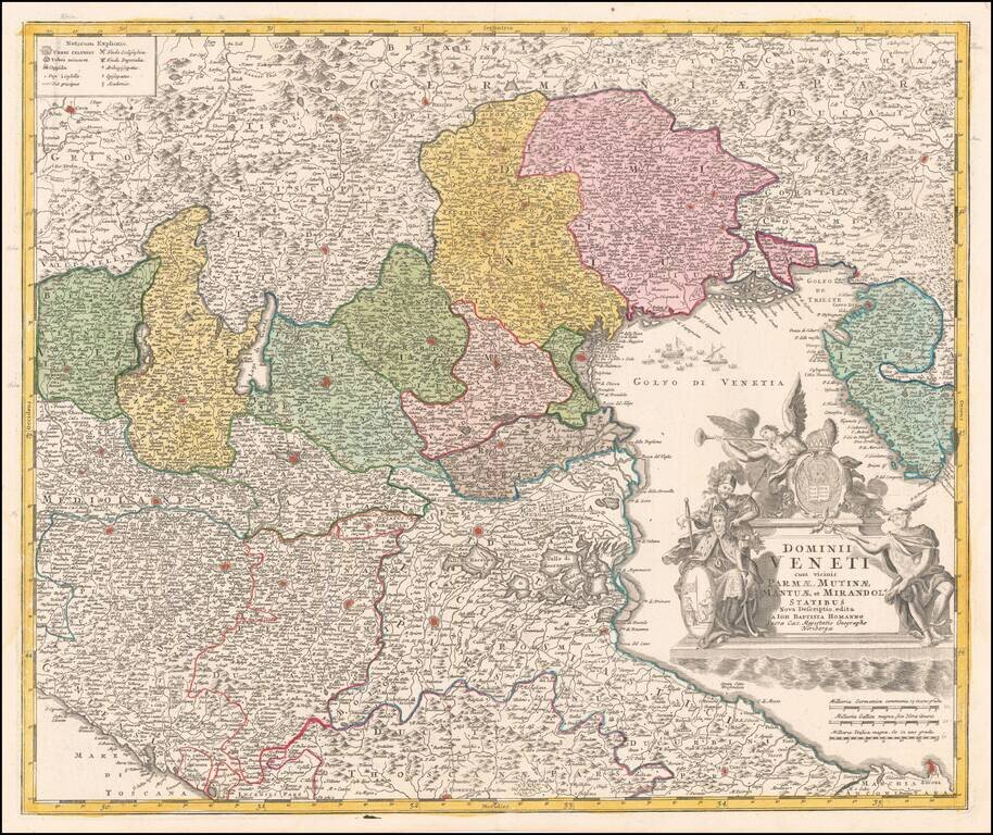
Nice full color example of this decorative map of the Dominions of Venice, published by Homann in Nuremberg. Includes a large decorative cartouche.
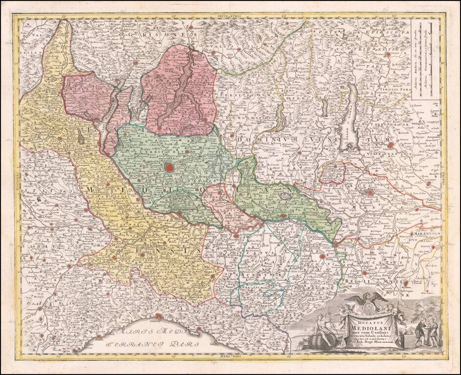
Detailed regional map of the Duchy of Milan, centered on Milan, published by JB Homann in Nurmberg. The map includes Lago Maggiore, Lago Como and Lago Garda. Other major cities include Genova, Mantova, Modena, Verona, Trient, Cremona, Parma,...
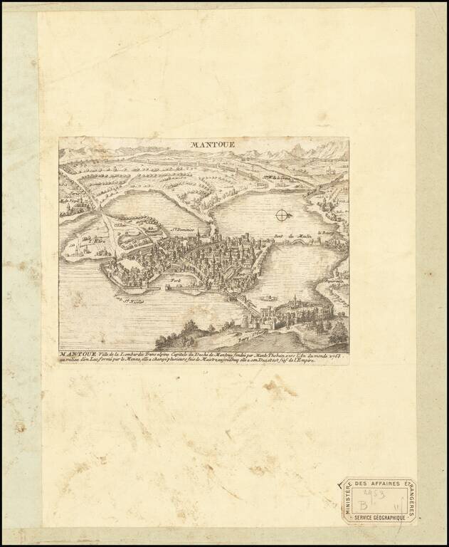
Engraved birdseye view of Mantua, a northern Italian city surrounded by lakes. The view pictures an early Mantua before the southern lakes were drained. Several streets and neighborhoods are named throughout this view, as well as the various bridges...
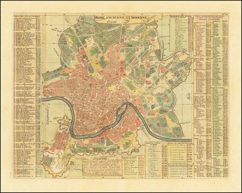
Highly detailed plan of Rome with substantial notes concernign locations of the various buildings, streets, gardens, colleges, churches etc. A finely engraved map from Chatelain's monumental 7 volume Atlas Historique, one of the most famous and...