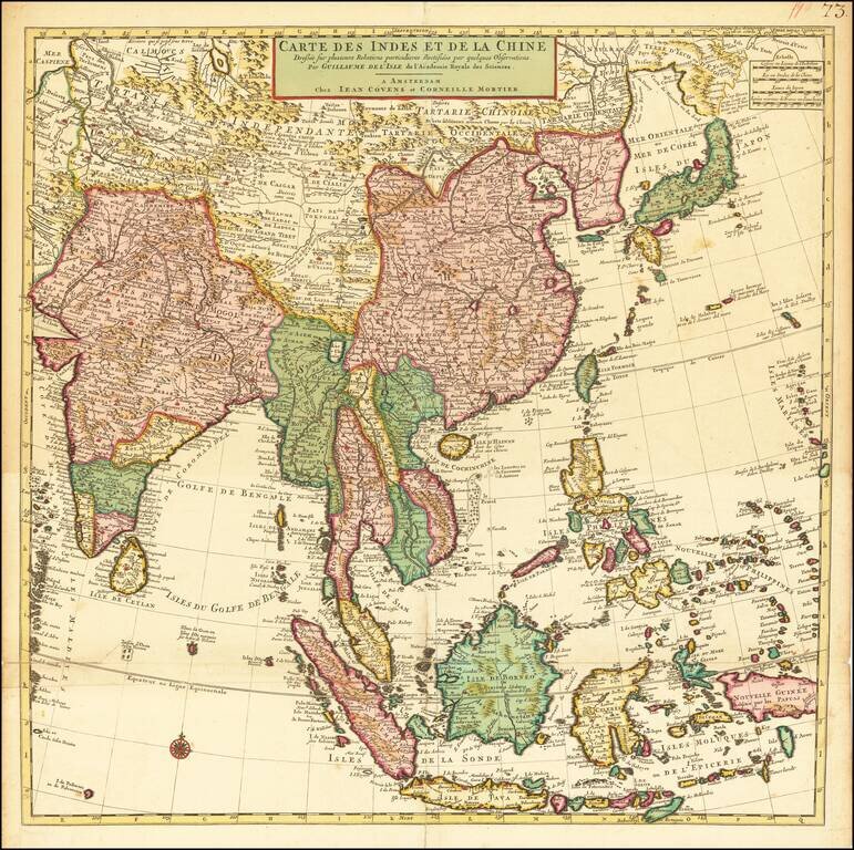
Fine, Detailed Map of Eastern Asia Notable example of this meticulously-drawn map of East Asia and the Indian subcontinent published in Amsterdam. The map is based upon the earlier work of the famed geographer Guillaume De L'Isle. It covers much of...
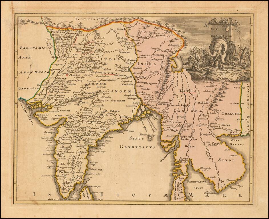
Decorative map of ancient India, from Weigel's Descriptio Orbis Antiqui.
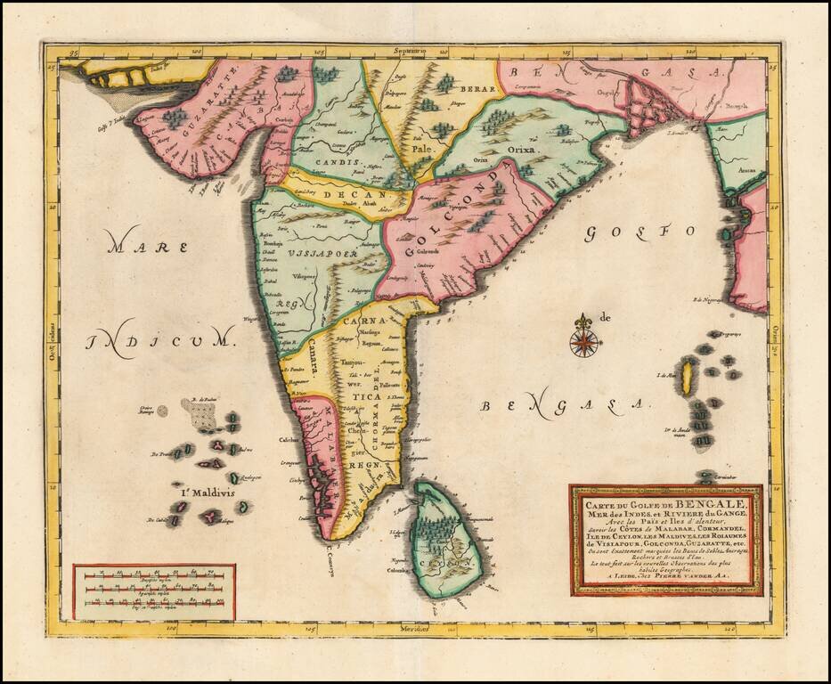
Detailed map of the southern part of India, Sri Lanka and the Maldives, published by Vander Aa in Leiden. The map provides a highly detailed treatment of the region, including topographical details.
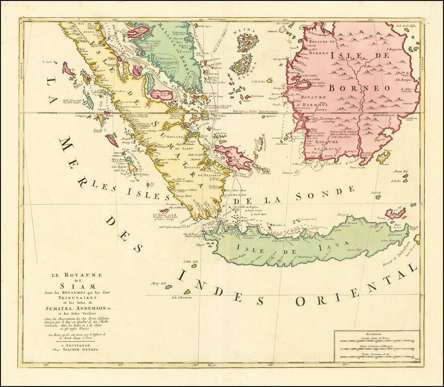
In Fine Contemporary Dutch Color Fine old color example of Joshua Ottens map of Southeast Asia, extending from the Malay Peninsula in the north to Java and Sumatra in the south, with Malacca and Borneo. One of the more fascinating notes shows a...
![l'Ile de Sumatra . . . [shows Singapore]](/map/small/68965.jpg)
Detailed map of Sumatra, Singapore Straits (Straet van Sincapura), Bintan Island (P. Panjang) and the contiguous coastline of Malaysia. Malacca is named, with some coastal and river details around Kuala Lumpur (P. Perach, R. Perang, Songi Borros)....
![Imperii Persici In Omnes Suas Provincias . . . [includes Cyprus]](/map/small/64524.jpg)
Detailed map of the Persian Empire, published by Homann. The maps extends from the Black Sea, Khasikstan and Turkistan in the North to the Red Sea, Persian Gulf, Euphrates and the Mediterranean in the South, showing almost all of Cyprus. Decorative...
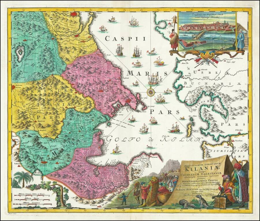
Decorative Map of Northern Iran, Part of Azerbaijan, Armenia and Turkmenistan -- Caspian Sea Region Gorgeous map of parts of Georgia, Armenia Kilani, Dageston, Schirvan and the southern part of the Caspian sea with Caucasus and Turkmenistan....
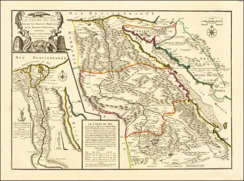
Striking large format map of the Nile, Egypt, the Red Sea and contiguous regions, from De Fer's Atlas ou Recueil de cartes geographiques. De Fer's highly detailed map shows the course of the Nile River from Abyssinia through Egypt to the Mediterranean...
![[Kashan] Prospect der Stadt Caschan in Persien sunff tag reisen von Ispahan](/map/small/62095.jpg)
Scarce panoramic town-view of Caschan (Iran) near Ispahan with good detail of Mosques etc.
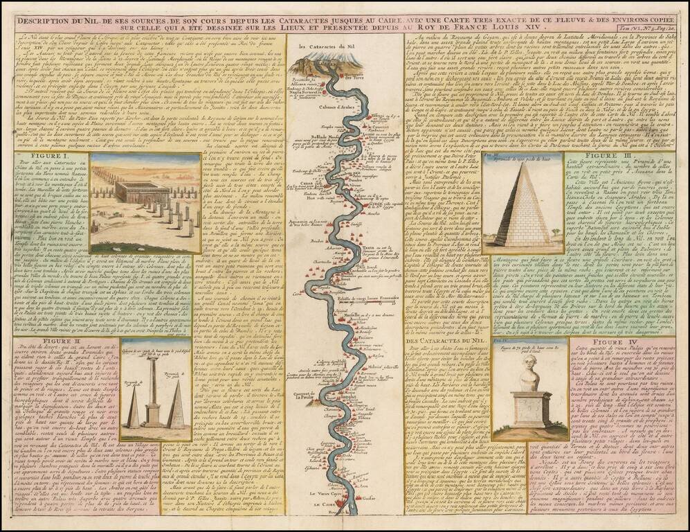
Detailed map of the course of the Nile, from the cataracts of the Nile at the south (top of the image) to Cairo and Giza. At the right, one of the Pyramids is shown (1400 Pieds tall), with additional images at the left from the Nile River Valley.
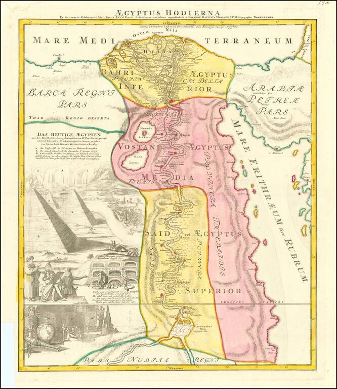
Nice full color example of Homann's decorative map of Egypt. Homann's map of Egypt is focused on the Nile River Valley from the Mediterranean to below the first cataract at the confluence of the White and Blue Nile. Nearly a third of the map is...
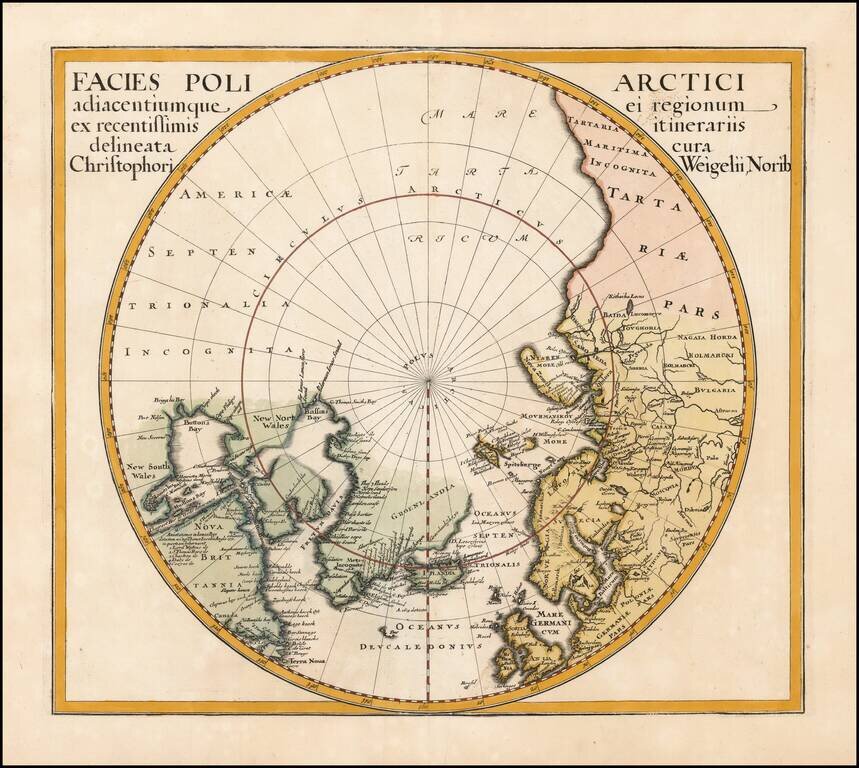
Interesting map of the North Pole from Davide Kohler's Descriptio Orbis Antiqui…published by Weigel in 1720. The map shows the prevailing belief in a massive northern hemisphere, extending to Alaska, Canada, the British Isles, Scandinavia and...