![[Heightened in Gold] Tabula Novissima atque Accuratissima Caraibicarum Insularum sive Cannibalum quae etiam Antille Gallicae Dicuntur Item Insulae Supraventum, et in Archipelago Mexicano](/map/small/60450op.jpg)
Fine contemporary color example of Ottens map of the Windward Islands, with a large inset map of Martinique. The map is heightened in gold and colored in the most deluxe fashion -- the best example we have ever seen. The map bears the imprint of the...
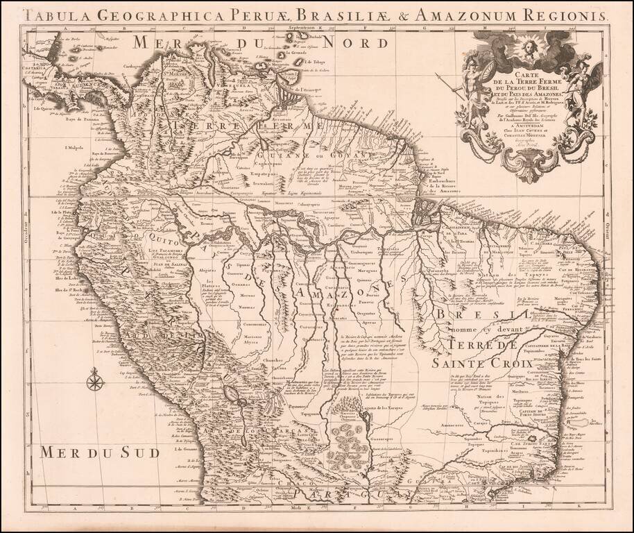
Nice example of Coven's & Mortier's edition De L'Isle's maps of the northern part of South America. The map Colombia, Venezuela, Peru, Ecuador, Brazil, Guiana and parts of Bolivia, Chile, Paraguay and Argentina. De L'Isle was known for his fine...
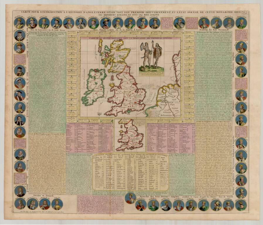
Fantastic early map of the British Isles, surrounded by the portraits of the Saxon Kings and Queens of England, from Egbert in 801 to Queen Anne in 1701. Central map of the British Isles under Roman occupation. Smaller map defining the Anglo-Saxon...
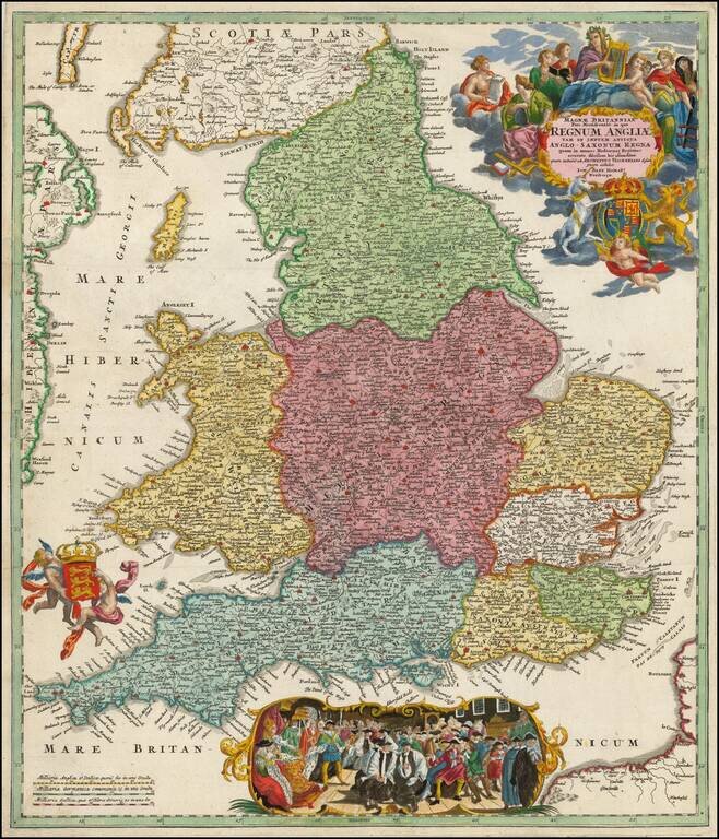
Decorative map of England, title cartouche, two coats of arms and decorative vignette. Includes a scene of scene with the Royal Court presiding. Large allegorical cartouche and two coats of arms.
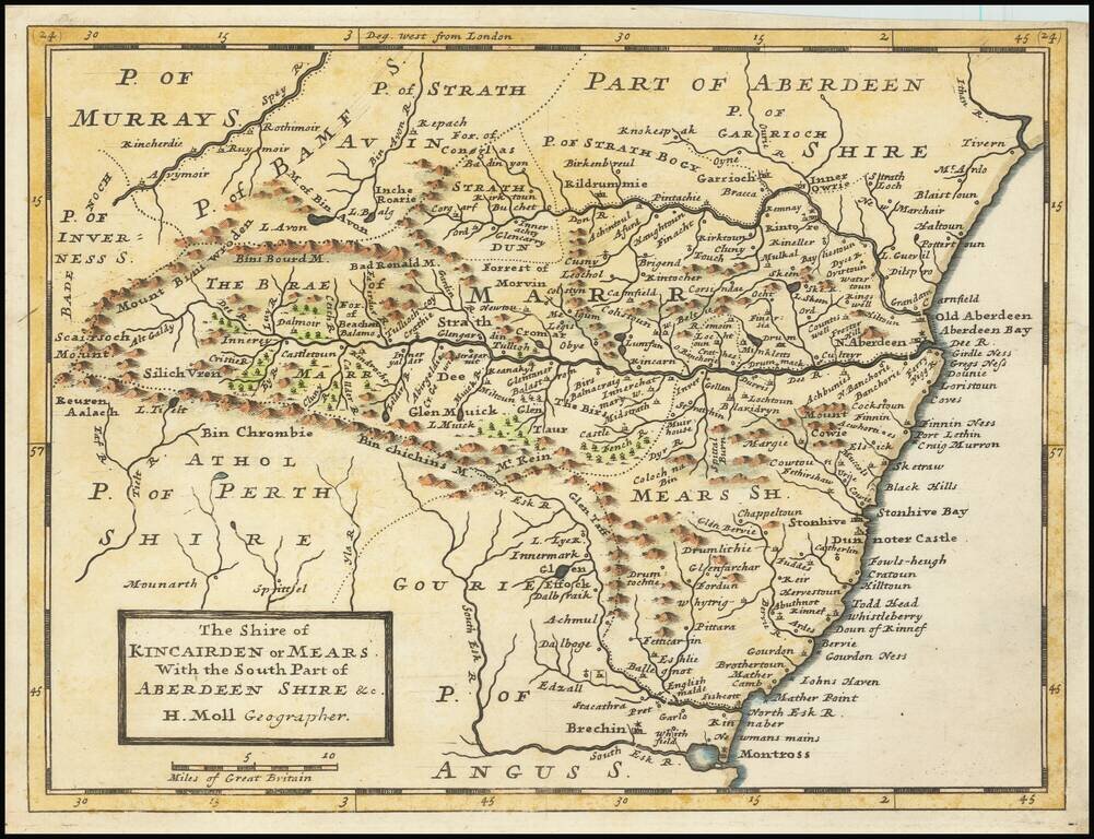
Small engraved map of the region around Aberdeen, Scotland, by Herman Moll. Shows the old shires Kincairden or Mears and part of Aberdeenshire.
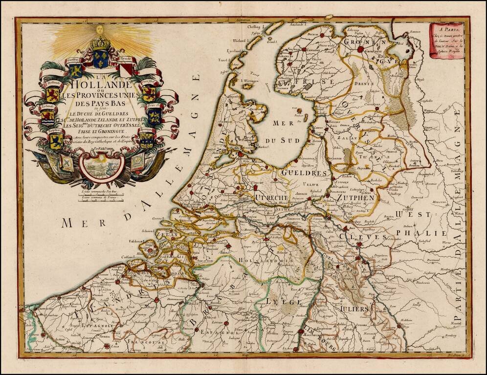
Scarce map of the 7 Provinces published in Paris by Danet. Includes 7 coats of arms in the title cartouche.
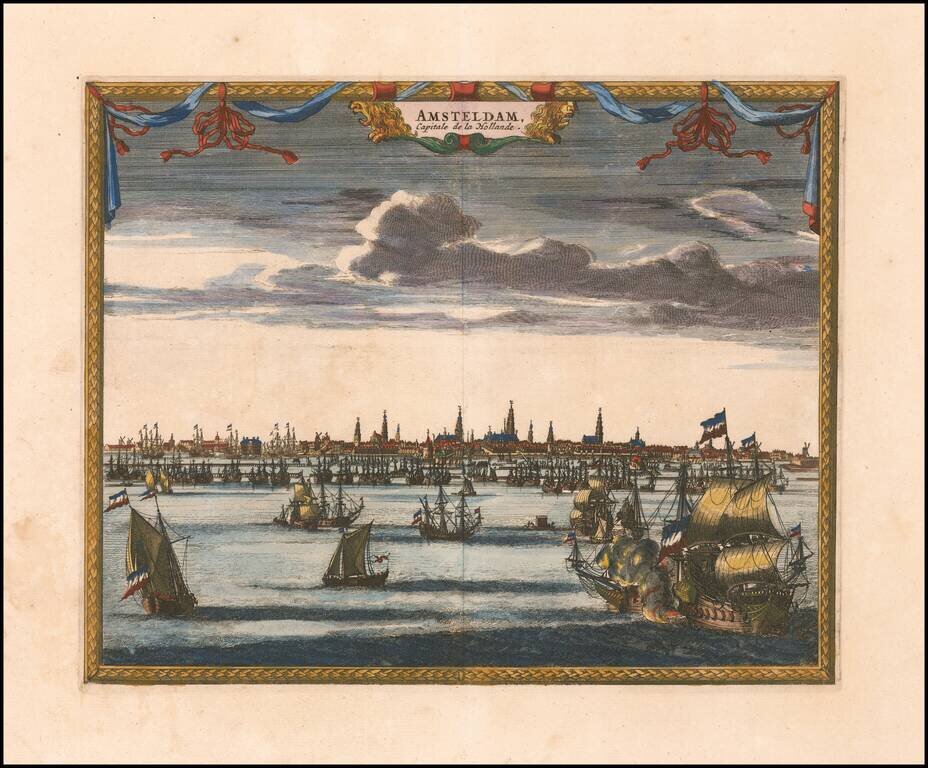
Attractive and uncommon panorama of Amsterdam, which appeared in Van der Aa's Galerie Agreeable du Monde.
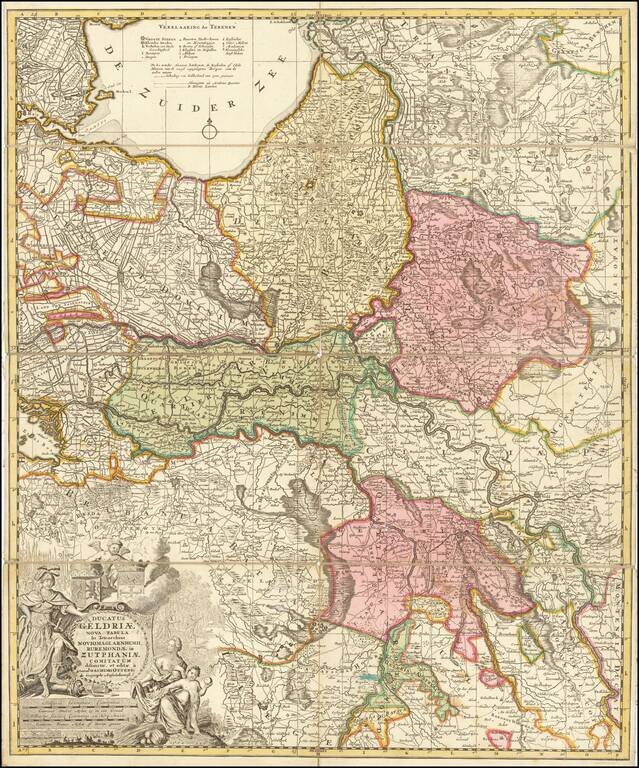
Detailed map of the Duchy of Gelderland, Zutphen, and part of northern Netherlands, published in Amsterdam by Ottens. Includes an elaborate cartouche.
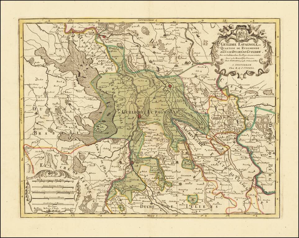
Attractive engraving of Gelderland with the towns of Roermond and Venlo at center. The map is filled with tiny villages, towns, lakes and rivers. Adorned by a decorative strapwork title cartouche and five distance scales. The county of Gelderland,...
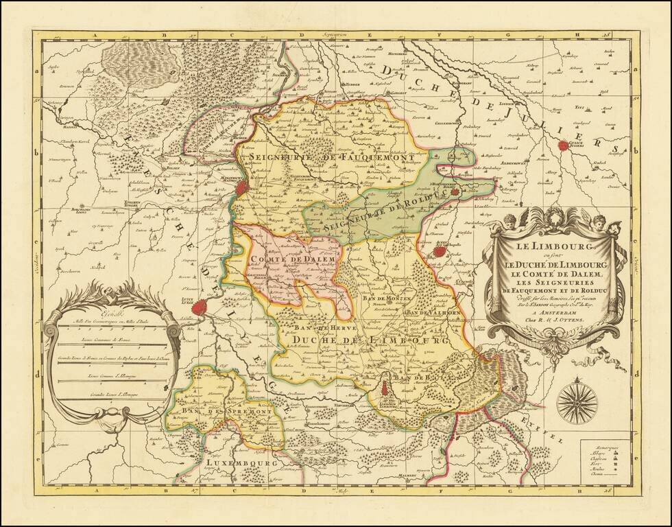
A fine and detailed map of Limburg and Dalem in the southern Netherlands. The map includes a separate sheet with an alphabetical table of towns and villages within Limburg. Based on the work of Nicholas Sanson, the map highlights the counties and...
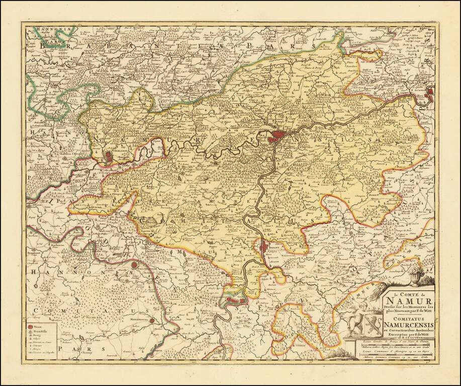
Detailed map of the County of Namur, published in Amsterdam by Ottens.
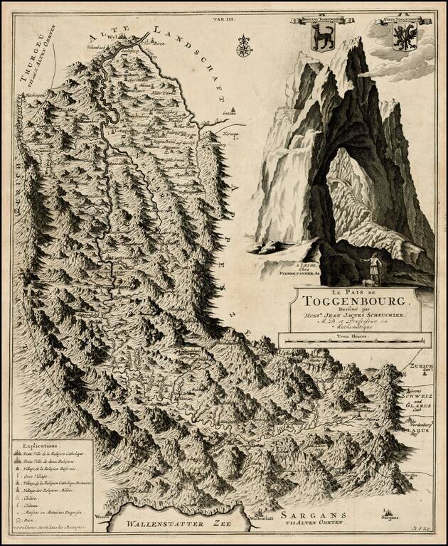
Detailed regional map of Toggenbourg in the Kanton of St. Gallen, with two coat of arms and a striking mountain image. Fantastic topographical image.
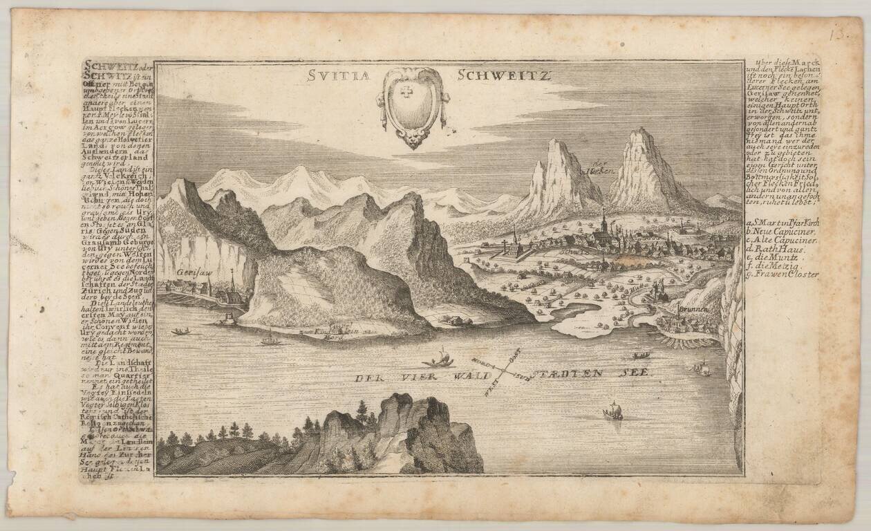
Detailed antique engraved view of Schwyz, Switzerland, probably published in Bodenehr's Curioses Staats und Kriegs Theatrum. The view faces north over Vierwaldstattersee, with Gersau on the left and Schwyz on the right. The coat of arms of Schwyz is...
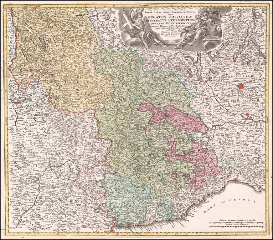
Striking example of Homann's decorative map of the Savoy and Piedmont regions, centered on Torino. The map coverage extends from Grenoble, Geneva, Die and Romans, to Genoa and Milan. Highly detailed, with excellent graphical representation of the...
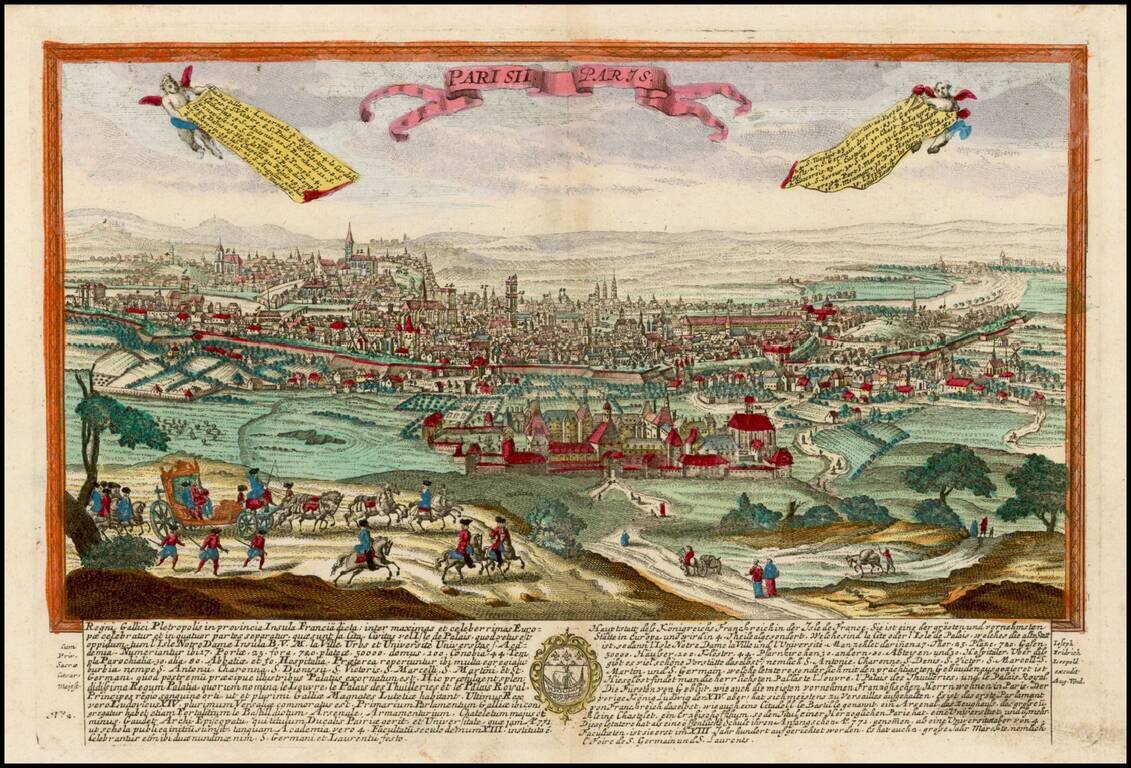
Finely engraved view of Paris, based upon a larger view by Jeremiah Wolff. Leopold's view of Paris was one of a rare series of views, published in Augsburg.
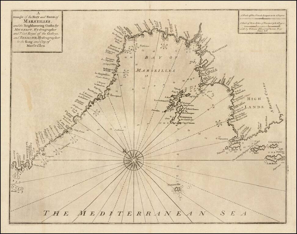
Striking chart of area around the Bay of Marseille, based the chart of the Marseilles region published in Henri Michelot and Laurent Bremond's Carte Generalle dele Mer Mediterranee. The map appeared in Mount & Page's English Pilot, Book III....