Map size in jpg-format: 21.5267MiB
Click to open in high resolution (open in new tab).

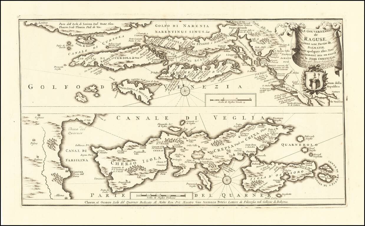
Rare map of the Republic of Ragusa on the Dalmatian coast around Dubrovnik, published in Amsterdam by Peter Schenk Junior.
The map covers the area from Kotor to the island Korcula, Hvar and Island Cres and Losinj, with a part of the Istrian coast below.
A note in Italian next to Dubrovnik describes the city being destroyed in the earthquake of 1667 and its later reconstruction. The upper image is partly based on the map by Vincenzo Coronelli from ca 1695 showing the Republic of Dubrovnik (Ragusa) that existed from 1358 to 1808. The uncommon lower map showing the island Cres is dedicated to Giovanni Antonio Petris, a lecturer of philosophy at the Bologna Universiti. Petris da Cherso (or Petric in Croatian) came from an old noble family of Cres.
Peter Schenk the Elder (1660-1711) moved to Amsterdam in 1675 and began to learn the art of mezzotint. In 1694 he bought some of the copperplate stock of the mapmaker Johannes Janssonius, which allowed him to specialize in the engraving and printing of maps and prints. He split his time between his Amsterdam shop and Leipzig and also sold a considerable volume of materials to London.
Peter Schenk the Elder had three sons. Peter the Younger carried on his father’s business in Leipzig while the other two, Leonard and Jan, worked in Amsterdam. Leonard engraved several maps and also carried on his father’s relationship with engraving plates for the Amsterdam edition of the Histoire de l'Académie Royale des Sciences.
If you are a student, write to us in telegram: @antiquemaps and indicate what material you need and for what work you need a map in high detail. We are ready to provide material on special terms. For students only!