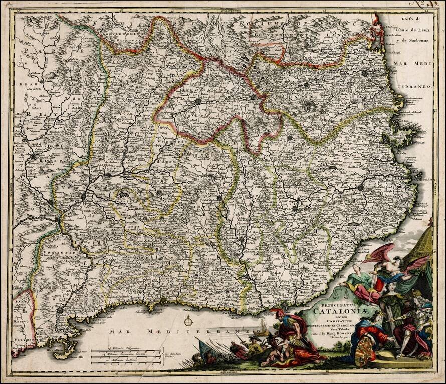
Decorative example of Homann's map of Catalonia. Includes ornate cartouche, coat of arms, etc. The present example would appear to be an early example of the map, pre-dating Homann's privilege.
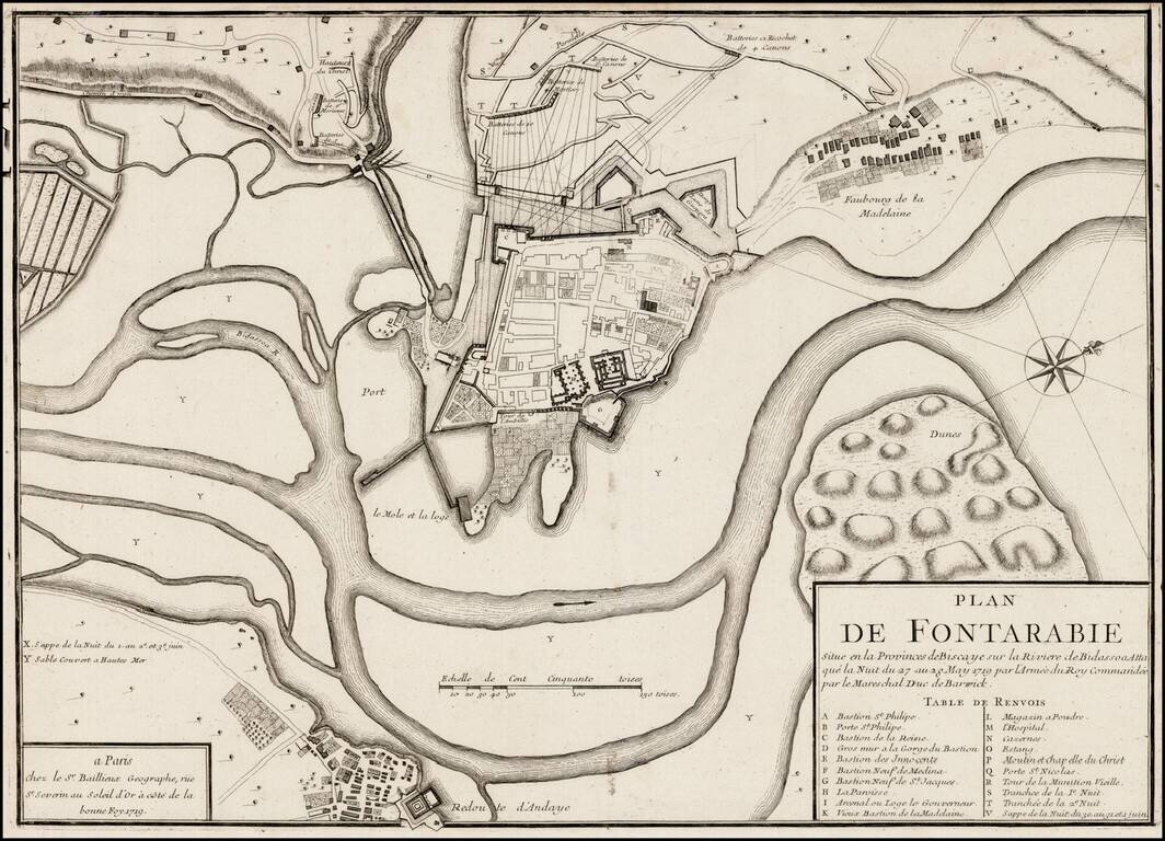
Rare plan of the siege of Fontarabia, published by Gaspar Bailleul in Paris. Fontarabia was attacked by French in May 1719. The main body of the army, in all forty thousand strong, crossed the frontier soon afterwards, and entered upon the blockade,...
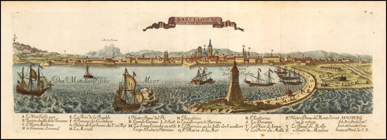
Rare birdseye view of Barcelona, published in Augsburg by Leopold. Includes a decorative coat of arms and a key listing 24 important places within the view. Not in Fauser.
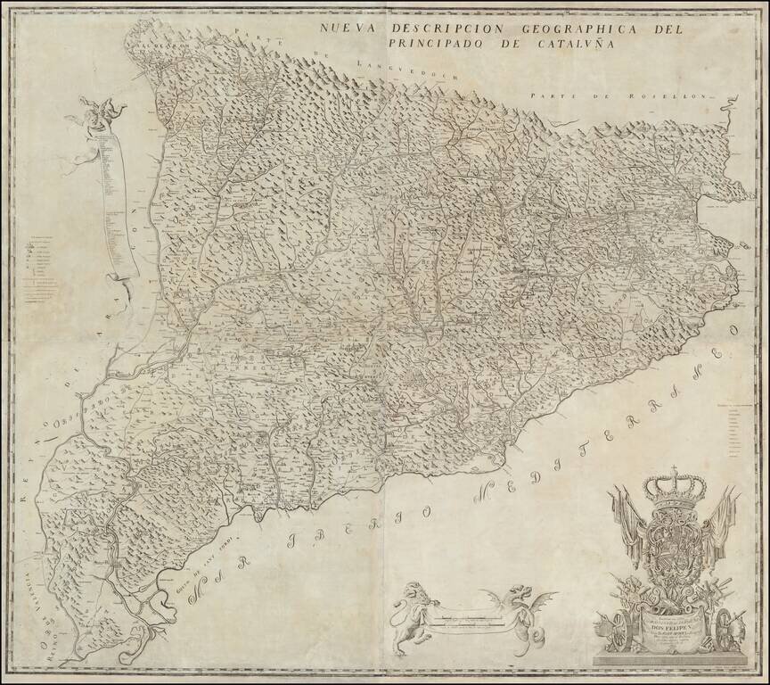
The First and Most Famous Domestically Produced Map of Catalonia of the Eighteenth Century Fine map of Catalonia by Josef Aparici, the first large format map of Catalonia published by a Catalan. The map was first published in 1720, with a second...
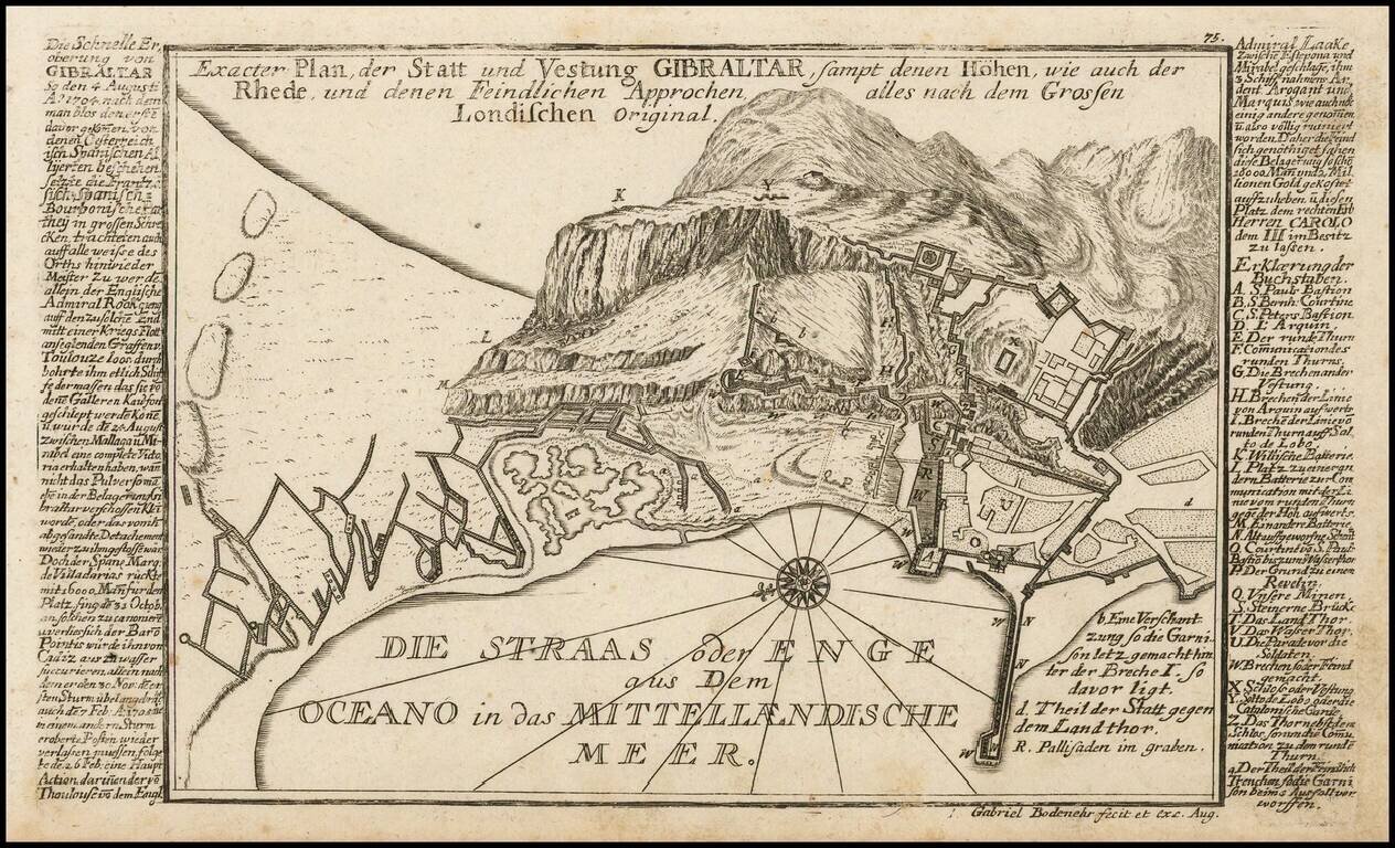
Detailed antique engraved Gibraltar, probably published in Bodenehr's Curioses Staats und Kriegs Theatrum. The plan features a detailed treatment of the topography of Gibraltar, as well as the fortification and major buildings of the famous peninsular...
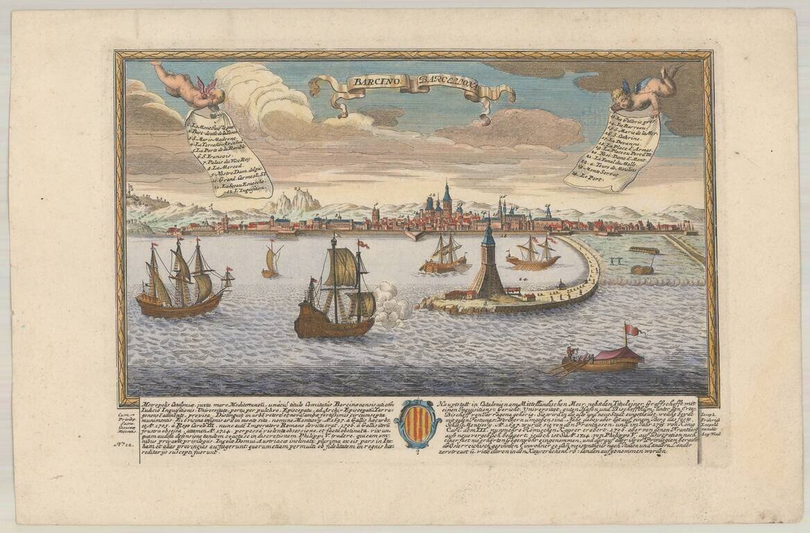
Rare View of Barcelona, Capital of Catalonia. Finely engraved view of Barcelona, published in Augsburg by Johann Stridbeck. Includes a striking harbor view.
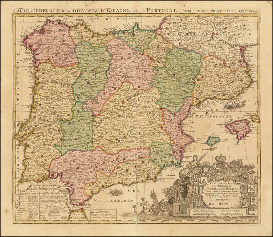
Decorative map of Spain and Portugal, identifying a number of the significant battles fought during the war of Spanish Succession. The map includes a number of battles, including a graphic depiction of the naval Battle of Velez-Malaga (August 24,...

Antique Map of the Environs of Istanbul with a View of "the city of Stambul or Constantinople" from the East Side of the Bosphorus Decorative antique map and early view of Istanbul and environs. The map includes a large inset bird's-eye view of the...
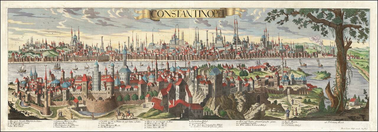
Rare, Highly Detailed View of Sixteenth-Century Istanbul This exceptional view of Constantinople (Istanbul) was published by Jeremiah Wolff, the most successful map publisher in Augsburg during his time. It is sumptuously detailed and includes the...
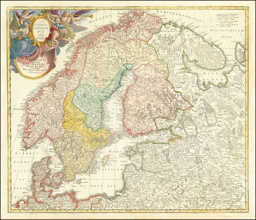
Nice example of Homann's first map of Scandinavia, pre-dating his privilege, where he reworks the map to include a different title and cartouche. Provides excellent detail throughout the region.
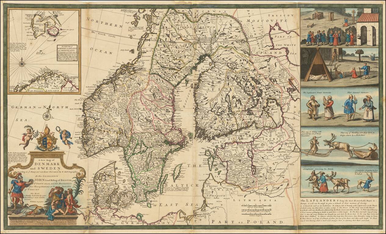
Nice example of Herman Moll's map of Scandinavia, with a large inset map and 5 wonderful vignettes, including a very early example of skiing. A very interesting note on the Laplanders below the vignettes and other notes throughout. This example of...
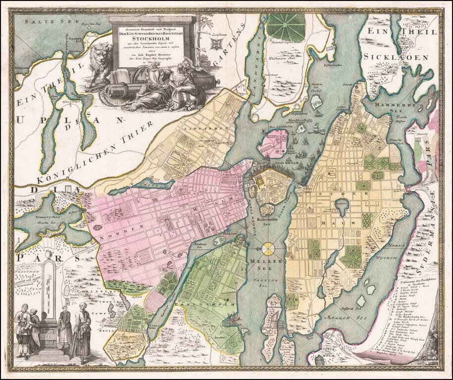
Detailed plan of Stockholm, by one of the leading German map makers of the early part of the 18th Century. Includes an elaborate plan, 2 cartouches and a key showing 28 places.
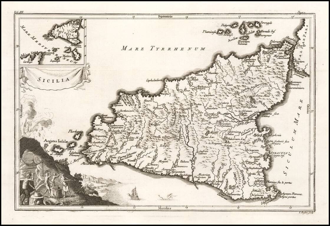
Decorative map of Ancient Sicily, with an inset showing Sicily's relationship to the coast of Africa. Vignette shows Mount Aetna erupting, with a work scene below.
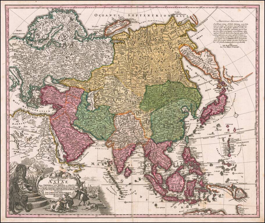
Nice example of Johann Christoph Homann's first map of Asia. The map extends from the Mediterranean to the Pacific and including parts of Nova Hollandia, Carpentaria, Nova Britannia and the Marianas, along with a nice incomplete version of the...
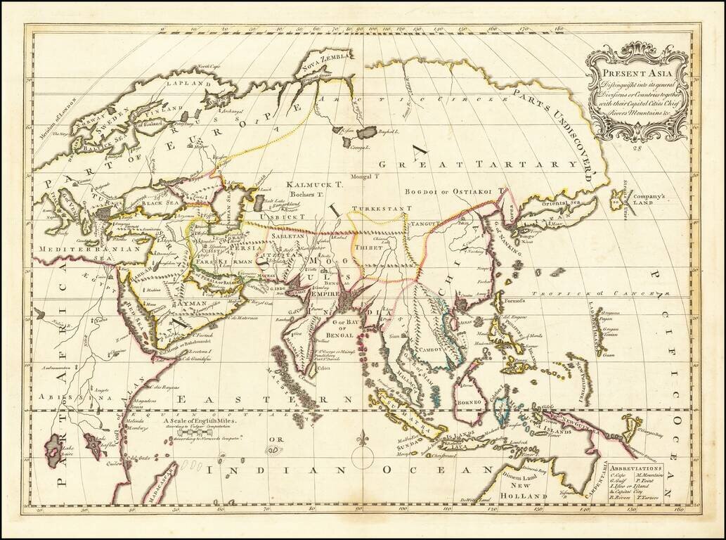
Rare late state of Wells modern map of Asia. This decorative map was part of a set of 22 maps dedicated to William, Duke of Glouchester, who was then an 11 year old student at Oxford.