Map size in jpg-format: 44.3457MiB
Click to open in high resolution (open in new tab).
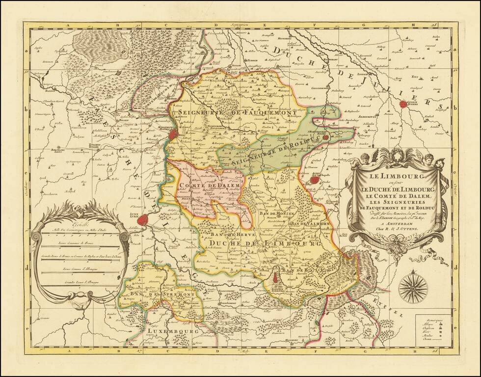
A fine and detailed map of Limburg and Dalem in the southern Netherlands. The map includes a separate sheet with an alphabetical table of towns and villages within Limburg.
Based on the work of Nicholas Sanson, the map highlights the counties and lordships of Faquemont, Rolduc, Salem, Herve, Balen, Sprimont, Monzen, etc, Major cities are colored coded in red including Aachen, Maastricht, Liege, Limburg, etc. The map is embellished with a beautifully engraved title cartouche, scale of distance, a compass, and remarks. Abbeys, chateaus, forts, windmills, and paths are noted throughout the region.
If you are a student, write to us in telegram: @antiquemaps and indicate what material you need and for what work you need a map in high detail. We are ready to provide material on special terms. For students only!


