logo

1720. Carte pour l'Introduction a l'Histoire d'Angleterre ou l'on Voit son Premier Gouvernement et l'Etat Abrege de cette Monarchie sous les Empereurs Romains, et sous les Rois Saxons

  • Carte pour l'Introduction a l'Histoire d'Angleterre ou l'on Voit son Premier Gouvernement et l'Etat Abrege de cette Monarchie sous les Empereurs Romains, et sous les Rois Saxons

Carte pour l'Introduction a l'Histoire d'Angleterre ou l'on Voit son Premier Gouvernement et l'Etat Abrege de cette Monarchie sous les Empereurs Romains, et sous les Rois Saxons information:

Year of creation: 
Resolution size (pixels): 
 7901x6762 px
Disk Size: 
 9.34223MiB
Number of pages: 
 1
Place: 
 Amsterdam
Author: 

Print information. Print size (Width x height in inches):
Printing at 72 dpi 
  109.74 х 93.92
Printing at 150 dpi 
 52.67 х 45.08
Printing at 300 dpi 
 26.34 х 22.54

An example of detailing the file of this map of in a printable high-resolution:

Click to open in high resolution (open in new tab).
Attention! this is just the central piece (central area 960x960 px) of the map file!
This is an example, so that you can see and study the level of detail of a given map. The entire Map will be fully available after payment!

Carte pour l'Introduction a l'Histoire d'Angleterre ou l'on Voit son Premier Gouvernement et l'Etat Abrege de cette Monarchie sous les Empereurs Romains, et sous les Rois Saxons

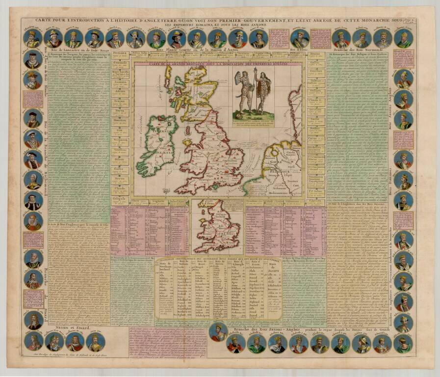
Fantastic early map of the British Isles, surrounded by the portraits of the Saxon Kings and Queens of England, from Egbert in 801 to Queen Anne in 1701.

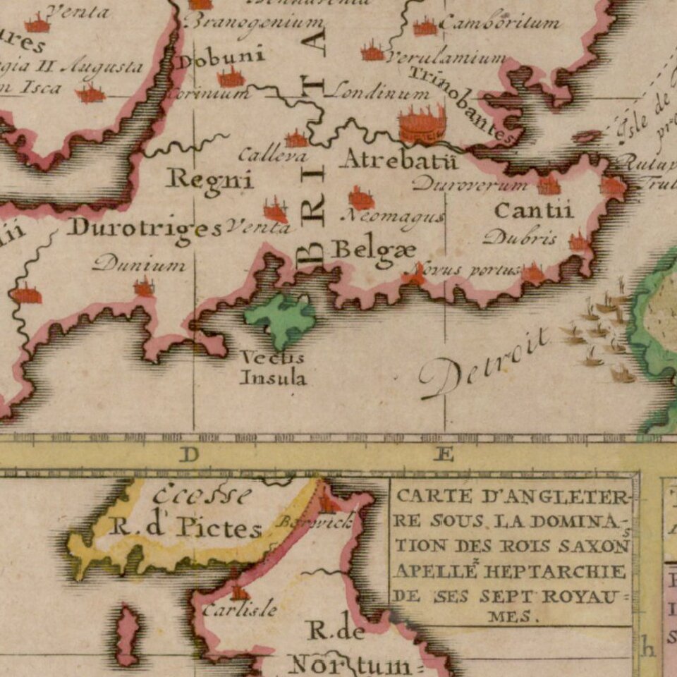
Central map of the British Isles under Roman occupation. Smaller map defining the Anglo-Saxon kingdoms. Both maps surrounded by extensive panels of descriptive text

A marvelous and highly decorative map.

Henri Abraham Chatelain (1684-1743) was a Huguenot pastor of Parisian origins. Chatelain proved a successful businessman, creating lucrative networks in London, The Hague, and then Amsterdam. He is most well known for the Atlas Historique, published in seven volumes between 1705 and 1720. This encyclopedic work was devoted to the history and genealogy of the continents, discussing such topics as geography, cosmography, topography, heraldry, and ethnography. Published thanks to a partnership between Henri, his father, Zacharie, and his younger brother, also Zacharie, the text was contributed to by Nicolas Gueudeville, a French geographer. The maps were by Henri, largely after the work of Guillaume Delisle, and they offered the general reader a window into the emerging world of the eighteenth century.


Special conditions for students!

If you are a student, write to us in telegram: @antiquemaps and indicate what material you need and for what work you need a map in high detail. We are ready to provide material on special terms. For students only!

Item information:

Year of creation:
Size:
7901x6762 px
Disk:
9.34223MiB
Number of pages:
1
Place:
Amsterdam
Author:
Henri Chatelain.
$14.99

Related item