
Detailed map showing parts of Wyoming, Colorado, New Mexico and South Dakota, extending west to Rocky Mountains, the Rio Grande River, San Luis Valley and Cheyenne area Shows the proposed raiload lin along the South Fork of the Platte River, extending...
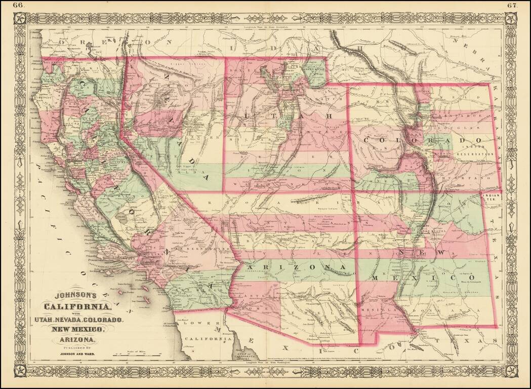
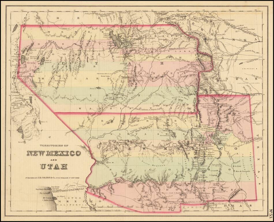
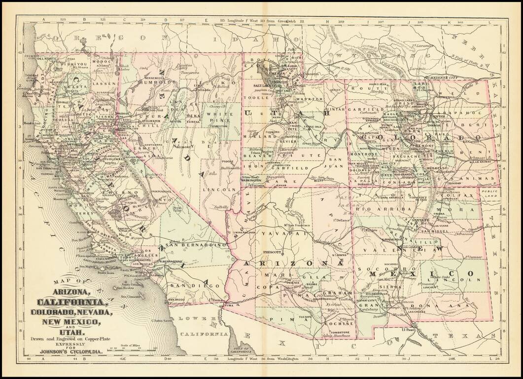
Interesting map of the southwest, hand colored by counties and showing a number of interesting territorial anomalies. Nevada has its lower corner truncated, leaving Las Vegas in Arizona. In each of the states and territories, the county configurations...
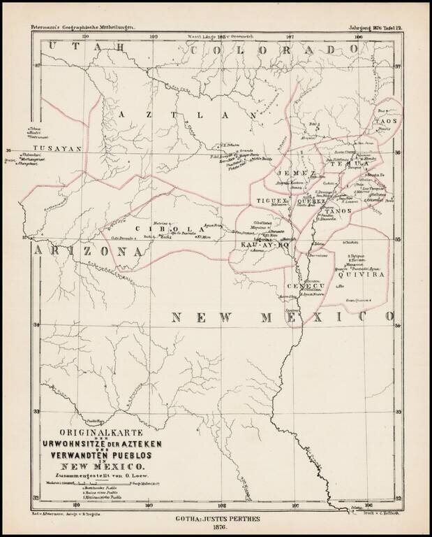
Scarce German map showing locating the major Indian Tribes of New Mexico and the Ancient Indian Regions, from Petermann's Geographishce Mittheilungen. Names of the regions of the old Aztecs settlements are given on the map: Aztlan, Tusayan, Cibola,...
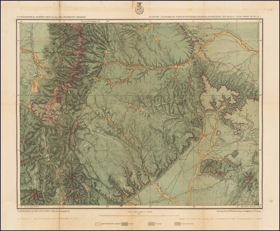
Detailed topographical map showing the region bounded by the Taos, New Mexico area in the southwest, San Luis, Colorado and Trinchera Peak in the northwest, Purgatory River and Trinidad Colorado in the Northeast and the area just south of Laughlin Peak...
A cornerstone map, exceptionally detailed and showing many routes and places of interest in the settlement of the American West. This map was published several times from the mid-1850s through the 1870s. This map shows Fremont's 1844 and 1845 routes,...
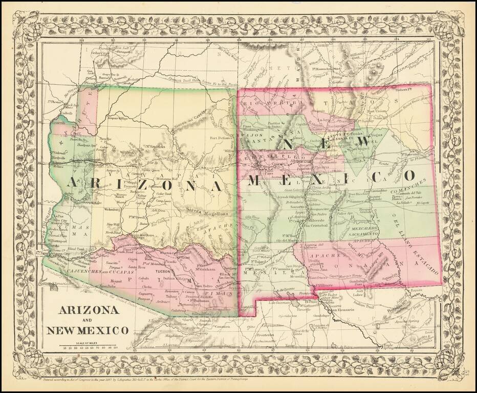
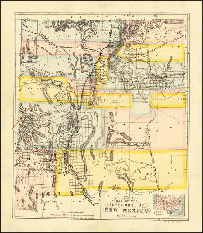
Attractive regional map of New Mexico and Arizona, colored by counties with beautiful decorative border. Shows towns, roads, railroads and rivers. This is a period when western county and state borders were rapidly evolving, such that each year holds...
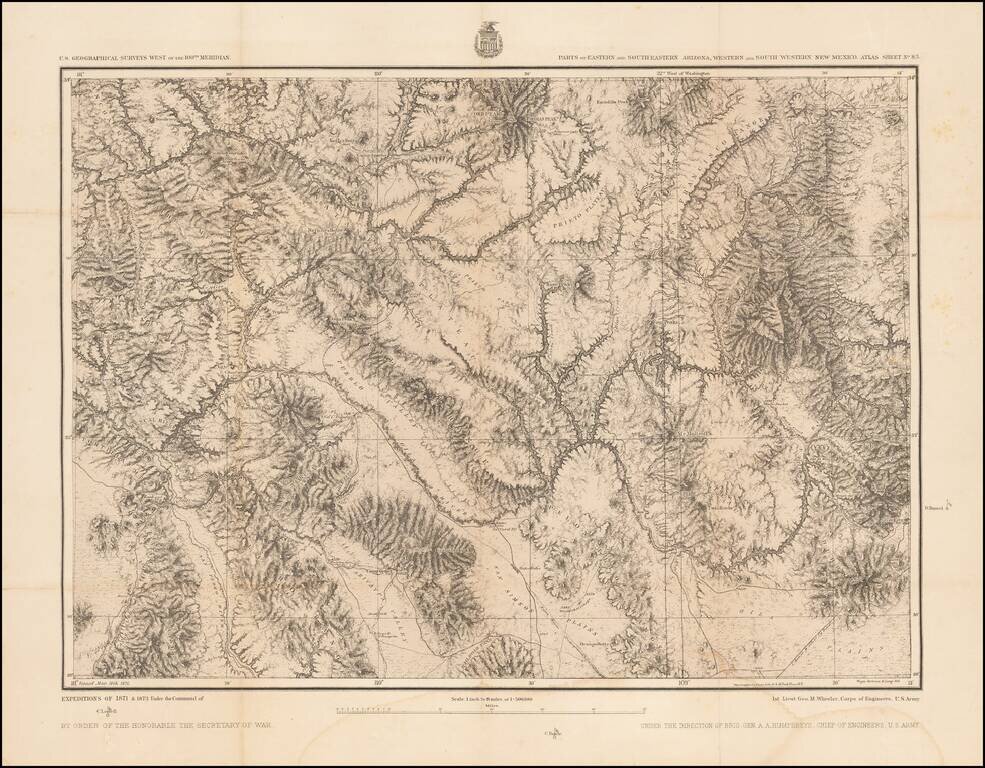
Detailed topographical map showing southwestern New Mexico and southeastern Arizona. Shows towns, roads, mountains, rivers, lakes, hydrographical details, etc. The map was generated during the Wheeler Survey. The Wheeler Survey was a survey of a...
Detailed map of New Mexico and Arizona, showing a number of newly formed counties and transitional borders in both states. The Southern Pacific is shown running from Yuma, across Arizona with a line splitting off at Deming, and extending to Frontera...
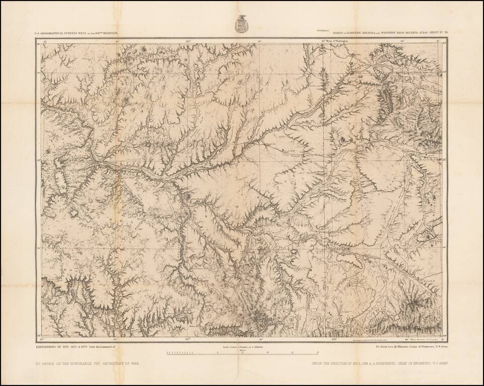
Includes the Phoenix Area Detailed topographical map showing eastern Arizona and western New Mexico. The map extends from the Phoenix area in the southwest (Pleasant Valley) to the Flagstaff area in the northwest, to the Fort Wingate / Gallup, New...
Detailed map of California and the Southwest, colored by Counties.
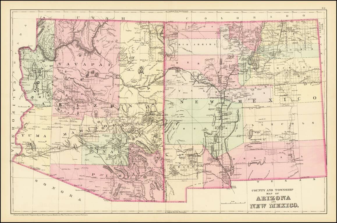
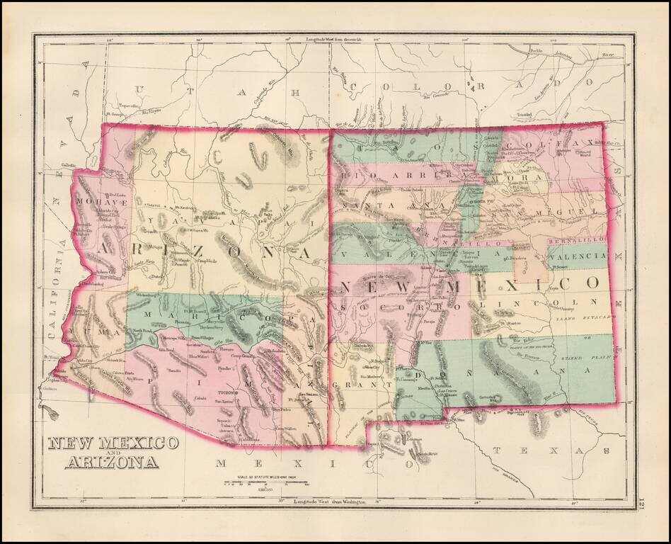
Detailed map of Arizona and New Mexico, colored by counties and showing towns, roads, railroads, rivers, lakes and a host of other information. The map predates the formation of Sierra County, New Mexico in 1884. One of the most detailed maps of the...
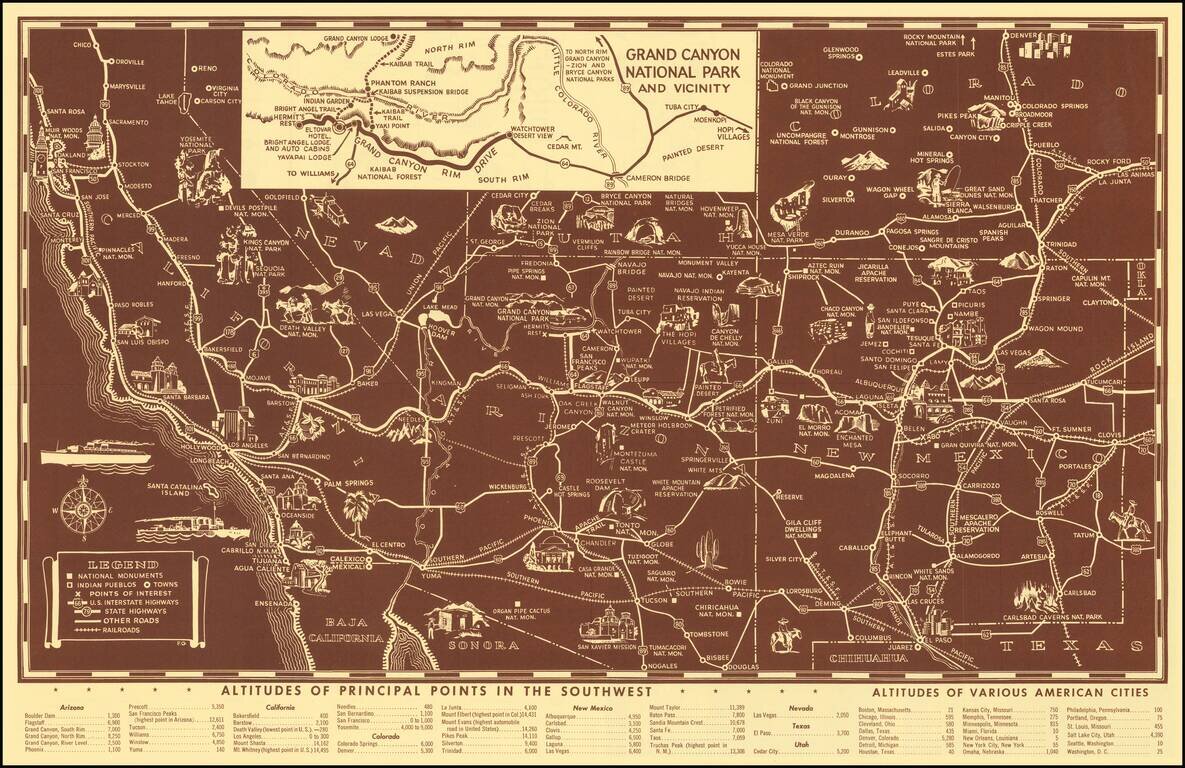
Scarce pictorial map of the American Southwest, published by Fred Harvey. The map provides a detailed pictorial image of the American Southwest, with an inset of the Grand Canyon. The verso includes a table of Indian Signs and Symbols, along with...
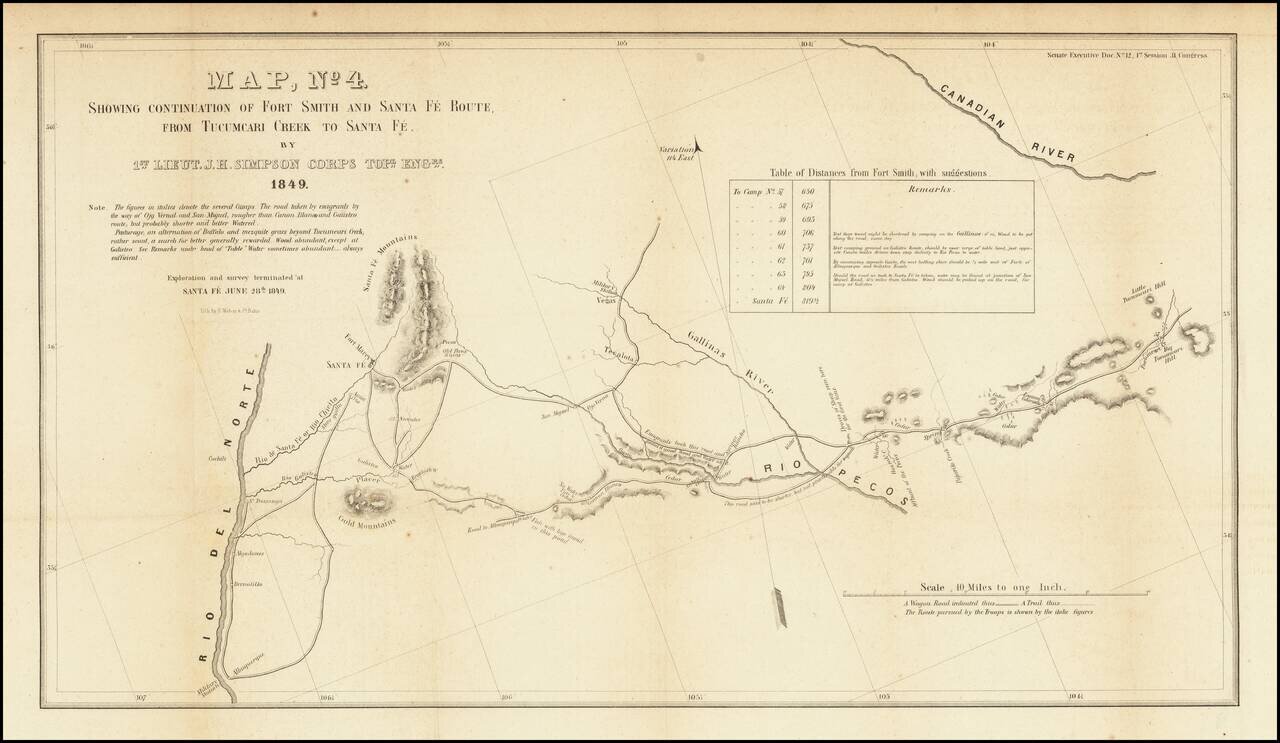
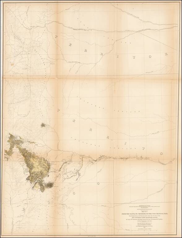
Detailed map of a portion of New Mexico Territory, showing the area east of the Rio Grande to the Canadian River. The map focuses on the roads and rivers in the region and the details surveyed by the exploration party led by James Simpson. Major...
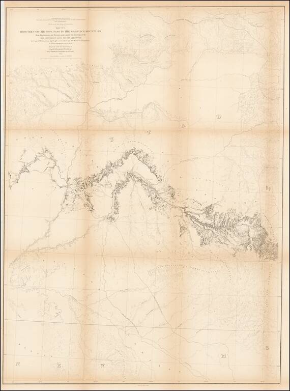
Detailed map extending from Bridger's Pass in the north to New Mexico, centered on the Sawatch and Wasatch Mountains. Shows proposed railroad line through Bridger Pass in Northeast Utah Territory, including parts of present day Colorado and Wyoming...
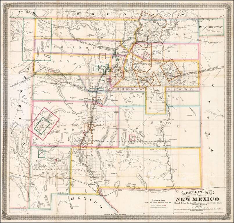
One of the Earliest Separately Published Maps of New Mexico Territory Detailed early map of New Mexico, prepared by the engineer and surveyor William Raymond Morley is generally acknowledged to be the first map to show only the territory of New...
British Land Speculation in New Mexico? Rare early map of New Mexico Territory, lithographed in London by Whiteman, Hicks & Whiteman. New Mexico is colored showing early counties, with the earliest proposed railroads illustrated, including a line...