
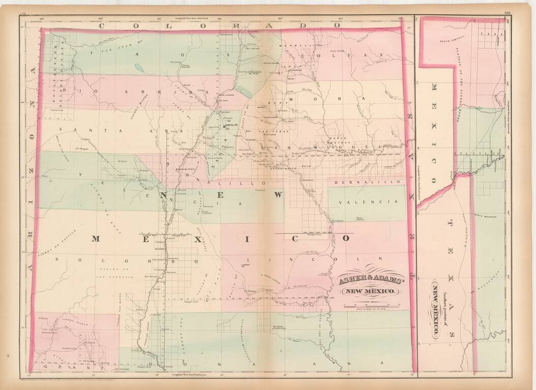
Remarkable large format railroad map of New Mexico Territory. The earliest separately issued map of New Mexico Territory in its modern configuration to appear in a commercial atlas . The map illustrates the early railroads, settlements, mining...
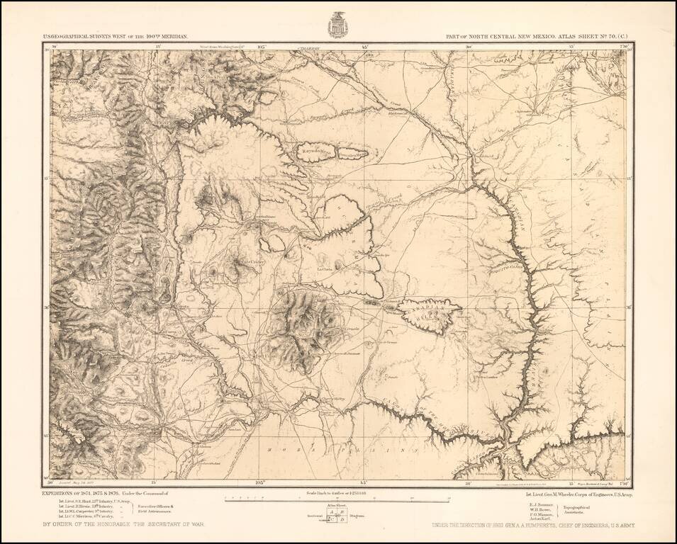
Detailed topographical map showing north central New Mexico, with the Taos Mountains at the upper left and Fort Union toward the center. Shows towns, roads, mountains, rivers, lakes, hydrographical details, etc. The map was generated during the...
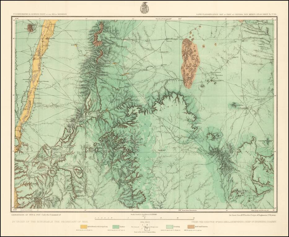
Detailed topographical map of central New Mexico, showing the area immediately southwest of Albuquerque. Shows towns, roads, mountains, rivers, lakes, hydrographical details, etc. The map was generated during the Wheeler Survey. The Wheeler Survey...
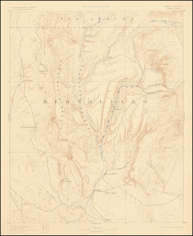
Detailed geological map of a large portion of Bernalillo County, published by the United States Geological Survey, originally surveyed in 1887-88. The map is centered on Jemes Peak and Jemes Creek. Covers the region north of Albuquerque and west of...
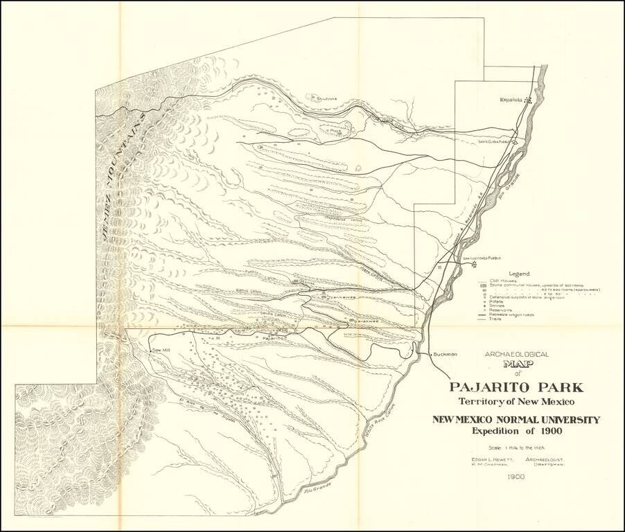
Highly detailed map of what is now Bandelier National Monument bounded on the northwest by the Jemez Mountains and on the east and south by the Rio Grande. On the northeast are Espanola and Santa Clara Pueblo. This map shows topography, names all the...
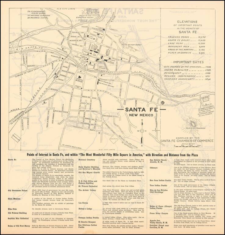
The Most Wonderful Fifty Mile Square in America Fine map of Santa Fe, during the earliest period of its artistic and preservationist history. Detailed map of the town of Santa Fe, New Mexico, with a regional map of the area around Santa Fe on the...