

The Second Issue of Fremont's Map of the West--Issued Following the Discovery of Gold in California Nice example of Fremont's seminal map of the West, which focuses on California, Arizona, Utah and Nevada. Wheat dedicates 13 pages and 2...
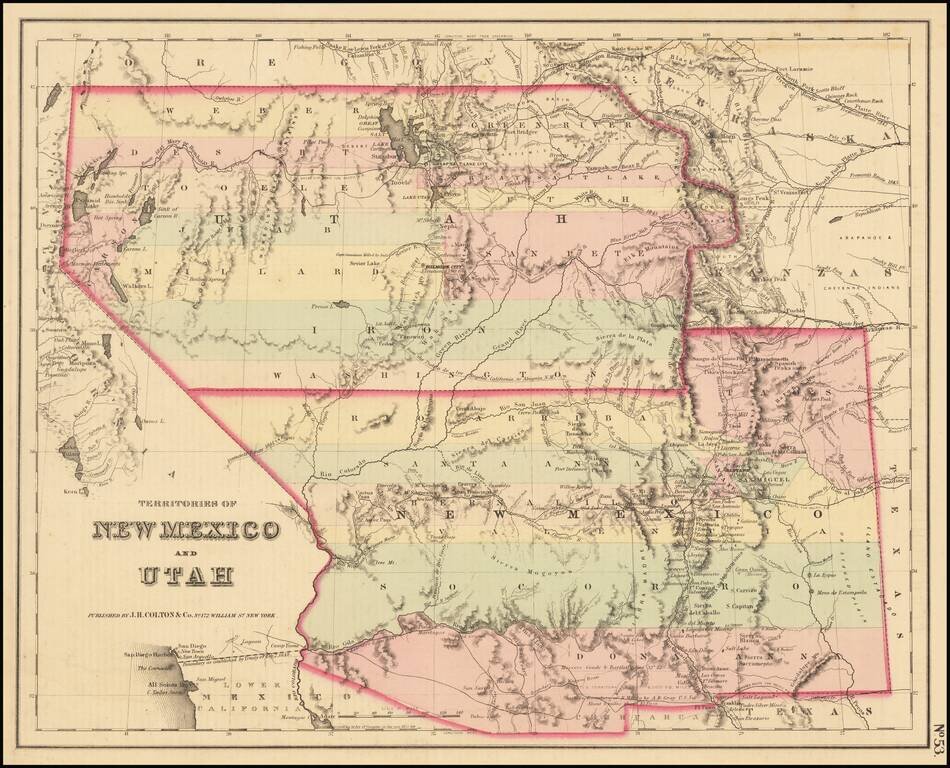
A cornerstone map, exceptionally detailed and showing many routes and places of interest in the settlement of the American West. This map was published several times from the mid-1850s through the 1870s. This map shows Fremont's 1844 and 1845 routes,...
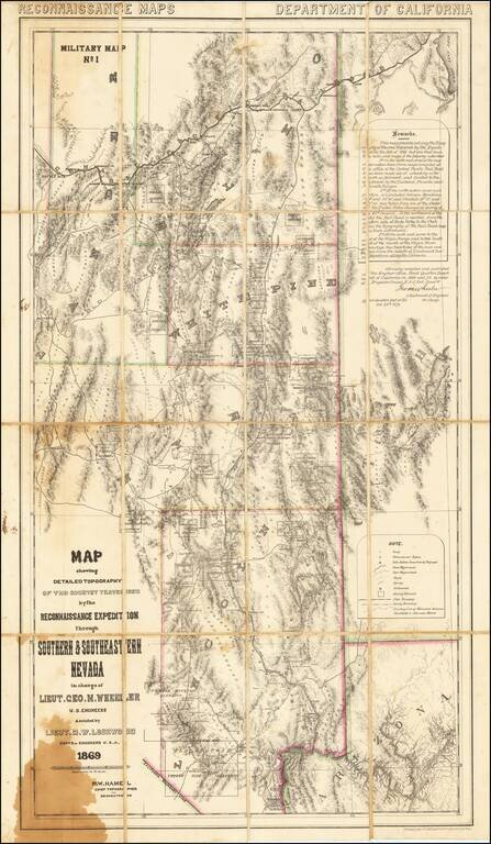
A Nevada & Grand Canyon Rarity -- The Foundation Map for Southern Nevada A remarkable map of the Eastern Half of Nevada, including Las Vegas, the Grand Canyon, Great Salt Lake and Sevier Lake (then called Preuss Lake), being the first scientific...
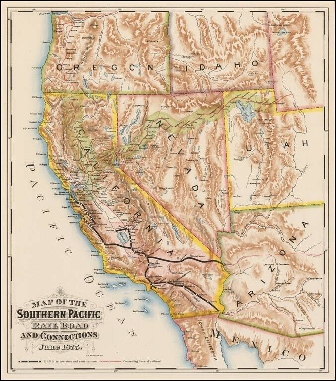
Fine colored chromolithographic example of the earliest known map focused on the general lines of the Southern Pacific Railroad, published more than a year before the line was completed through Los Angeles. Rare promotional map for the Southern...
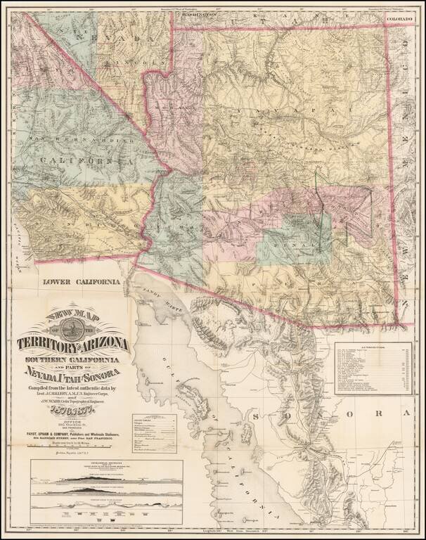
The Finest Large Format Map of Arizona, Southern California and Southern Nevada from the 1870s. Large and striking map centered on Arizona with pieces of the adjacent states and territories, at a time when Arizona was undergoing a mineral boom, and...
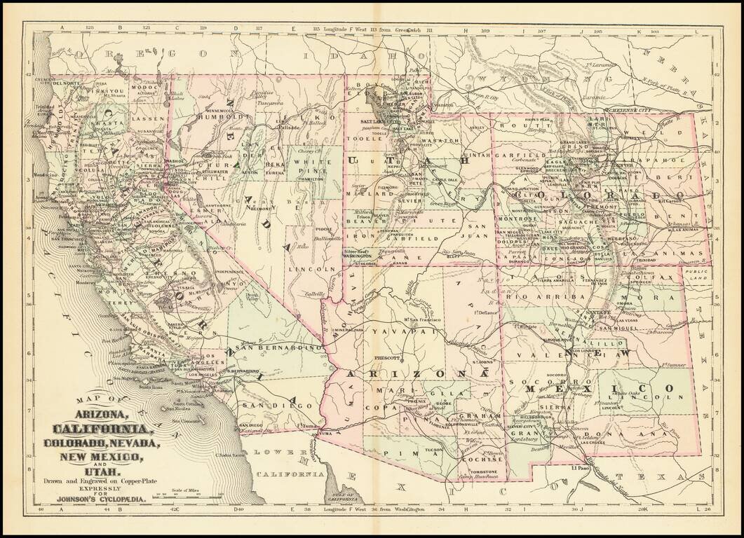
Detailed map of California and the Southwest, colored by Counties.
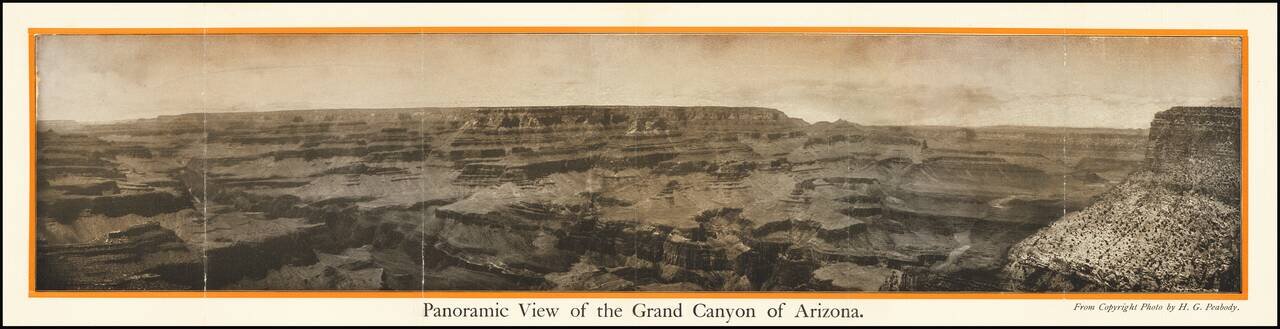
The Grand Canyon of Arizona -- Most Sublime Scenic Panorama in the World Fine photographic view of the Grand Canyon, published in conjunction with the Pan American Exposition. Includes a promotional tract on the verso. Title on verso: The Grand...
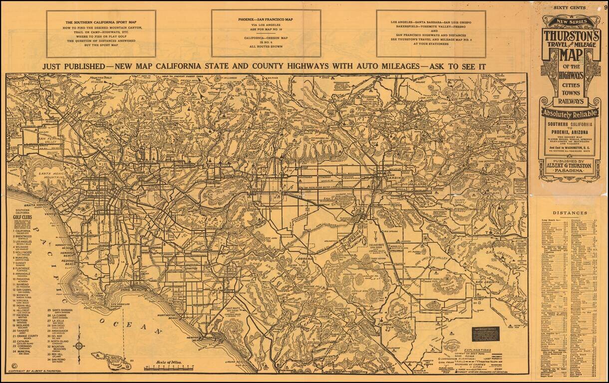
An Early Road Map of the Southwest Fantastic early automobile map of the Desert Regions between Southern California and Phoenix, published in 1915 by Albert G. Thurston and drawn by D.C. McClain. The desert map is quite extraordinary, providing a...
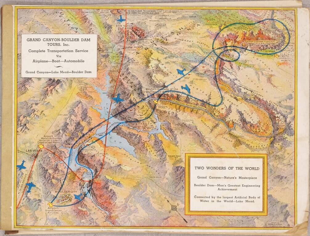
Pioneer Air Tours For The Grand Canyon July 1936 booklet outlining the services of the recently created Grand Canyon - Boulder Dam Tours Inc., with illustrated covers by famed pictorial map artist Gerald Eddy. The booklet outlines the tours offered...
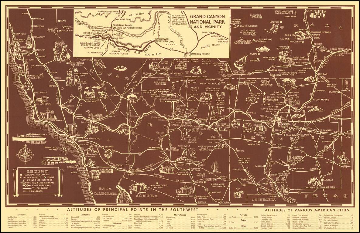
Scarce pictorial map of the American Southwest, published by Fred Harvey. The map provides a detailed pictorial image of the American Southwest, with an inset of the Grand Canyon. The verso includes a table of Indian Signs and Symbols, along with...
![Guide To the Blazed Trails of Montana and Wyoming . . . [Montana, Wyoming, NW Colorado, Eastern Idaho, Northern Utah, NE Nevada] Rand McNally Offical 1923 Auto Trails Map [Yellowstone National Park and Glacier National Park on verso]](/map/small/66099.jpg)
Early Automobile Road Map Detailed map of [Montana, Wyoming, NW Colorado, Eastern Idaho, Northern Utah, NE Nevada, published by the Automobile Club and prepared fkr Kilmer & Sons of Spokane, Washington, The map is scarce -- this is the first...
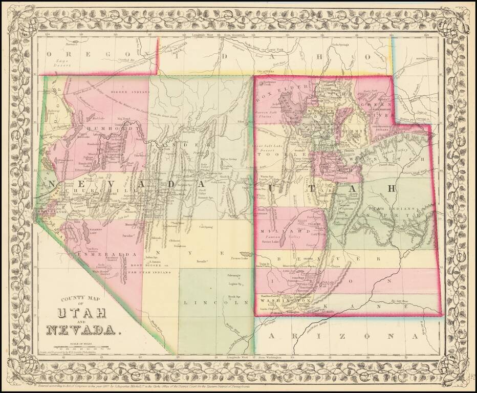
Detailed map of Nevada and Utah, colored by counties and showing towns, mountains, rivers, railroad lines, Indian Tribes, mining districts, etc. The first map of the region to appear in a commercial atlas. Decorative floral border.
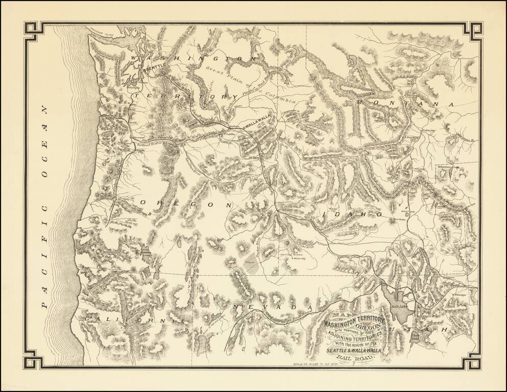
The First Map Printed in Seattle -- Seattle & Walla Walla Rairoad Map With Manuscript Corrections Likely In the Hand of the Maker Fine example of this rare map of the Pacific Northwest, illustrating the proposed route of the Seattle & Walla...
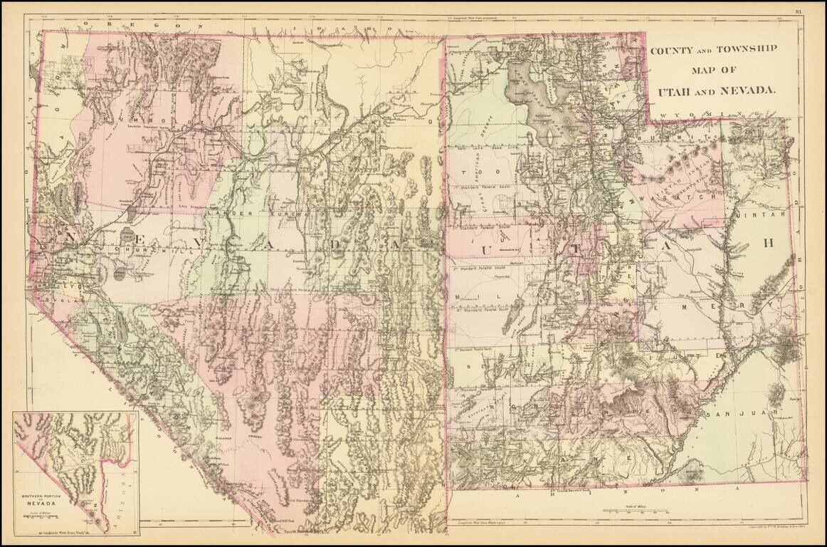
A detailed map of Utah and Nevada, colored by counties and showing towns, roads, railroads, rivers, lakes, and a host of other details. While earlier editions of the map include all of Utah but lack the southern tip of Nevada, this 1884 edition adds...
![[Heavily Annotated] Great Shoshone and Twin Falls Water Power Company Map Showing Location of Power houses, Substations and Transmission Lines](/map/small/62919.jpg)
Heavily Annotated Blue Print Copy of One of the Earliest Large Scale Hydro-Electric Power Companies in Idaho Wall map of a portion of the Northwestern United States, centered on Twin Falls and Shoshone Falls, illustrating the area proposed to be...
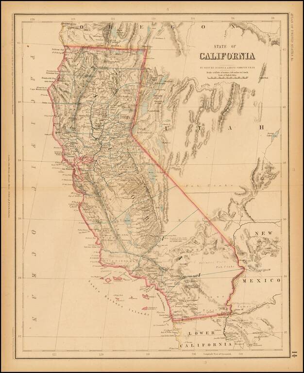
Rogers & Johnston' rare map of California, from the Atlas of the United States, perhaps the most coveted of all mid 19th Century American Atlases. This now rare atlas derives from a Wall Map first published in 1857 as a collaboration between...