
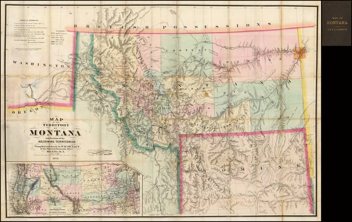
One of the great maps in the record of Western Cartography Nice example of the 1870 edition of the W.W. De Lacy map of Montana, referred to by Carl Wheat as "one of the great maps in the record of Western Cartography." The present example is the...
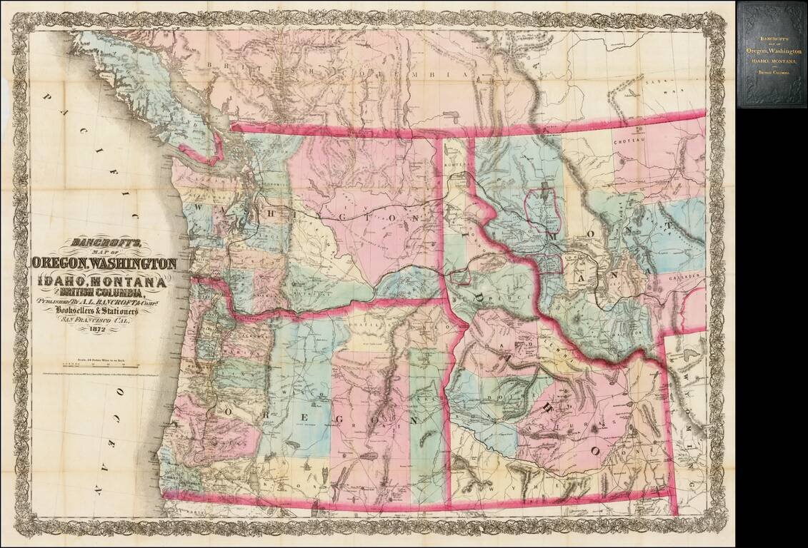
Rare separately issued map of the northwestern United States and British Columbia, issued in 1872 by A.L. Bancroft & Co. in San Francisco. Bancroft's map was first issued by HH Bancroft in 1868. The map was drawn from a section of Bancroft's...

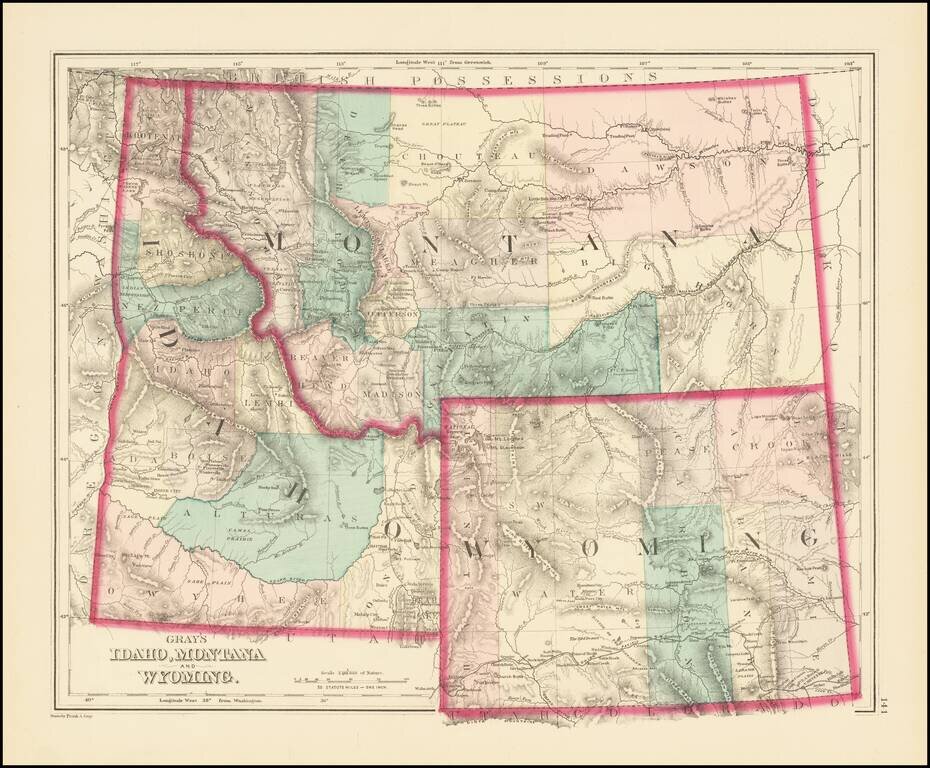
Excellent early map of Idaho, Montana and Wyoming Territories, published by SA Mitchell Jr. Includes early county configurations for each: Wyoming has only 7 counties; Montana has 11 counties; Idaho has 13 counties. The map shows Indian...
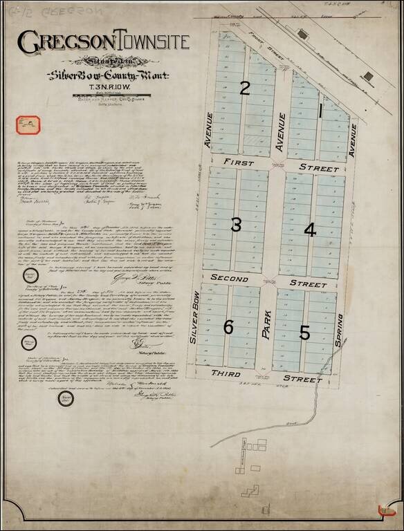
Original Plan For Gregson Townsite -- Locating The Original Hotel and Bathhouses for Upper Deer Lodge Hot Springs Resort ( aka Gregson Hot Springs Resort), One of the Earliest Resorts in Montana Territory. Unique example of the original...
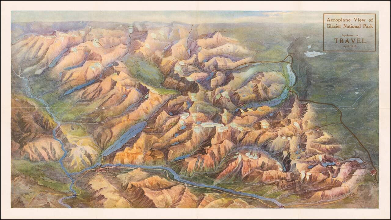
Rare birdseye view illustrating Glacier Park and environs. The present example is a separately issued example, which was a Supplement to the April, 1913 edition of Travel Magazine. The view would later be re-issued with different coloration in 1914....
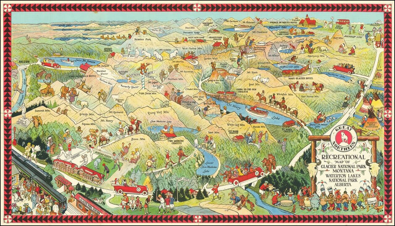
Fine early pictorial map promoting the Great Northern Railway. The map includes a lively offering of park scenes, including Grizzly Bears confronting tourists on a bridge, yacht rides in the major lakes, and another Grizzly Bear dumping Champagne (?)...
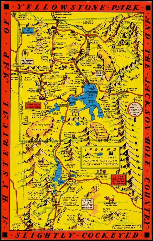
"Drawn in Broken English by Jolly Lindgren," this comic pictorial map is full of puns and comic vignettes related to Yellowstone and environs. The Lindgren brothers issued a number of other silly whimsical maps of national parks and other parts of the...
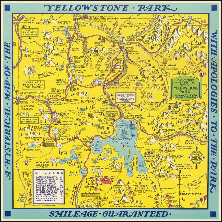
Scarce 1948 edition of the Jolly Lindgren map of Yellowstone, "Hatched & Scratched by Jolly Lindgren." This edition adds the table of miles at bottom left, among other changes, including the addition of Pilot Peak at the top right corner. This...
![(Nothern Half) [Bancroft's Map of the Pacific States]](/map/small/54924.jpg)
Previously Unkown 1863-64 Second State. "Bancroft's, in scope, was probably the most important map yet produced by a publisher of the Pacific coast." - Streeter (TMW 1061) Two northern sheets of an engraved proof of the previously-unknown 1863 second...
![(Northern Half) [Bancroft's Map of the Pacific States]](/map/small/54923.jpg)
Rare Early State with a Massive Idaho Territory Upper half of HH Bancroft's rare map of the Pacific States, first published in 1863. The map includes all of Oregon, Washington, Idaho, and most of Montana and Wyoming, with a large inset of Hawaii. The...
![(Notherneastern Sheet) [Bancroft's Map of the Pacific States]](/map/small/54925.jpg)
Engraved Proof Sheet. "Bancroft's, in scope, was probably the most important map yet produced by a publisher of the Pacific coast." - Streeter (TMW 1061) Engraved proof of the 1867 edition of H.H. Bancroft's Map of the Pacific States. The detail in...
Excellent early map of Idaho Territory, Wyoming Territory and Montana Territory, published by OW Gray. Wyoming is shown with only 7 counties. Idaho has 10 counties and Montana has only 11. Yellowstone National Park is noted as a proposed national...
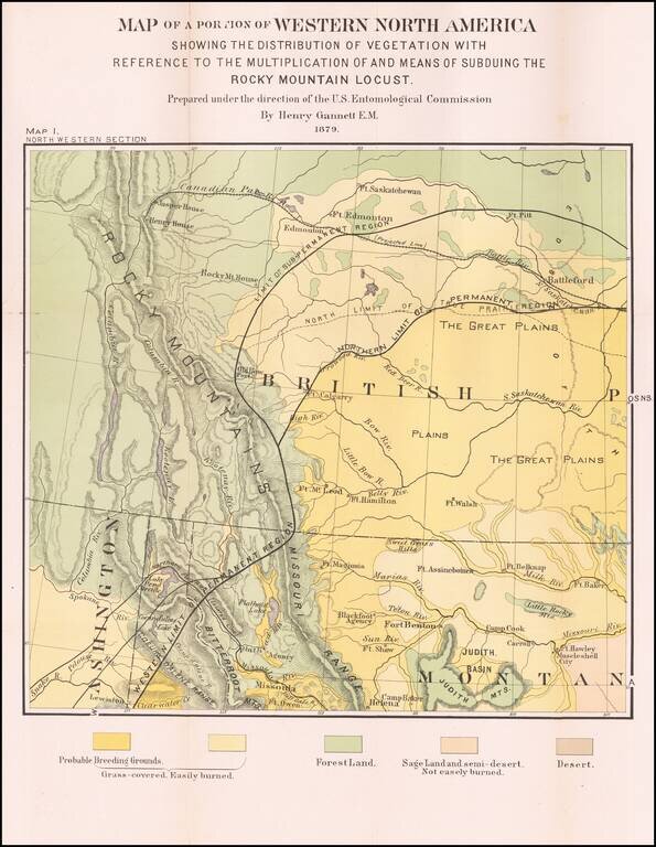
Detailed Vegetation Map of northern Montana, Idaho, Western Washington and contiguous parts of Alberta and British Columbia, from the Second Report of the United States Entomological Commission for the years 1878 and 1879. The map is relatedto the...
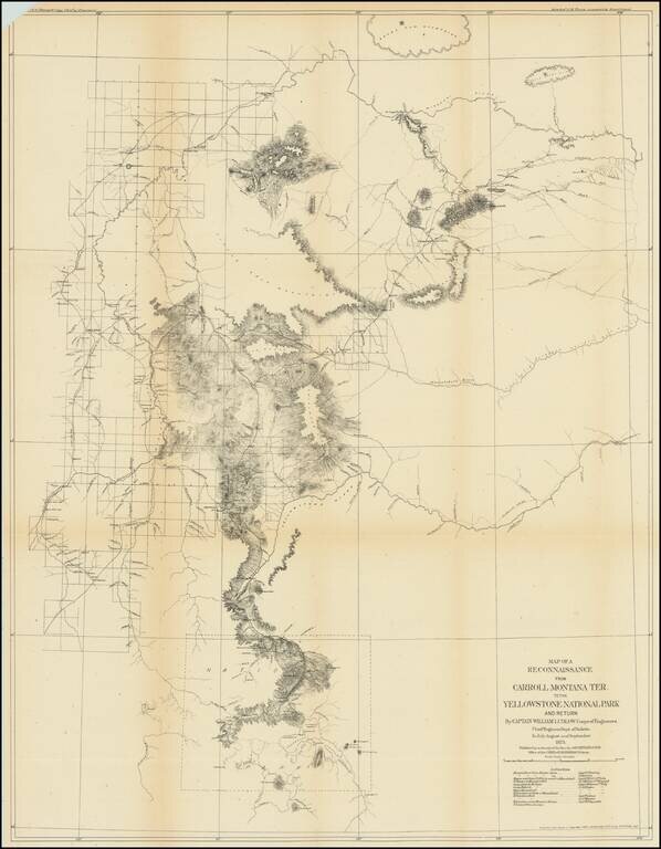
Captain William Ludlow's Expedition To Yellowstone From Montana in 1875 Important early exploration and survey of the route from Carroll, Montana to Yellowstone, undertaken by Captain William Ludlow in 1875. Carroll, Montana was described by Ludlow...
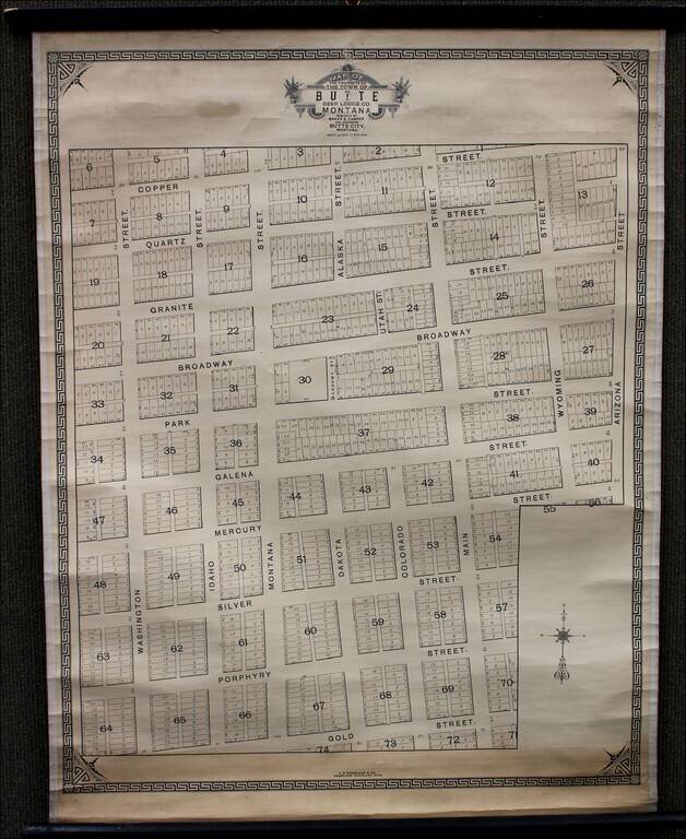
Rare Variant Edition Rare variant of Baker & Harper's "Plat of the town site of the town of Butte, Deer Lodge County," published in 1876. As noted at the bottom, the map was published by H.B. Stranahan & Co. Engravers of Cleveland, Ohio....
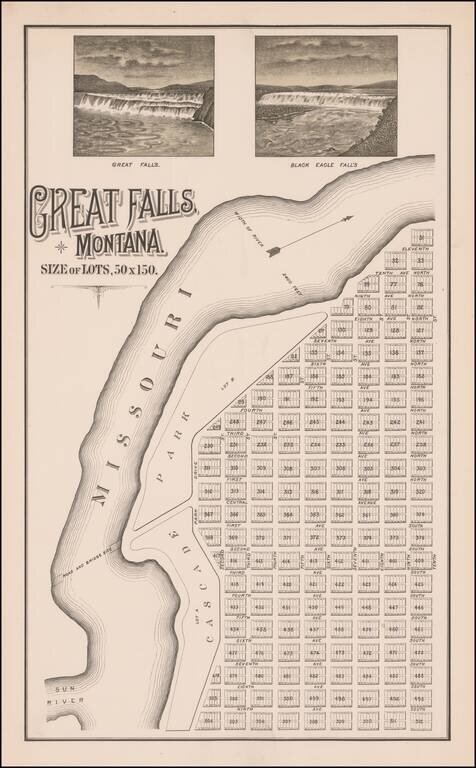
The Lost Original Map of the Townsite of Great Falls, Montana Flawless example of this previously unknown map of Great Falls, Montana, almost certainly published by its original founders (Great Falls Townsite Company) in December 1883. The map...