
Rare old maps of the United States.
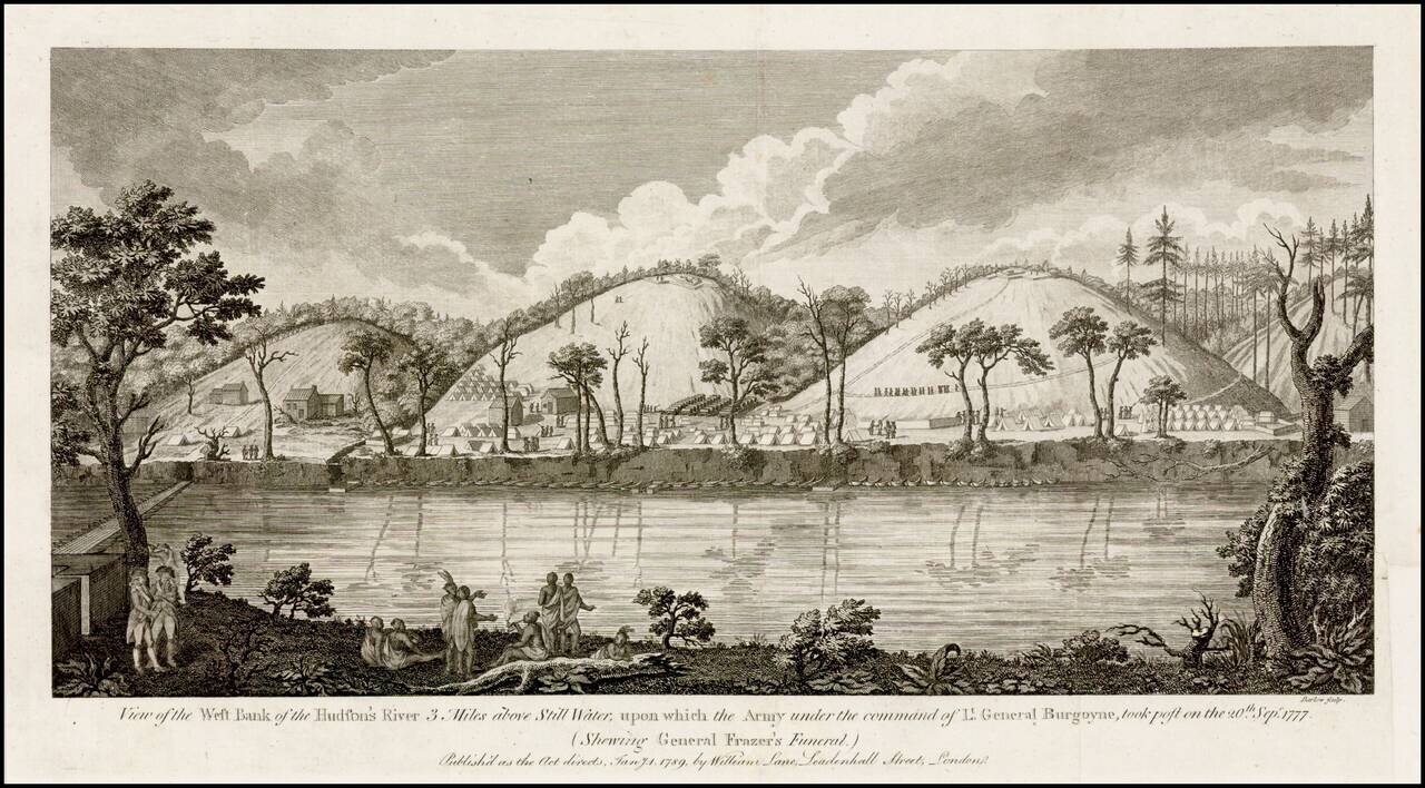
Fine view of Burgoyne's encampment along the Hudson River, published shortly after the end of the American Revolution. Burgoyne's campaign to defeat the revolutionary forces by advancing from Canada and meeting another British army from New York City...
![Attaques Des Forts De Chouaguen en Amerique. . . . 1756… [French & Indian War Battle Plan--Fort Oswego, Fort Ontario and Fort George]](/map/small/57191.jpg)
Rare French & Indian War Battle Plan, showing the fortifications and battles fought at the mouth of the Chouaguen (Oswego) River in 1756. The key at the bottom of the battle plan explains the various activities of the French, English and Indians,...
![Attaques Du Fort William-Henri…1757 [French & Indian War Battle Plan--Fort William Henry]](/map/small/57193.jpg)
Rare French & Indian War Battle Plan, showing the fortifications and battles fought at Fort William Henry on Lake George. The key at the bottom of the battle plan explains the various activities of the French, English and Indians, including...
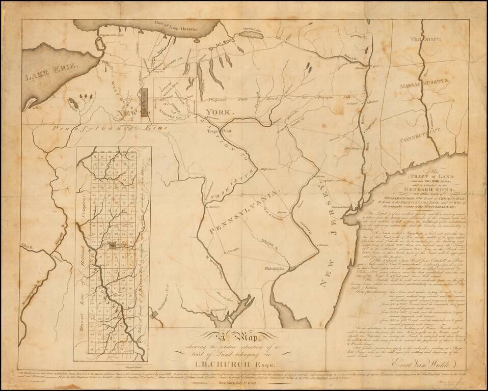
Rare early 19th Century map relating to the early settlement of western New York. This undeveloped 100,000-acre tract on the Genesee River in western New York had been used to repay a debt to John Barker Church from financier Robert Morris. Church was...
![[Mohawk River, New York] (Two manuscript maps of Cosbys Manor, Mohawk River, with other documents related to the same.)](/map/small/59703.jpg)
Early 19th-Century Manuscript Maps and Court Papers Concerning the Disposition of Lands on the Mohawk River in New York. Together, two manuscript map sheets, showing thousands of acres of land on the Mohawk River. One of the maps shows lot numbers...

A Rare British Sea Chart of the Southeast and Mid-Atlantic Regions (The Colonial Williamsburg / William Wooldridge Copy) Extremely rare separately issued chart of the coast from New York to North Carolina, which was issued separately and in Laurie...
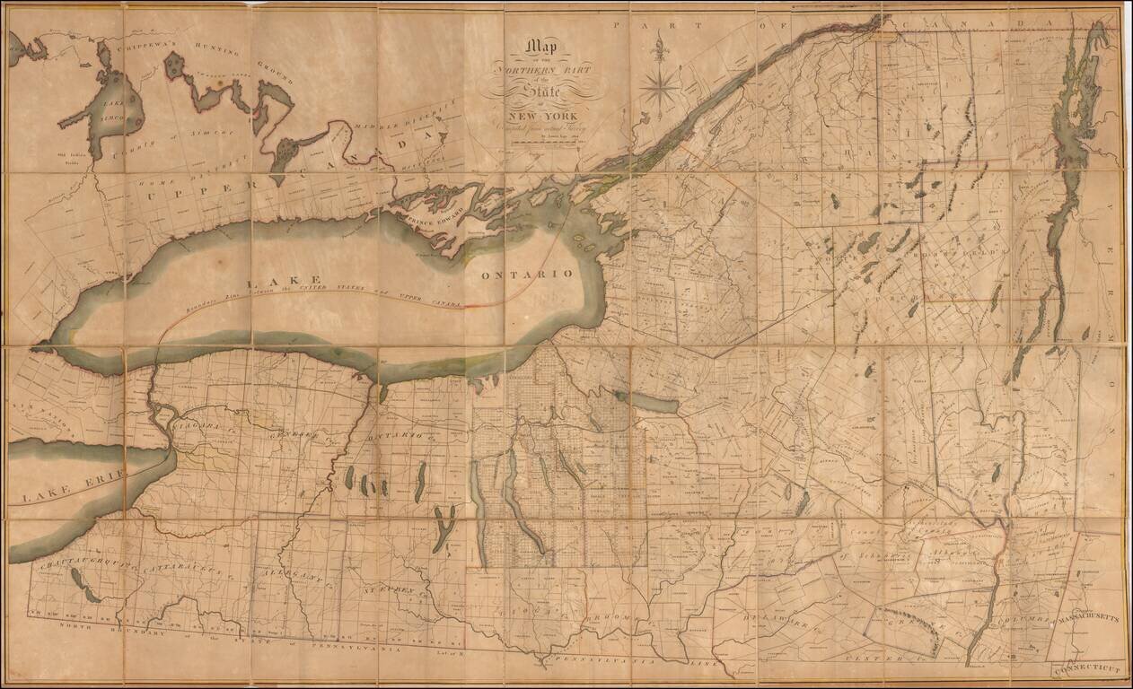
Important early map of the Northern part of New York State, published by Amos Lay. Lay's map of New York was the best general map of the region at the time of its publication. The map provides a detailed view of the Canadian border just one month...
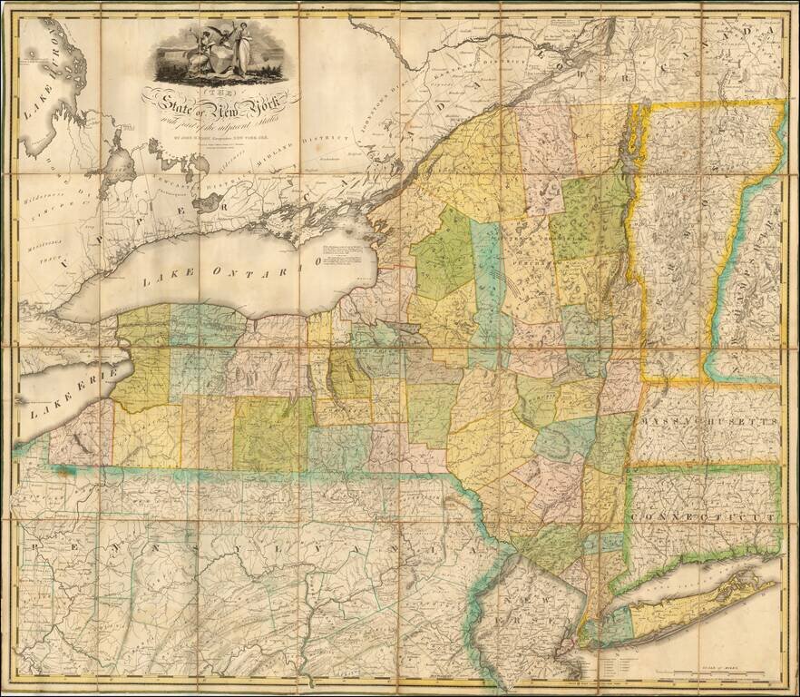
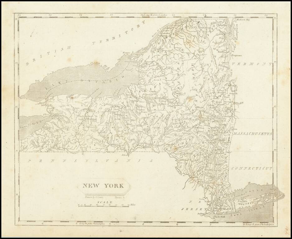
"Remarkable for its Clarity of Execution and Detail" (Rumsey) Fine example of John Eddy's large map of New York State, engraved by Peter Maverick. Nice example of one of the most important maps of the state of New York issued in the first part of...
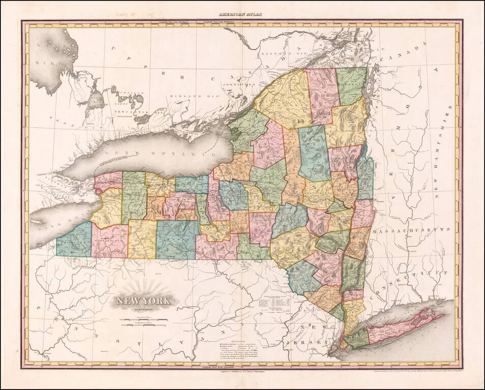
First state of the best atlas map of New York State published in the 19th Century. This vividly colored example is richly annotated throughout the map with various regional details on various rivers, roads and other local features. The early counties...
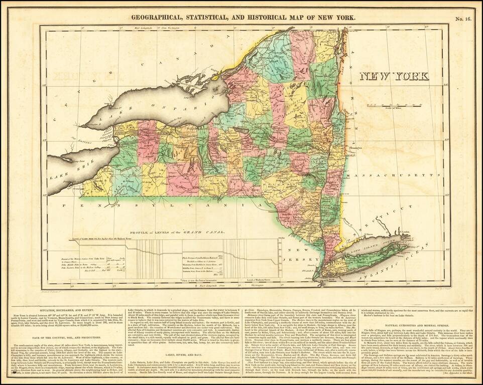
Detailed early map of New York, colored by county. A number of western and northern counties not yet formed. Shows towns, roads, rivers, canals, etc. Profile of the Grand Canal.
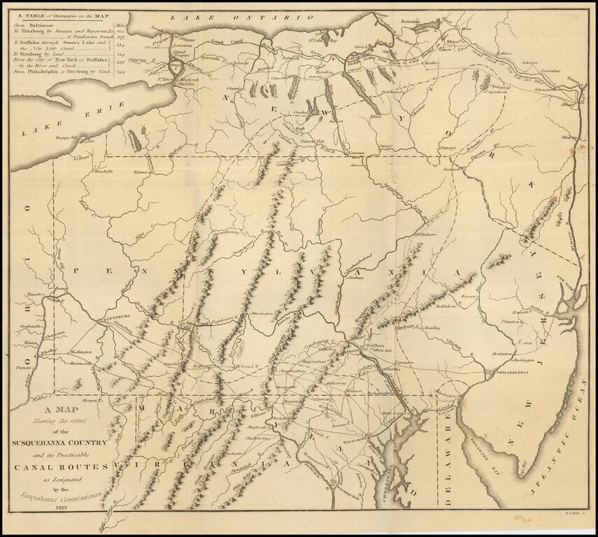
Fine large folding map, illustrating the work of the Commissioners appointed in December 1822 to survey the route of a Canal which would connect the Susquehanna River with the City of Baltimore. Published by Fielding Lucas Jr. in Baltimore, this rare...
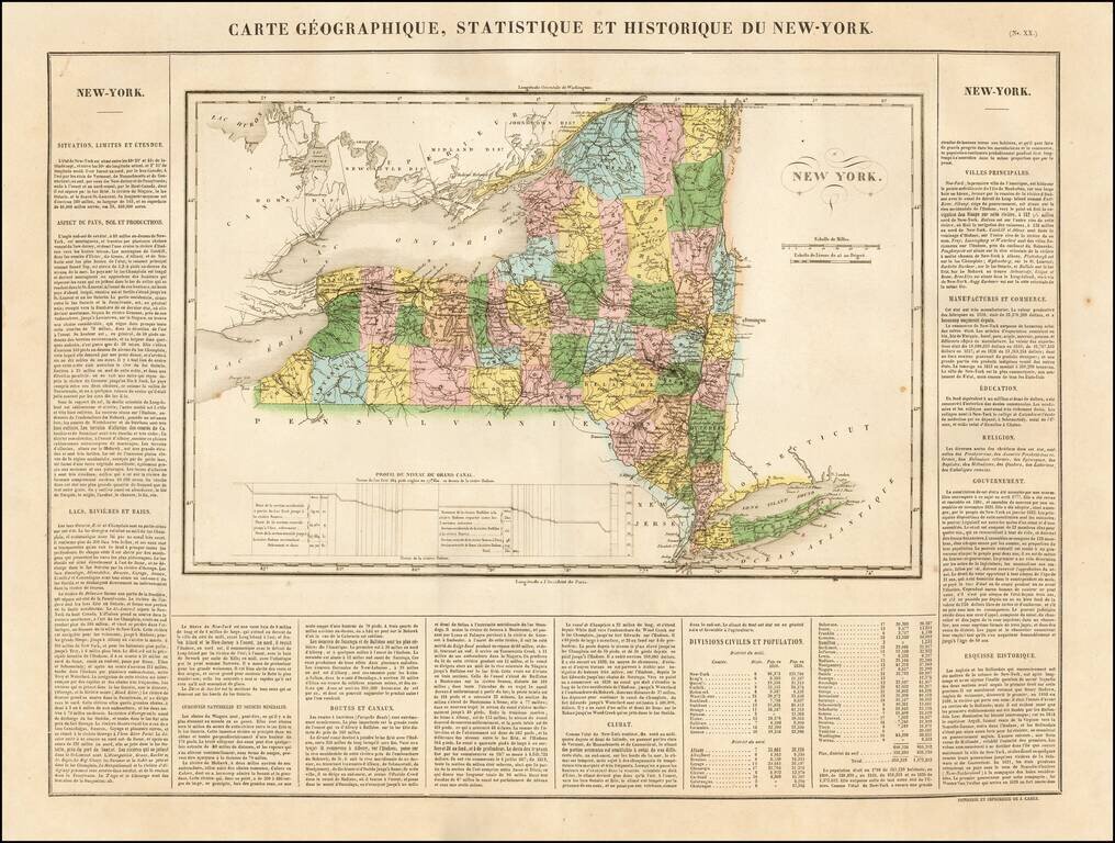
One of the Earliest Maps of New York State Published in Europe. Excellent wide margined example of the Buchon's map of New York. Buchon's work is prized for the fine engraving quality. The text includes wonderful contemporary details concerning the...
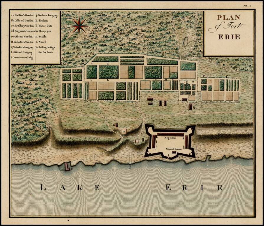
Important early plan of Fort Erie, from Collot's monumental Voyage dans l'Amerique Septentrionale ou Description des Pays Arroses par le Mississippi, l'Ohio, le Missouri, et Autres Riveres Affluentes, published posthumously in 1826, but based upon...
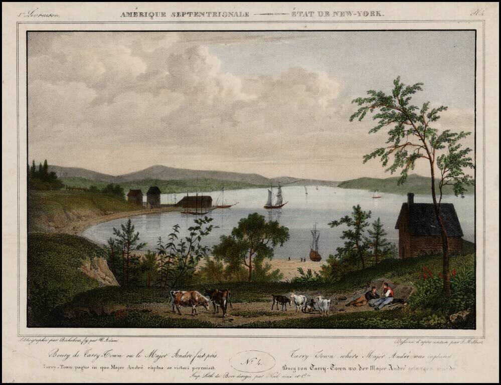
Decorative print of Tarry Town lithographed by Bichbois, which appeared in Jacques Milbert's rare Itineraire Pittoresque du Fleuve Hudson &c Milbert travelled to the United States in 1815 and returned to France in 1823. During his stay he studied...
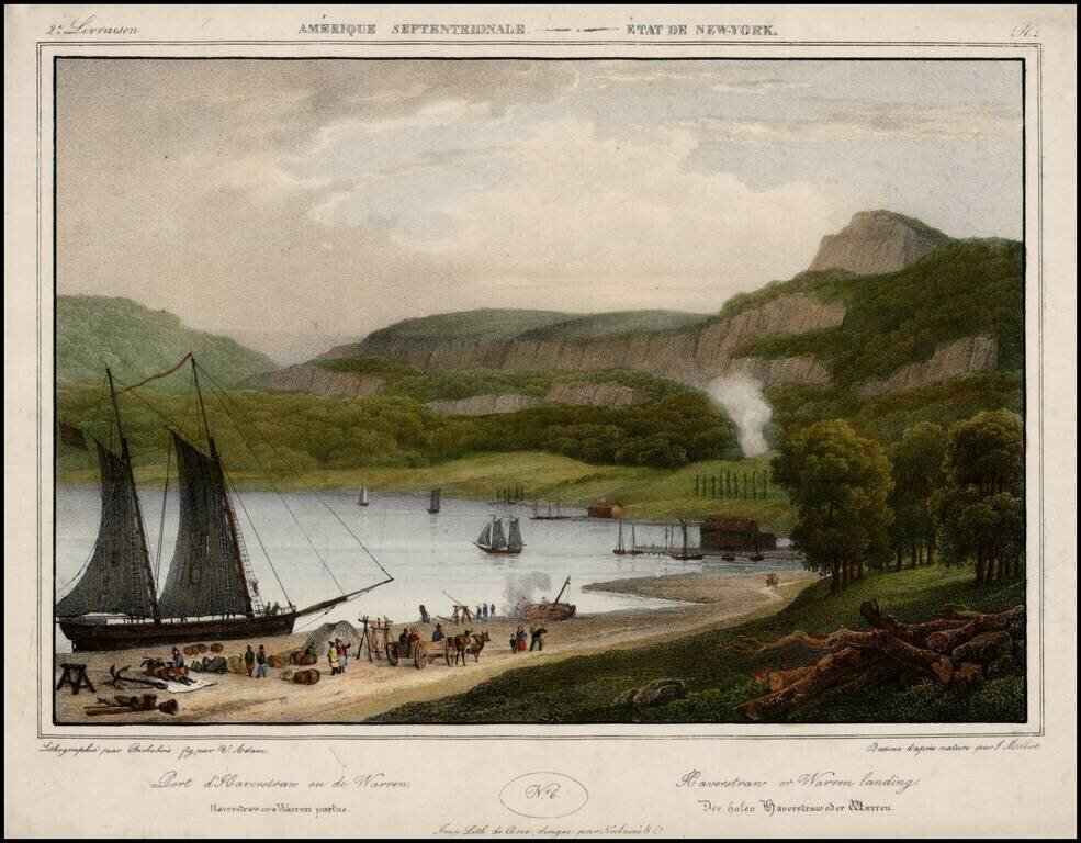
Decorative print of Haverstraw or Warren Landing, lithographed by Bichbois, which appeared in Jacques Milbert's rare Itineraire Pittoresque du Fleuve Hudson &c Milbert travelled to the United States in 1815 and returned to France in 1823. During...