Map size in jpg-format: 53.385MiB
Click to open in high resolution (open in new tab).
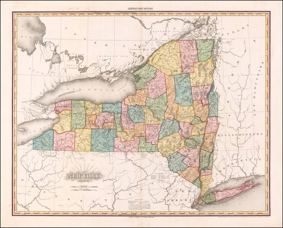
First state of the best atlas map of New York State published in the 19th Century.
This vividly colored example is richly annotated throughout the map with various regional details on various rivers, roads and other local features.
The early counties are shown in remarkable detail, from original surveys. Includes roads, rivers, lakes, turnpikes, villages, mills, ironworks, forts, post offices, battle grounds, places of worship, public houses, roads, ferries, falls, etc.
Tanner commenced production of his most ambitious project, his American Atlas, in 1818. Released in 5 folios between 1819 and 1823, the Atlas is widely regarded as the single most beautiful large scale American Atlas ever published. The maps are large, detailed and elegantly engraved. The production resulted in the split of Tanner from his partners Kearney & Vallance, but resulted in the greatest of American Atlases.
If you are a student, write to us in telegram: @antiquemaps and indicate what material you need and for what work you need a map in high detail. We are ready to provide material on special terms. For students only!

![[Site of A Presidential Assassination] Plan of the Pan American Exposition to be held at Buffalo, New York (May 1 - Nov. 1, 1901)](/map/small/69181.jpg)