Map size in jpg-format: 2.97443MiB
Click to open in high resolution (open in new tab).
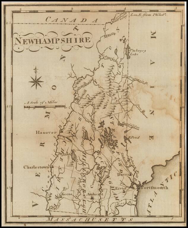
One of the earliest American maps of New Hampshire from the first American gazetteer.
Joseph T. Scott, a Philadelphia engraver and publisher, issued his gazetteer during the early days of American cartography. Scott included much detail of rivers, counties, roads, and towns.
If you are a student, write to us in telegram: @antiquemaps and indicate what material you need and for what work you need a map in high detail. We are ready to provide material on special terms. For students only!
![[Vermont / New Hampshire Grants]](/map/small/69612.jpg)