Map size in jpg-format: 37.4743MiB
Click to open in high resolution (open in new tab).
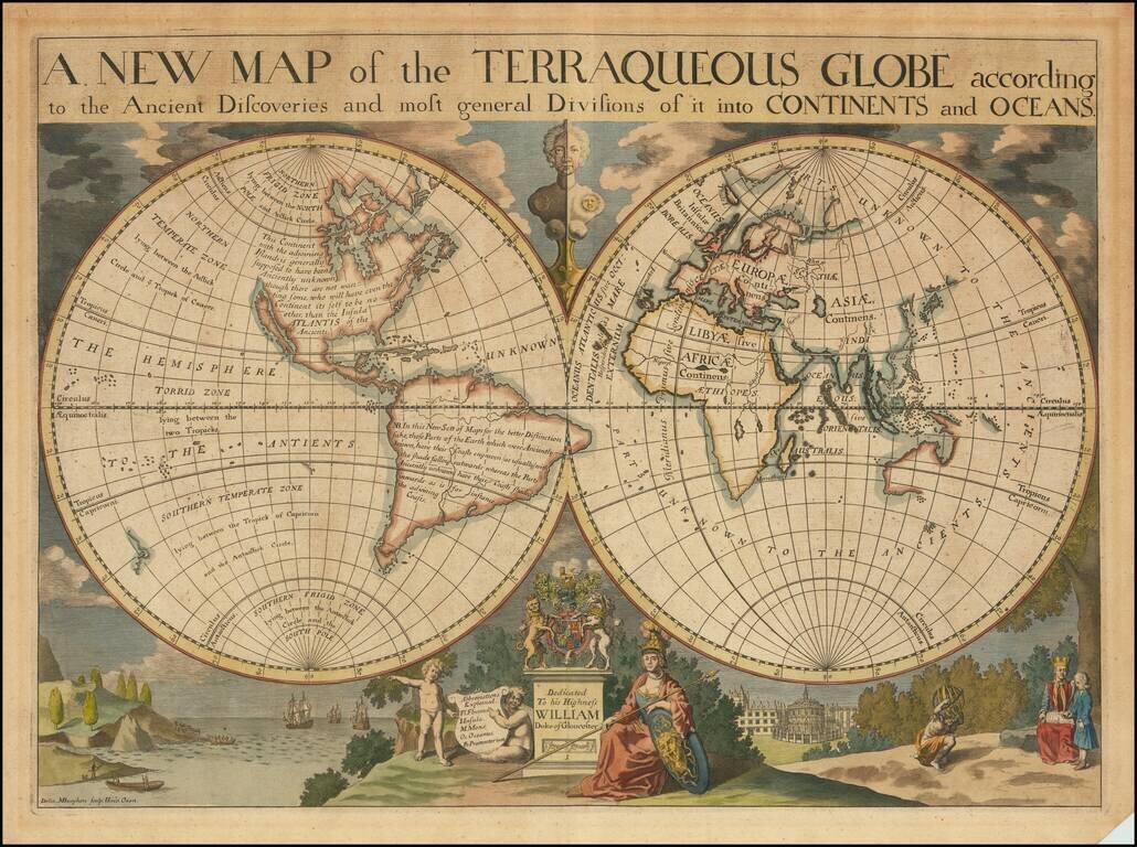
Decorative double hemisphere map of the World, dedicated to William, Duke of Glouchester.
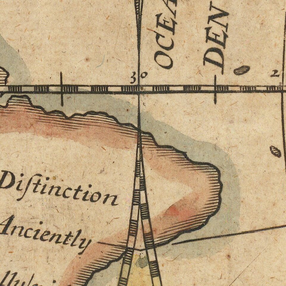
This map shows California as an Island, an incomplete New Holland attached to N. Guinea, partial New Zealand Coast line and no Southern Continent. Extensive annotations in North and South America, including a suggestion that the Americas might have been the lost continent of Atlantis, stating: "This Continent with the adjoining islands is generally supposed to have been Anciently unknown though there are not wanting some, who will have even the Continent itself to be no other than the Insula Atlantis of the Ancients."
Wells map of the world is 1 of a set of 22 maps dedicated to William, Duke of Glouchester, who at the time of publication of the maps was studying at Oxford. Edward Wells was teacher of mathematics and geography at Christchurch College of Oxford University. Below the hemispheres is a dedication vignette, with William shown with his tutor under the tree on the right. The 13-year-old William, heir to the throne, began studies at Christchurch in 1700 at the age of 11, and died a few months after the map was issued. On either side of this are small landscapes, one of ships arriving in the New World and one of the Radcliffe Camera in Oxford.
The engraver of the map, Michael Burghers, was an engraver and draftsman from Holland, who came to England and settled in Oxford in 1673. There he worked under David Loggan and succeeded him as Engraver to the University. Burghers engraved the first Oxford Almanack in 1676, and continued to engrave most of them for the next 43 years. He also illustrated books and produced architectural, botanical and portrait engravings.
California as an island
The popular misconception of California as an island can be found on European maps from the sixteenth through the eighteenth centuries. From its first portrayal on a printed map by Diego Gutiérrez, in 1562, California was shown as part of North America by mapmakers, including Gerardus Mercator and Abraham Ortelius. In the 1620s, however, it began to appear as an island in several sources.
The myth of California as an island was most likely the result of the travel account of Sebastian Vizcaino, who had been sent north up the shore of California in 1602. A Carmelite friar, Fray Antonio de la Ascension, accompanied him. Ascension described the land as an island and around 1620 sketched maps to that effect. Normally, this information would have been reviewed and locked in the Spanish repository, the Casa de la Contractación. However, the manuscript maps were intercepted in the Atlantic by the Dutch, who took them to Amsterdam where they began to circulate. Ascension also published descriptions of the insular geography in Juan Torquemada’s Monarquia Indiana (1613) (with the island details curtailed somewhat) and in his own Relacion breve of ca. 1620.
The first known maps to show California as an island were on the title pages of Antonio de Herrera’s Descripcion de las Indias Occidentales (1622) and Jacob le Maire's Spieghel Der Australische Navigatie (1622). Two early examples of folio-maps are those by Abraham Goos (1624) and another by Henry Briggs, which was included in Samuel Purchas’ Hakluytus Posthumus or Purchas his Pilgrimes (1625). In addition to Briggs and Goos, prominent practitioners like Jan Jansson and Nicolas Sanson adopted the new island and the practice became commonplace. John Speed’s map (1626-7), based on Briggs’ work, is well known for being one of the first to depict an insular California.
The island of California became a fixture on mid- and late-seventeenth century maps. The island suggested possible links to the Northwest Passage, with rivers in the North American interior supposedly connecting to the sea between California and the mainland. Furthermore, Francis Drake had landed in northern California on his circumnavigation (1577-80) and an insular California suggested that Spanish power in the area could be questioned.
Not everyone was convinced, however. Father Eusebio Kino, after extensive travels in what is now California, Arizona, and northern Mexico concluded that the island was actually a peninsula and published a map refuting the claim (Paris, 1705). Another skeptic was Guillaume De L’Isle. In 1700, De L’Isle discussed “whether California is an Island or a part of the continent” with J. D. Cassini; the letter was published in 1715. After reviewing all the literature available to him in Paris, De L’Isle concluded that the evidence supporting an insular California was not trustworthy. He also cited more recent explorations by the Jesuits (including Kino) that disproved the island theory. Later, in his map of 1722 (Carte d’Amerique dressee pour l’usage du Roy), De L’Isle would abandon the island theory entirely.
Despite Kino’s and De L’Isle’s work, California as an island remained common on maps until the mid-eighteenth century. De L’Isle’s son-in-law, Philippe Buache, for example, remained an adherent of the island depiction for some time. Another believer was Herman Moll, who reported that California was unequivocally an island, for he had had sailors in his offices that claimed to have circumnavigated it. In the face of such skepticism, the King of Spain, Ferdinand VII, had to issue a decree in 1747 proclaiming California to be a peninsula connected to North America; the geographic chimera, no matter how appealing, was not to be suffered any longer, although a few final maps were printed with the lingering island.
If you are a student, write to us in telegram: @antiquemaps and indicate what material you need and for what work you need a map in high detail. We are ready to provide material on special terms. For students only!


