
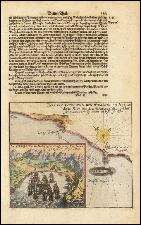
Rare early map of the area around Lima in Peru, with a large inset map of Insula de Pescadores.
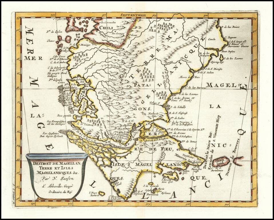
Fine example of Sanson's early regional map of the southern tip of South America, from P. de las Baixas and Port Desire in the east and the southern portion of Chile in the west, showing Magellanica in remarkable detail, including Staten land, Destroit...
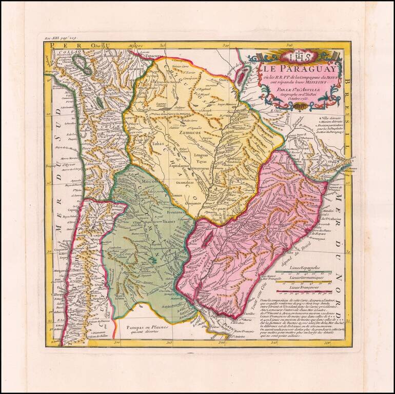
Fine Example of D’Anville’s Map of Paraguay in Fine Original Color Detailed and scarcely-seen map of the Jesuit missions in central South America, based upon the observations of the Jesuit missionaries and the latest maps. This example is from a...
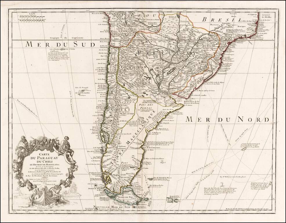
Nice example of Philippe Buache's edition of De L'Isle's map of the southern part of South America. The map shows the routes of a number of 17th century explorers in both the Atlantic and Pacific Oceans, as well as a marvelous and highly annotated...
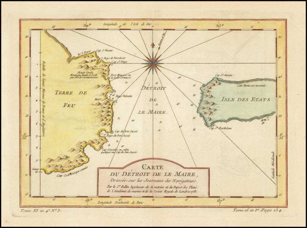
Detailed map of the Straits of Le Maire and Tierra Del Fuego, with a large compass rose. One of the maps produced by Nichlas Bellin for Prevost d'Exiles' influential travel book, L'Histoire Generale des Voyages.
![[Straits of Magellan] Carte Reduite Du Detroit De Magellan Dressee sur les Journaux des Navigateurs; Par le Sr. Bellin . . . 1753](/map/small/68956.jpg)
Highly detailed map of the Straits of Magellan, based upon important recent surveys. Many islands, bays and other details in the Straits.
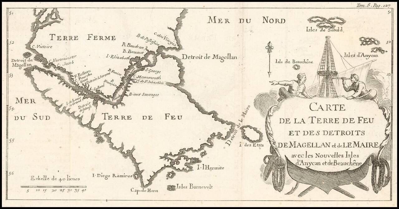
Rare Map of the Straits of Magellan Showing French, English, Spanish, and Dutch Discoveries Rare map showing European discoveries up to the early eighteenth century. The map depicts a large scale outline of southern Patagonia, or Terre Ferme,...
![[Straits of Magellan] Carte Reduite Du Detroit De Magellan Dressee sur les Journaux des Navigateurs; Par le Sr. Bellin . . . 1753](/map/small/66318.jpg)
Highly detailed map of the Straits of Magellan, based upon important recent surveys. Many islands, bays and other details in the Straits.
Second Edition of Nodal's Important Work, Including Teixeira's Suppressed Map of the Straits of Magellan Nice example of Pedro Teixeira's suppressed map of the Straits of Magellan, published in Garcia de Nodal's Relación del viaje hecho por los...
Nice example of this detailed map of the Straits of Magellan on continuous regions, prepared from the recently completed map of Juan de La Cruz Cano & Olmedilla and Hiolito Ricarte. Cruz Cano's eight-sheet map of South America, much like the...
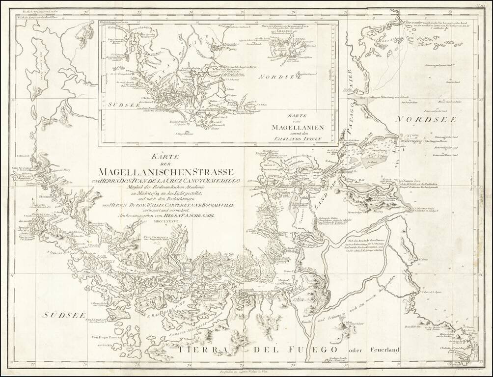
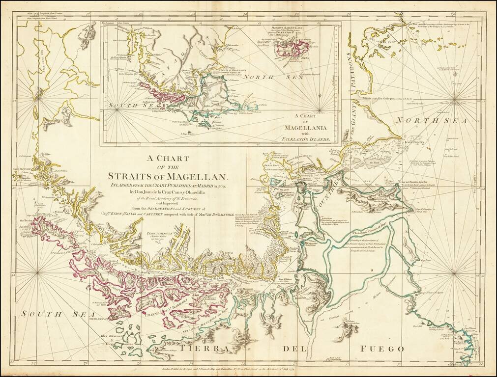
Navigating Magellan's Strait at the End of the Eighteenth Century Sharply-detailed map of the Strait of Magellan, published in Vienna by F.A. Schraembl. The map provides a fine depiction of the Strait, with a large inset showing the wider region of...
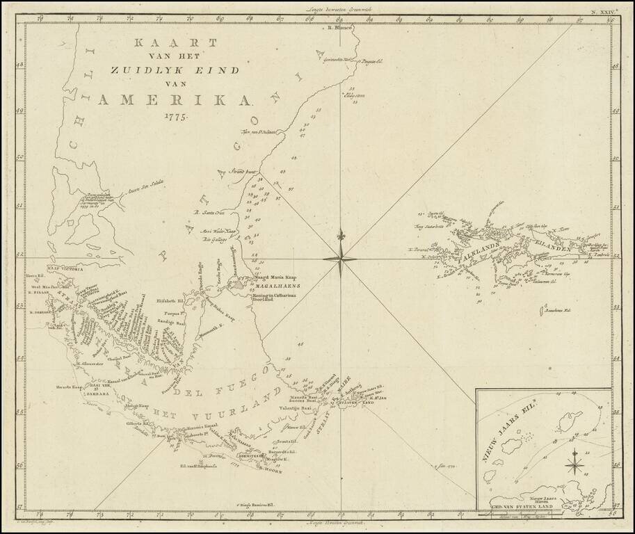
Scarce map of the sourthern part of South America, focusing on Cook's tracks around the Cape Horn and Tierra del Fuego in 1775. From a Dutch edition of the Official Account of Cook's Expedition.
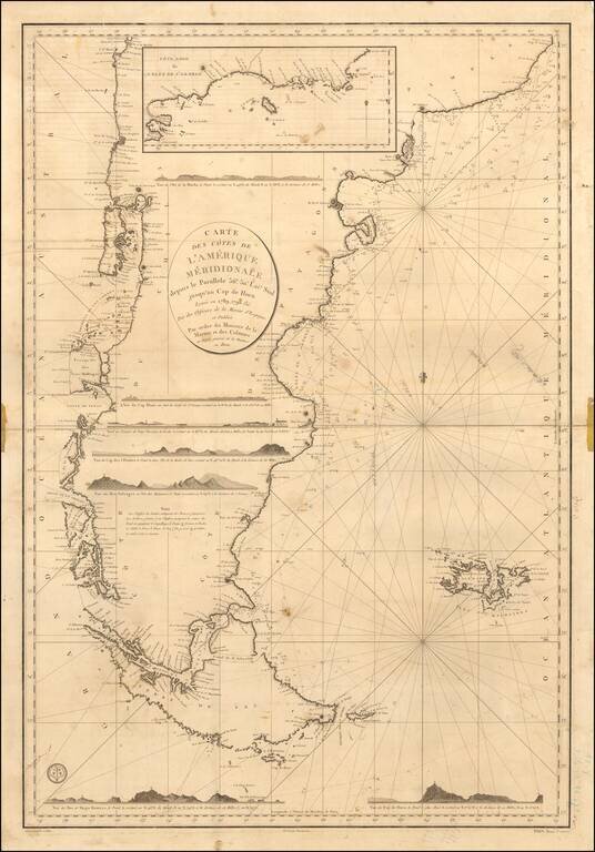
Annotated with the notes of a voyage to around the Tierra del Fuego. First state of this scarce French Sea chart of the southernmost part of South America, first published by the Depot de la Marine in 1800. Fine sea chart of the Southernmost coasts...
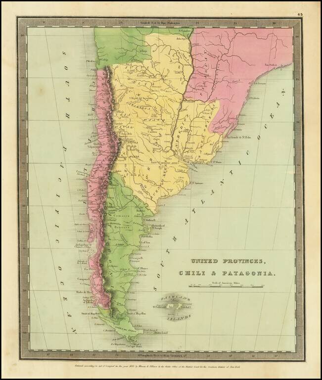
Striking map of the southern portion of South America, colored by provinces.
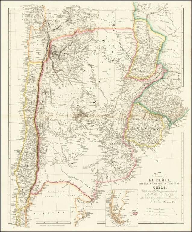
Shows Darwin's expeditions during the second voyage of the Beagle. A highly detailed map of Argentina, Chile, Uruguay and Paraguay, with an inset of Patagonia, published by John Arrowsmith, London's leading mid-19th century map maker. The map is...
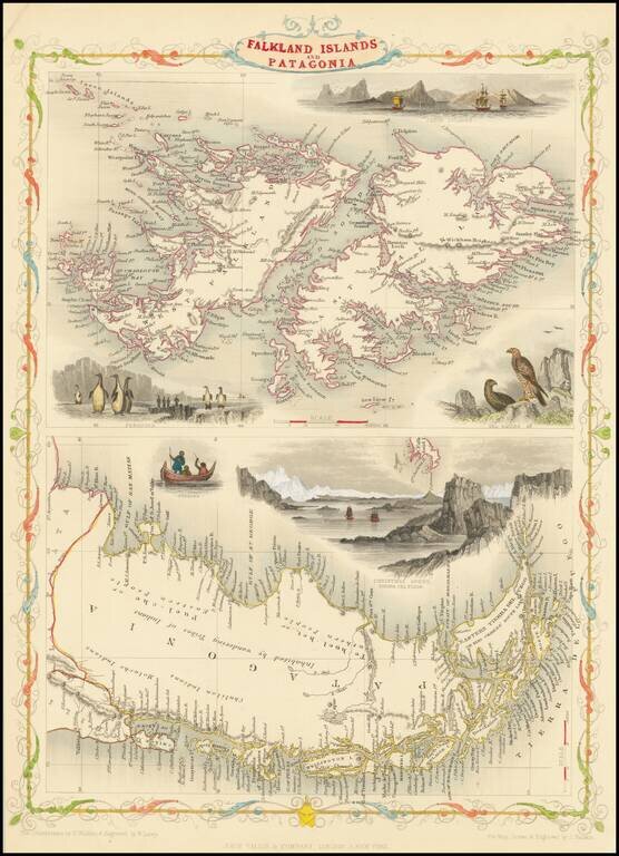
Decorative and detailed map of Patagonia and the Falkland Islands, showing mountains, rivers, towns, islands, etc. Vignettes of the Jason Islands, Sea Eagles, Penguins, Fugians, and Christmas Sound. Engraved for R. Montgomery Martin's Illustrated...