
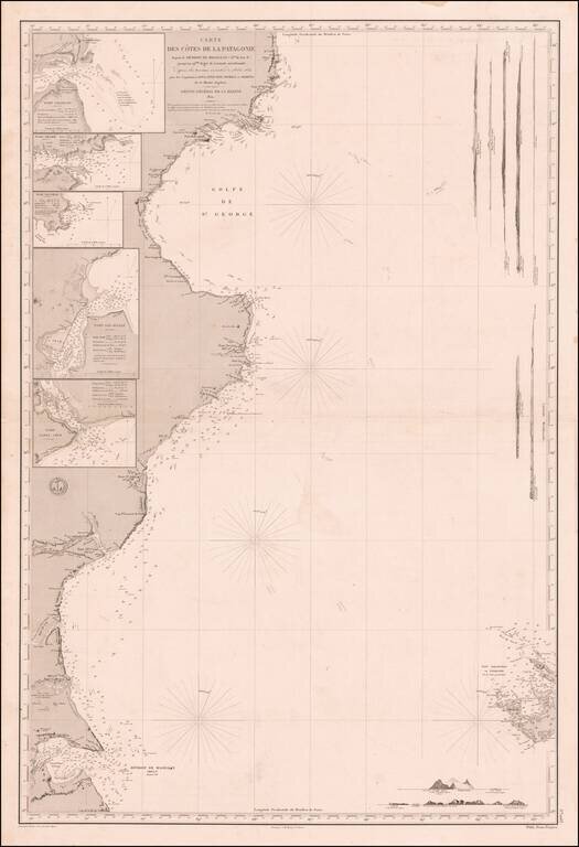
Fine Sea Chart of Eastern Patagonia Based on the Beagle Surveying Expeditions Remarkable sea chart of the eastern coast of Patagonia, published by the French hydrographic authority, the Dépôt de la Marine. The hydrography is based on the pioneering...
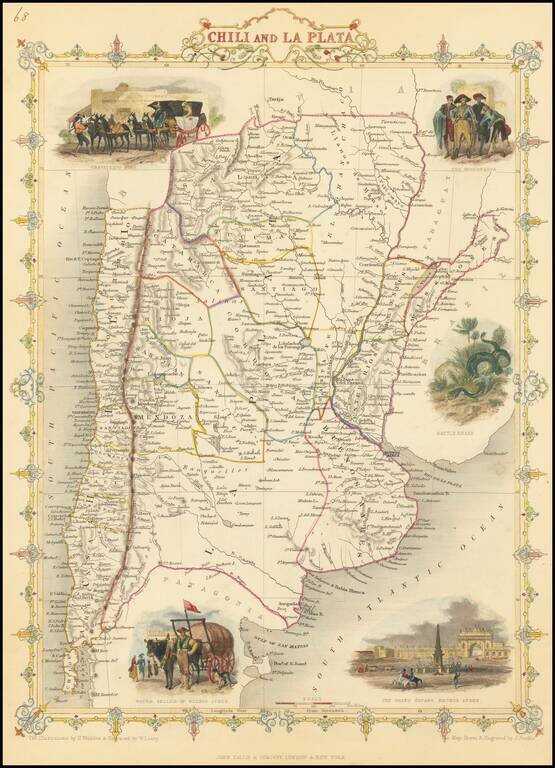
Decorative and detailed map of the region, showing mountains, rivers, towns, islands, etc. Vignettes of a Travelling Post, the Gobernador, the Grand Square in Buenos Ayres, and a Water Seller in Buenos Ayres. Tallis was one of the last great...
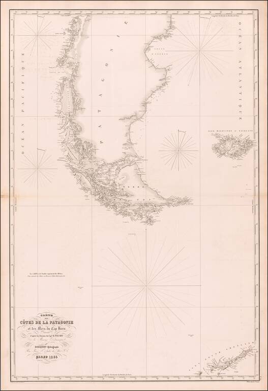
Rare separately published sea chart of the southern tip of South America, the Falkland Islands and the South Shetland Islands, published in Paris by Aime Robiquet. The chart lists Captain R. Fitz Roy of the British Admiralty as the source for the map...
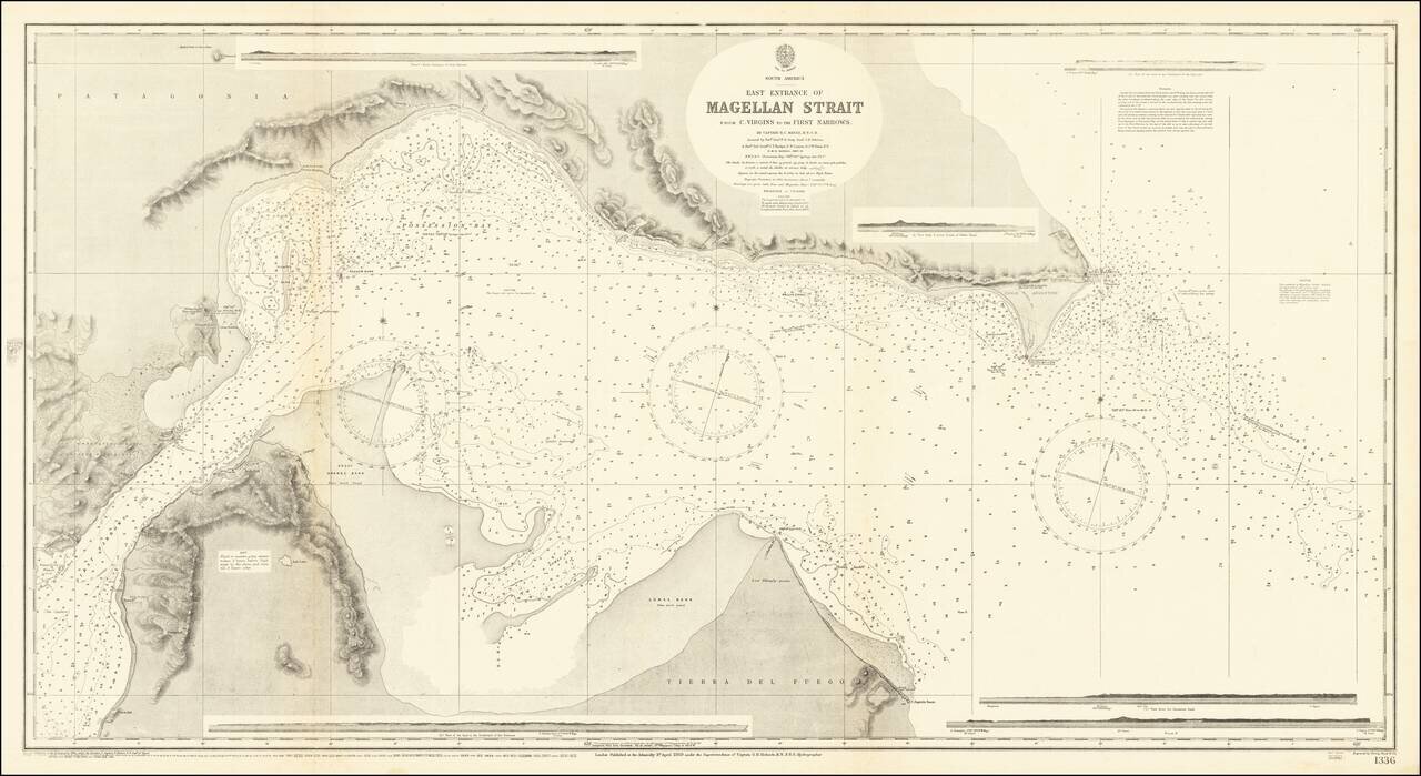
Detailed British Admiralty chart of the easternmost entrance to the Strait of Magellan. "The Light house was not visible to us before we saw it in a bearing of N 25° W true." An exceptionally detailed chart. Rarity This is the first time we have...
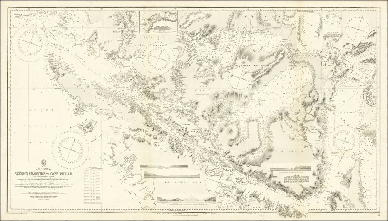
Finely executed Sea Chart of a large portion of the Straits Magellan, published by the British Admiralty. The chart is based upon a series of 19th Century surveys, with major corrections in 1885, 1898, 1903, 1910 and 1920. The map incorporates the...
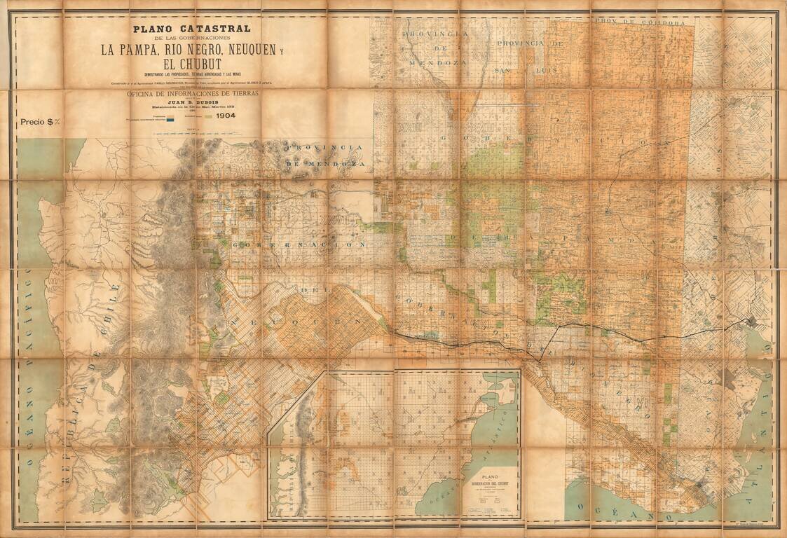
One of the earliest extant maps of the Region Showing Settlements in Patagonia Fine large format cadastral map of a large section of Patagonia, specifically, of the Argentine Provinces of La Pampa, Rio Negro, Neuquen and Chubut, published by the...
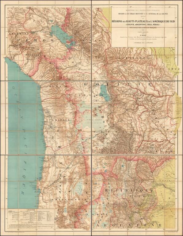
The First Comprehensive Scientific Mapping of the Andes Rare large scale map of the South American Highlands of Bolivia, Argentina, Chile and Peru, compiled by Victor Huot as part of a comprehensive study of the region by the Scientific Mission of G....
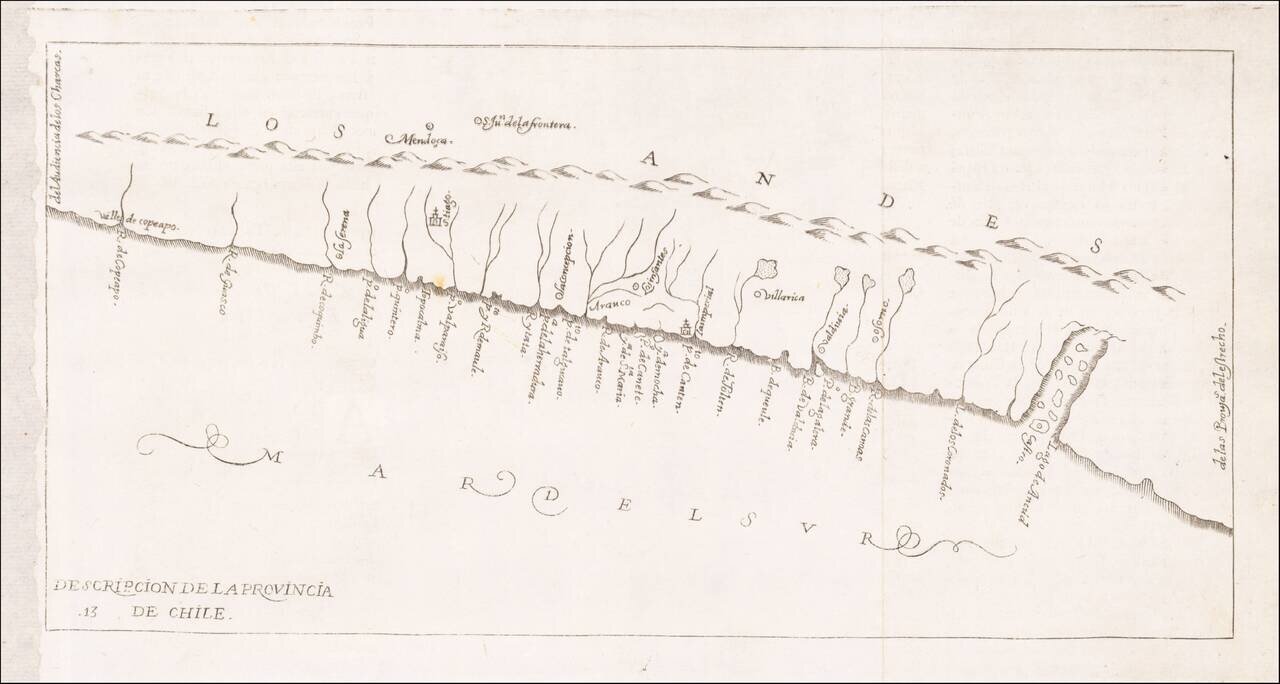
Rare early map of the province of Chile, locating rivers and settlements, the earliest map to include information from the previously secret manuscript maps of the Spanish cosmographer, Juan López de Velasco. The map first appeared in Herrera's...
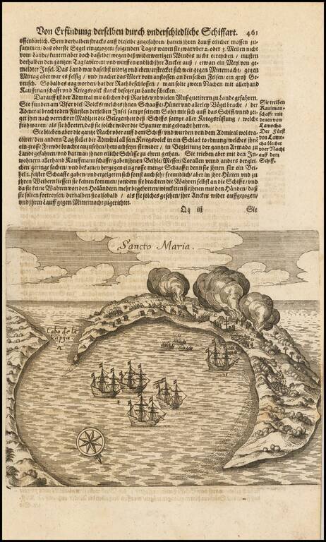
Detailed map of the Island of Sancto Maria (Arauco), illustrated as part of the voyages of Joris Van Spielbergen. The island of Arauco in Chile was first sighted by Juan Bautista Pastene, in 1544, during the Spanish exploration of the Chilean...
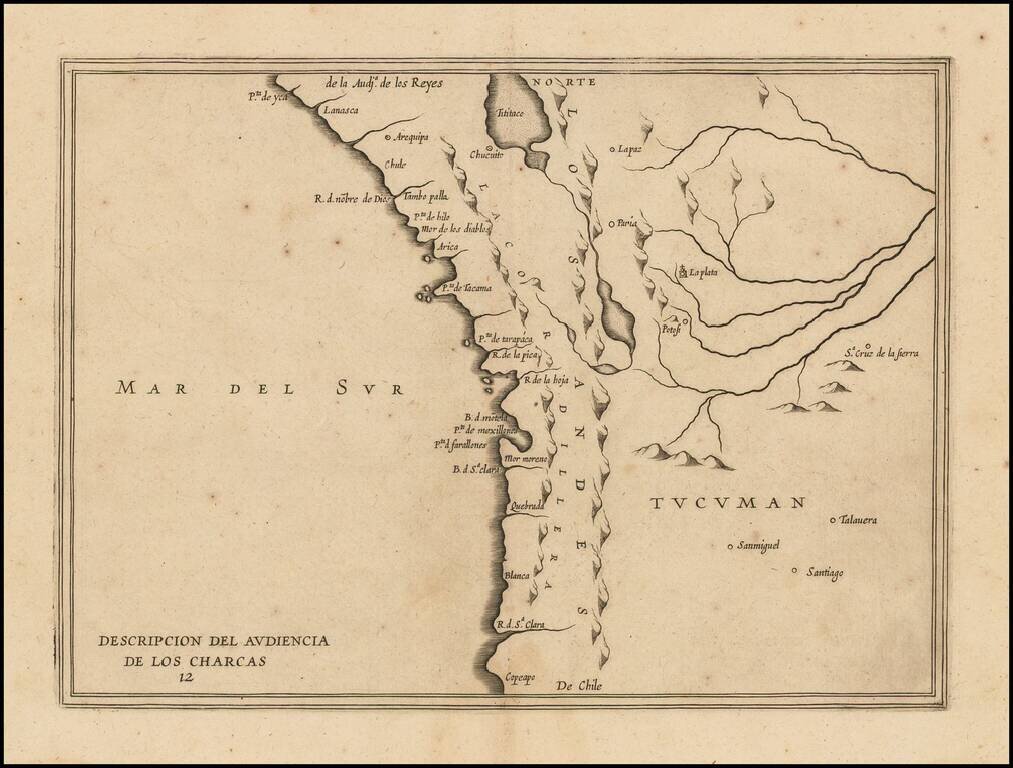
Rare early map of the Audiencia of the New Kingdom of Charcas, parts of modern-day Peru, Bolivia and Chile. The map locates rivers and settlements. The earliest map to include information from the previously secret manuscript maps of the Spanish...
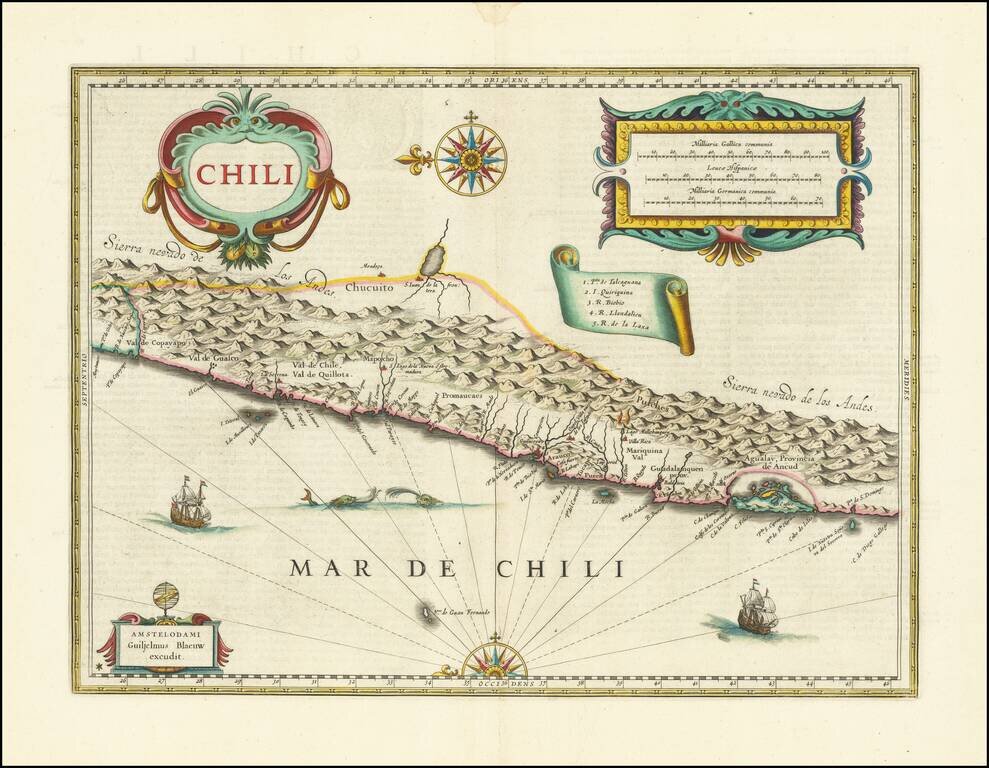
The First Large Atlas Map of Chile, from the Dutch Golden Age Nice old color example of Blaeu's map of Chile. This is the first large atlas map of the Spanish colony, although it also shows land controlled by the Mapuche and never conquered by the...
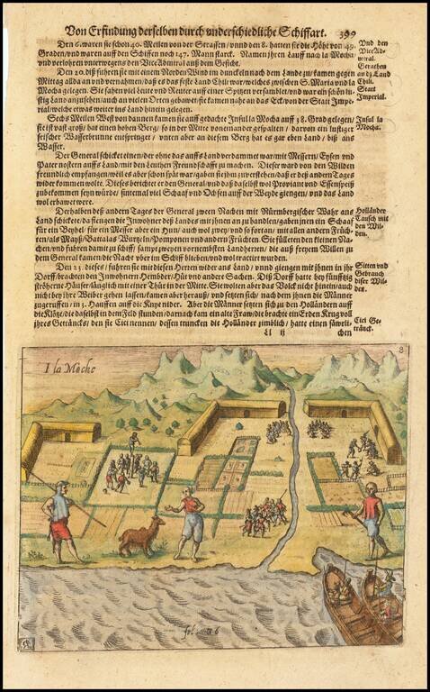
Theodore De Bry's edition of this early view of settlement on the Island of Mocha in Chile, including an indigenous chiliquenes (Llama), copied from Olivier Van Noort's expedition narrative. The island was historically inhabited by an indigenous...
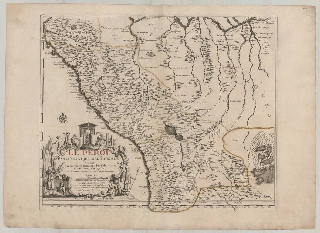
Fine example of De Fer's map of Peru and contiguous parts of the Andes and Upper Amazon River Basin. The striking large format map is the result of some of the most up to date cartographic information coming back to Europe from the Jesuit...
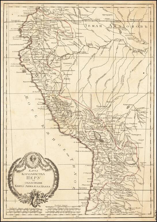
Russian-language antique map of the "Kingdom of Peru" from Ecuador to Chile on the western coast of South America. The map was created by Alexander Wilbrecht in Saint Petersburg in 1793, and was based on Janvier's Carte Du Perou ou se trouvent les...
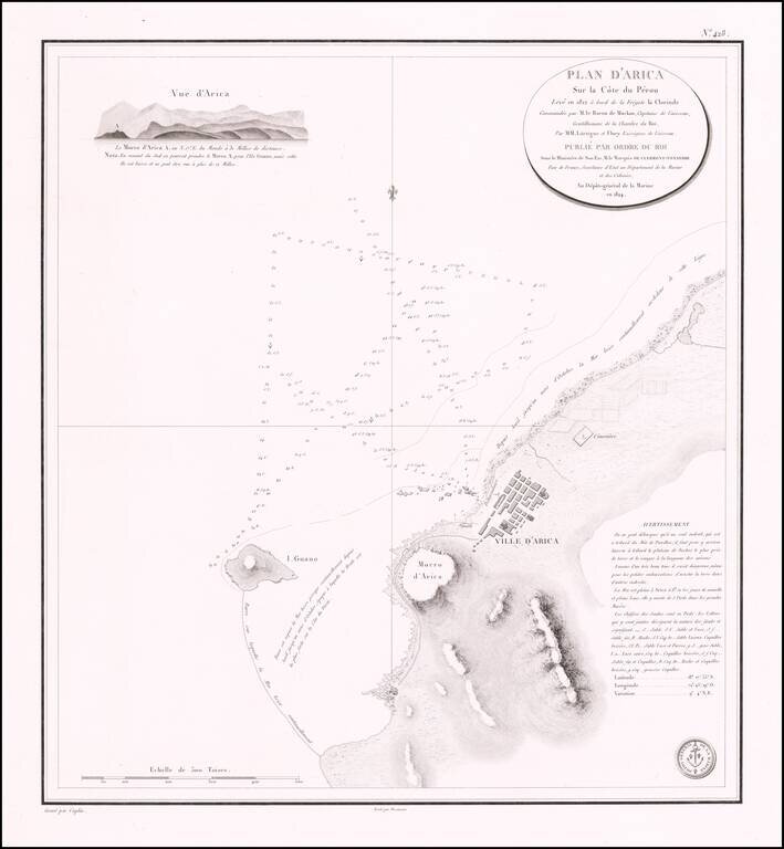
Rare separately published sea chart of the northern Chilean Coastline, centered on the town of Arica. Fine chart of the area around Arica in Chile, on the border with Peru, from Volume 7 of the Neptune Francois. The plan was drawn in 1822 during...
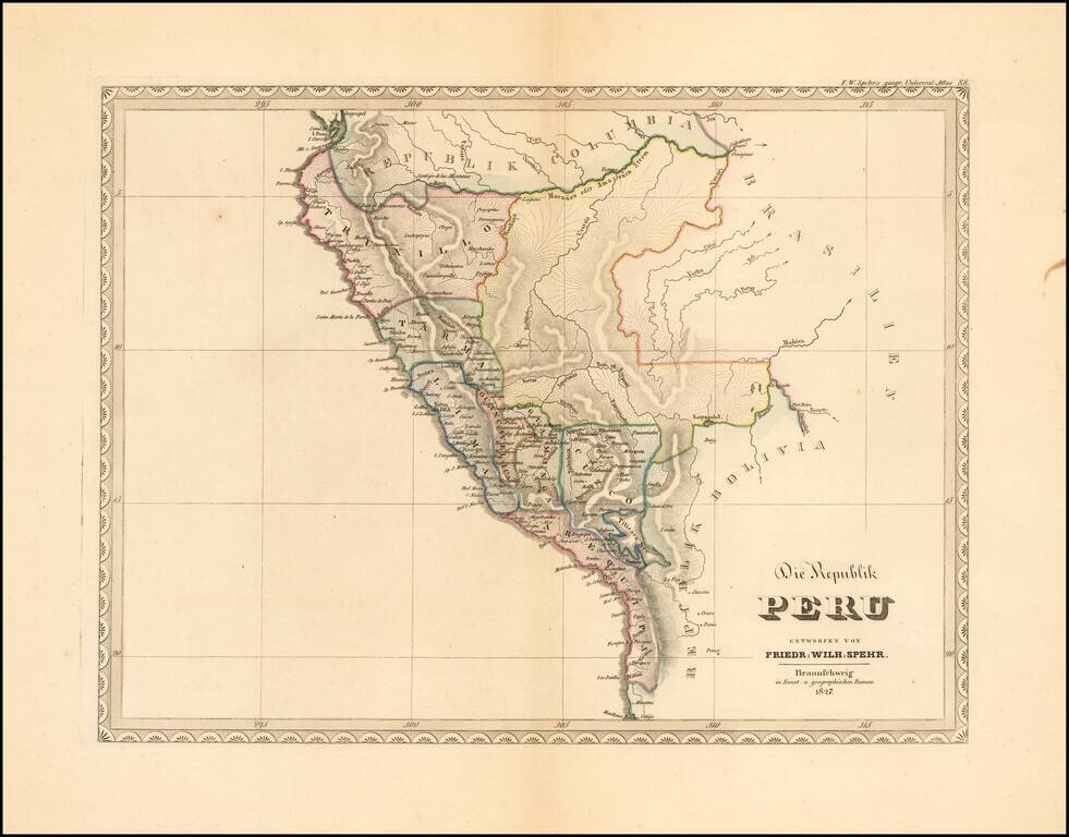
Extremely rare early map of the Republic of Peru, published by F.W. Spehr. The map was intended to be a part of Spehr's Geographischer Universal-Atlas. This work was started between 1822 and 1825, but the atlas was never completed, with only 36 of...