
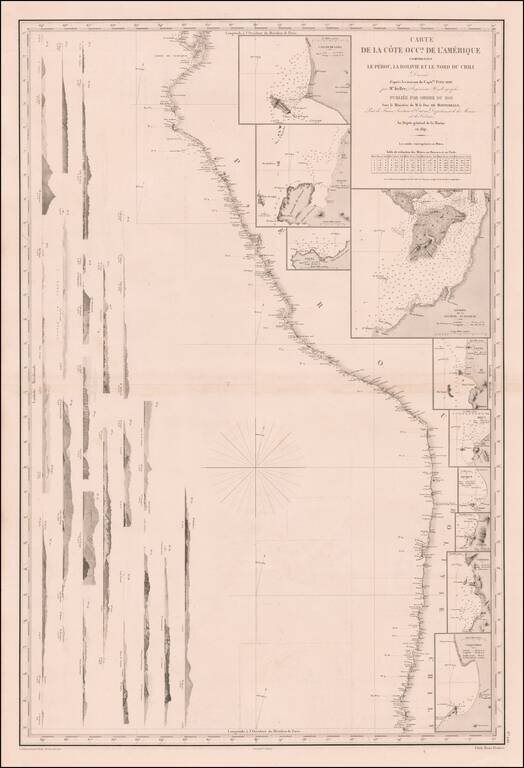
Remarkable sea chart of part of the West coast of South America, published by the French Hydrographic Survey. The chart extends from Guayaquil in the North to the Bay of Coquimbo in Chile, centered on Arica. The map includes large insets plans of:...
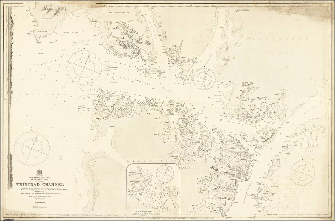
Detailed British Admiralty chart of a western section of the Strait of Magellan, illustrating the Trinidad Channel. The following report appeared in surveys of the Admiralty for 1879: On the western coast of South America, H.M.S. Alert, with an...
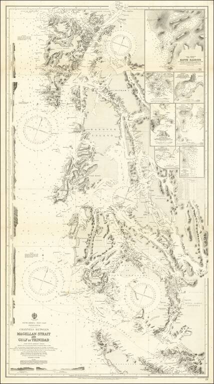
An Important Modern Charting of Southwestern Patagonia Fine chart of the western part of the Straits of Magellan and the southern part of Chile, extending north to the Reserva Nacional Alcalufes and Desolation Island. The sea chart was first issued...