Map size in jpg-format: 21.1333MiB
Click to open in high resolution (open in new tab).
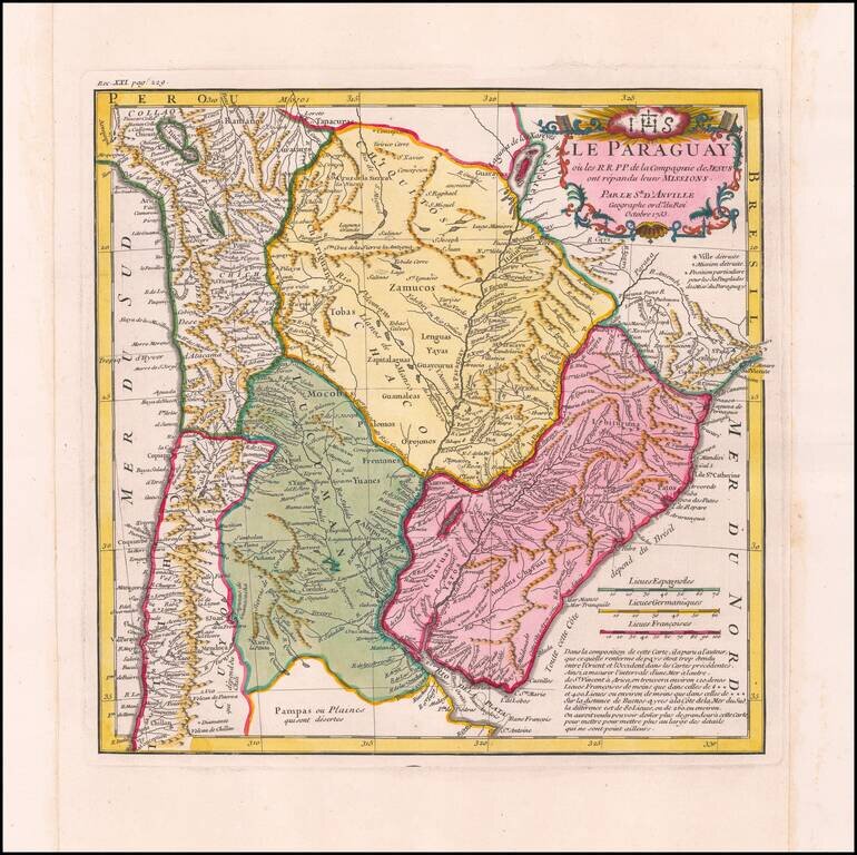
Fine Example of D’Anville’s Map of Paraguay in Fine Original Color
Detailed and scarcely-seen map of the Jesuit missions in central South America, based upon the observations of the Jesuit missionaries and the latest maps. This example is from a 1734 publication of Jesuit letters and materials and is rarer than the re-paginated example published in the later eighteenth century.
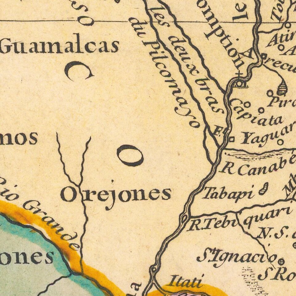
The map shows the area that now makes up parts of the countries of Chile, Paraguay, Bolivia, Peru, Brazil, Uruguay and Argentina. Mountains and rivers are shown in all the territories. In addition to key towns and villages, shown with a small building symbol, there is a key just under the cartouche which explains other features. These include destroyed villages, destroyed missions, and locales of importance to the tribes in contact with the Jesuits.
In the upper right corner is a decorative cartouche. A floral frame contains the title, which is topped with books and the Christogram of the Jesuits. The Christogram, IHS, derives from the first three letters of the name of Jesus in the Greek alphabet.
The Society of Jesus and Paraguay
The Society of Jesus was founded in 1540 by Ingatius of Loyola, Francis Xavier, and Peter Faber. Known for erudition and evangelism, Jesuits were often the first order to set up missions around the world and they provided much of the information about new places for European savants like D’Anville. Their priests were famous for being well-educated, hence the books in this cartouche.
The Jesuits began setting up missions in South America in the sixteenth century. These were not simply churches, but new communities where indigenous peoples lived and worked near or in connection with the priests. These mission-oriented communities were known as reductions. The area with the largest reductions were in Paraguay and the Río de la Plata area, where the Jesuits worked among the Guaraní people. There, the Jesuits practically operated their own state within a state, governing with little influence from Spanish and Portuguese authorities.
Just when this map was made, in 1733, the Río de la Plata missions were at their high point, with 141, 182 peoples living in 30 missions as of 1732. Less than three decades later, in 1759, the Jesuits were expelled from the Portuguese Empire due to political disputes in Europe. In 1767, they were also expelled from the Spanish Empire, ending the reduction system illustrated on this map.
D’Anville and his sources
In the lower right corner, there are three scale bars which show Spanish, German, and French leagues. Below this is a note which discusses D’Anville’s method in creating the map. It translates as:
In the composition of this map, it appeared to the author, that what country contains was too extensive between the East and the West in the preceding Maps. Thus to measure the interval from one sea to another, from St. Vincent to Arica, we find about 120 of our leagues Francoises less than those of XXX and 400 leagues or less than those of XXX. On the distance from Buenos Ayres to the South Sea Coast, the difference is 80 leagues, or 260 or so. We would have liked to be able to give more grandeur [meaning size] to this map, to put more of the details that are not elsewhere.
In this comment, D’Anville reveals his process for mapmaking. As a cabinet geographer, D’Anville relied on comparing all available sources about an area; he did not undertake surveying himself. In the comment, he is criticizing other mapmakers for their inconsistent and erroneous efforts to depict the width of South America. Although he leaves their names off the map, he is still trying to show himself as superior to his rivals. He also chafes at the small size of the map, which was meant to be bound in a book, which limited how much detail he could include.
D’Anville wanted to include so much detail because he was then involved in creating a definitive map of South America. The printed version of this map, the Carte de l’Amérique Méridionale, was not printed until 1748, fifteen years after the present example. However, D’Anville was already at work on revising the cartography of South America. He produced an early version of the 1748 map in manuscript for the Duc d’Orleans in 1737.
D’Anville was receiving some sources for this South America project from his contacts in Portugal. Since 1724, D’Anville had been contracted to work for the Portuguese Crown, in addition to his position with the French Crown. This allowed him access to otherwise hard-to-locate documents.
D’Anville also used other printed maps, for example those of Juan Francisco D'Avila's rare map of the Jesuit provinces, first issued in 1726. The map includes a number of improvements and the addition of more detail in areas largely ignored by D'Avila. Another influence was the map prepared by Father Antonio Maccioni and Father Jerónimo Herrán, whose work was published in Rome in 1732 by Joannes Petroschi.
Not only did this map influence D’Anville’s later cartography, but it also was used by diplomats long after D’Anville’s death. The map was one of many cited in a submission from Brazil to the United States in 1889. The United States were acting as arbiter in a boundary dispute between Brazil and Argentina and historical cartography was one of the sources of evidence used to shore up their claims.
The map was prepared for a Catholic publication, the Lettres Edifiantes et Curiuses ecrites des Missions Etrangers (1734). It was included in volume 21, at page 229, as indicated by the page number in the upper left corner. D'Anville included a memoir about the map in the same book.
A later state of the map has a different page number, as the Lettres were re-issued in 1780-3. However, this earlier example, with a volume 21 page number, survives in fewer examples based on holdings in institutional collections.
If you are a student, write to us in telegram: @antiquemaps and indicate what material you need and for what work you need a map in high detail. We are ready to provide material on special terms. For students only!