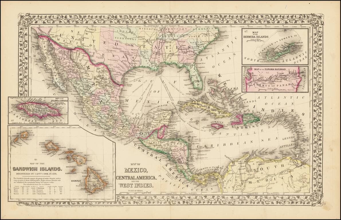
Rare and antique old maps of the North America
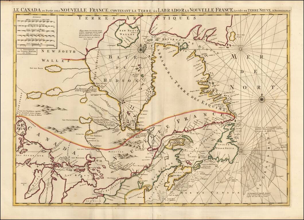
Fine large format map of Eastern Canada, Hudson's Bay and the Great Lakes, published by Mortier in 1696. The map is a significantly enlarged version of Jaillot's Le Canada ou Partie de la Nouvelle France . . . first published in 1685. Kershaw...
![A Chart of the Atlantick Ocean from Buttons Island To Port Royall [Includes Large Map of Chesapeake Bay, Delaware Bay, New York City and Vicinity]](/map/small/23075.jpg)
Rare and Fine Chart of the Eastern Seaboard from an Influential Atlas Scarce early-eighteenth century English sea chart of the East Coast of North America, which includes a second and more detailed chart of the region between Cape Henry and Long...
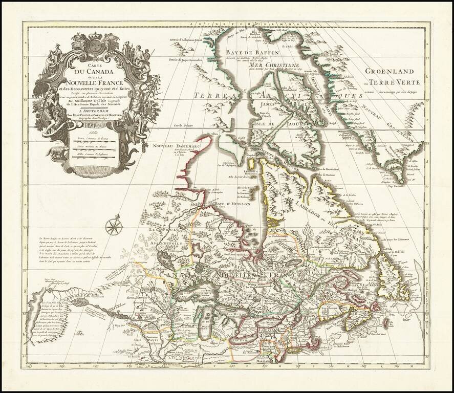
Fine example of Covens & Mortier's edition of De L'Isle's seminal map of Canada, the Great Lakes and Upper Midwest, and one of the most important and influential maps of Canada published in the 18th Century. De L'Isle's map is of seminal...
The Northeastern quadrant of Covens & Mortier's four-sheet edition of Popple's seminal map of North America, widely regarded as one of the two most important maps of North America produced in the 18th century (along with the Mitchell Map). Unlike...
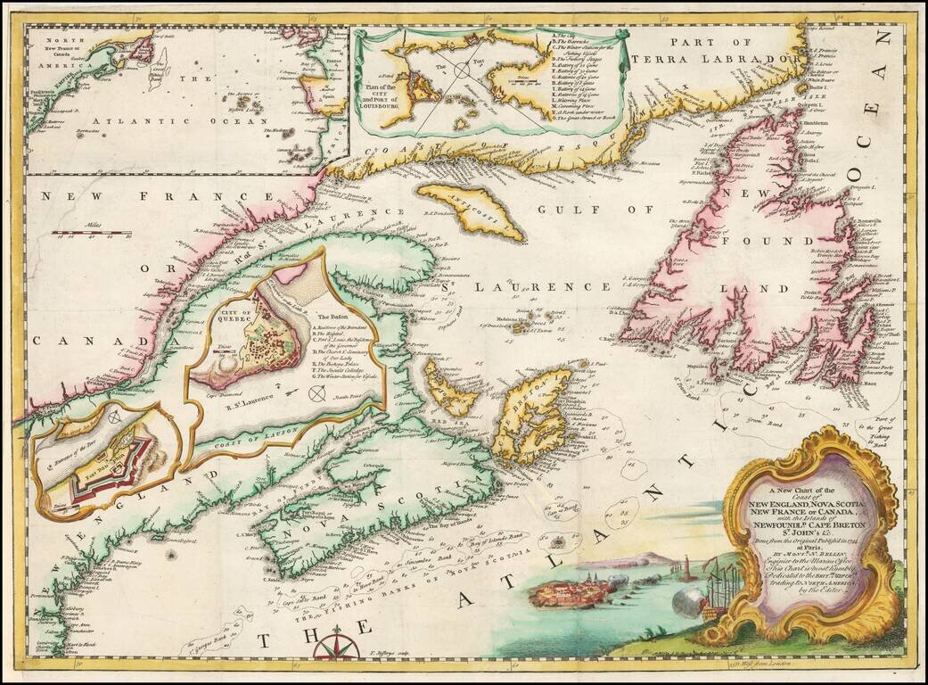
Interesting regional map from the January 1746 issue of Gentleman's Magazine. Shows in detail the Eastern coast of Canada with depths in soundings. Insets of Quebec City, Fort Dauphine, the Atlantic Ocean, and a Plan of City and Port of Louisbourg...
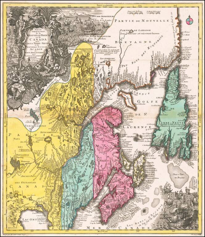
A beautiful map of Northeastern Canada, including Nova Scotia, Labrador, and Newfoundland, published by Tobias Conrad Lotter in Augsburg. The map's vertical format elongates the geography and distorts the true shape of Newfoundland. The St. Lawrence...
First state of Jeffery's map of New England and Nova Scotia, published by Thomas Jefferys in London. A finely executed map, extending south to Massachusetts and west to Montreal and Lake Champlain. The map incorporates information from other...
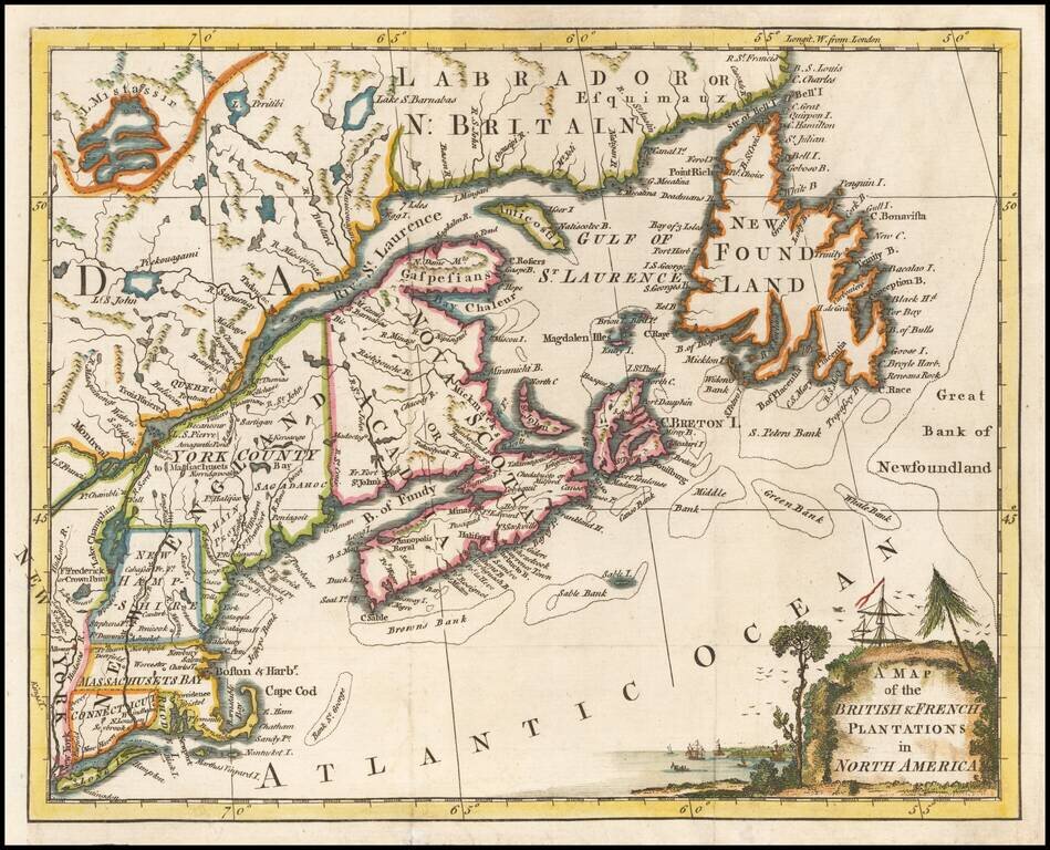
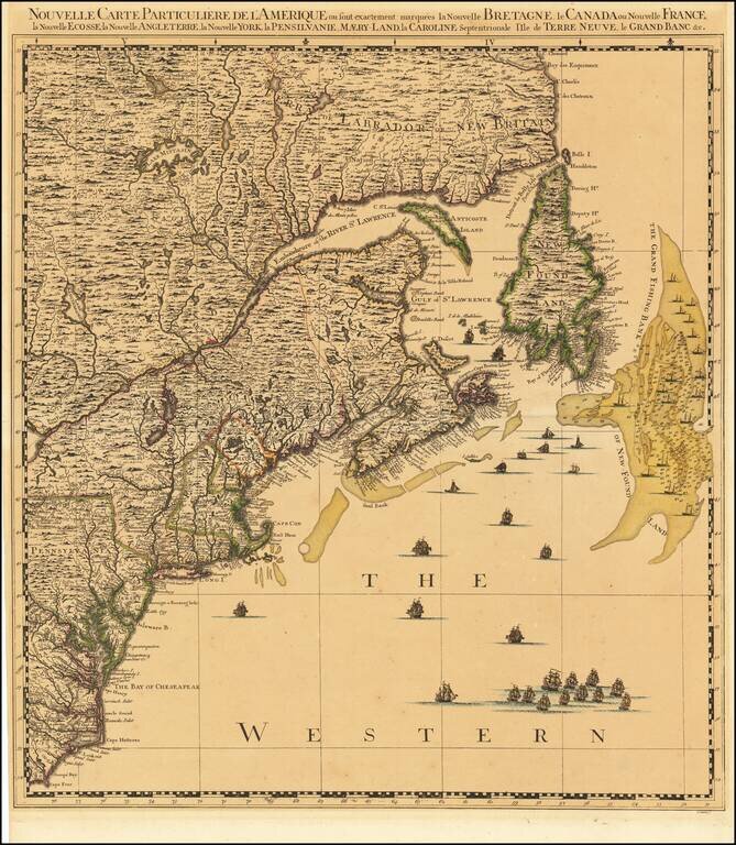
One of the earliest printed maps of the British Colonies to appear in a British Periodical. Detailed early map of the British & French Colonies in North America, extending from Long Island and the Hudson River to the St. Lawrence, Newfoundland...
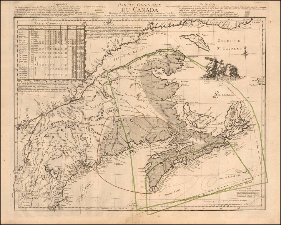
The French and British Historical Claims to Territory in the Canadian Maritimes and Maine, published in Paris on the eve of the Seven Years' War (1756-63). This truly fascinating and historically important map details the Acadia Boundary Dispute...
![Partie De L'Amerique Septent? Qui comprend La Nouvelle France ou Le Canada . . . [Large Great Lakes Inset]](/map/small/57758.jpg)
Decorative and highly detailed map of New England and Part of Canada, extending east to Newfoundland, with a large inset map of the Great Lakes. The large inset of the Great Lakes is based upon Bellin's map, and provides one of the best large format...
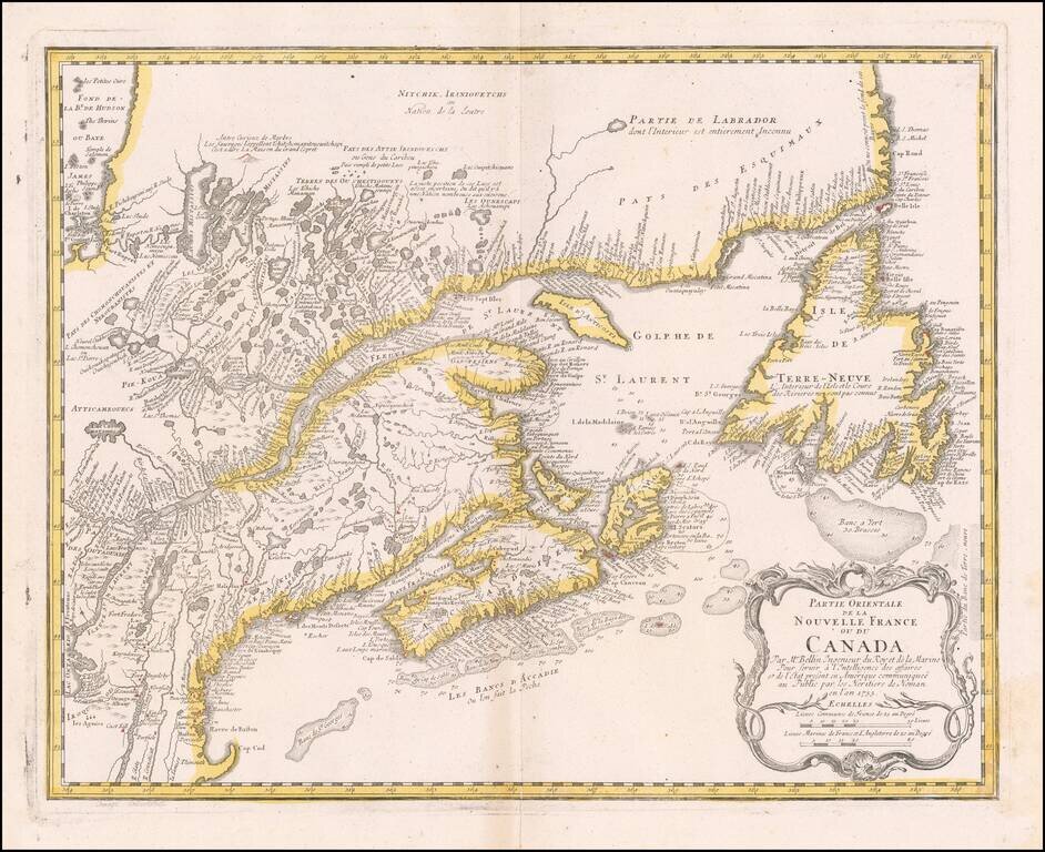
Nice example of the Homann Heirs edition of Bellin's map of New England and Eastern Canada. The map extends from Lake Ontario, the St. Lawrence River and Cape Cod in the South to Hudson Bay, Cape Rond and Newfoundland in the Northeast. A highly...
Rare First Edition, Second State, of Samuel Holland's Map of New York, Vermont, New Jersey, etc. Important colonial map of the Hudson River and its tributaries, including the Mohawk, and also with New Jersey and the upper course of the St. Lawrence...
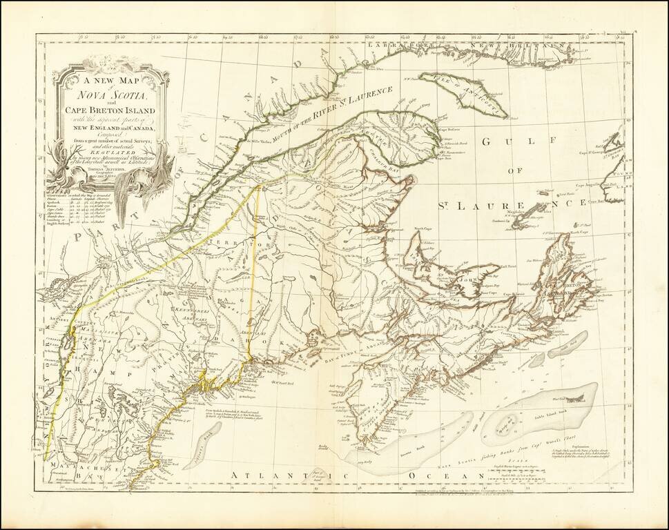
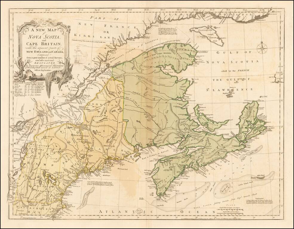
Highly detailed map of Nova Scotia, Cape Breton Island and contiguous regions, published in London by Thomas Jefferys in his landmark work, The American Atlas. Jefferys American Atlas, first published in 1775, would become the definitive reference...
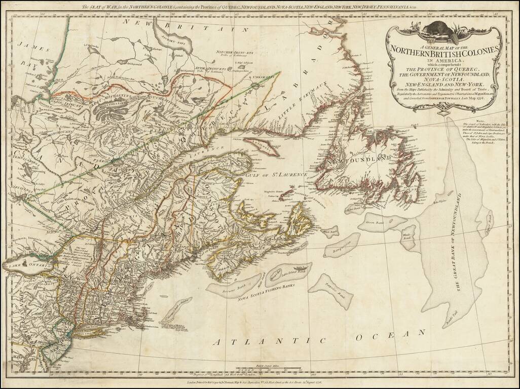
A scarce "Holster Atlas" edition of Sayer and Bennett's highly important map of New England and eastern Canada at the start of the American Revolution. This edition of the map was prepared specifically for the American Military Pocket Atlas, an atlas...
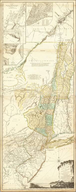
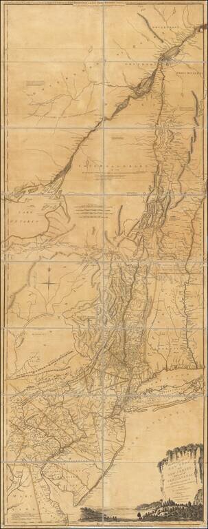
Rare Final State of Samuel Holland's Map of New York, Vermont, New Jersey, etc. Nice example of this important colonial map of the Hudson River and its tributaries, including the Mohawk, and also with New Jersey and the upper course of the St....
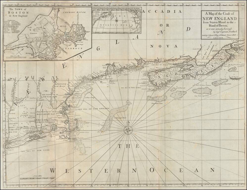
Navigating The Northeastern Seaboard Detailed coastal chart of the Northeastern part of the United States and part of Canada, reduced from Cyprian Southack's seminal 8 sheet chart that made up The New England Coasting Pilot, one of New England's...