
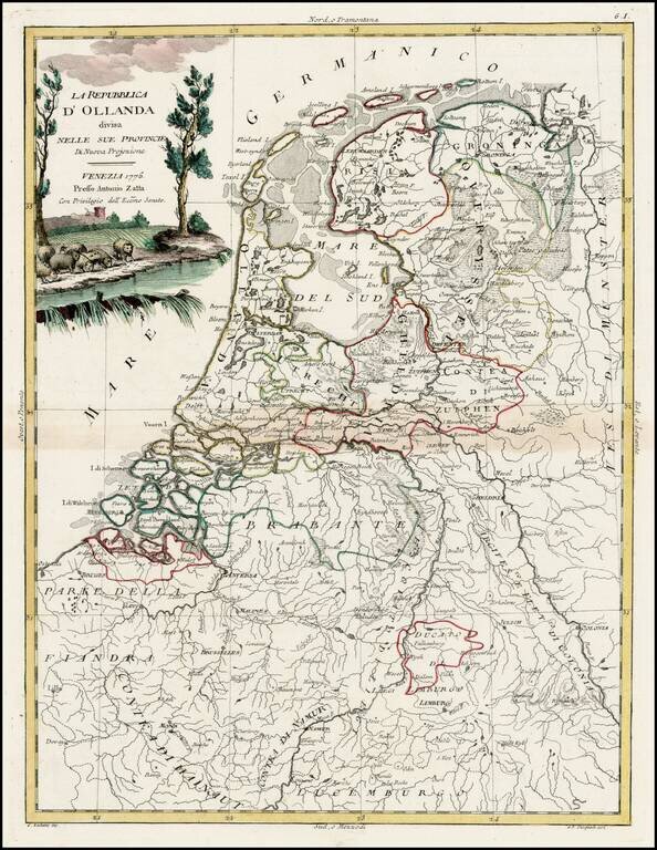
Decorative map of the Low Countries from Zatta's Atlante Novissimo.
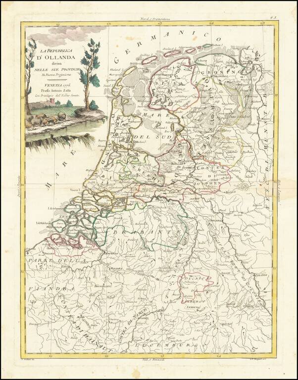
Decorative map of the Low Countries from Zatta's Atlante Novissimo.
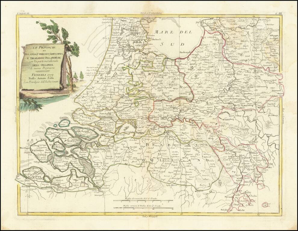
Decorative map of Dutch provinces of Zeland, Utrecht, Geldria and Dutch Brabant, from Zatta's Atlante Novissimo.
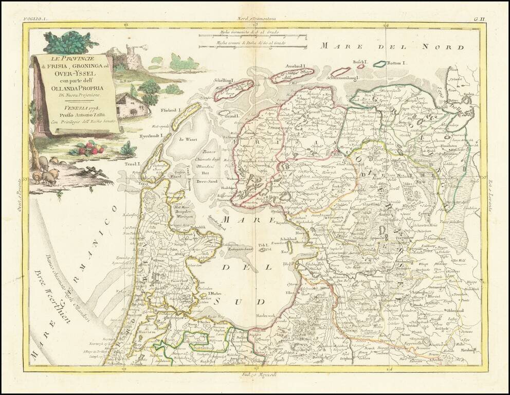
Decorative map of Dutch provinces of Frisia, Over-Yssel and Groningen, from Zatta's Atlante Novissimo.
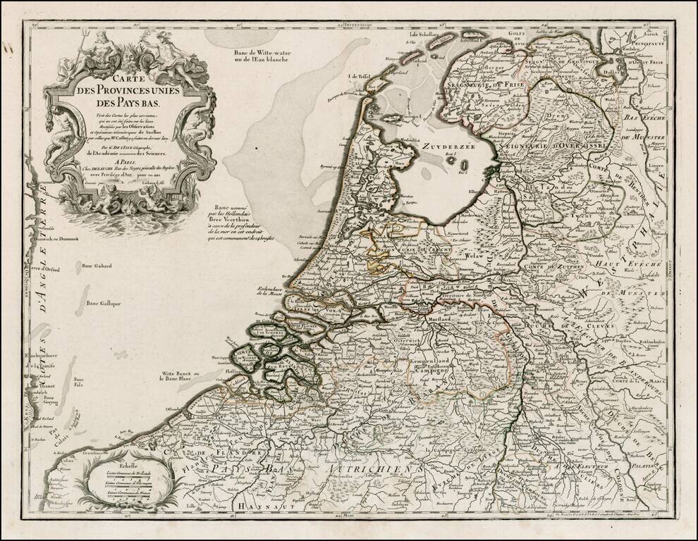
Detailed map of the Netherlands and Belgium, originally based upon the work of De L'Isle and Buache. Decorative Cartouche.
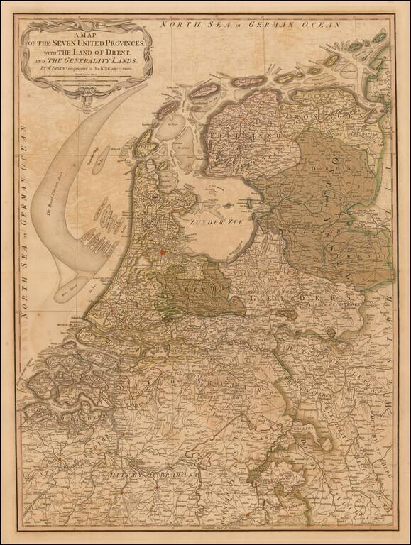
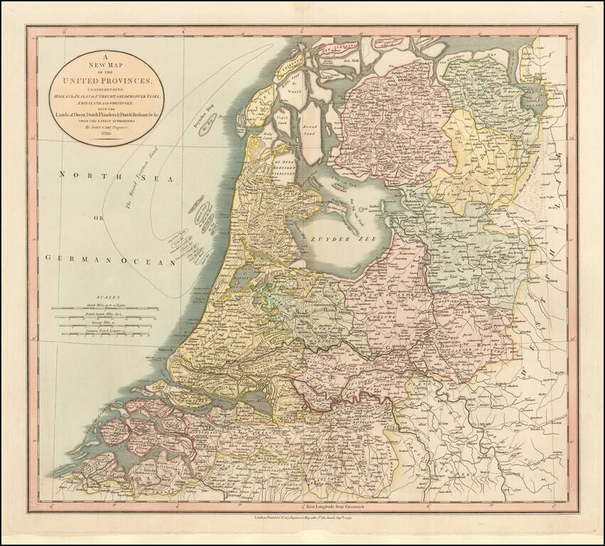
First edition of Faden's large and detailed map of Holland, originally issued 1789. The 'Generality Lands' were parts of Catholic Flanders captured and controlled by the United Provinces.
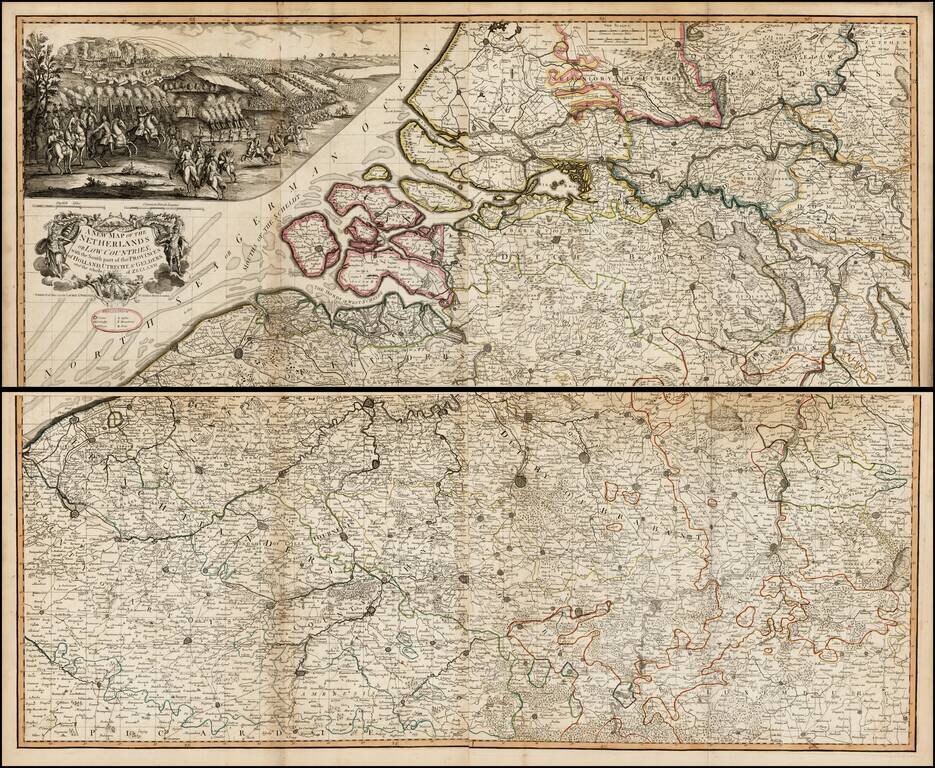
Scarce large format map of the southern part of the Low Countries, published by Laurie & Whittle in 1794. Above the decorative cartouche is a large (9" x 20") and beautifully rendered battle scene that may be the Battle of Flushing. Filled with...
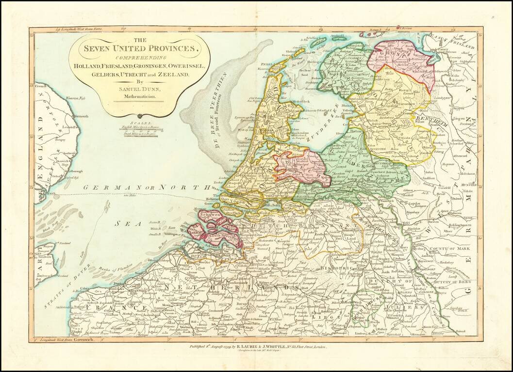
Nice detailed map of the Low Countries, colored by provinces. From Dunn's New Atlas or Mundane System of Geography.
![[Monastery Ter Apel] Petite carte des environs de Klooster ter apel et de Rooswinkel . . . 1796](/map/small/60565.jpg)
Finely executed manuscript map of the area around the Monastery Ter Apel in the Groningen area. Ter Apel Monastery Ter Apel Monastery was a monastery in the village of Ter Apel in the northeastern Dutch province of Groningen. It is the only monastery...
![[Monastery Ter Apel] Plan des digues de retenues nommees Leijdijken, derriere le Village de Klooster ter Apel, avec le project d' une Redoute sur l'alignement de la digue de traverse nommee, Korten ??? ??? dam, pour la defence de cet acces: paasage unique](/map/small/60585.jpg)
Finely executed manuscript map of the area around the Monastery Ter Apel in the Groningen area. The full title and translation are: [Monastery Ter Apel] Plan des digues de retenues nommees Leijdijken, derriere le Village de Klooster ter Apel, avec...
Nice example of John Cary's map of the Low Countries, hand colored by provinces. Shows the fine detail of late 18th Century English maps.
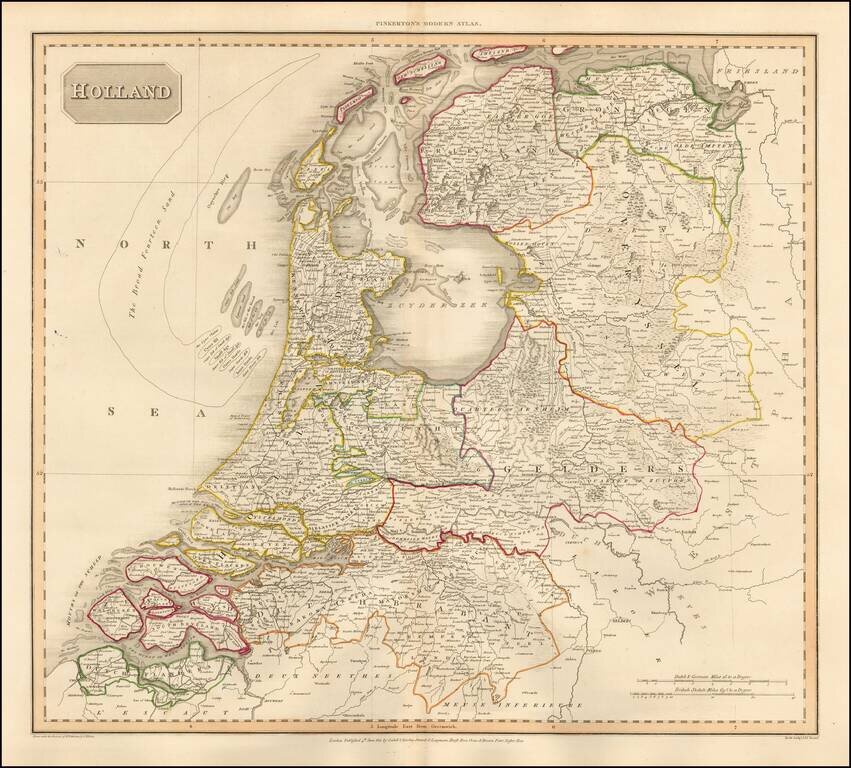
Detailed map of the Netherlands, from the rare Philadelphia edition of John Pinkerton's Modern Atlas. The map is colored by regions and shows towns, roads, rivers and a host of other details.
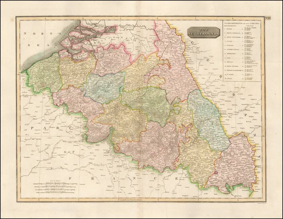
Detailed map of the Belgian Netherlands, including Roer, Rhin & Moselle, Mont-Tonnerre, Saare, Fortes, Sambre & Meuse, Jemmapes, Lys, Escaut, Deux-Nethes, Meuse Inferieure, L'Ourt, and Dyle. Large detailed map.
![[Napoleon's Battles in France, Belgium Netherlands, Luxembourg, Germany] No. 1 Frontiere du Nord. Mesny 5.](/map/small/60727.jpg)
Finely executed manuscript map of the Theater of War in Northwestern Europe, illustrating various battles, some with dates. The maps are printed on hand made paper with a large elaborate watermark D & C Blauw, the paper of the iconic Blaeu firm,...
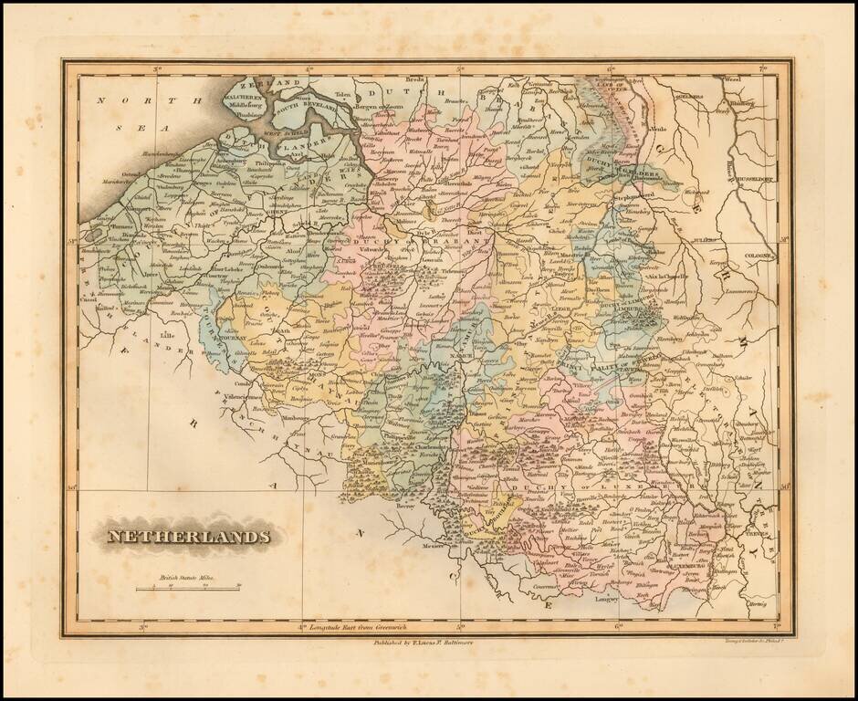
Fielding Lucas's 1823 engraved map of the Netherlands. Fielding Lucas' fine work distinguished him as the best publisher of the era. His maps are printed on a higher quality paper than contemporary maps by Carey & Lea and demonstrate a superior...

Large and highly detailed map of the Netherlands, hand colored by regions. Shows towns, railways, canals, rivers, lakes, coastal details, etc. Decorative piano key border. Scarce full color example, from Johnston's National Atlas.