
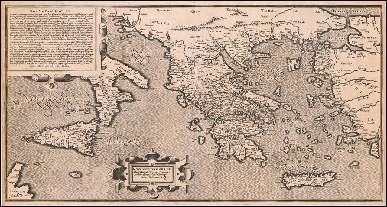
Extremely rare 16th Century map of the "New Greek Universe," by George Achatz von Eneneckel. The map extends from Sicliy and Puglia to the western coast of Asia minor, the regions controlled by the Ancient Greeks. This is the first time we have ever...
![[Crete / Corsica / Sardinia] Corsica [and] Sardinia [and] Creta . . . [and] Insulae Mari Ionii](/map/small/33196bp.jpg)
Decorative example of Ortelius' maps of Corsica, Sardinia, Crete and the Ionian Sea, from his Theatrum Orbis Terrarum, the first modern atlas of the world.
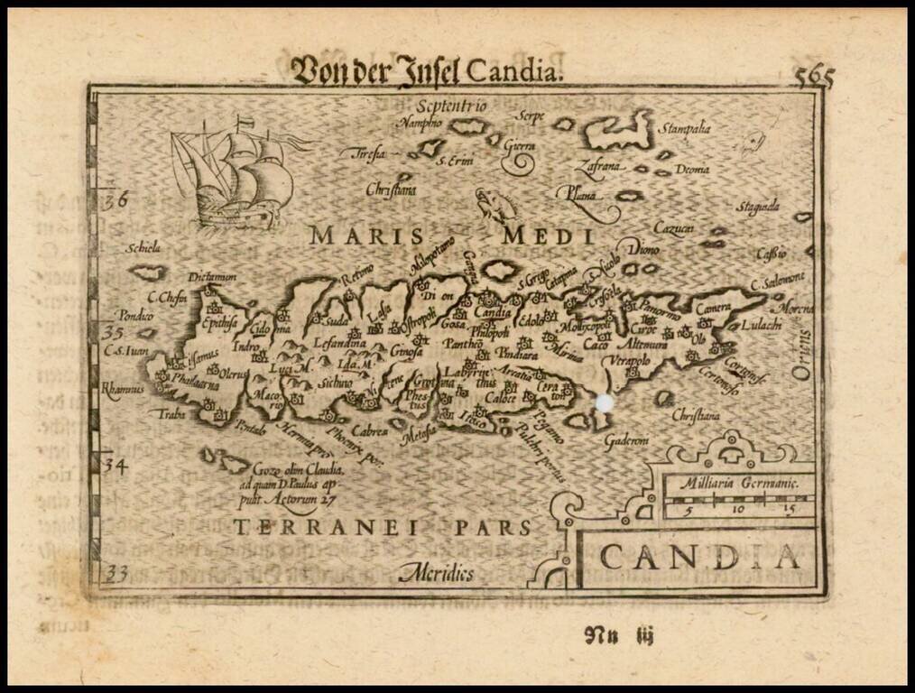
Nice example of this early state of Barent Langenes's map of the Island of Crete, which first appeared in the 1598 edition of Langenes's Caert-Thresoor, published in Middelburg. Langenes's map was first issued in his Caert-Thresoor and later...
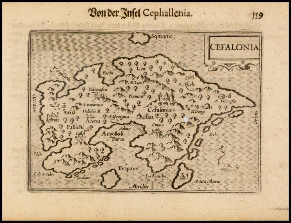
Nice example of this early state of Barent Langenes's map of the Island of Cefalonia, which first appeared in the 1598 edition of Langenes's Caert-Thresoor, published in Middelburg. Langenes's map was first issued in his Caert-Thresoor and later...
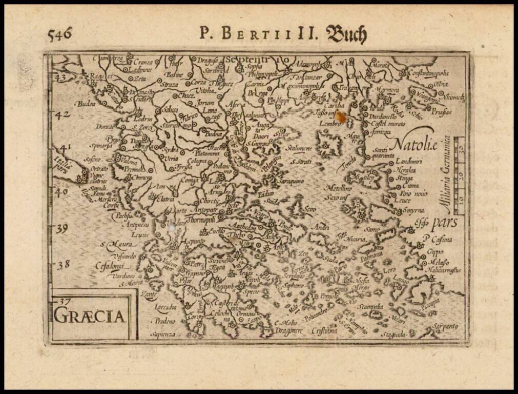
Nice example of this early state of Barent Langenes map of Greece, which first appeared in the 1598 edition of Langenes Caert-Thresoor, published in Middelburg. Langenes's map was first issued in his Caert-Thresoor and later re-published by Bertius...
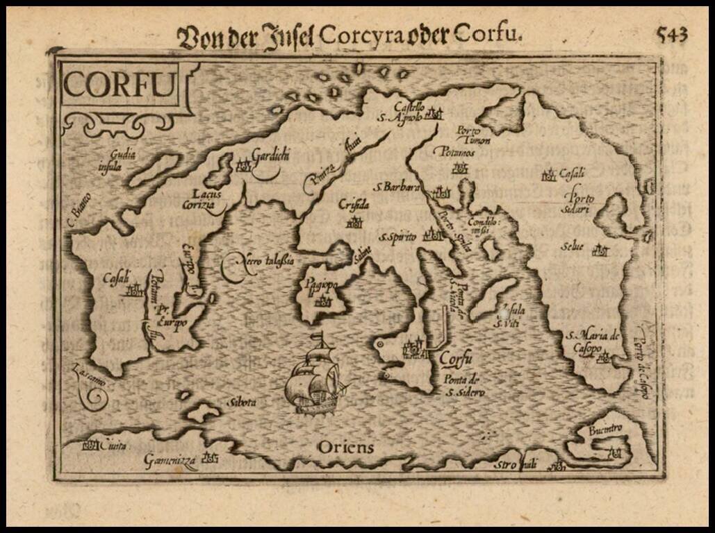
Nice example of this early state of Barent Langenes's map of the Island of Corfu, which first appeared in the 1598 edition of Langenes's Caert-Thresoor, published in Middelburg. Langenes's map was first issued in his Caert-Thresoor and later...
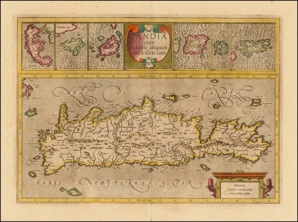
Nice old color example of the true first edition of Mercator's map of Crete and neighboring Greek Islands, from the first edition of Mercator's Atlas Sive Cosmographia. . . . Includes two large cartouches. Nice detail in the map of Crete and the large...
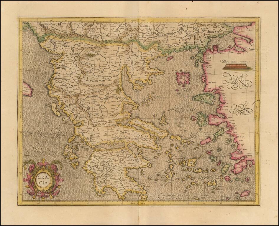
Fine example of Mercator's map of Greece, from an early edition of Mercator's Atlas Sive Cosmographia. The map bears the signature of "Gerardum Mecatorem," on the maps created by Mercator during his lifetime. The map is one of the earliest modern...
Striking early map of Cyprus, with 6 smaller maps below, showing Stalimini, Chius, Mitilene, Negroponte, Cerigo and Rhodus Islands. A fine example of Mercator's work, with the classic engraving of the sea characteristic of his work. Nice example.
Striking early map of Greece. Decorative cartouche, sailing ship and elaborate engraving style.
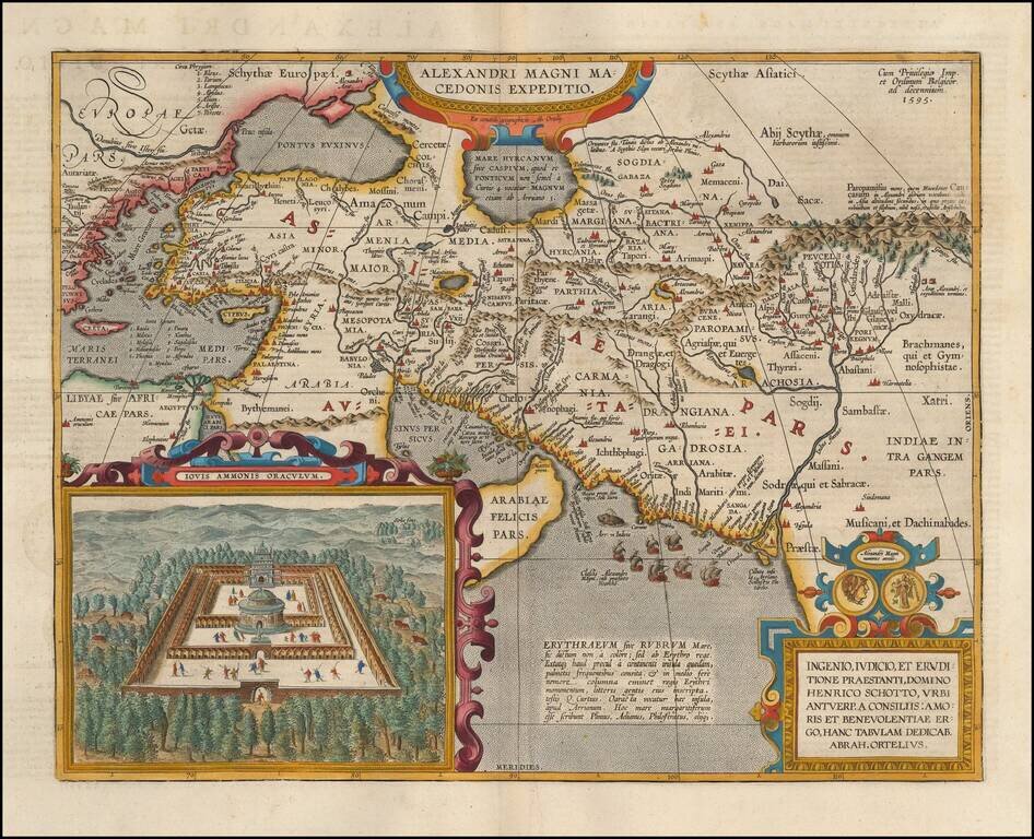
Detailed map of Alexander the Great's expedition to Macedonia. Includes an inset: Iovis Ammonis Oraculum, the oracle in Lybia which Alexander visited before he went to India. Several decorative cartouches, sailing ships, sea monsters, etc.
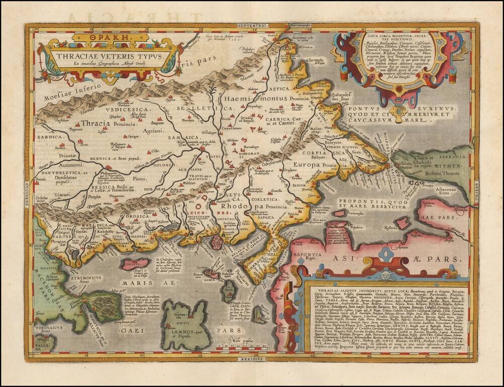
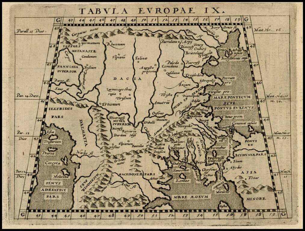
Fine map of ancient Thrace, extending from Byzantium (Istanbul) and the Bosphorus Straits to Macedonia, published by Abraham Ortelius. The map is based on Gastaldi's 1560 map of South East Europe, and on information from numerous ancient sources,...
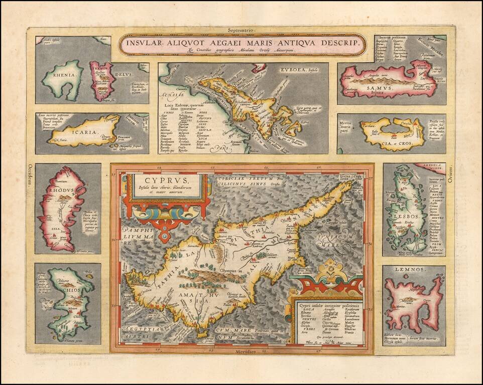
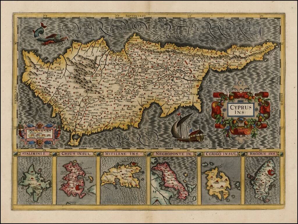
Striking full color example of Ortelius' map of Cyprus, ringed by smaller maps of islands in the Aegean, including Lesbos, Rhodes, Rhenia, Tremon, Icaria, Euboaea, Chios, Lemnos, Cia et Ceos and Samus. From Abraham Ortelius' Theatrum Orbis Terrarum,...
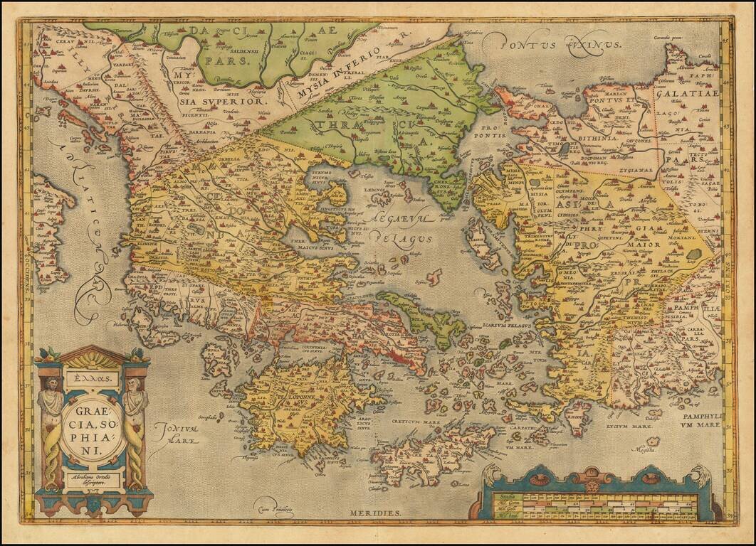
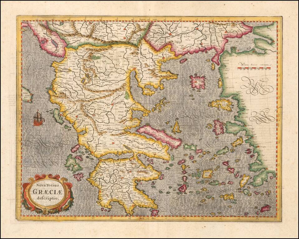
Old color example of Ortelius' decorative map of Greece, Turkey and Asia Minor, with neighboring islands, from Ortelius' Theatrum Orbis Terrarum, the first modern atlas of the world. The map is embellished by a decorative cartouche and scale of miles....
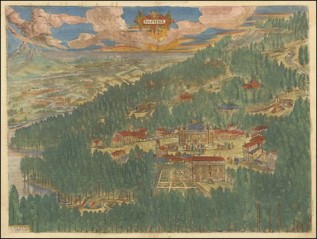
Fine old color example of Abraham Ortelius' view of the mythical paradise of Tempe in Thessaly, Greece. Located at the foot of Mount Olympus, this valley was known as the playground of the gods. The Pineios River, named after the river god Peneus,...