
![Oporto [Porto]](/map/small/67738.jpg)
Antique Map of Porto, Portugal Highly detailed plan of Porto, including a large panoramic birdseye view of the City from Torre da Marca. One of the best 19th Century English town plans to appear in a commercial atlas.
![[Rhodes]](/map/small/68772.jpg)
Fine Image of the City Gates of Rhodes, from the Nuremberg Chronicle Striking view of one of the city gates of the city of Rhodes, from the famous Nuremberg Chronicle. The Chronicle featured many city illustrations, some of which were the first...
![Decima et Ultima Europa Tabula [Greece]](/map/small/41909.jpg)
One of the Earliest Maps of Greece To Incorporate Modern Geographical Details Fine example of Sylvanus' map of Greece, one of the earliest obtainable maps of the region and the first printed in two colors. Sylvanus' map of Greece is one of the...
![[Ptolemaic Greece]](/map/small/50928.jpg)
An Early Edition of Fries Map of Greece Nice example of Lorenz Fries map of Greece and part of the Balkans, from his Geographia, first published in 1522. The publisher of this edition, Michael Villanovus (or Servetus), was tried by Calvin for heresy...
![[Greece & Islands]](/map/small/41869.jpg)
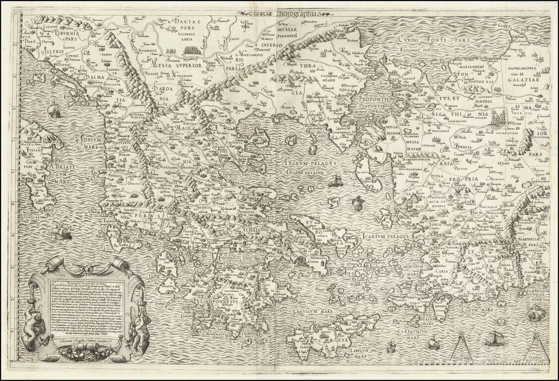
Interesting early map of a portion of Greece, which appeared in the 1538 edition of Solinus' Polyhistor, rerum toto orbe memorabilium thesaurus locupletissimus. Huic ob argumenti similitudinem Pomponii Melae de situ orbis libros tres adiunximus. The...
Fine unfolded example of Gastaldi's modern map of Greece, one of the earliest modern maps of Greece, from Gastaldi's Geografia di Claudio Ptolemeo Alexandrino . . . , published in Venice in 1548. Giacomo Gastaldi is considered as the foremost Italian...
![Tabula Europae X [Greece]](/map/small/45830.jpg)
Interesting map of the region includiing Greece, from the 1548 edition of Ptolemy's Geographia. Gastaldi's maps are considered important early maps for regional collectors. Giacomo Gastaldi was one of the most important Italian mapmakers of the...
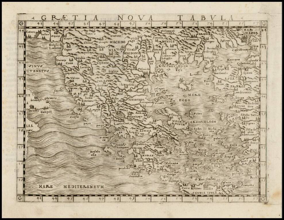
Nice example of Antonio Salamanca's 1558 map of Greece, based upon Nikolaos Sophianos's landmark 8-sheet map of Greece, from classical and modern authorities. Antonio Salamanca's map of Greece is the earliest obtainable map based upon Nikolaos...
![[Greece] and [Eoboea]](/map/small/59211.jpg)
Fascinating map of Greece, with Euboea (Evia) on verso, from Honter's 1561 De Cosmographiae Rudimentis. Honter's maps are based upon modern sources and are among the earliest modern printed maps of the regions shown.
![[Eastern Mediterranean]](/map/small/59510sb.jpg)
The Only Surviving Example Rare Lafreri school map of the Eastern Mediterranean and vicinity. The map is the Southeastern Sheet of an Unrecorded Map of Europe, published in Venice. The present example is the third state of three.
![[Eastern Mediterranean]](/map/small/61501sb.jpg)
Only known example of the rare map of of the Eastern Mediterranean. As note by Bifolco, this unique map is one of four sheets from a 16th century wall map of Europe, which an incomplete example survives the Civic Library of Bergamo in Italy (3 of 4...
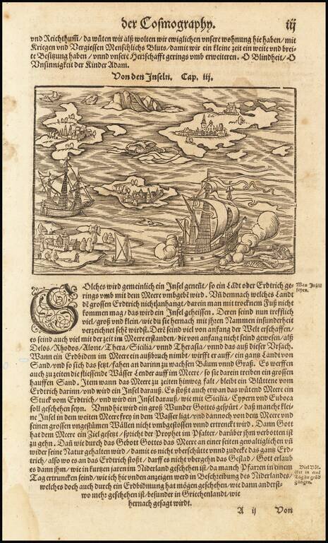
Fascinating map of a ship in the Mediterranean. Islansd mentioned in the text include Sicily, Rhodes, Delos, Alone, and Thera.
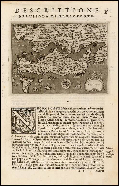
One of the earliest obtainable printed maps of Negroponte. From Porcacchi's L'Isole Piu Famose del Mondo, one of the most popular Isolario's of the 16th Century. Italian text below map and on the verso.
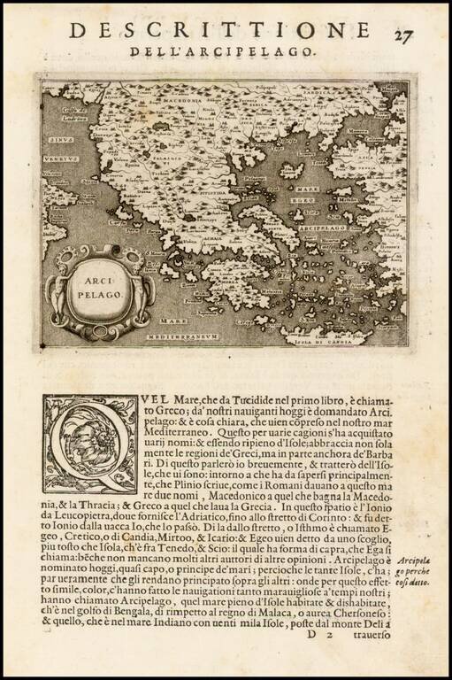
One of the earliest obtainable printed maps of Greece. From Porcacchi's L'Isole Piu Famose del Mondo, one of the most popular Isolario's of the 16th Century. Italian text below map and on the verso.
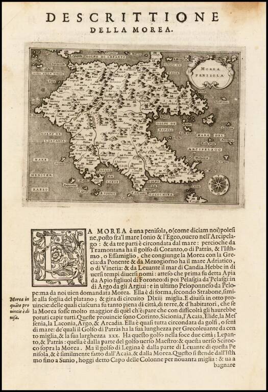
One of the earliest obtainable printed maps of Morea. From Porcacchi's L'Isole Piu Famose del Mondo, one of the most popular Isolario's of the 16th Century. Italian text below map and on the verso.
![Cyprus Insula [with] Candia, Olim Creta](/map/small/65746.jpg)
Striking example of Ortelius' first map of Cyprus and Crete, from Ortelius' Theatrum Orbis Terrarum, the first modern atlas of the World. The map is based upon earlier maps by Bordone (1528) and Camocio (1564). During the time of the map's creation,...