
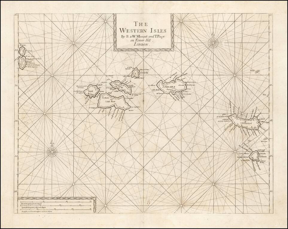
An Early Engish Sea Chart of the Azores Fine early chart of the Azores, which appeared in the English Pilot First Part, Southern Navigation.
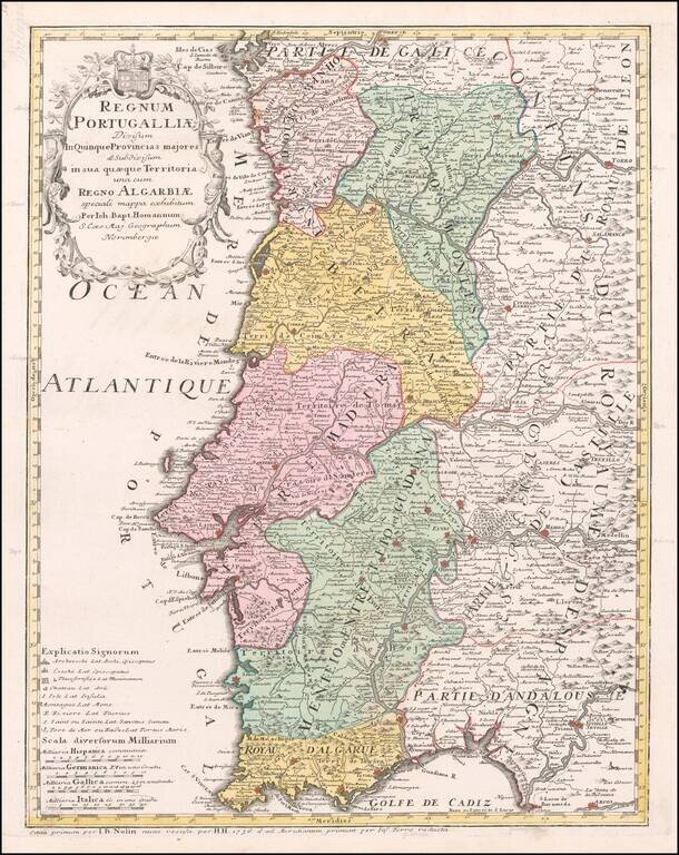
Detailed map of Portugal and the Algarve, first published by Johann Baptist Homann in 1736. The map is colored by provinces, showing towns, rivers, mountains, harbors, roads, etc. Very large title cartouche with figures and a coat of arms.
![Les Isles Canaries . . . [With inset map of the Islands of Madeira and Porto-Santo]](/map/small/70853.jpg)
Detailed map of the Canary Islands, from De Vaugondy's Atlas Portatif, Universal et Militaire. Large inset of Madera and Porto Santo. Lots of place names shown.
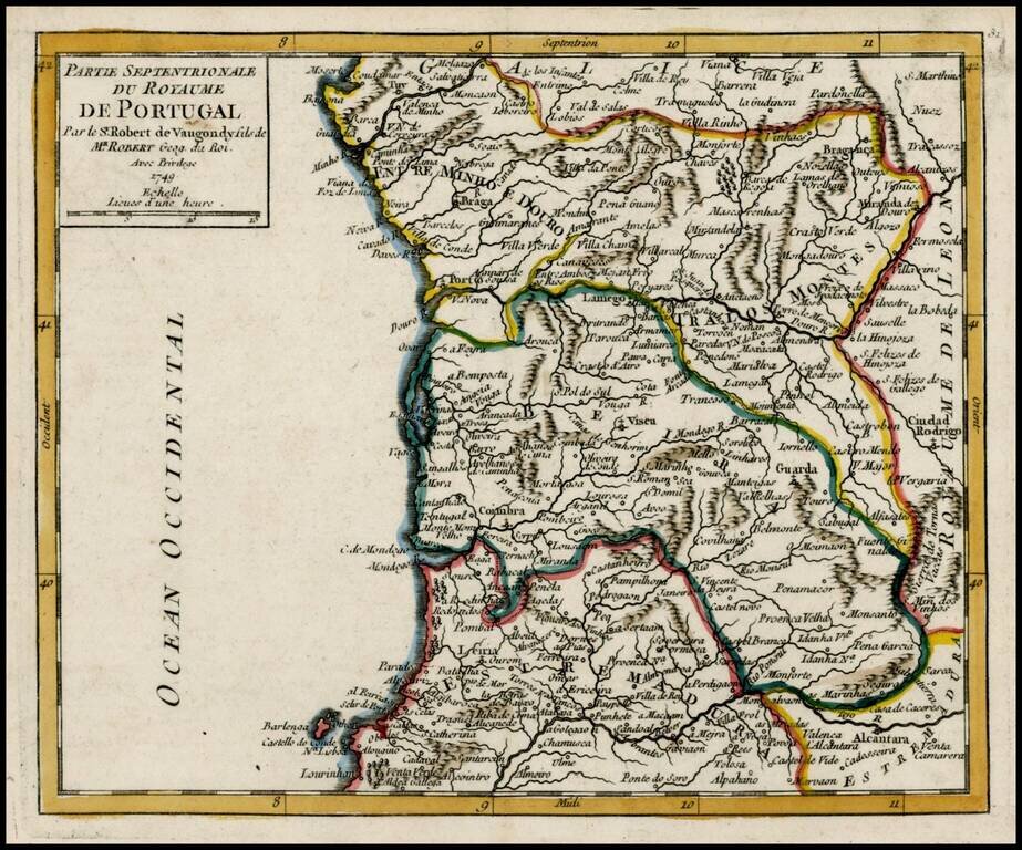
Detailed map of the Northern part of Portugal, from De Vaugondy's Atlas Portatif.
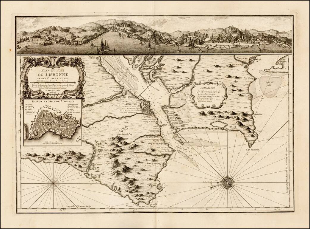
Scarce map and plan of Lisbon, published by Jacques Nicolas Bellin in Paris. The map was published shortly after a major earthquake destroyed much of Lisbon on November 1, 1755. Includes a fine view of Belem and Lisbon at the top and and inset plan...
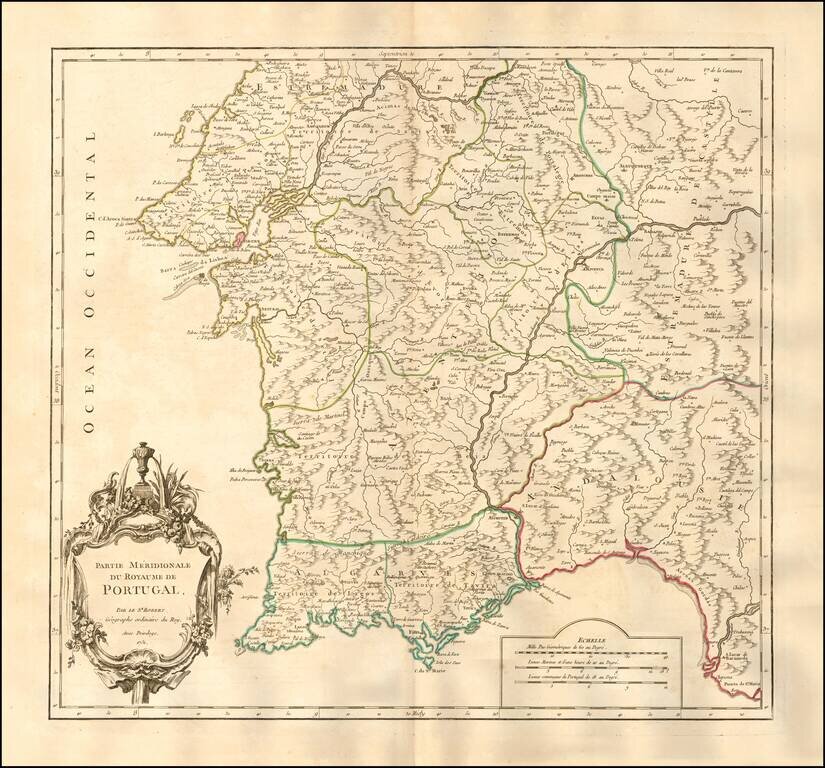
Nice example of the first edition of De Vaugondy's map of the southern part of Portugal. Lisbon and the Barra da Lisboa are prominently featured. Several hundred towns are shown. Decorative cartouche. An excellent large format map from the middle of...
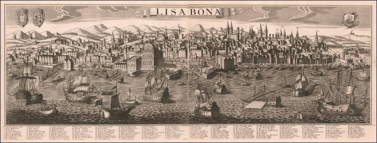
George Balthasar Probst's large engraved view of Lisbon, on two sheets joined. The view demonstrates Probst's characteristic attractive engraving, with its busy harbor scene in the foreground giving way to a complex urban matrix further back. The map...
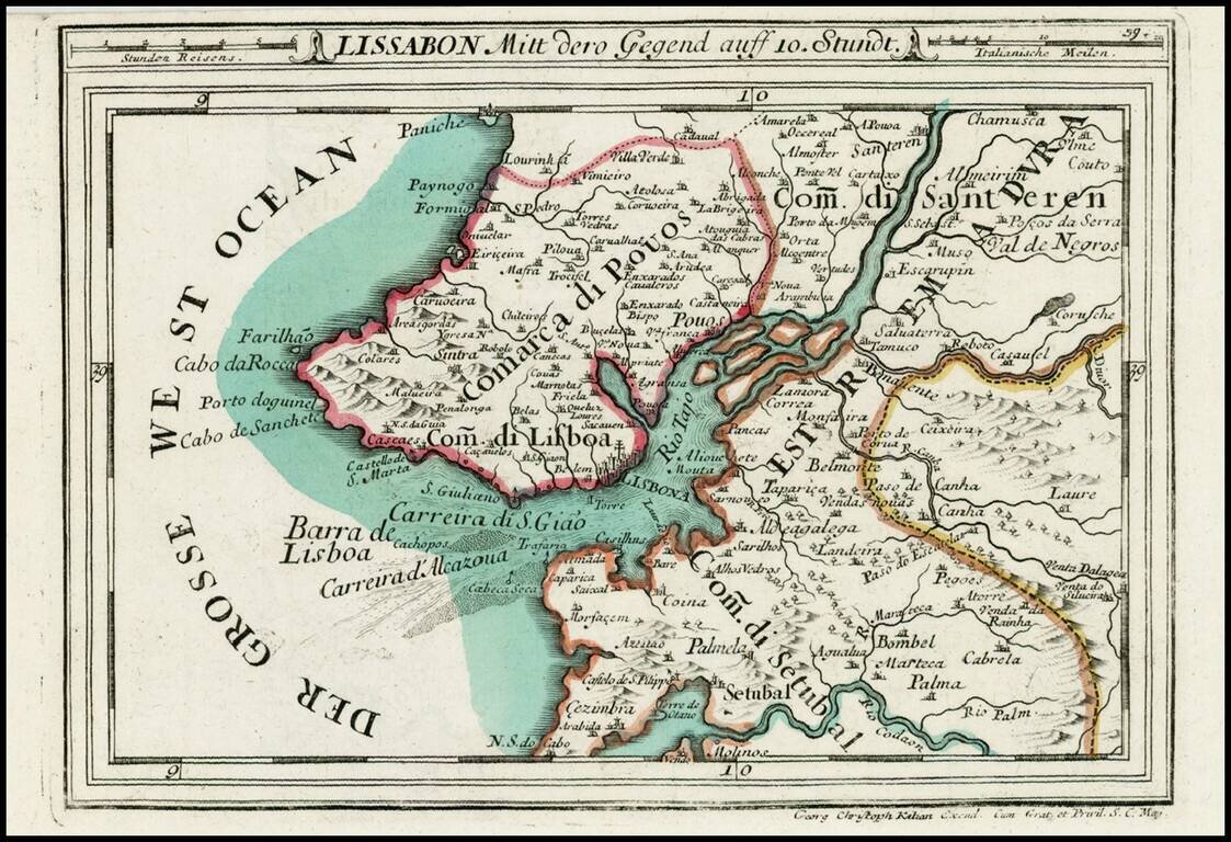
Detailed map of the Lisboa and the lower part of the Tago River, from Heiden's Americanische urquelle derer innerlichen kriege des bedrängten Teutschlands. . .
Scarce double page map of Portugal in original color, from Rizzi-Zannoni, the Royal Geographer of France. One of the most highly detailed large format maps of Portugal published in a commercial atlas during the period. Includes exceptional detail,...
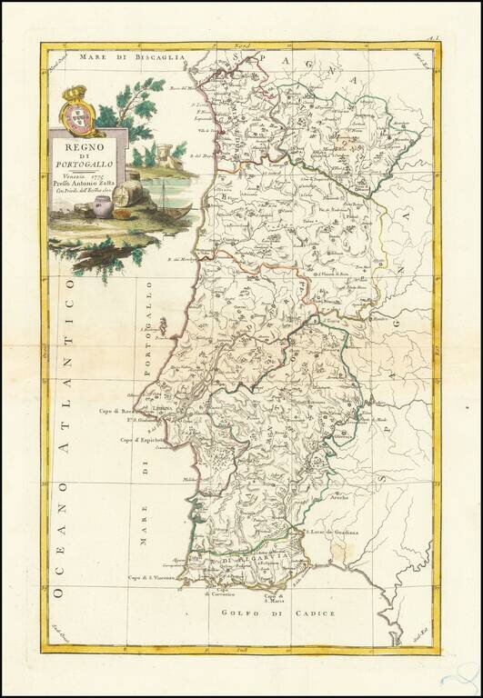
Detailed map of the Kingdom of Portugal, published in Venice. Includes a decorative title cartouche, with coat of arms. From Zatta's monumental Altante Novissimo, one of the last great decorative atlases of the 18th Century.
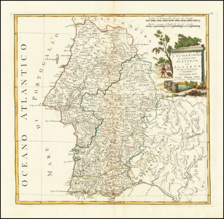
Detailed map of the Southern parts of the Kingdom of Portugal, published in Venice. Includes a decorative title cartouche, with coat of arms. From Zatta's monumental Altante Novissimo, one of the last great decorative atlases of the 18th Century.
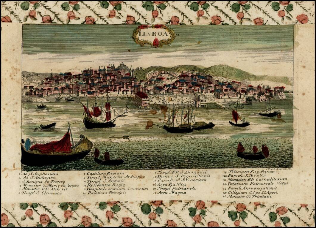
Rare view of Lisbon, Portugal, engraved by Francesco Ambrosi. The author is Giovanni Remondini (1713-1773), a Venetian cartographer and publisher. The Remondini dynasty operated in Bassano del Grappa (Vicenza province, Veneto), Italia in XVII - XIX...
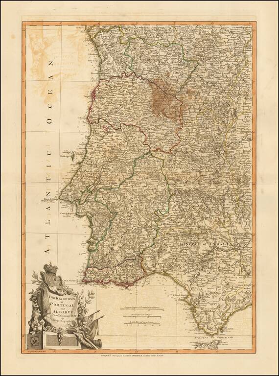
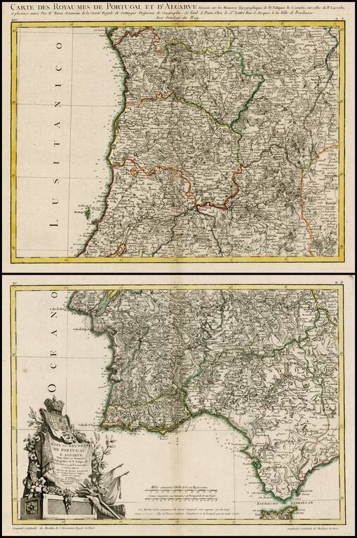
Beautiful double-page engraved map of Portugal, encompassing the Straits of Gibraltar, by John Lodge. The map features an elaborate cartouche in the lower left corner with the coats of arms of Portugal and Algarve. Algarve was a nominal kingdom in the...
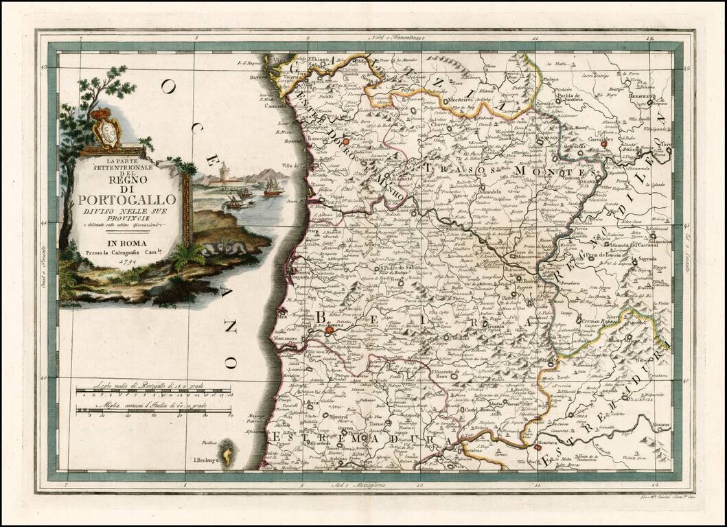
Rare and highly decorative regional map of the north part of Portugal, colored by regions. Includes an ornate cartouche.
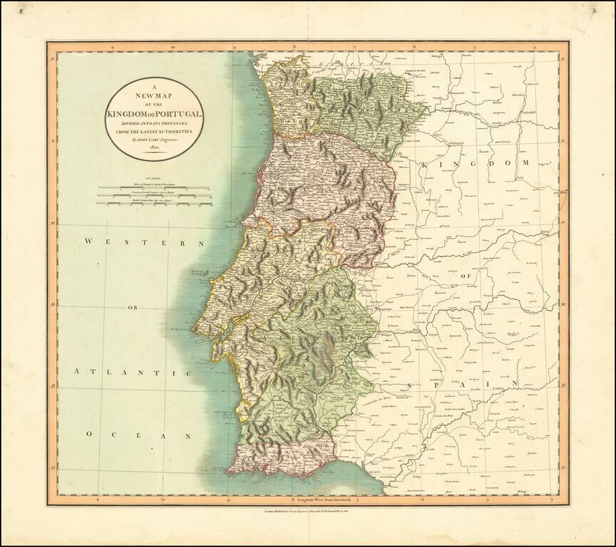
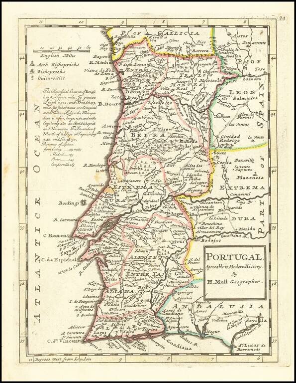
Detailed map of Portugal, hand colored by provinces. Shows roads, rivers, lakes, mountains, islands, etc. One of the best large format English atlas maps of the period.