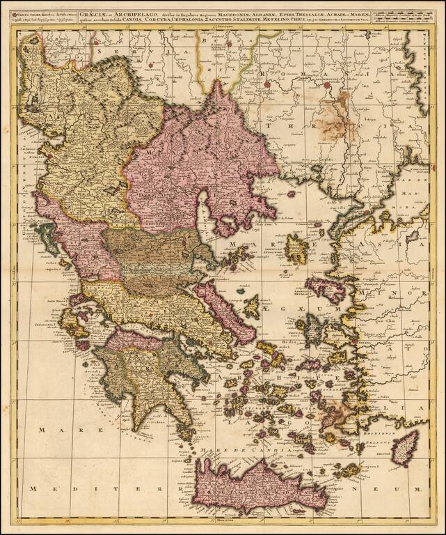
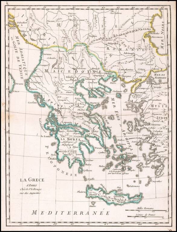
Detailed map of Greece and neighboring islands, engraved in Amsterdam by Valk.
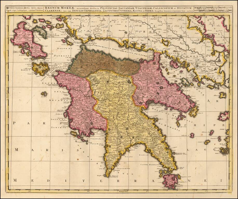
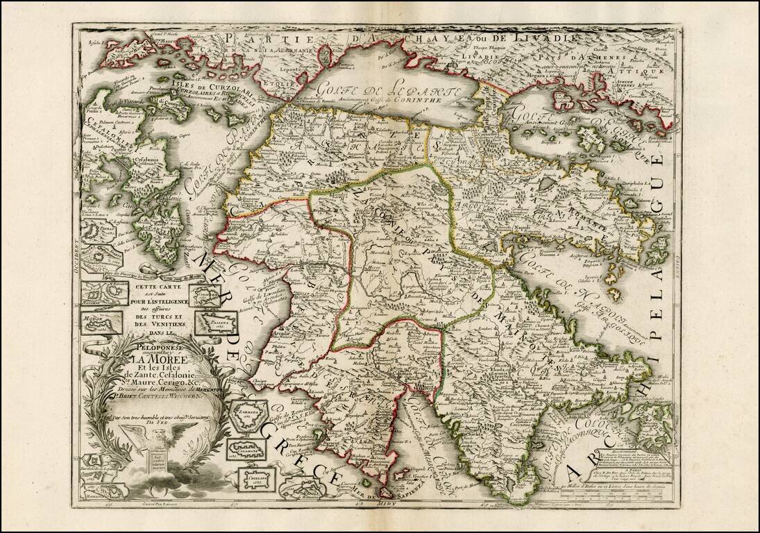
Detailed map of Morea and neighboring islands, engraved in Amsterdam by Valk.
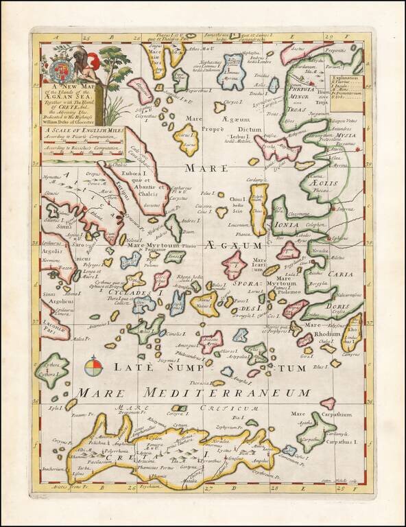
Decorative map of the Aegean Islands. This decorative map was part of a set of 22 maps dedicated to William, Duke of Glouchester, who was then an 11 year old student at Oxford.
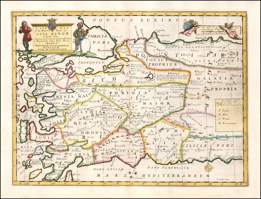
Striking map of Asia Minor and and neighboring Islands. This decorative map was part of a set of 22 maps dedicated to William, Duke of Glouchester, who was then an 11 year old student at Oxford.
Scarce map of Peloponese and part of Greece and the Greek Isles, published by De Fer. Highly detailed map, which includes 12 inset plans of fortified towns and harbors for places within the bounds of the map. The dedication note that the map was...
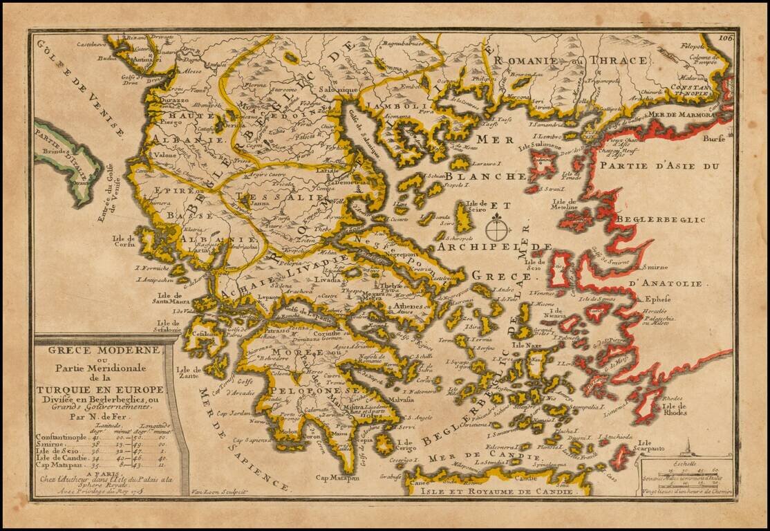
Detailed map of the Southern Part of Greece and contiguous Islands. From De Fer's Atlas Curieux.
![L. Rouwolfs Reys-Togten, door de Levant, of Oosterse Landschappen der Middellandse Zee [shows Cyprus]](/map/small/55336.jpg)
Interesting map of the Mediterranean region, showing Leendert Rouwolf's route from France to Tripoli. Includes decorative cartouche.
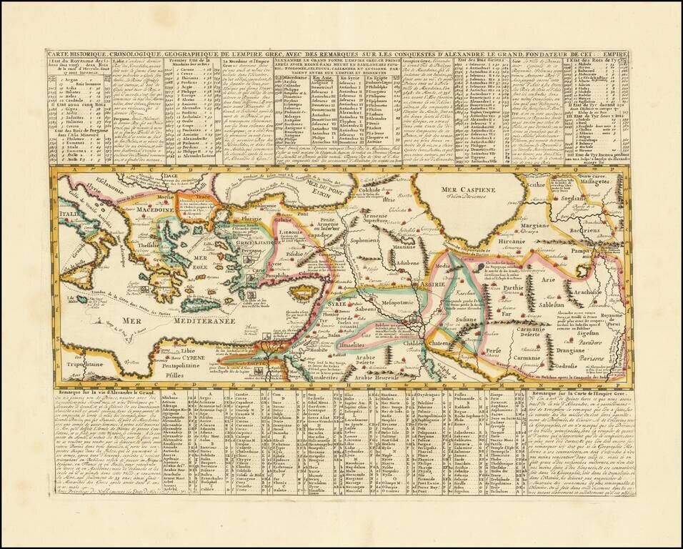
Mapping the Conquests of Alexander the Great. Interesting historical map of the Mediterranean, Black and Caspian Sea regions under Greek Rule. The map has excellent toponymic detail throughout, including extensive notes, trade routes, etc. The...

Decorative map of Greece and part of Turkey, including a decorative view of Constantinople, from John Senex's General Atlas. Includes decorative cartouches, compass rose and other embellishments.
![The Severn or Channel of Bristol [with a chart of the Irish Sea.]](/map/small/47485.jpg)
Fine Charts of British and Irish Waterways Scarce pair of sea charts printed on a single sheet, comprising a chart of the Severn estuary and another of the eastern Irish Sea. The former includes Bristol, while the latter features the Isle of Man. The...
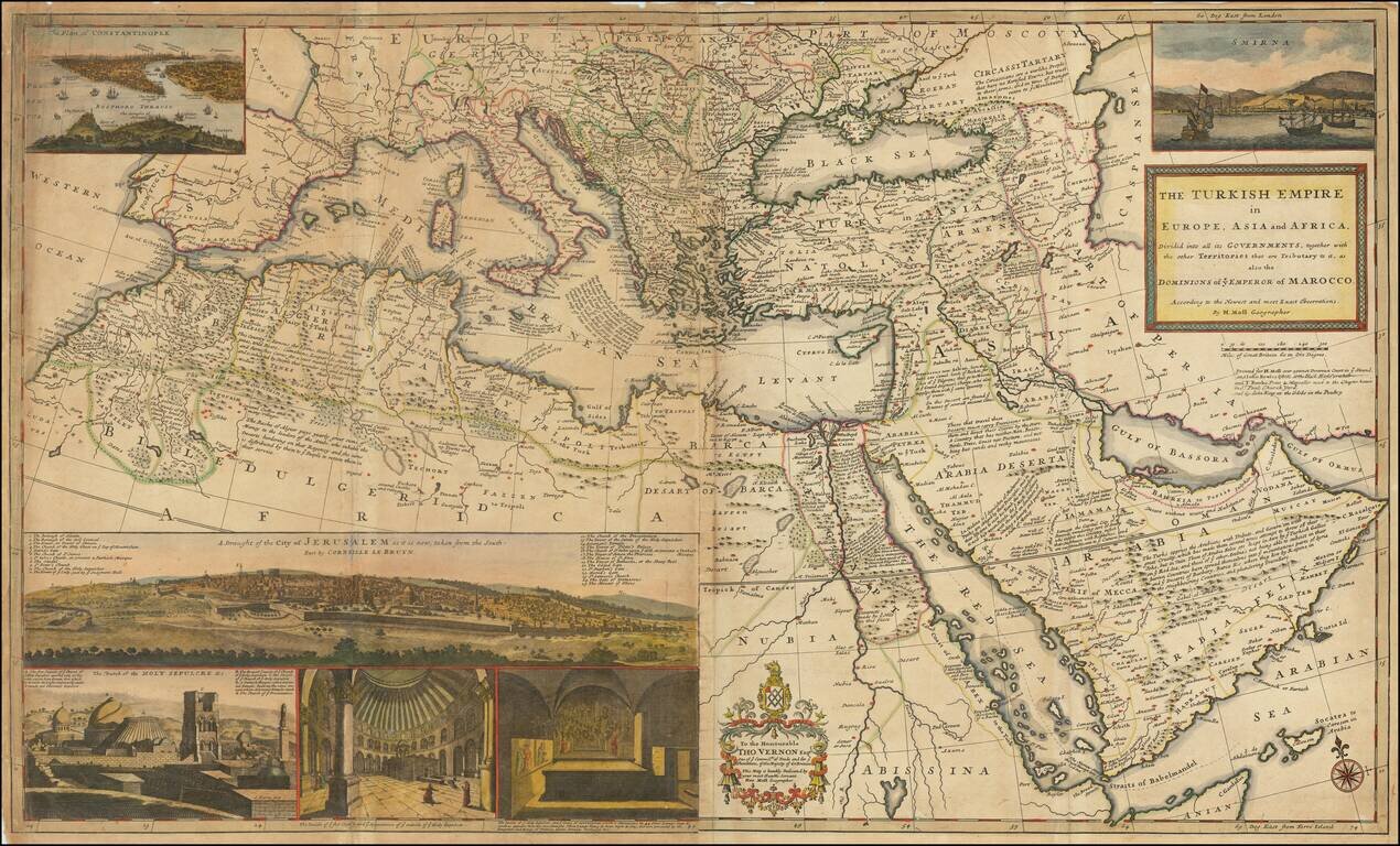
Dynamic Map of the Ottoman Empire with Rich Imagery of Jerusalem Striking large-format map of the Ottoman Empire by Herman Moll, one of England's leading map makers at the beginning of the eighteenth century. The map shows the sprawling Ottoman...
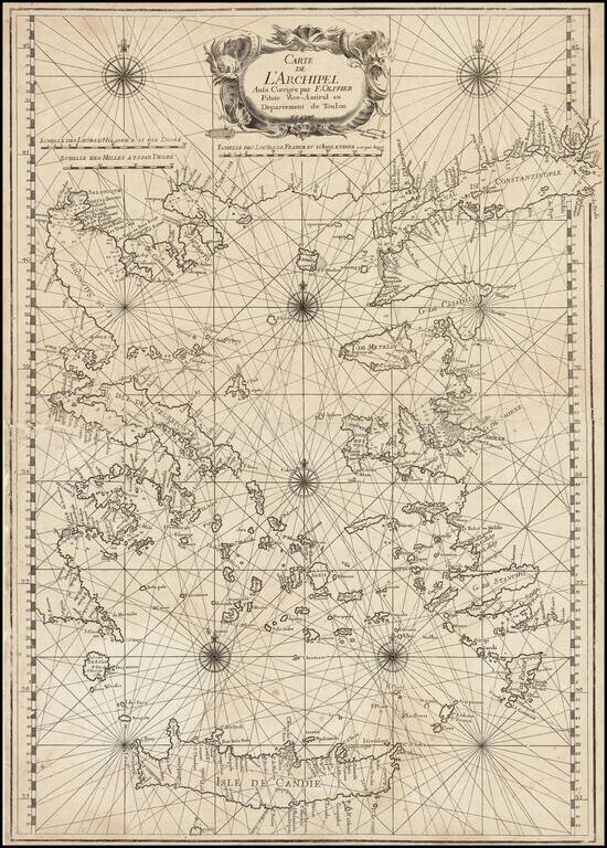
Fine example of this rare map of the Greek Islands, published by Francois Olivier in Toulon in 1746. The title is set within a fine title cartouche depicting sea monsters. Below are Dutch, English and French scale bars. The chart itself is finely...
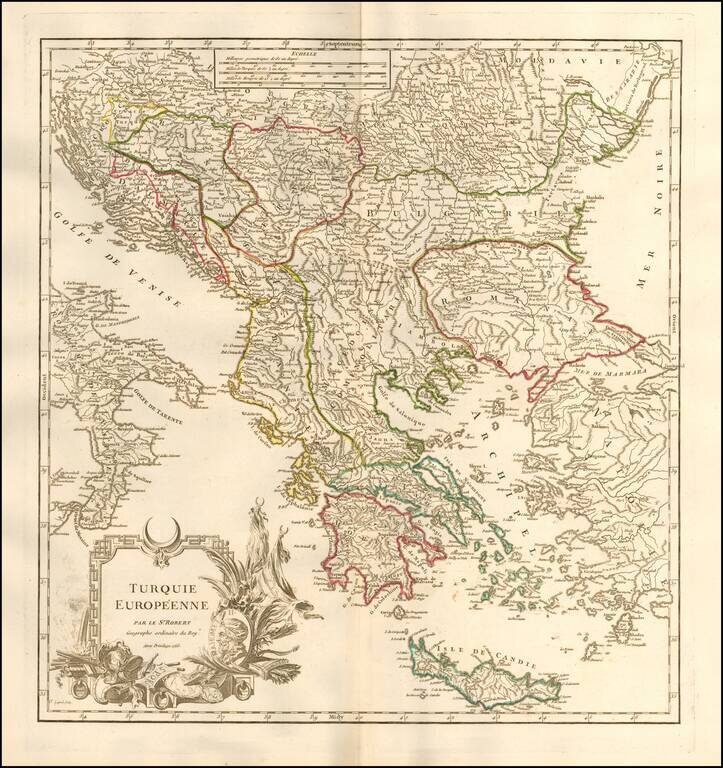
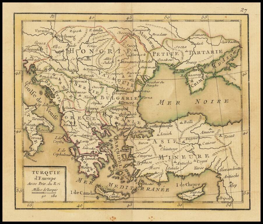
Detailed map of Greece, Romania and the neighboring regions, during the period when the region was still a port of the Ottoman Empire. Includes an elaborate title cartouche. From an early edition of De Vaugondy's Atlas Universel, one of the most...
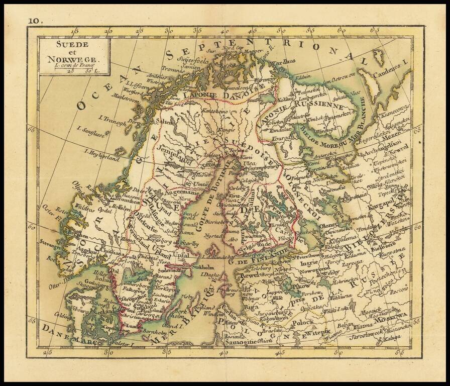
Small engraved map of Scandinavia and northwestern Russia. The map is scarce, this being the first time we have had it.