
![Constantinoplen en Egypten door Nicolaus Schmidt in enn zes Jarige Reystogt uyt Duytsland [shows Cyprus]](/map/small/57615.jpg)
Decorative map of the region bounded by Italy, Corsica, Sardinia and Sicily in the west and extending to Cyprus, Asia Minor and the Holy Land in the east. Centered on Greece and the Balkans. The map was engraved to illustrate a Dutch translation of...
![Pas-Caart van de Weder zytsche Zee-kusten soo van Italia als Dalmatia en Griecken inde Golff van Venetien , , , 1716 [Large inset of Corfu]](/map/small/20108.jpg)
Striking full color example of Van Keulen's chart of the Gulf of Venice, from his De Nieuwe Groote Lichtende Zee-Fackel, part III. Includes an ornate cartouche and other embellishments, with large insets of Corfu, the mouth of the Po River and Paxoi...

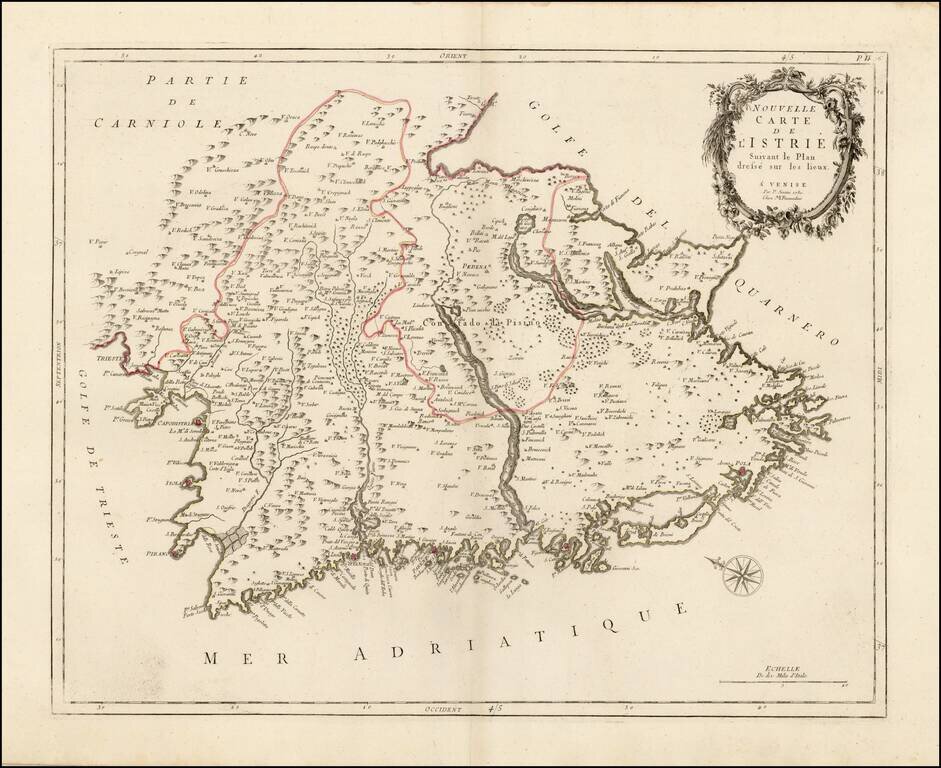
Detailed map of Istria, from Remondini. Detailed map of the region, with decorative cartouche.
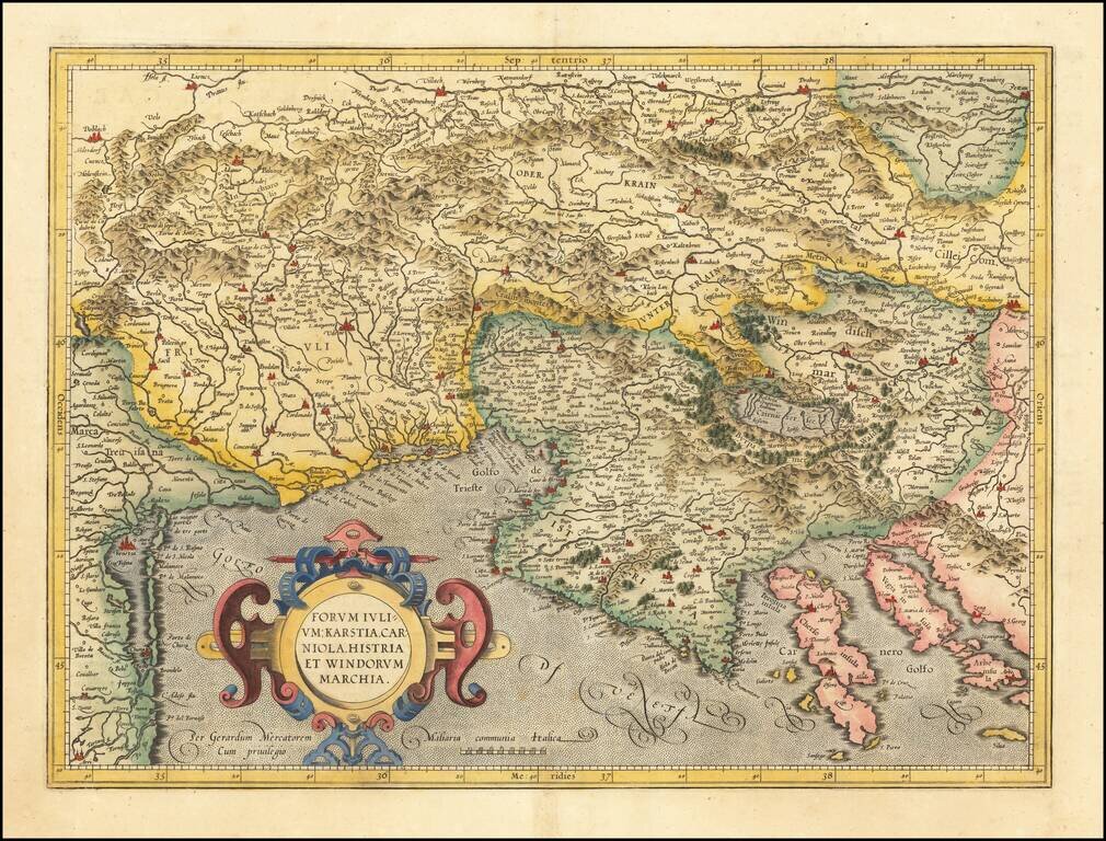
Detailed regional map of the Gulf of Venice and Gulf of Trieste regions, including Friuli and Istria. Includes Slovenia, northwestern Croatia and parts of Italy and Austria.
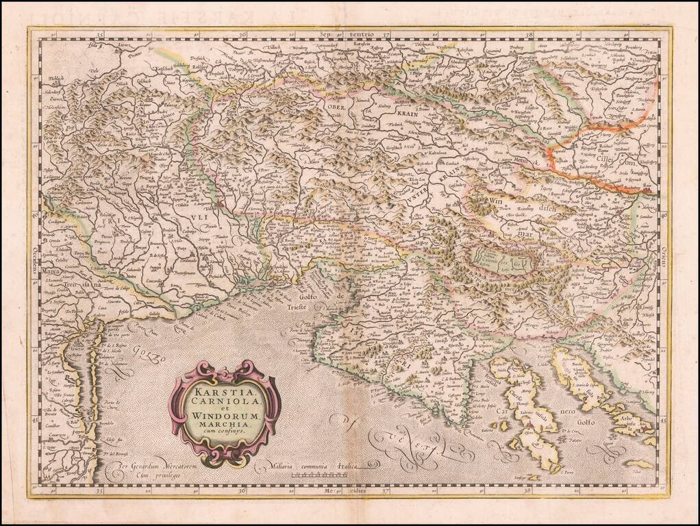
Detailed regional map of the Gulf of Venice and Gulf of Trieste regions, including Friuli and Istria. Includes Slovenia, northwestern Croatia and parts of Italy and Austria.
![Le Cours Du Po . . . [Eastern Sheet--Gulf of Venice, Padua, Vincenz, Feltre, Friouli, Carniola, Istria]](/map/small/58163.jpg)
Striking map of the Course of the Lower Po River, showing the Theater of War in Italy. Nolin's map was first issued in 1702 and corrected in 1703. The map was probably made to illustrate all the territories of the War of Spanish Succession in northern...
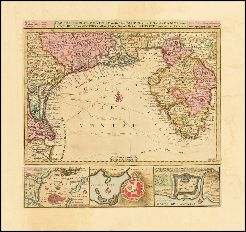
Fine Old Color Example Finely executed chart of Istria and the Gulf of Venice, based upon an earlier map by Cantelli. The map includes plans of the “Laguna” of Venice, the bay and town of Pula and the town of Rijeka below the chart representing...
Scarce regional map of Istria, published in Venice by Francois Santini. Unlike many of the maps in Santini's atlas, this regional map of Italy is not drawn from De Vaugondy and is based upon Italian sources. One of the most detailed maps of the...
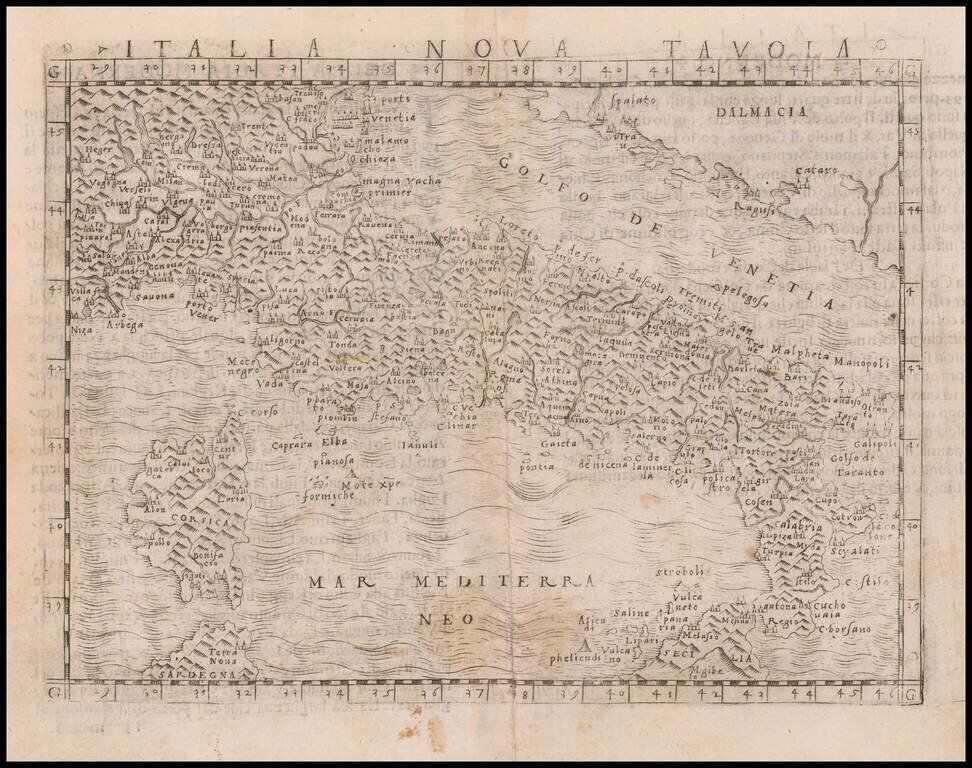
Nice example of Gastaldi's modern map of Italy, one of the earliest obtainable modern maps of Italy. Giacomo Gastaldi is considered as the foremost Italian cartographer of the 16th century along with Paolo Forlani. From Piedmont, Gastaldi established...
![[Italy]](/map/small/54236.jpg)
Finely engraved image of Northern and Central Italy, with south at top. The Apennine Mountains can be seen running down the center of the map. The image appeared in the 1568 Venice edition of Ludovico Ariosto's Orlandi Furioso, which first published...
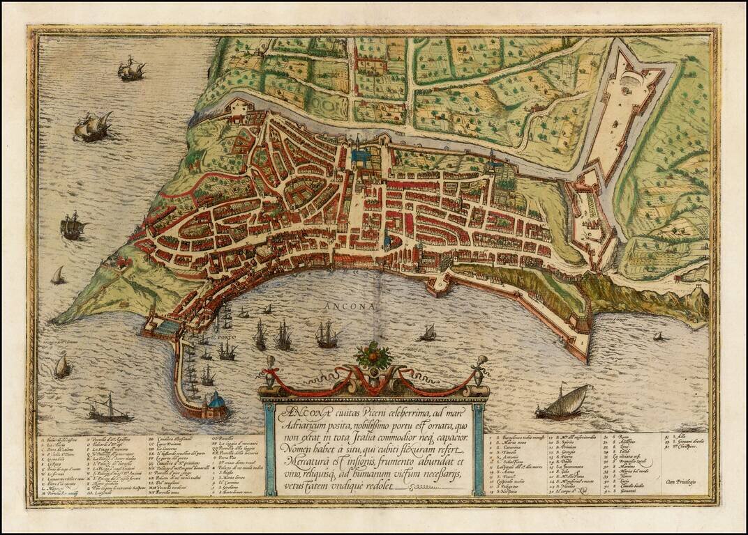
A fine early view of Ancona in the Marche region of Italy, published by Braun & Hogenberg in their monumental 6 volume Civitatus Orbis Terrarum.
![Genua Ligurum domina . . . [and] Florentia urbs est Insignis Hetruariae, olim Fluentia dicta . . . (Genoa & Florence)](/map/small/67437.jpg)
Beautiful Original Hand-Color view of Florence and Genoa A fine example of this pair of birdseye views of "Genua" and "Firenze." The details on these views is extensive, and the work is attractively produced. Additional text describes both cities and...
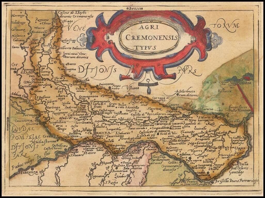
Rare modern map of the Cremona region, published in Cologne by Johannes Metellus in 1579 in fine original color. The map is one of the earliest obtainable modern maps published by the so-called Cologne School of mapmakers, which consisted primarily of...
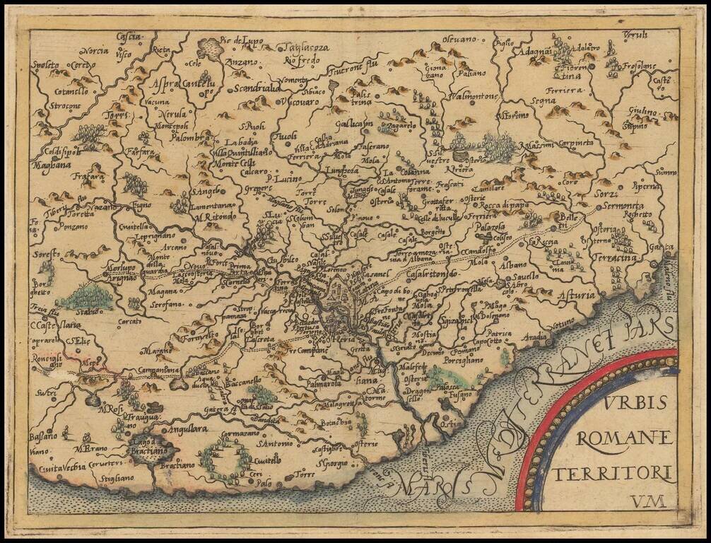
Rare modern map of the Territory of Rome, published in Cologne by Johannes Metellus in 1579 in fine original color. The map is one of the earliest obtainable modern maps published by the so-called Cologne School of mapmakers, which consisted primarily...
![Insularum Aliquot Maris Mediterranei Descriptio [Sicily, Malta, Sardinia, Corfu, Elba and Zerbia]](/map/small/45115.jpg)
Fine example of Ortelius' maps of the islands of Sicily, Malta, Sardinia, Corfu, Elba and Zerbia, from the Ortelius' Theatrum Orbis Terrarum, the first modern Atlas of the World. Includes a number of sailing ships, including a sinking vessel off...
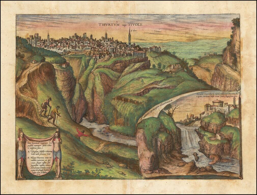
The city of Tivoli, shown from Mount Tiburtini, with an inset of the famous cascading waterfalls. In the foreground, illustrations of 3 climbers include Hoefnagel and Abraham Ortelius, who visited the town and studied it in 1578, as noted in the...