
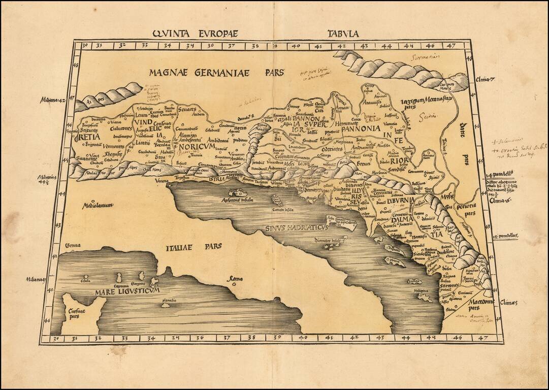
Nice example of Martin Waldseemuller's map of the region between the Danube River and the Adriatic Sea from the 1513 edition of Waldseemuller's Geographia. The map extends from Italy and the Adriatic Sea in the South to Austria, Croatia, Slovenia,...
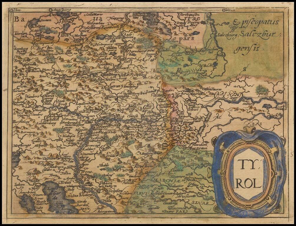
Rare modern map of the Tyrol region, extending from Lago di Garda and Vincenzo in the south to Innsburck, Kitzbuel and Villach in the north, published in Cologne by Johannes Metellus in 1579 in fine original color. The map is one of the earliest...
![Rhetiae alpestris descriptio in qua hodie Tirolis Comitatus [with] Goritiae, Karstii, Chaczeolae, Carniolae, Histriae, et Windorum Marchae Descrip.](/map/small/22133.jpg)
A nice full color example of these two regional maps by Ortelius. The Tirolian map extends from Mantua, Verona and Vincenza to Furstenfeld, Mildorf and Wasserburg and is centered on Innsburck. Salzburg also appears. The second map extends from the...
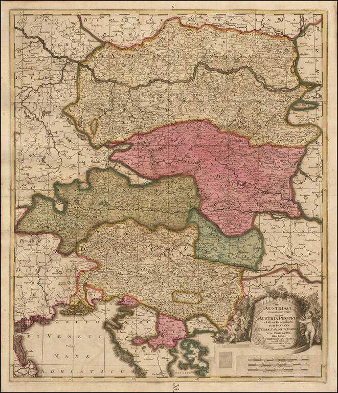
Fine example of Gerard Valk's map of Austria, the Gulf of Venice and part of Croatia and Istria. Highly detailed map of the region bounded by the Gulf of Venice and the Golfo Carnero, Stiria and Cherso Island in the South, and extending to north of the...
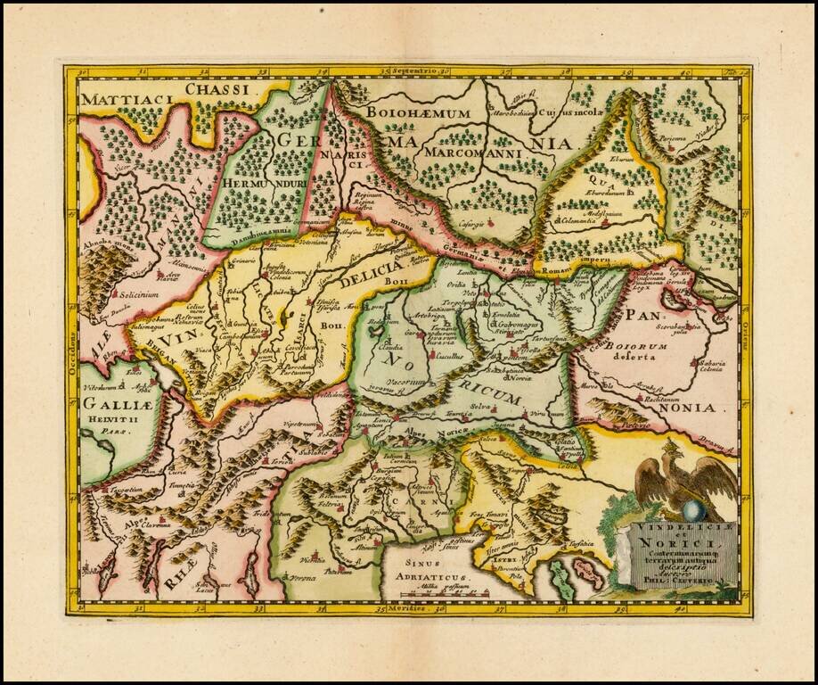
Decorative 18th Century Map of the region north of the Adriatic, from Cluver's Introductionis en Universum Geographicus…., one of the most prolific 17th and 18th Century Geography books.
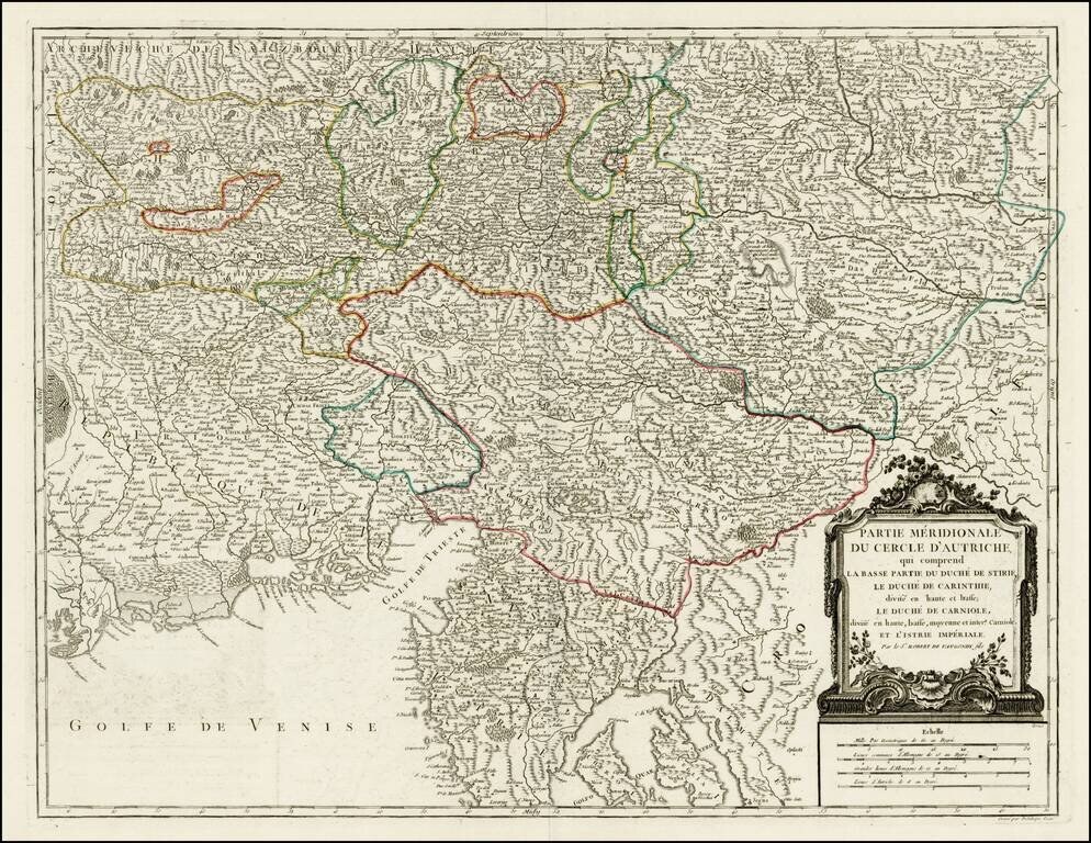
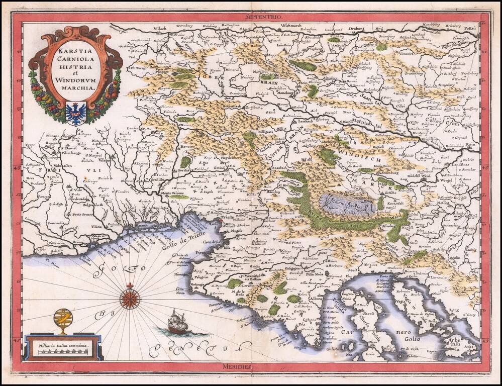
Detailed regional map of the region north of the Gulf of Venice, Istria, etc.. Shows the Southern portion of the Austrian Empire, from the Republic of Venice and the Gulf of Venice in the west to the Croatian Border. Shows Salzburg, Graz, Rijeka,...
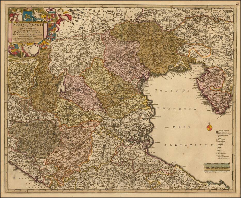
Detailed regional map of the area north of the Gulf of Venice, hand colored by provinces. Shows roads, rivers, lakes, mountains, islands, towns, etc. One of the best large format English atlas maps of the period. Gorgeous wide margined example.
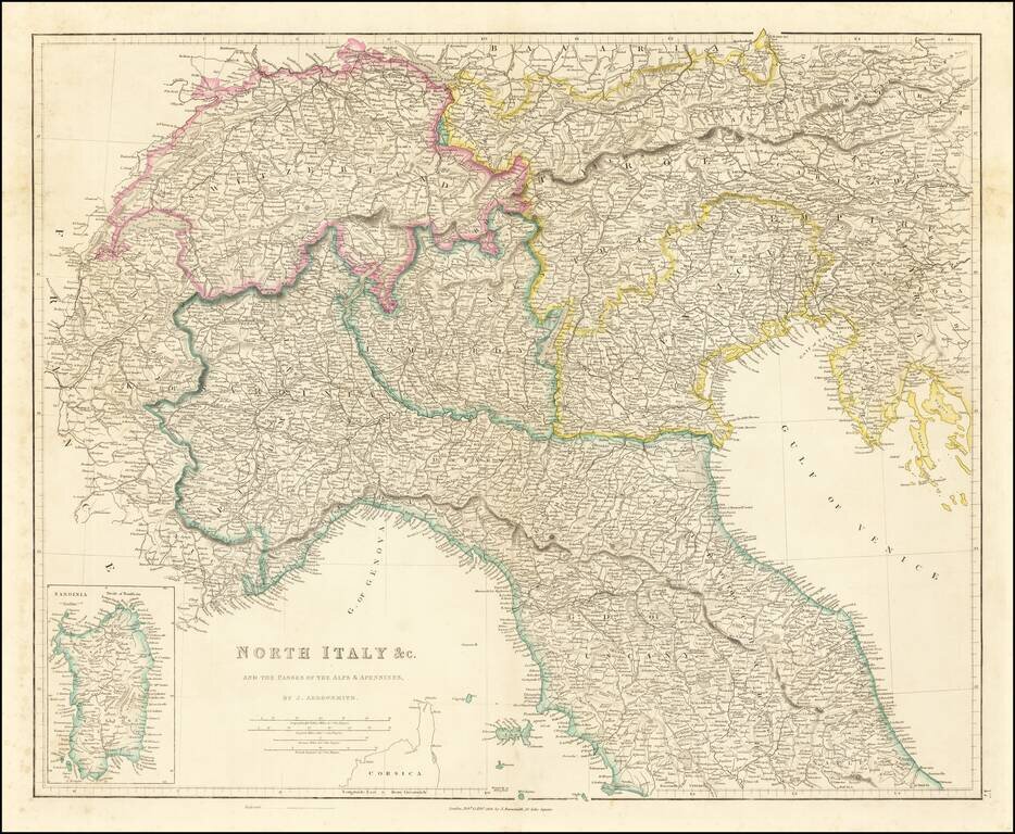
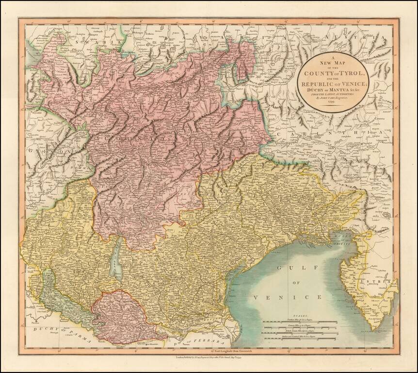
Detailed map of Northern Italy (including Switzerland and Austria, etc.), published in London by John Arrowsmith. The map appeared in Arrowsmith's London Atlas.
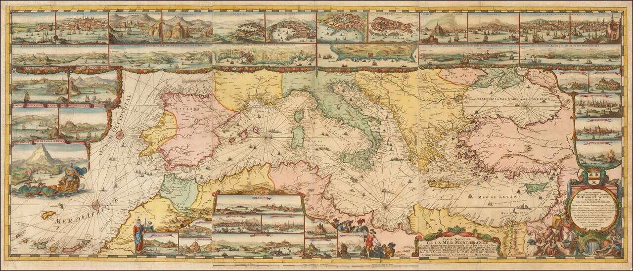
The Most Lavishly Illustrated Map of the Mediterranean of the 17th Century Covens & Mortier edition of Romeyn De Hooghe map of the Mediterranean, embellished with 38 inset maps and views of the major ports and harbors of the Mediterranean. Fine...
![[Balkans / Adriatic / Italy] Tabula Europae V](/map/small/59530.jpg)
Nice example of Gastaldi's map of Italy and the Balkans, based on Ptolemy. Giacomo Gastaldi's Atlas of 1548 has been called the most comprehensive atlas produced between Martin Waldseemüller's Geographiae of 1513, and the Abraham Ortelius Theatrum of...
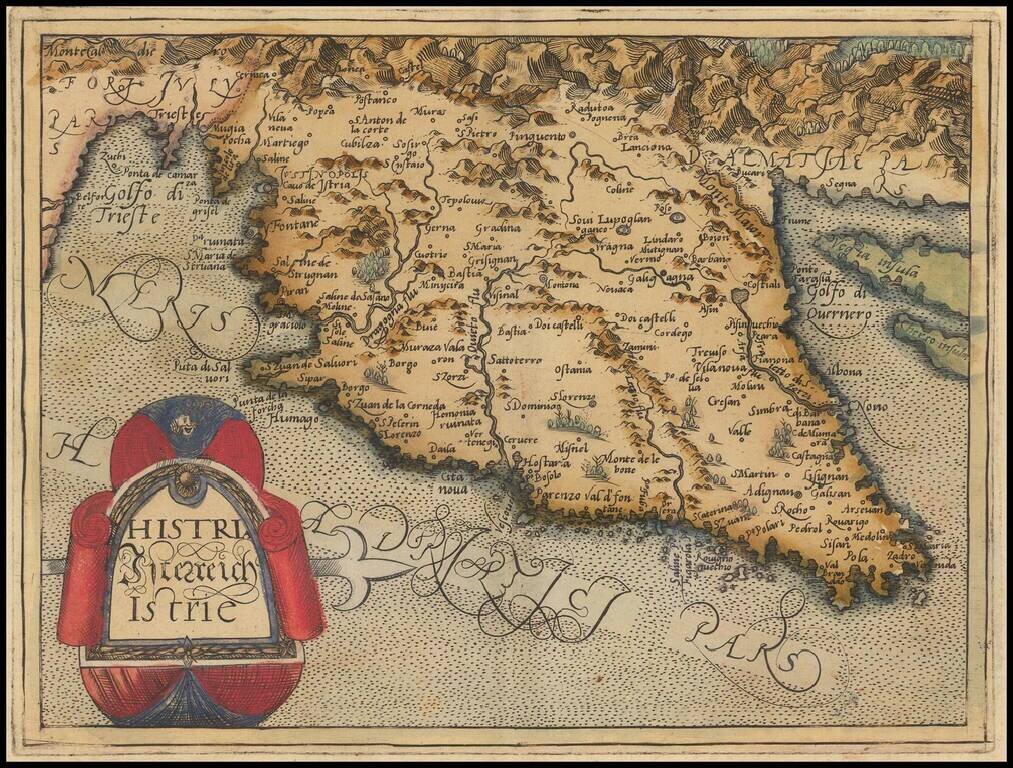
Rare modern map of Istria, published in Cologne by Johannes Metellus in 1579 in fine original color. The map is one of the earliest obtainable modern maps published by the so-called Cologne School of mapmakers, which consisted primarily of Flemish and...

Nice old color example of Jansson's second map of Istria, with east oriented at the top. Jansson's map is based upon Magini's map of 1620, which appeared in his atlas of Italy, the first modern atlas to focus on Italy. Shows the Istria peninsula,...
Detailed regional map of the Gulf of Venice and Gulf of Trieste regions, including Friuli and Istria. Includes Slovenia, northwestern Croatia and parts of Italy and Austria. The map is based upon earlier maps by Gerard Mercator and Guillaume Blaeu.
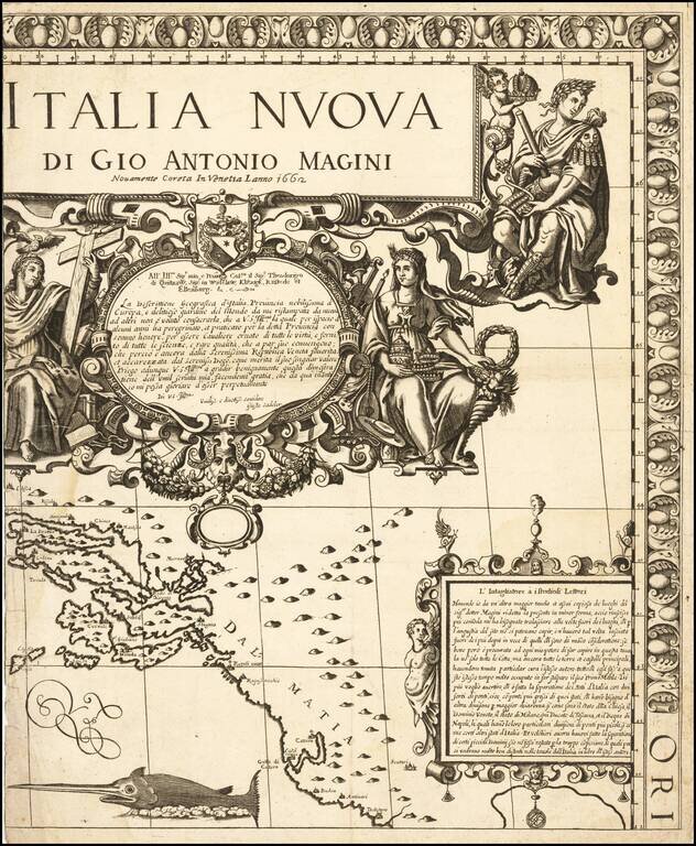
Fine example of the title sheet from Giovanni Antonio Magini's 8 sheet wall map of Italy. The map covers the Dalmatian Coastine centered on Ragusa (Dubrovnik). Extends south to Cattaro (Koro) and Budva and north to Spit. Fine large titled and...
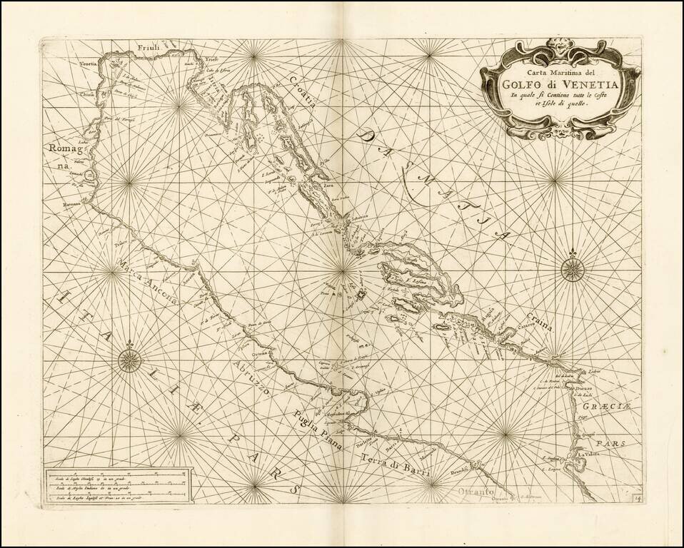
Fine chart of the Gulf of Venice and Northern Part of the Adriatic Sea, which appeared in Volume 1 of Coronelli's Corso Geographico, published in Venice. The sea chart would appear to be the chart originally issued in 1663 by Francesco Maria Levanto...
Nice old color example of this decorative map of the region, including much of Northeastern Italy and the Gulf of Venice. Extends from Istria and Ancona to the Gulf of Spezia and the Tirol and Bergamo. Includes Lago di Garda, Verona, Vicenza and...