
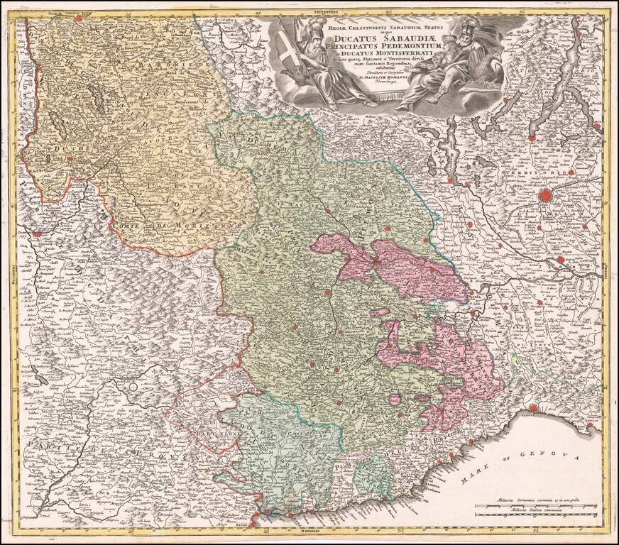
Striking example of Homann's decorative map of the Savoy and Piedmont regions, centered on Torino. The map coverage extends from Grenoble, Geneva, Die and Romans, to Genoa and Milan. Highly detailed, with excellent graphical representation of the...
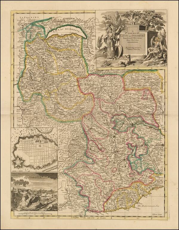
Nice example of John Senex's map of Piedmont & Savoy, from his New General Atlas. The map includes an inset plan of Turin and a view of Verrua. Fine dark impression of this scarce map, with an ornate title cartouche. John Senex John Senex...
Highly detailed map of Northern Italy, Nice region and part of Switzerland, from DeVaugondy's Atlas Universel. Includes towns, mountains, rivers, lakes and a host of other details. Decorative cartouche. De Vaugondy's atlas was one of the most...
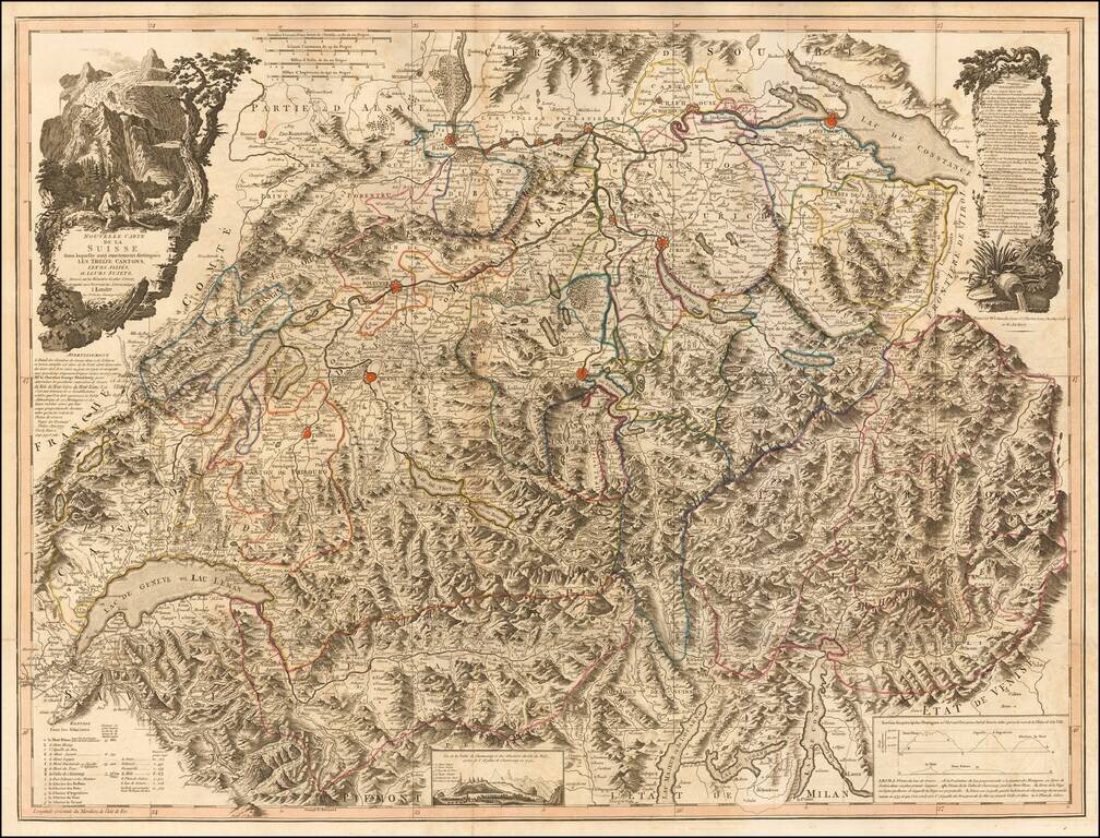
Scarce large format map of Switzerland and Northern Italy. The map is a remarkable depiction of the topography of the region, reminiscent of the work of Cantelli and Rossi at the end of the 17th Century. The map reflects the art of map printing at...
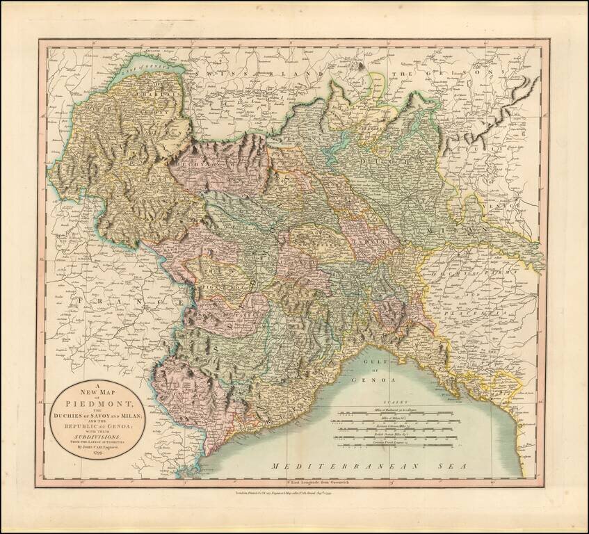
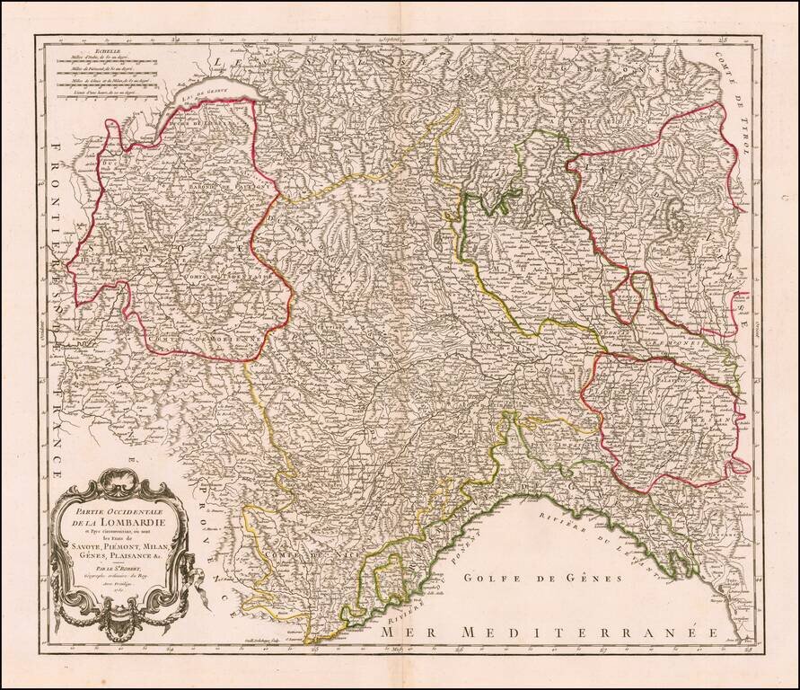
Detailed map regional map of Northwestern Italy, hand colored by provinces. Shows roads, rivers, lakes, mountains, towns, etc. One of the best large format English atlas maps of the period.
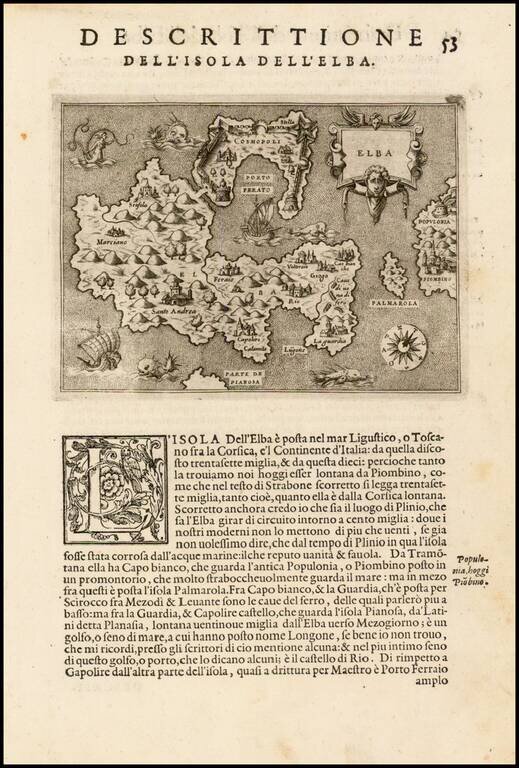
Fine early map of the Island of Elba and contiguous Tuscan Coastline, from Porcacchi's L'Isole Piu Famose Del Mondo… Finely engraved, with compass rose and decorative cartouche.
![Corsica [and] Sardinia](/map/small/41806.jpg)
Old color example of Gerard Mercator's maps of Corsica and Sardinia. Includes decorative cartouches.
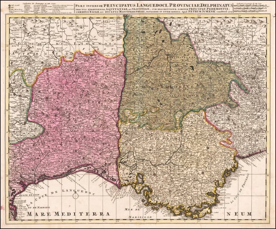
Detailed map of Southeastern France and the contiguous Italian Border (extending to Turin). Fine old color example.
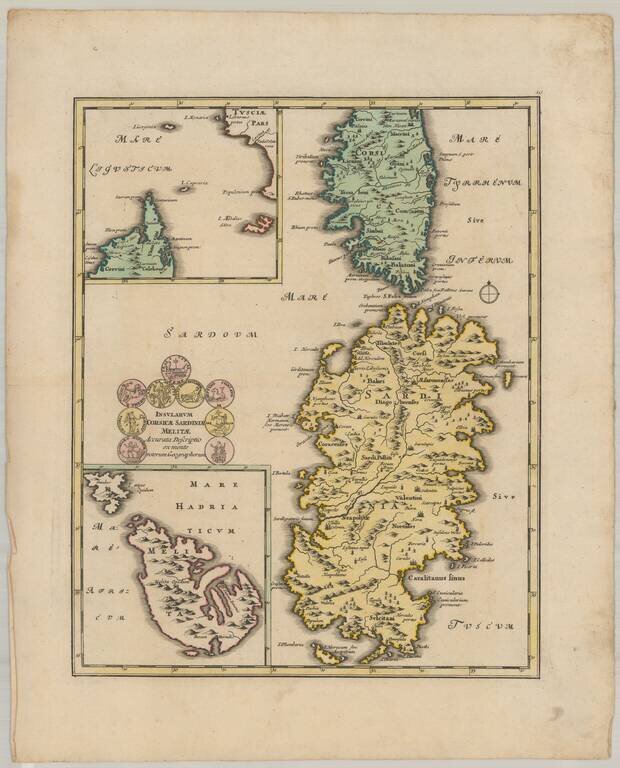
Decorative map of the islands of Corsica, Sardinia, and Malta.
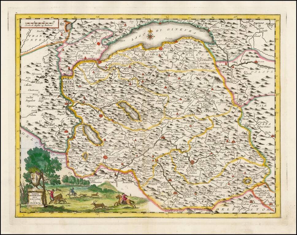
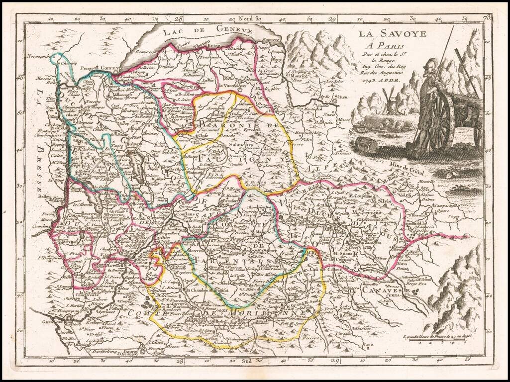
Striking map of the Duchy of Savoye, based upon De L'Ise's map. Includes a decorative cartouche and excellent geographical detail. Includes Lake Geneva. Albrizzi's maps are scarce and beautifully engraved.
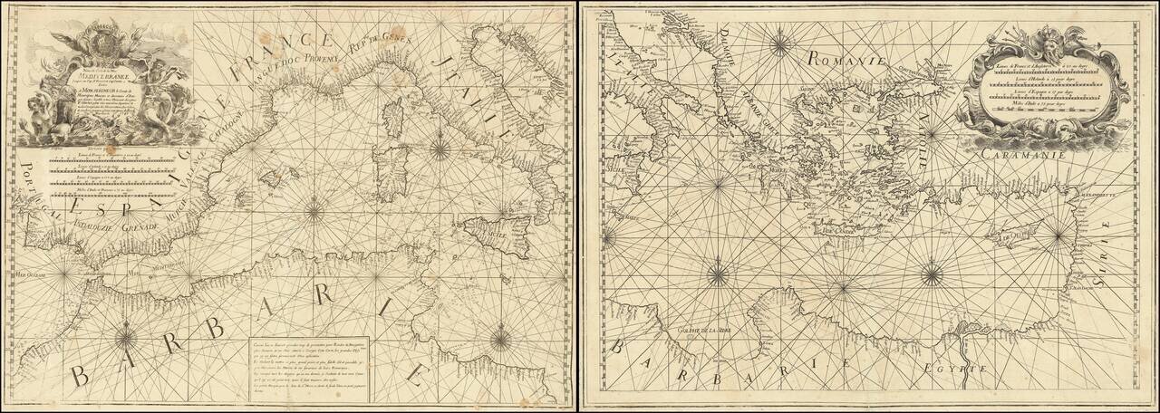
Rare 2 sheet chart of the Mediterranean, published by Francois Olivier in Toulon in 1746. One of the most advanced sea charts of the period, which was produced as a working chart and for which there are very few surviving examples. To the upper right...
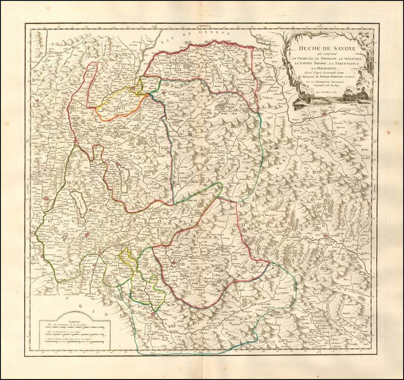
Detailed map of the Duchy of Savoy. Includes cities, villages, rivers, mountain ranges, castles, etc.
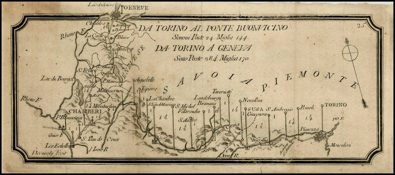
Rare postal roads map, showing the post roads from Torino to Geneva and Torino to Buonvincino. Includes distances, rivers and some topographical features.
![Carte Choroghique des 6 départemens du piémont formant la 29ime. division militaire territoriale. Ou Se trouve repartie la 28ime. Légion de gendarmerie nationale composée de 3[?] cadrons, 6 compagnies 18. Lieutenance[?] et 126 Brigades dont 63 apied, et 6](/map/small/60835.jpg)
Manuscript Administrative Map At The End of the Subalpine Repubic Prepared For General de Moncey A superlative Napoleonic military map of northwestern Italy, showing the former territory of the Subalpine Republic after it was folded into the French...
![Valetta, the Capital of the Island of Malta [with] Balearic Islands [and] Corsica and Sardinia](/map/small/54874.jpg)
Detailed plan of Valetta, with a map of the Balearic Islands and a map of Sardinia and Corsica.