logo

1669. Romani Imperii Qua Occidens est Descriptio Auth.Michaele Antonio Baudrand . . . 1669

  • Romani Imperii Qua Occidens est Descriptio Auth.Michaele Antonio Baudrand . . . 1669

Romani Imperii Qua Occidens est Descriptio Auth.Michaele Antonio Baudrand . . . 1669 information:

Year of creation: 
Resolution size (pixels): 
 13449x10691 px
Disk Size: 
 30.7759MiB
Number of pages: 
 1
Place: 
 Rome

Print information. Print size (Width x height in inches):
Printing at 72 dpi 
  186.79 х 148.49
Printing at 150 dpi 
 89.66 х 71.27
Printing at 300 dpi 
 44.83 х 35.64

An example of detailing the file of this map of in a printable high-resolution:

Click to open in high resolution (open in new tab).
Attention! this is just the central piece (central area 960x960 px) of the map file!
This is an example, so that you can see and study the level of detail of a given map. The entire Map will be fully available after payment!

Romani Imperii Qua Occidens est Descriptio Auth.Michaele Antonio Baudrand . . . 1669

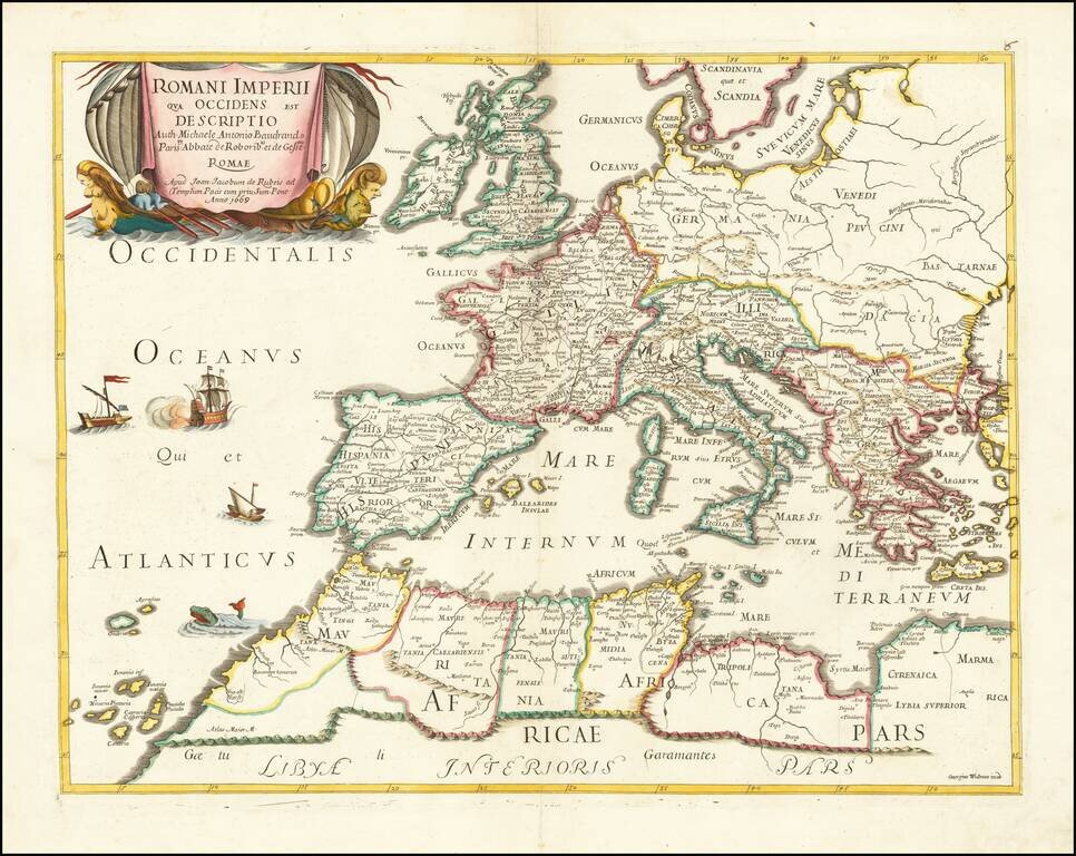
Rare map of the Roman Empire and contiguous regions.

This map was originally designed by Michel Antoine Baudrand (1633-1700), a French Historian and Geographer, who served as secretary to Cardinal Francesco Barberini (then Dean of the College of Cardinals) in Rome, during which time this map was originally conceived by Baudrand.

De Rubeis was Giacomo Rossi's Latinized name, under which some of his maps appear in the early part of his career.


Special conditions for students!

If you are a student, write to us in telegram: @antiquemaps and indicate what material you need and for what work you need a map in high detail. We are ready to provide material on special terms. For students only!

Item information:

Year of creation:
Size:
13449x10691 px
Disk:
30.7759MiB
Number of pages:
1
Place:
Rome
Author:
Joan Jacobum de Rubeis. Michel-Antoine Baudrand.
$14.99

Related item