
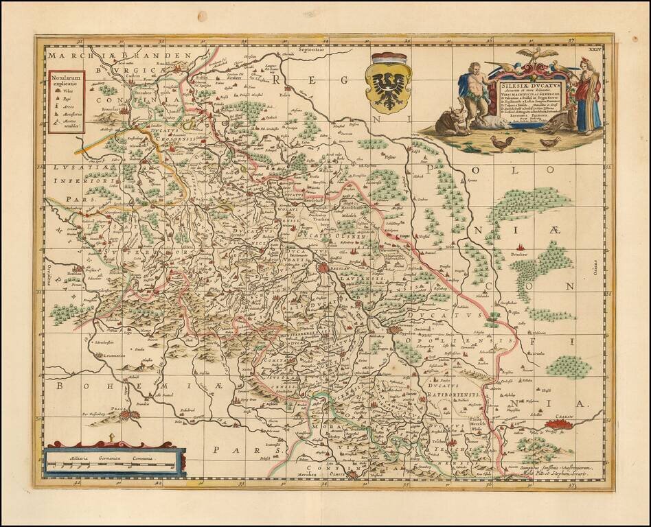
Scarce Moses Pitt map map of Silesia, centered on Breslau. Shows Cracow in the southeast, Prague in the southwest, and Posen in the North. Follows the course of the Oder from Ratisbone to beyond Frankfurt am Oder. Two cartouches and coat of arms....
Fine old color example of Frederick De Wit's map of Bohemia, Silesia, Moravia and Lusatia. Includes several coats of arms and a decorative cartouche.
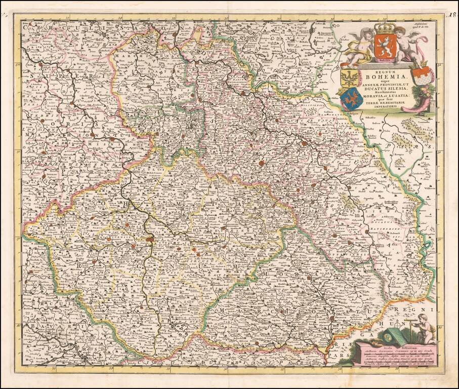
Rare Johannes De Ram map of Bohemia, Silesia, Moravia and Lusatia. Highly detailed map from one of the rarest Dutch map makers of the late 17th Century.
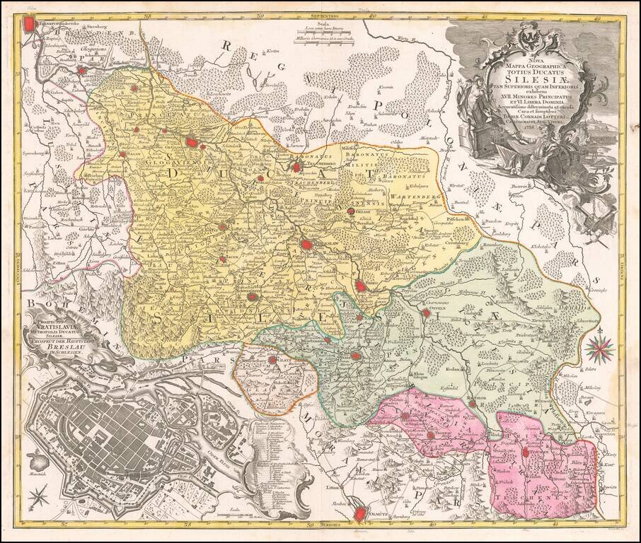
Detailed map of the region of Silesia, centered on Breslau (Wroclaw). Includes a large view of the town of Breslau (Wroclaw) in the lower left corner.
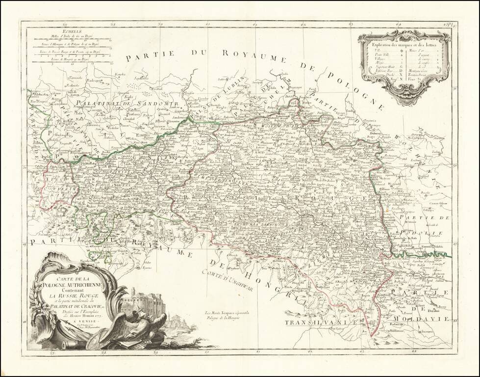
Fine and highly detailed map of Southern Poland and parts of Slovakia, Ukraine, Hungary, Romania and Moldova, which was then being called Austrian Poland and Red Russia. Santini gives credit to Homann Heirs in the cartouche.
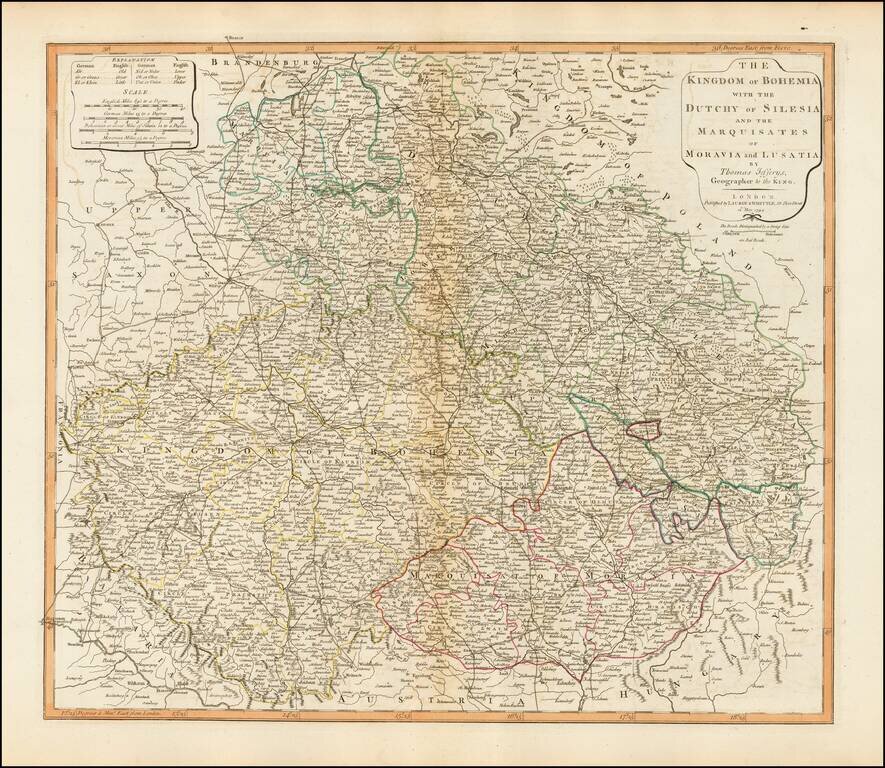
Detailed map of Bohemia, Moravia, Silesia and Lusatia, published in London by Laurie & Whittle. The map incorporates the modern day Czech Republic, Slovakia and the southern part of Poland.
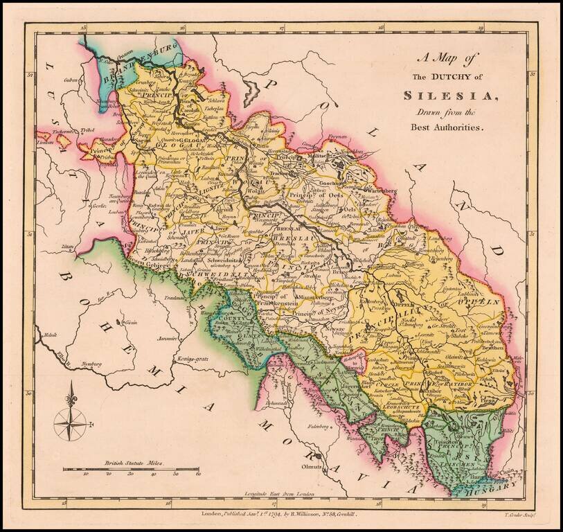
Scarce 18th Century English language map of Silesia, showing the region on either side of the Oder River. Includes Principalities of Glogau, Wolau, Lignitz, Oels, Breslau, Javer, Schweidnitz, Brieg, Oppeln, Neysze Trahenberg Sagan, Carolath,...
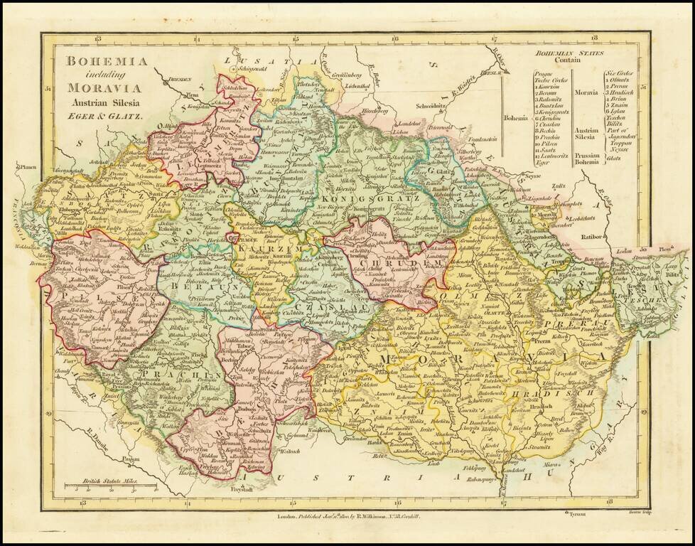
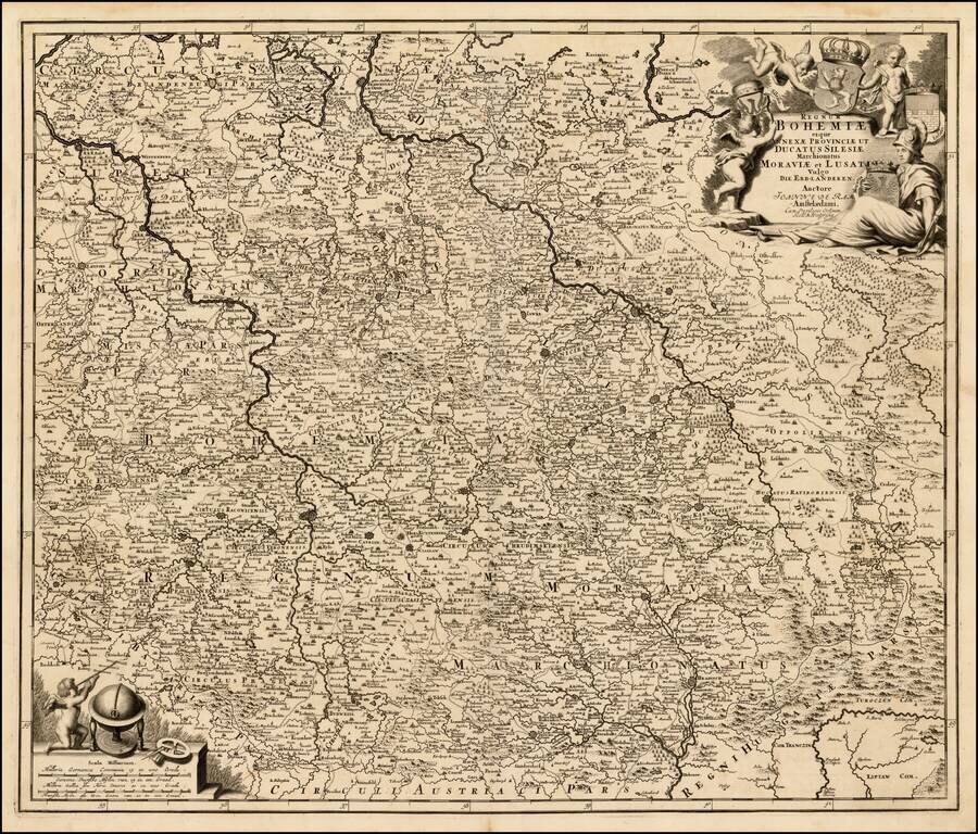
A fabulous regional map of Bohemia, Moravia, Silesia, Eger and Glatz, showing many long lost provincial borders, including Pilsen, Saatz, Leutmeritz, Buntzlau, Konigsgratz, Glatz, Olmutz, Chrudim, Cazslau, Kaurzim, Beraun, Rakonitz, Prachin, Bechin,...
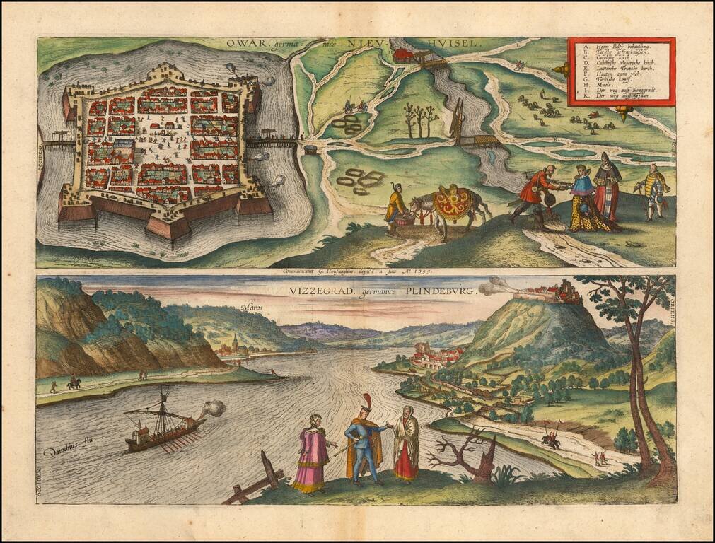
Fine pair of views of the cities of Nové Zámky, Slovakia and Visegrád, Hungary, from Braun & Hogenberg's Civitas Orbis Terrarum. These are among the earliest printed views of each of the two cities.
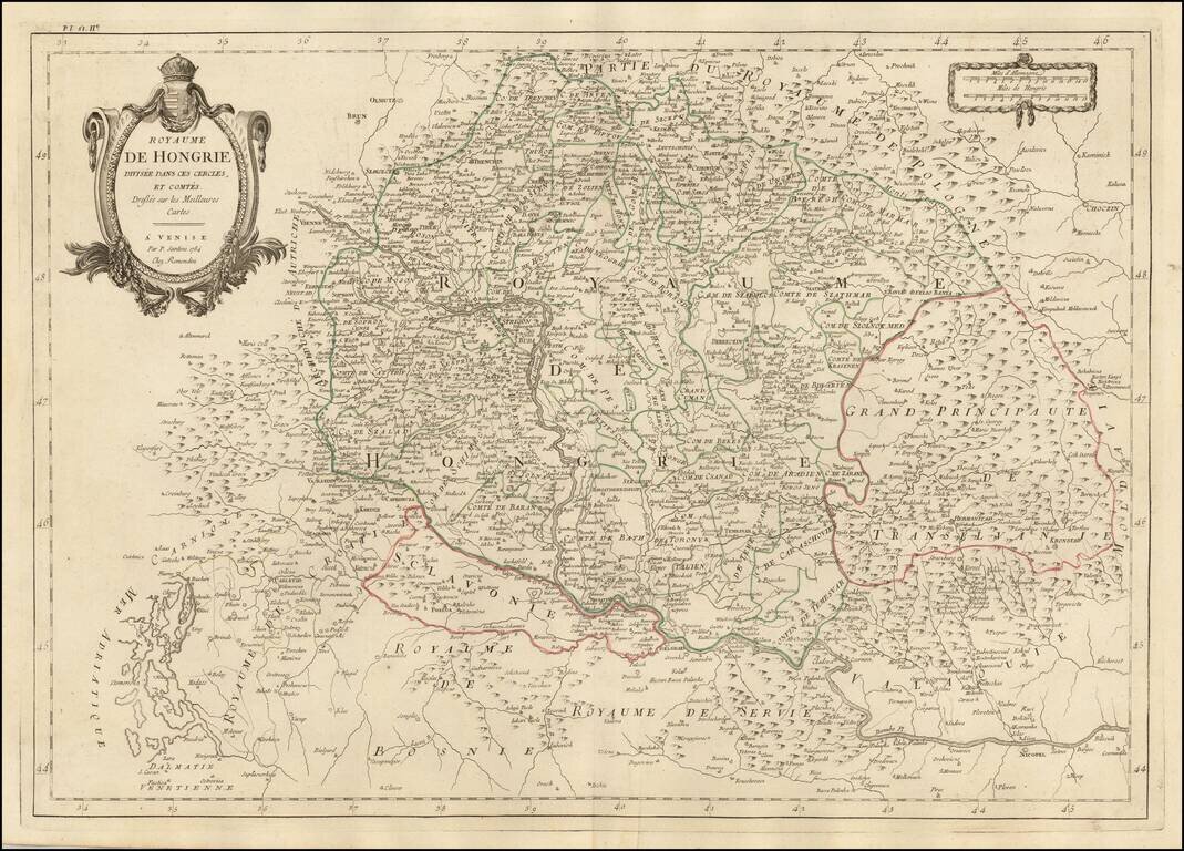
Finely detailed map of Hungary and adjoining regions, published in Venice by Santini. The map follows the course of the Danube from Vienna in the west to Nicopel (Nikopol, Bulgaria), and to the southwest, the Dalmatian Coastline. Includes large parts...
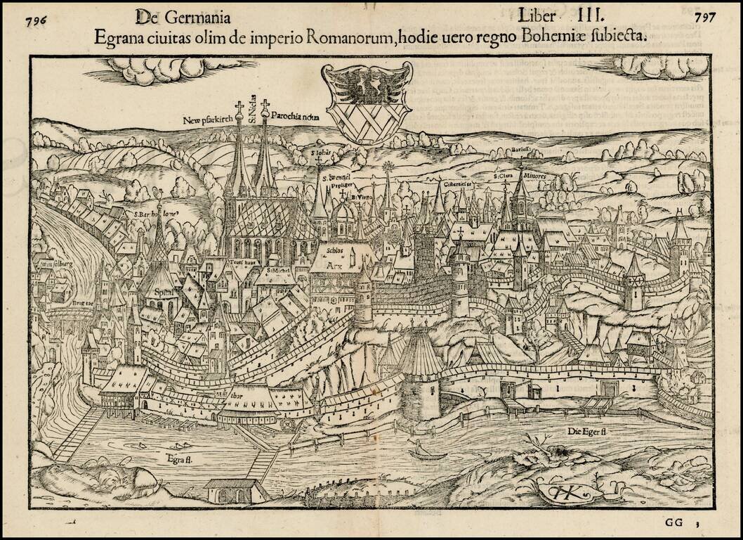
Important early view of the walled town of Eger, or Cheb, in the Czech Republic, including the city's coat of arms and the prominently labeled Church of Saint Nicholas. Munster's Cosmography was one of the most influential geographical works of the...
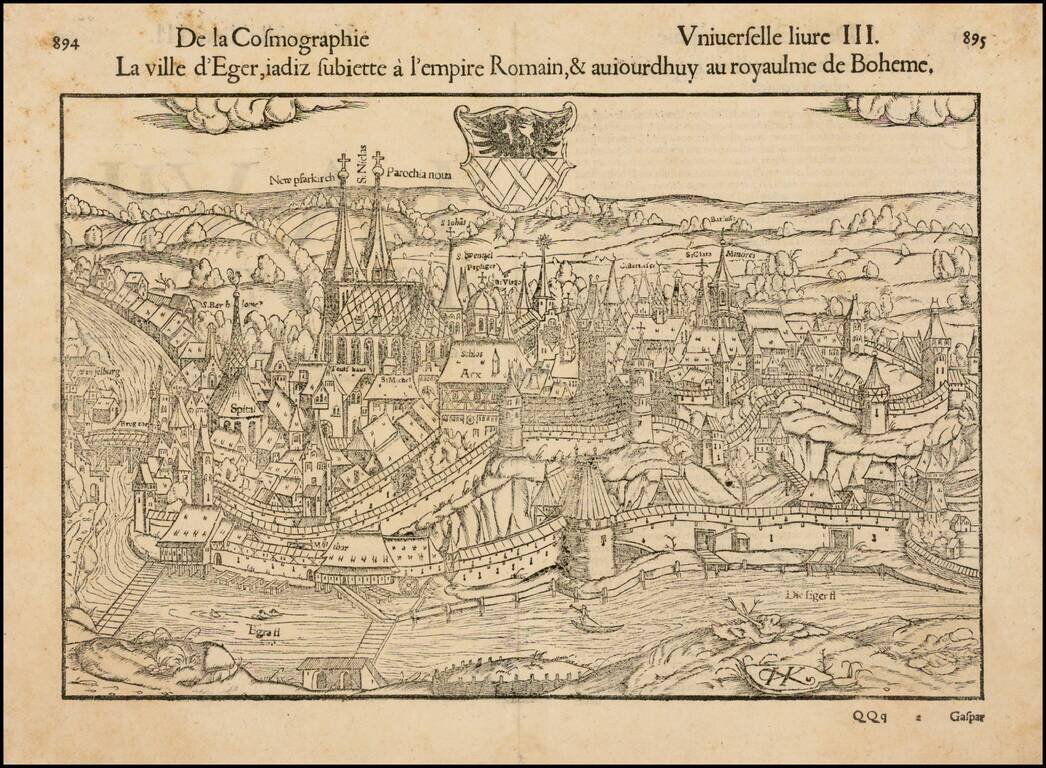
Decorative early view of Eger, in Bohemia, with coat of arms. Munster's Geographia (first published in 1540) and his later Cosmographia, were cartographic landmarks. The Geographia included not only Ptolemaic maps but also a number of landmark modern...
![Praga, Bohemiae Metropolis Accuratissime Expressa [with] Egra urbs a Flumio . . .](/map/small/53971.jpg)
Finely colored example of this striking view of Prague and of Egra, from Braun & Hogenberg's Civitas Orbis Terrarum.. Prague is shown dissected by the River, including three bridges and various watercraft in the river. One of the earliest and most...
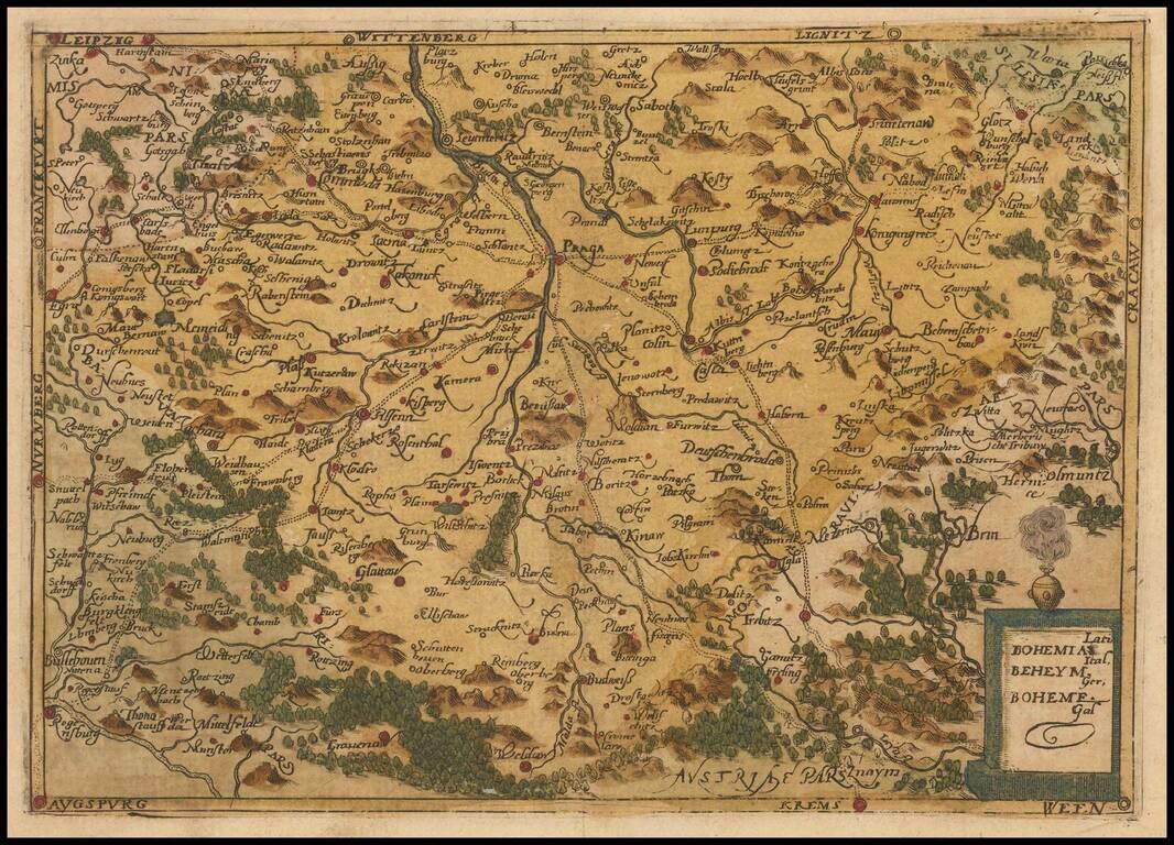
Rare modern map of Bohemia, published in Cologne by Johannes Metellus in 1579 in fine original color. The map is one of the earliest obtainable modern maps published by the so-called Cologne School of mapmakers, which consisted primarily of Flemish and...
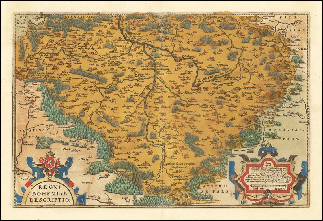
Fine old color example of Ortelius' decorative map of Bohemia, centered on Prague, based upon regional maps by Johann Criginger (1521-1571). The map shows remarkable detail, including towns, rivers, woods and other features. Two gorgeous cartouches...
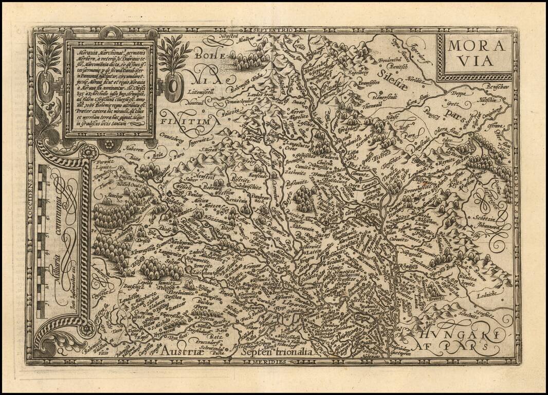
Fine example of Matthias Quad's map of Moravia. One of the few separate maps of Moravia published in the 16th Century.