

Rare edition of Cloppenburg's map of the Holy Roman Empire.
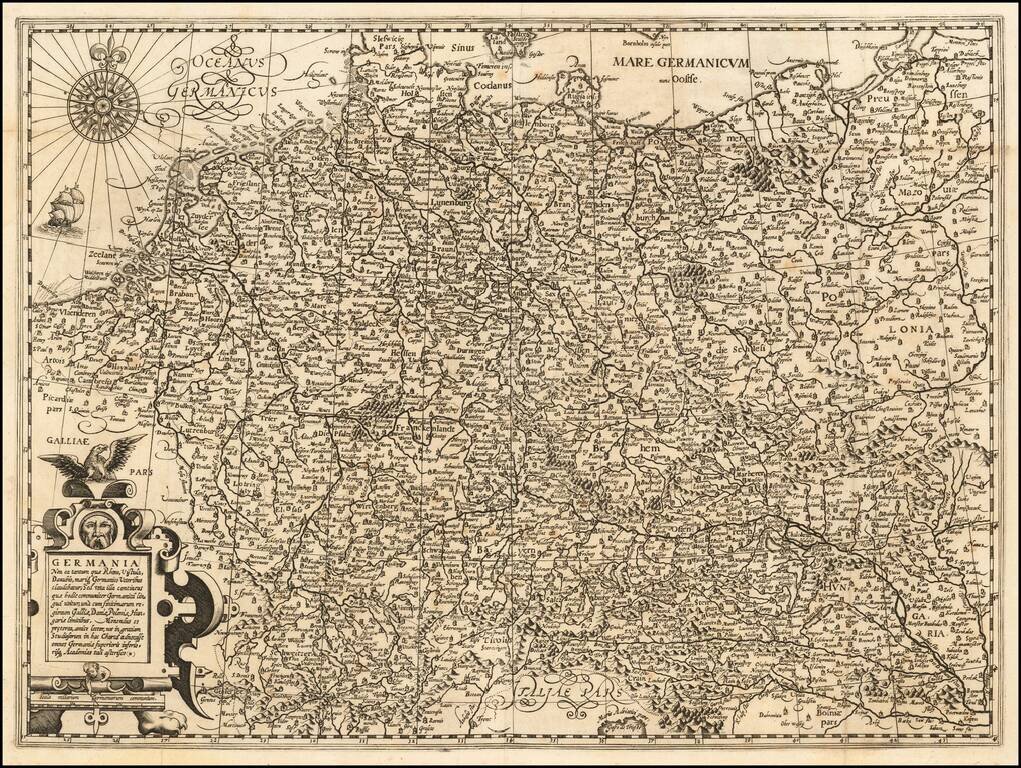
Rare map of the Holy Roman Empire, published in Paris by Jean Le Clerc. Le Clerc's map is based upon Willem Janszoon Blaeu's map of the same title, first issued in 1606, which includes town views across the top.
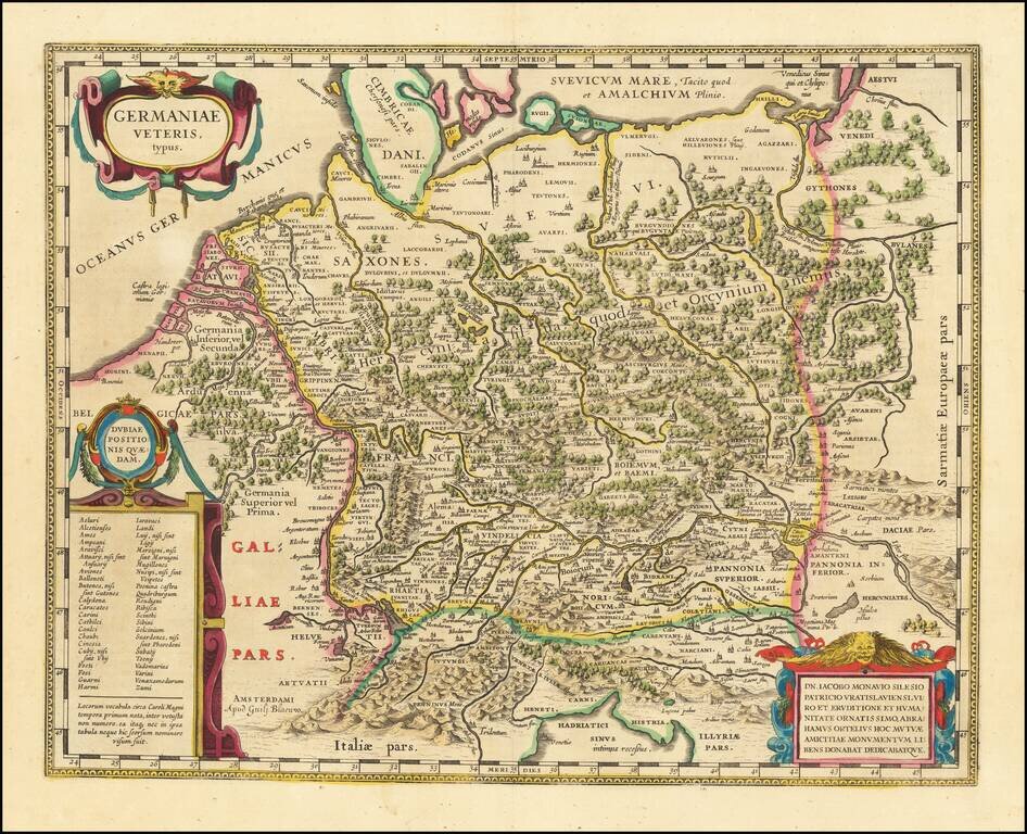
A Plethora of Anicent Place Names Striking example Blaeu's map of the Ancient German Empire in Northern Europe, based upon an earlier map by Ortelius. Extends from the Adriatic (Hadriatici Sinus) to the Baltic (Suevicum Mare) and the Vistula and...
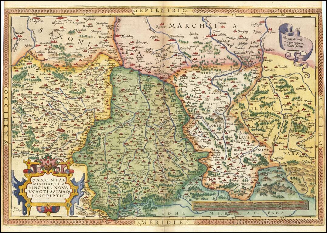
Nice example of Ortelius' regional map of Germany, extending from Prague to Berlin and Brandenberg, and from Mulhausen and Erpach to Goltberg, Sagan, Furstenberg, Leipzig and Frankfurt am Oder. Wide margins and nice old color. From the 1581 French...
![Turingiae Noviss Descript. Per Iohannem Mellinger Halens [with] Misniae et Lustaiae Tabula Descripta a. M Bartholomeao Sculteto Gorlit.](/map/small/61448.jpg)
Nice old color example of Ortelius' regional maps of Germany. The first map shows the regions of the Sala, Hel and Werra Rivers, from Hall, Merburg and Naumburg to Cruetzberg and Saltzungen, centered on Erfundt. The second shows the region centered...
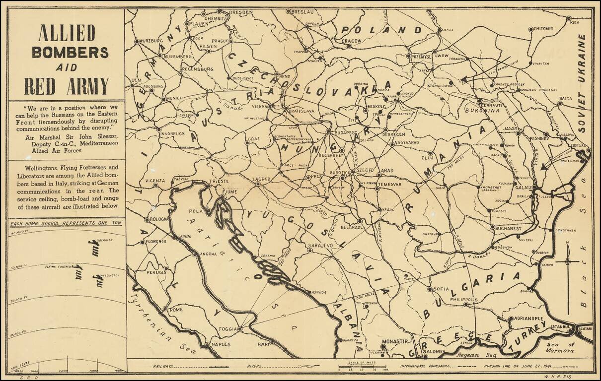
Anti-Nazi Propaganda Broadside Published in the British Empire Fascinating WWII broadside propaganda map, published in India, in order to keep the local populous informed about the War. The map provides a graphic overview of the Allied bombing...
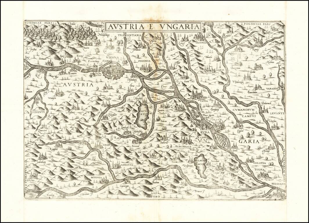
First State of Lafreri's Rare Map of Austria & Hungary Rare of the Austria and Hungary, published in Rome by Antonio Lafreri. The present map is among the earliest obtainable modern maps of Austria and Hungary. Based upon an early map engraved...
Decorative regional map of Austria and Hungary, following the Danube from Lintz to Bratislava and extending north to the Teya and south to the Dranus. A nice full color example with wide margins. From the 1587 French edition of Ortelius' Theatrum...
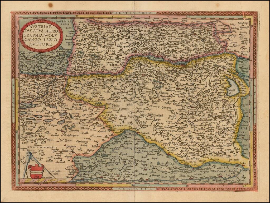
Very rare Nicolas Berey map of Austria. While at first glance, the map appears very similar to the Henricus Hondius map and the Guillaume Blaeu map of Austria of the same title, these are 3 entirely different copper plates. The most obvious difference...
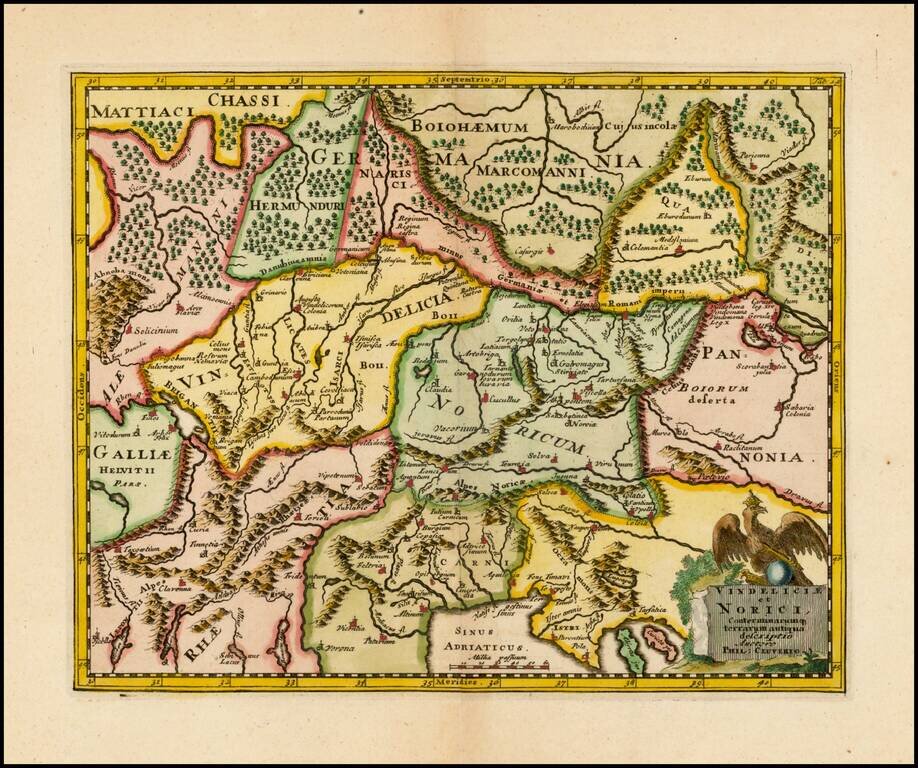
Decorative 18th Century Map of the region north of the Adriatic, from Cluver's Introductionis en Universum Geographicus…., one of the most prolific 17th and 18th Century Geography books.
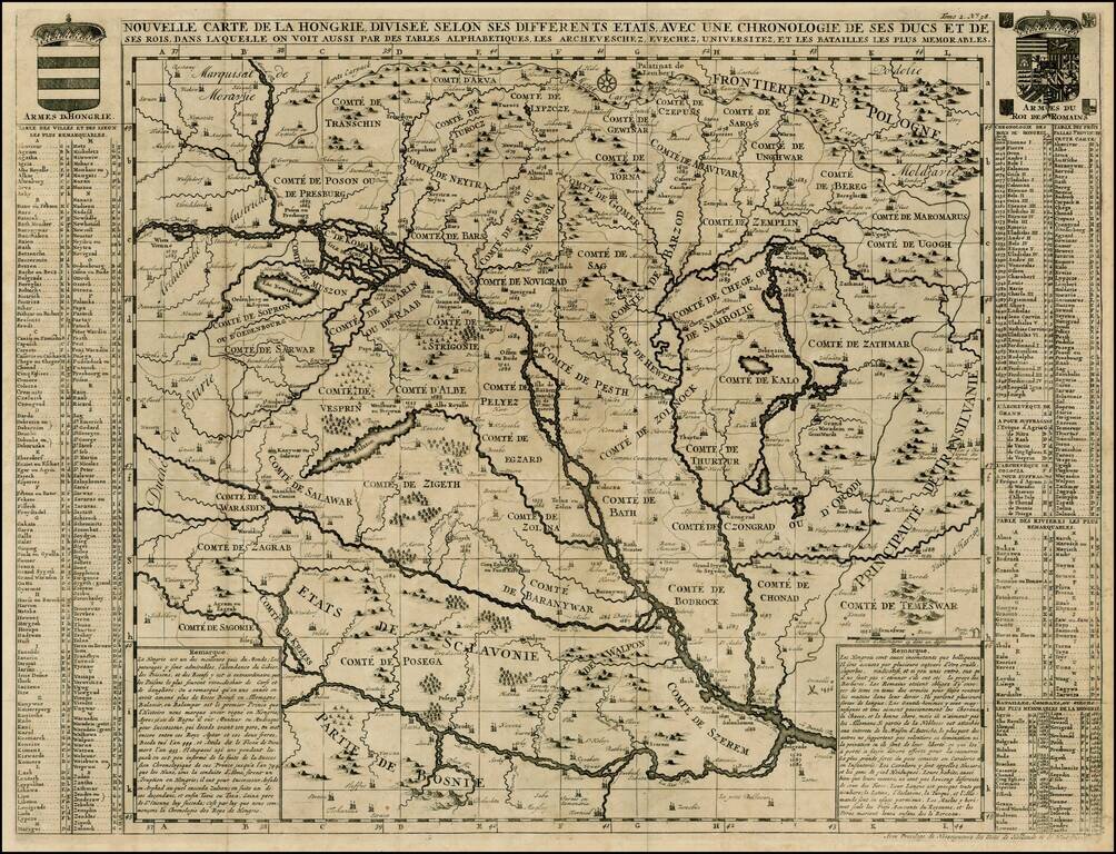
Detailed large format map of the Hungarian Empire, extending to Bosnia, Slovenia, Temeswar, and the Saw River in the south to Moravia, and the Frontiers of Poland in the north, centered on the course of the Danube from Vienna to Belgrade. Includes...
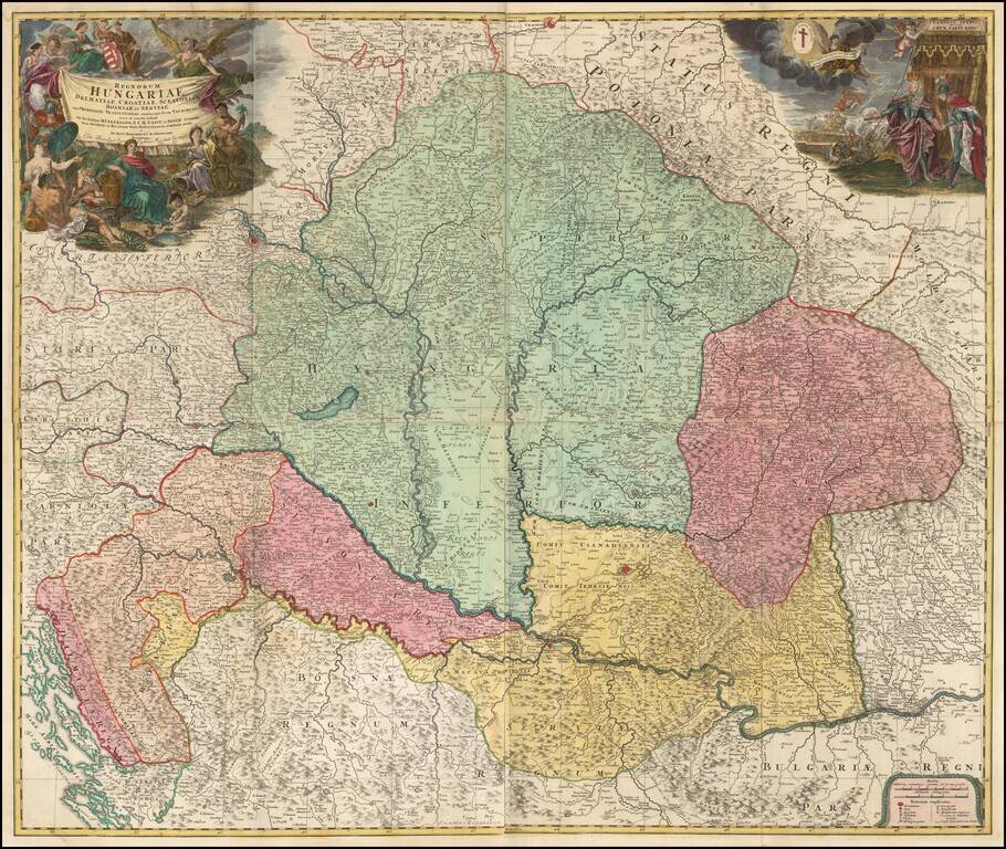
Fine Example of J.B. Homann's Wall Map of Hungary, Detailed early 18th century map of the region between Dalmatia, Serbia, Transylvania and Poland, centered on the Kingdom of Hungary Includes two decorative cartouches, the one at the right showing...
![[Poland, Croatia, Slovenia, Hungary, Serbia, Romania, Ukraine, Bulgaria] (La discrittione della Transylvania et parte del l'Ungaria, et il simil della Romania)](/map/small/59225.jpg)
Middle section of Paolo Forlani's rare 3-sheet map, covering South Poland, Croatia, Slovenia, Hungary, Serbia, Romania, Ukraine, Bulgaria, with Transylvania in the center. Krakow appears in the north, with the Danube River crossing from the northwest...
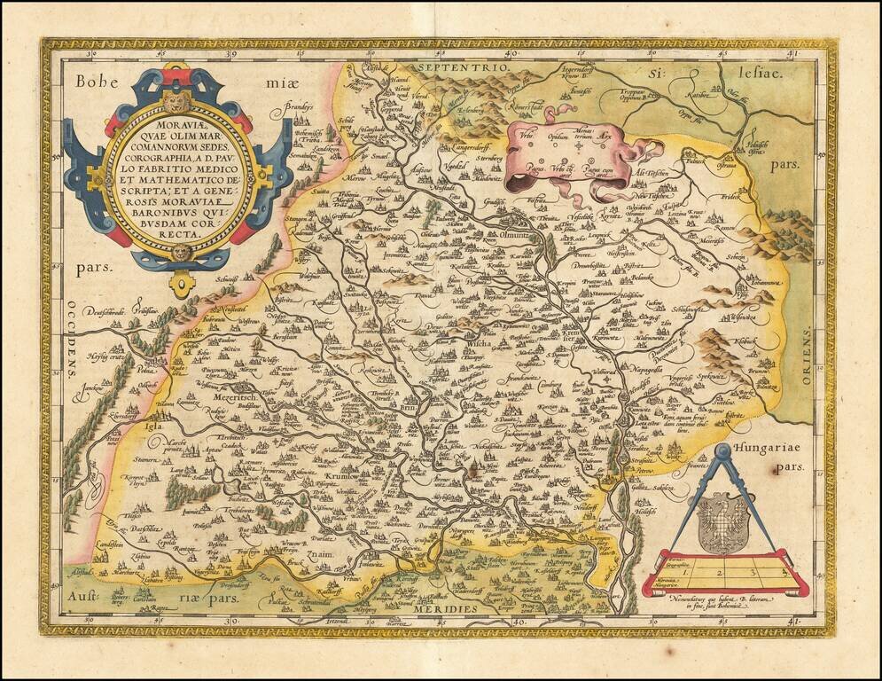
Fine old color example of the Ortelius map of Moravia, showing fortified cities, towns, rivers, etc. Large strapwork cartouche, title banner and smaller cartouche. From Ortelius' Theatrum Orbis Terrarum, the first modern atlas of the World.
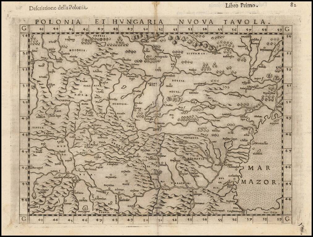
Striking dark impression of Ruscelli's map of Poland, Hungary, Slovakia, the Czech Republic and parts of the region bounded by the Black Sea in the east and the Danube in the south. Ruscelli's Atlas is an expanded edition of Gastaldi's Atlas of 1548,...
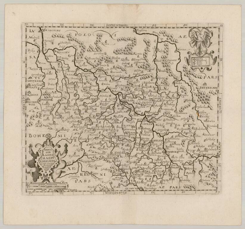
Scarce map of Southern Poland and a bit of Northern Moravia, published in Frankfurt by David Custodis (Custos).