
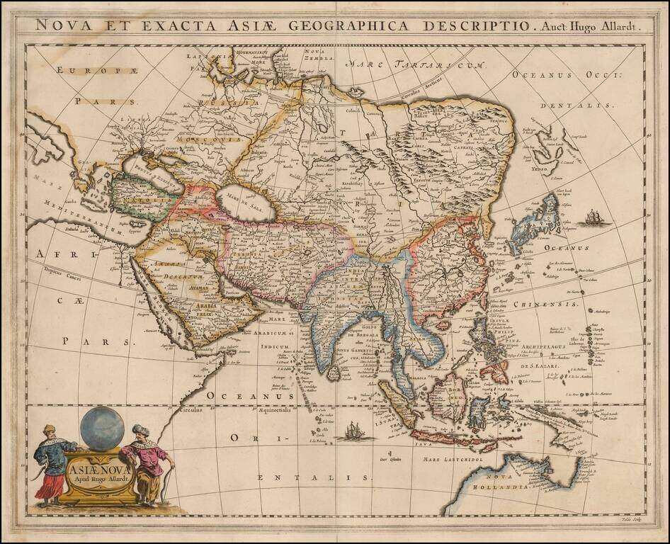
Rare Hugo Allard map of Asia and the north part of Australia. The map includes a nice representation of the Philippines. Korea is shown as a strangely shaped peninsula. China and the Great Wall are located. The depiction of Yedso, Comps. Landt and...
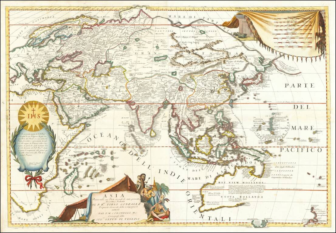
Striking Example of Coronelli's Striking Two-Sheet Map of Asia Fine example of Coronelli's detailed map of the Asian continent. The map shows the latest discoveries in Southeast Asia and the Pacific, and is dedicated to the Jesuit missionaries at...
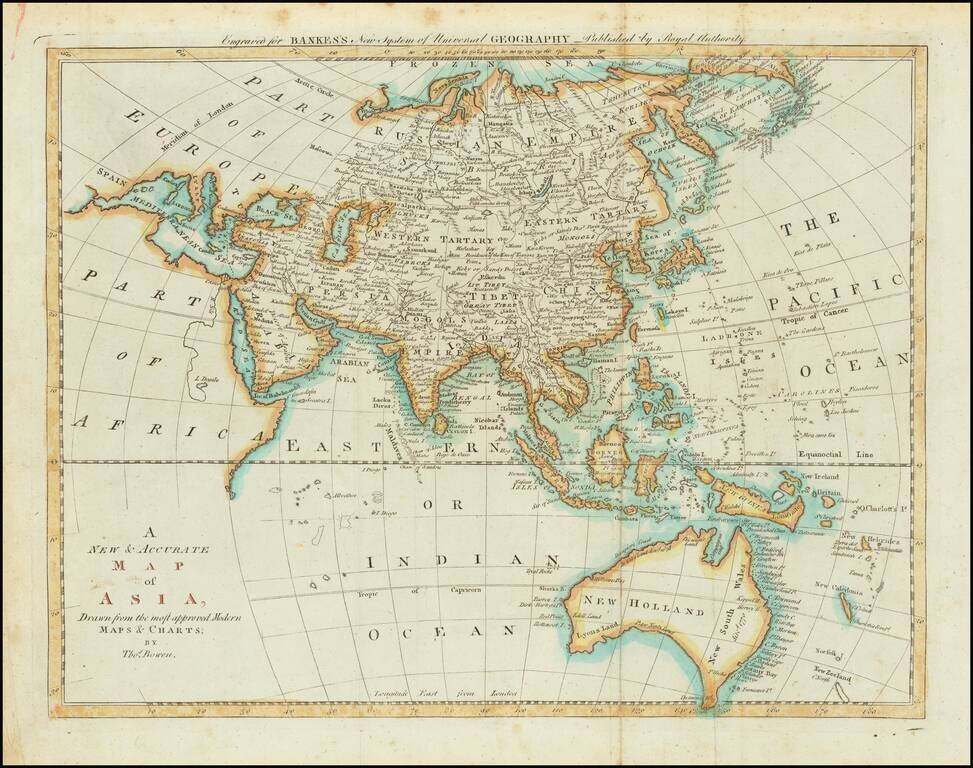
Detailed map of Asia and Australia, which appeared in Middleton's Geography. Shows a still largely speculative Southern Australian coastline. Among the most notable features is the reference of the Sea of Korea.
![Asia [with large inset of Australia]](/map/small/67619.jpg)
Detailed map of Asia, including part of Polynesia and a large inset of Australia. Includes color key noting the colonial possessions of Britain, France, Spain, Portugal, Holland and independent islands. Decorative border. An excellent map from the...
Southeast Asia with an Early Depiction of Northwestern Australia Based on Gerrit Frederikszoon de Witt's Discoveries in 1628 Scarce decorative map of Southeast Asia, China, India, the Philippines and western Oceana, along with the newly discovered...
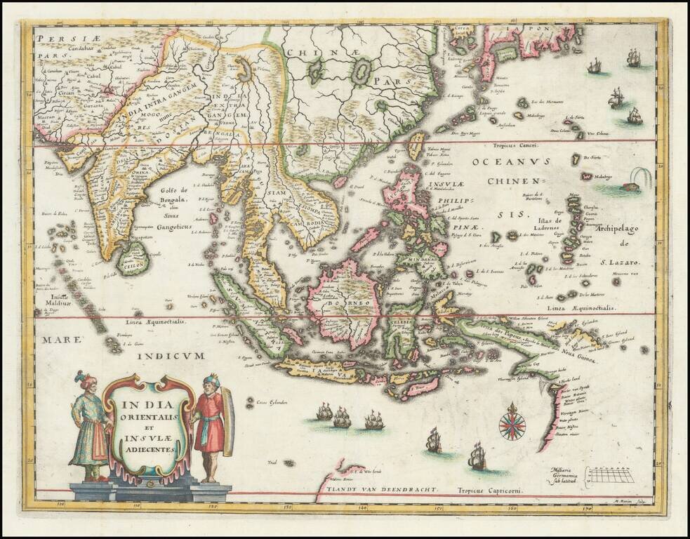
Southeast Asia with an Early Depiction of Northwestern Australia Based on Gerrit Frederikszoon de Witt's Discoveries in 1628 This is a scarce decorative map of Southeast Asia, China, India, the Philippines, and western Oceania. Perhaps the most...
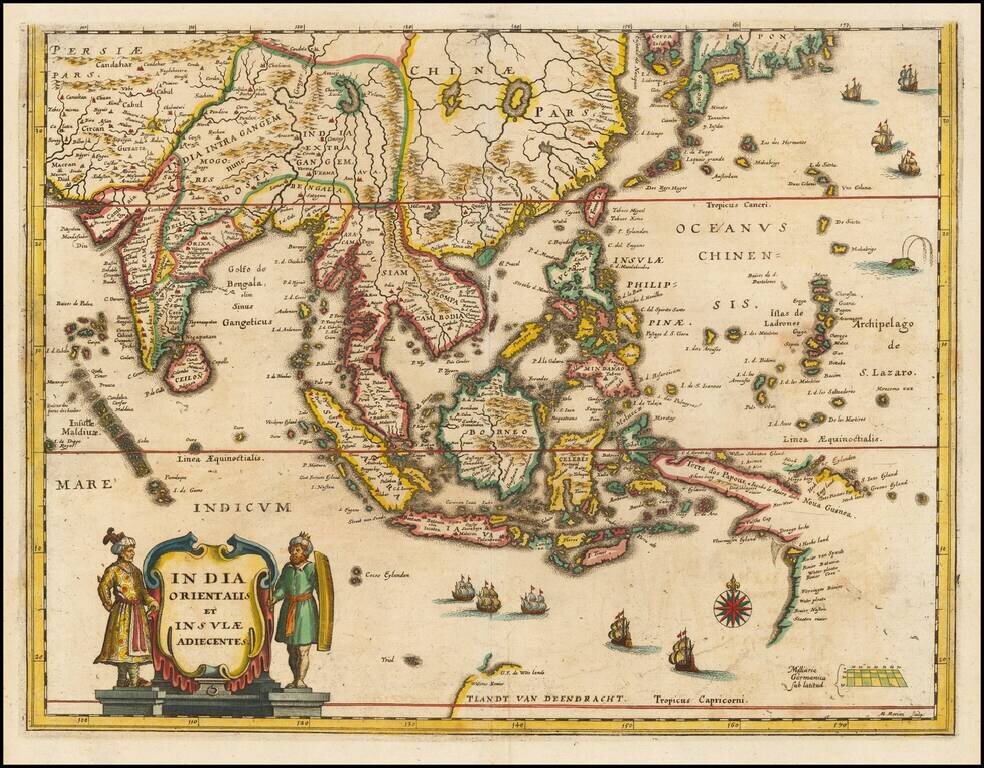
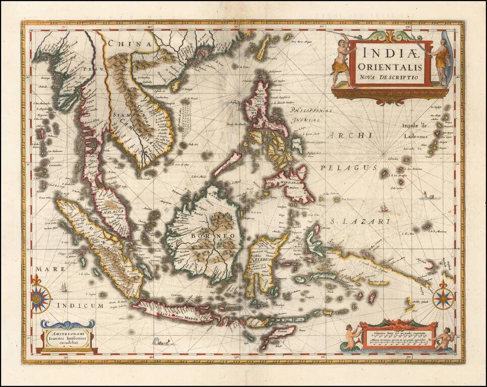
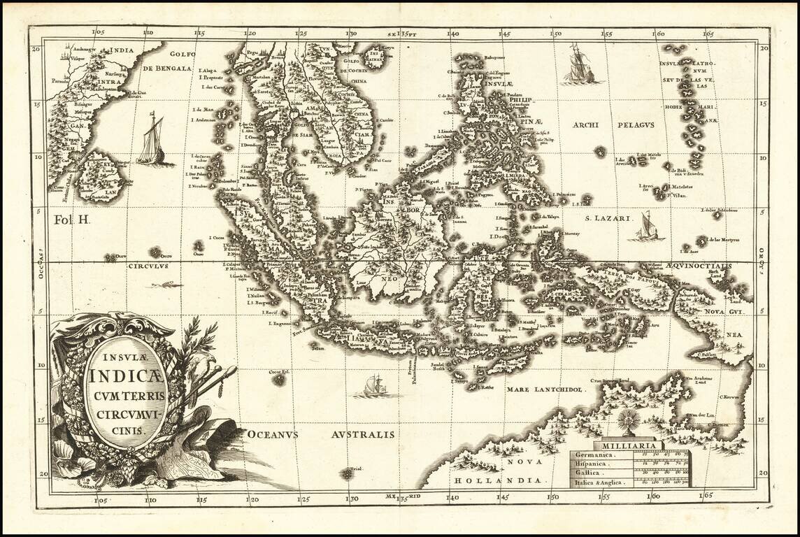
Detailed map of Southeast Asia and the North Coast of Australia, published in Amsterdam by Nicolas Visscher. The map extends from India and the Maldives in the west to New Guinea and the southern coast of Japan in the east, centered on the Stratis of...
![(Second World War - Okinawa) [Large Battlefield Composite Map of Okinawa]](/map/small/63896.jpg)
6.5-Foot-Tall Battle-Used Map of Okinawa. Impressive battlefield composite map of Okinawa, composed of numerous sections of SECRET Army Map Service sheets cut and pasted together to form one large image. The map covers all of Okinawa, but for a small...
![(Second World War - Okinawa) [Battlefield Composite Map of Southern Okinawa]](/map/small/63897.jpg)
Battle-Used Map of Okinawa. Impressive battlefield composite map of Okinawa, composed of numerous sections of SECRET Army Map Service sheets cut and pasted together to form one large image. The map covers the southern most parts of Okinawa, including...
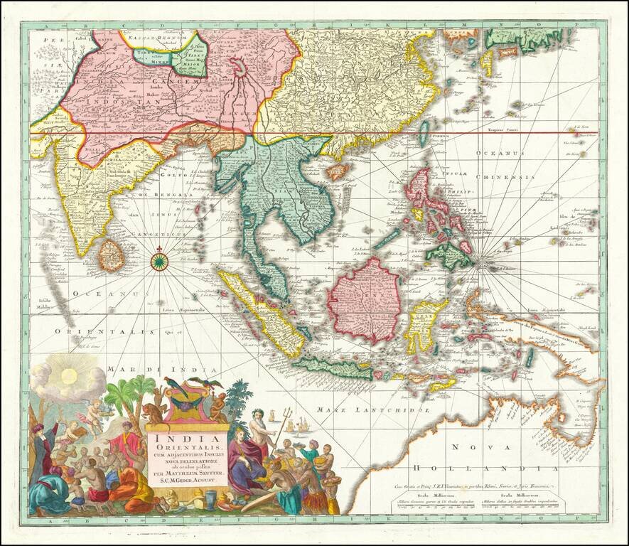
Antique Map of Southeast Asia, Indian Ocean and Australia A nice example of Seutter's scarce map of the East Indies and part of Australia, from the Atlas Novus. The map extends from Japan and Persia in the North, to the Maldives and Australia and the...
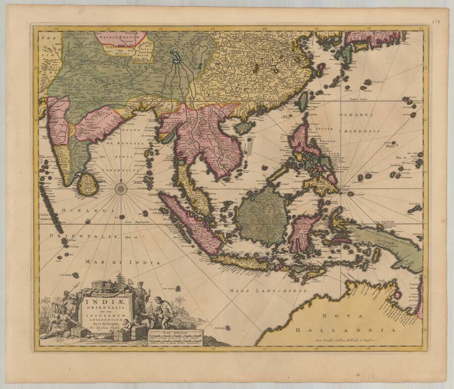
Important early map of Southeast Asia and the Philippines as well as a landmark map in the mapping of Australia, first published by Jan Jansson in 1630. The detail in the Philippines and Southeast Asia is excellent for the period. The map is perhaps...
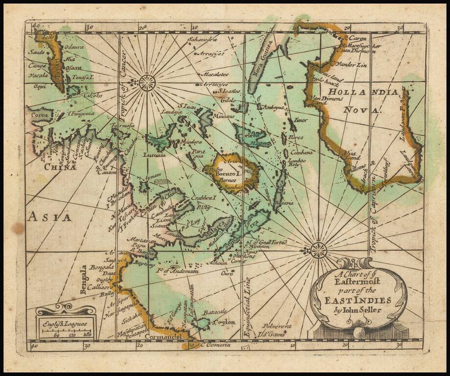
Extremely rare English map of the East Indies and Australia, oriented with the East at top of the map. The map covers the East Indies from India to Japan in the north and New Guinea and Australia in the south. Australia is named Hollandia Nova and...
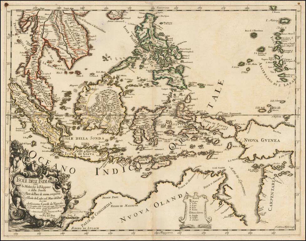
Scarce first state of this decorative map of Southeast Asia and the North Coast of Australia by Cantelli da Vignola and published in Rome by Rossi. Detailed and highly decorative 17th-century Italian map of northern Australia and the islands of...
Striking example of Scherer's map of Southeast Asia and the Northern part of Australia. Nova Guinea is still tenatively attached to Nova Hollandia. The coastline shows Van Arnham's Land, Van Der Lin, C. Diemen and C. Van Diemen's Land. A narrow strait...
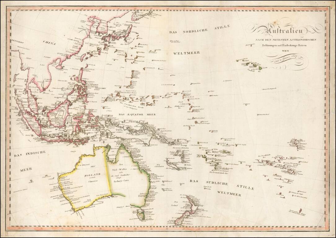
Fine early map of Oceana and Southeast Asia, published in Vienna by Tranquillo Mollo. Mollo's map includes a marvelous early depiction of Neu Holland vormals Ulimaroa. The coastline of Australia is still incomplete andther is no detail in the...
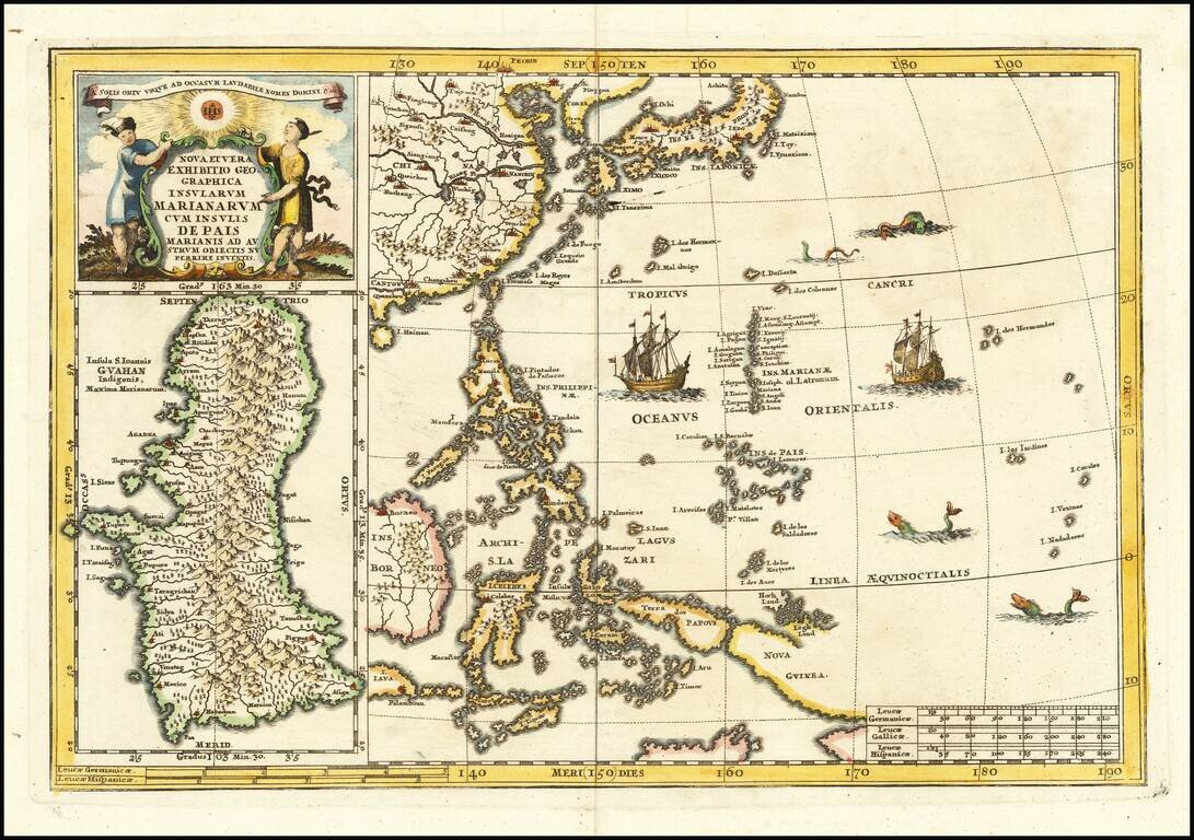
Fascinating map of the the Philippines, China, Japan and Korea, with a large inset of Guam, from Heinrich Scherer's monumental work. Includes a large inset of Guam. Heinrich Scherer (1628-1704) was a Professor of Hebrew, Mathematics and Ethics at the...