
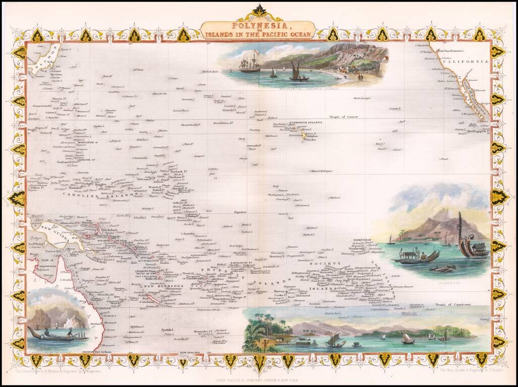
Nice full color example of John Tallis' map of the South Pacific. The map includes large vignettes of Kalakakooa Sandwich Islands, Otaheite, the Harbour of Dory in New Guinea and Resolution Bay, Marquesas. Engraved for R. Montgomery Martin's...
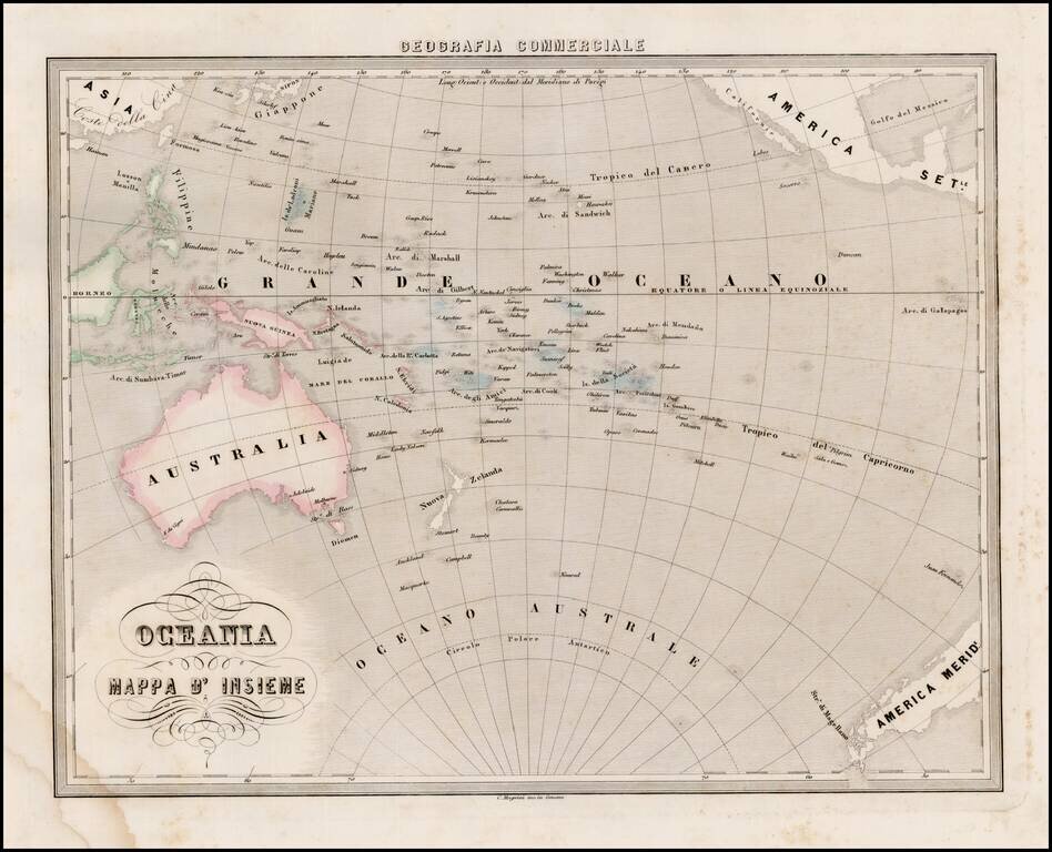
Interesting map of Oceana and the South Pacific, from Marmocchi's scarce Geografia Commerciale. The south polar of Antarctic is just beginning to be discovered. A very unique map.
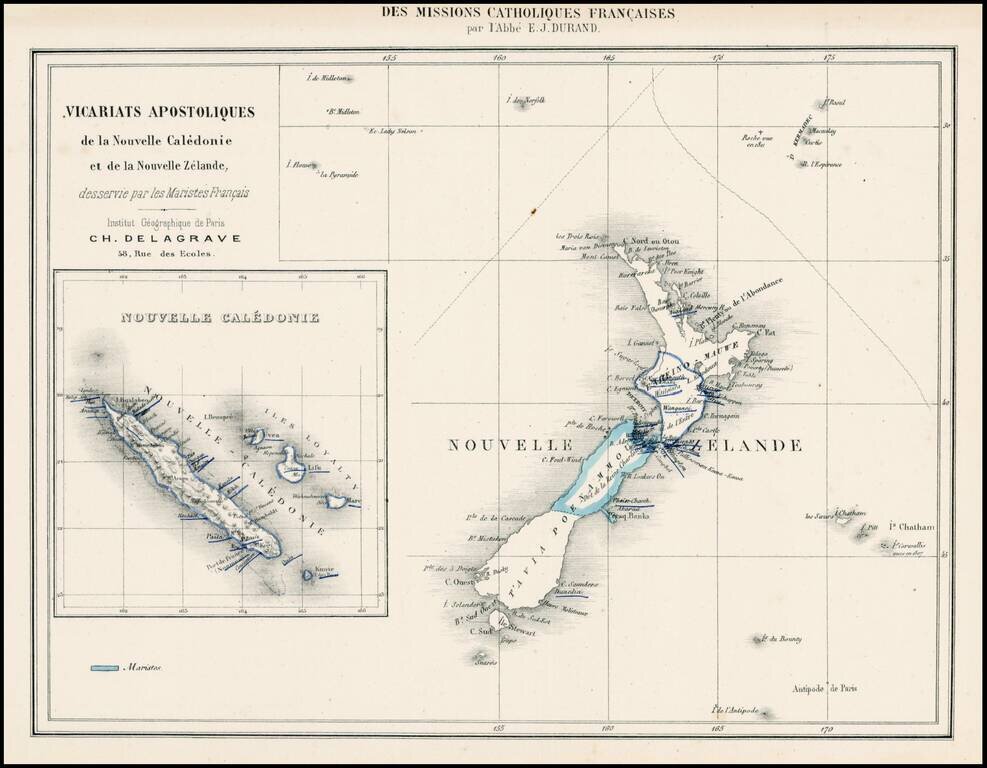
Rare map showing the Franch Marist Missionaries activities in New Zealand and New Caledonia.
![Map of Mexico, Central America, and the West Indies [Insets of Bermuda, Sandwich Islands, Jamaica and Panama Railroad]](/map/small/69133.jpg)
Attractive map of Mexico, the Caribbean and the Gulf Coast, published by SA Mitchell Jr. Includes large insets of Cuba, Bermuda, Jamaica, and the Isthmus of Panama and a small inset of Jamaica. Shows shipping routes from New Orleans to points...
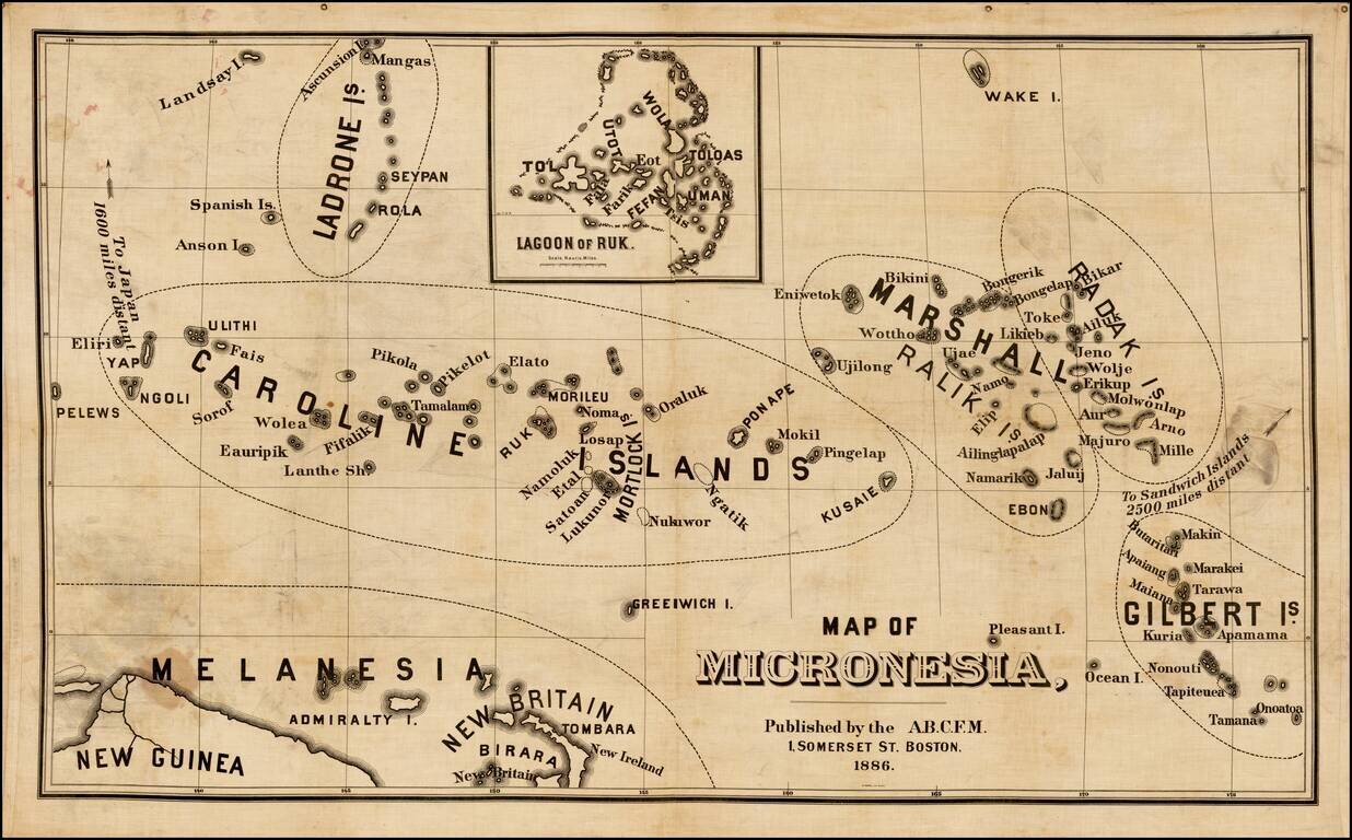
Rare map of Micronesia, published by the American Board of Commissioners for Foreign Missions in Boston. The American Board of Commissioners for Foreign Missions (ABCFM) was the first American Christian missionary organization. It was created in 1810...

Rare map showing the Catholic Missions on New Zealand, the Hawaiian Islands, Tahiti, Samoa, Tonga, New Caledonia, New Hebrides, Fijian Islands, the Marquesas, and a number of other islands, with a general map in the center, published as a Supplement to...
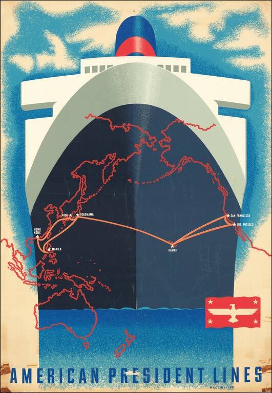
A San Francisco native, Macouillard was an accomplished artist, having studied at the California College of Arts and Crafts and the Art Students League of New York. He became Art Director of the Velvetone Poster Company in San Francisco and designed...
![[Australia and Houyhnhnms Land from Gulliver's Travels]](/map/small/54999.jpg)
Houyhnhnms Land and the Coast of Australia -- From Gulliver's Travels The Houyhnhnms are a race of intelligent horses described in the last part of Jonathan Swift's satirical Gulliver's Travels. The map shows Houyhnhnms Land to be south of...
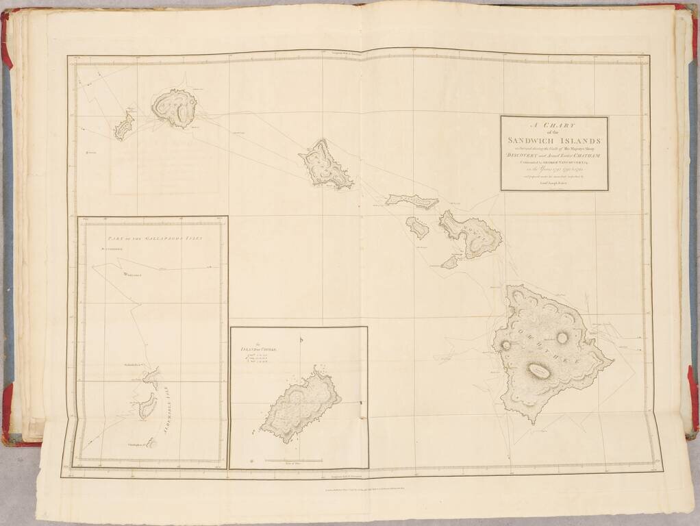
First Edition of Vancouver's Voyage of Discovery with Atlas, Containing Influential Charts of Hawai’i and the Pacific Northwest Fine, complete four-volume set of Vancouver’s A Voyage of Discovery to the North Pacific Ocean, and Round the World...

Interesting map of the Eastern Hemisphere showing explorers' routes with dates, an early projection of Australia, with Van Diemen's Land attached and speculative coastlines along most of the Southern and Eastern Coasts. A fine map from Brion De La...
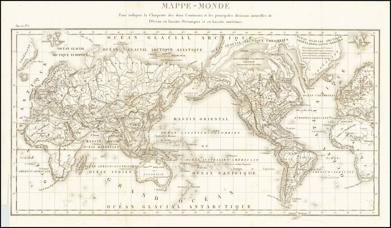
Fine General Hydrographical World Map Striking world map showing the world’s maritime basins. It was part of a geographic system meant to teach an overview of the world’s hydrography. The map was featured in Mémorial topographique et militaire...
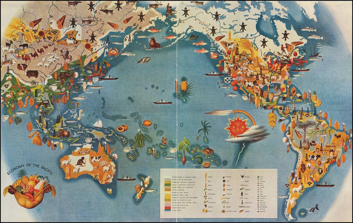
Smaller version of Miguel Covarrubias's iconic map from his Pageant of the Pacific series. This well regarded stylized map by the Mexican painter, illustrator, filmmaker and anthropologist Miguel Covarrubias, often called Mexico's Renaissance Man....
![[Musselini Celebrates Pearl Harbor] Grande Carta Del Pacifico](/map/small/64895.jpg)
Musselini Celebrates The Japanese Attack on Pearl Harbor -- Provoked by A Democratic Despot Issued 4 days after the Japanese attack on Pearl Harbor, this message from Musselini, celebrates the attack and speaking in fiery nationalistic rhetoric in...
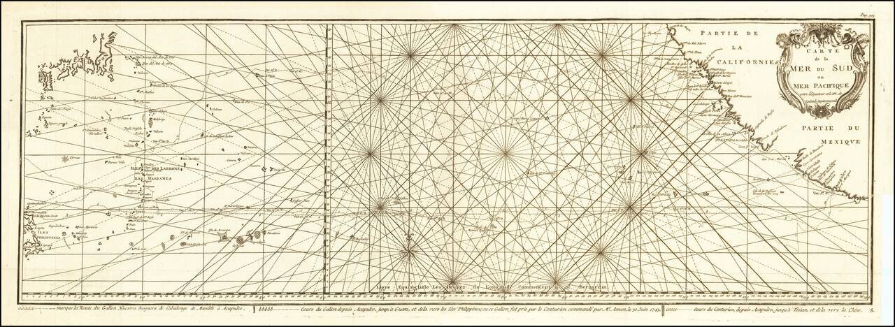
Impressive Chart of the Pacific Ocean Depicting a Thrilling Circumnavigation Dynamic chart of the mid-Pacific Ocean from the French-edition of Anson’s bestselling voyage account. It includes voyage tracks of Anson’s Centurion and the ship he...
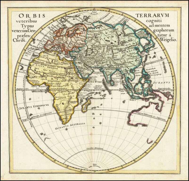
A detailed map of the Eastern Hemisphere, including a detailed depiction of the known coastlines of Australia. Four continents are shown in elegant color. Regions, cities, rivers, and more are all named and many more mountain ranges and features are...

Scarce late state of Guillaume De L'Isle's map of the Western Hemisphere, updated to include the 3 voyages of Captain James Cook. Dezauche also shows the route of the voyages of Abel Tasman (1642), Quiros, Magellan (1520), Le Maire (1616), Mendana...