
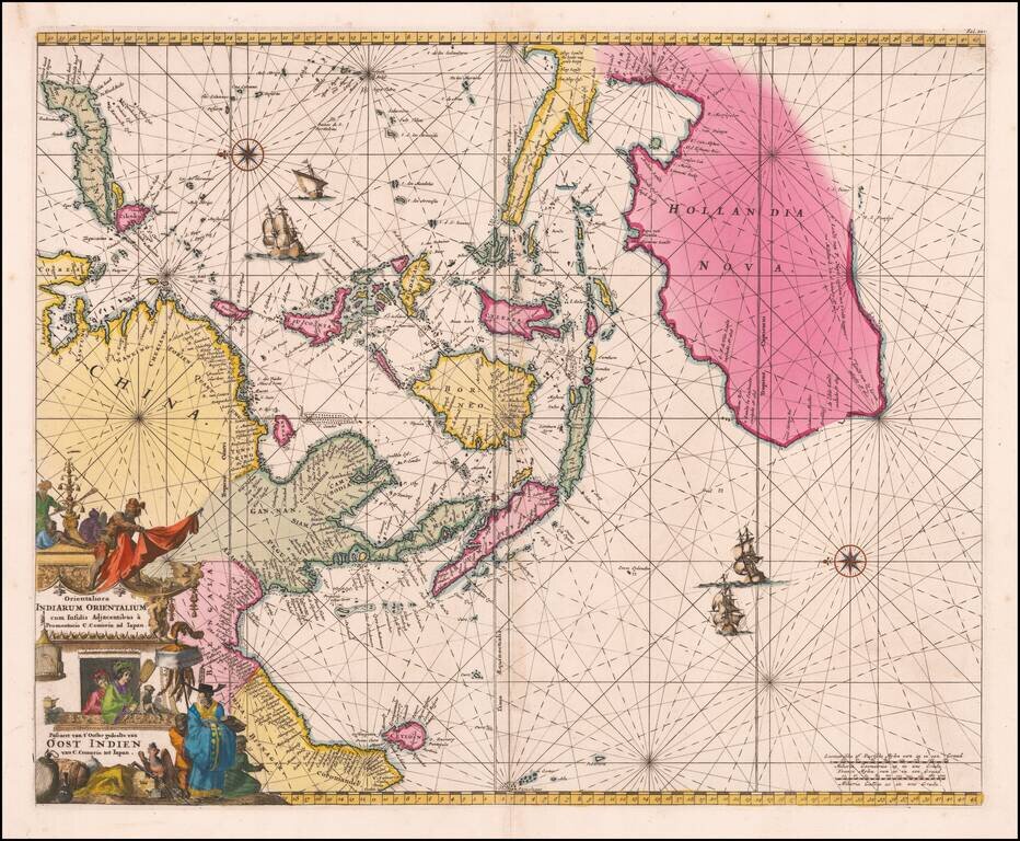
An Important Early Dutch Sea-Chart of Australia, the East Indies and Eastern Part of the Indian Ocean. Stunning original color example of De Wit's map of Australia, Southeast Asia, the Philippines, etc., first issued in 1675. The chart is...
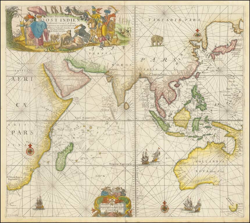
A Rare Dutch Chart of Southeast Asia, Australia, and the Indian Ocean A beautiful example of this rare sea chart of the Indian Ocean, Australia, etc., published in Amsterdam by Johannes Van Keulen. The chart appeared in Van Keulen's rare Maritime...
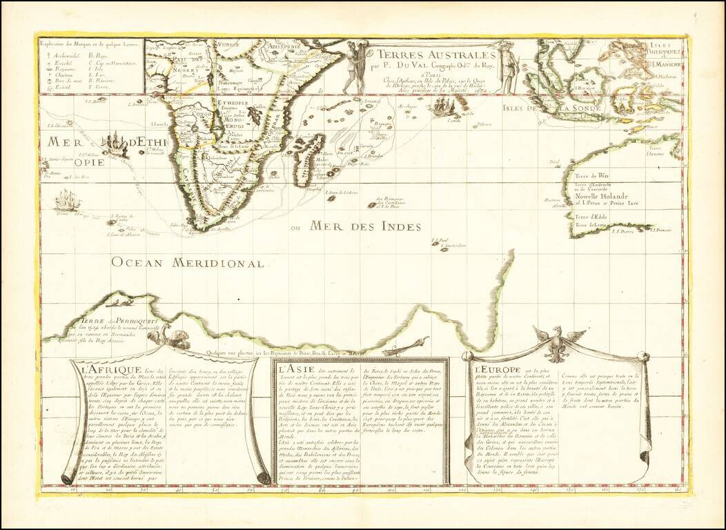
Antique Map of the Western Indian Ocean -- First State of the Second Printed Map to Show Gonneville's Land Fine early map of the Dutch Discoveries in the New Holland and the Indian Ocean, published in Paris by Pierre Du Val, the second printed map to...
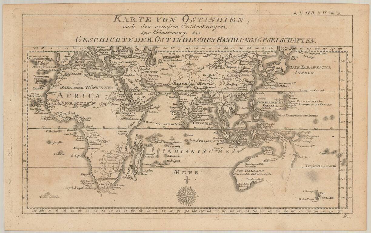
Rare map of Australia and the Indian Ocean, from Johann Justinus Gebauers' Algemeine Welthistorie . . . Zeit XXVI. Theil. Histoire Der Neuern Zeiten. VIII Theil. The map presents a fine depiction of Australia (Neu Holland) on the eve of the arrival of...

An 18th Century English Wall Map of Asia, Australia & The Indian Ocean Nice example of the 6 sheet Laurie and Whittle wall map of Asia, Australia and the Indian Ocean, first published in Asia in 1794. The map in its complete state covers an area...

Penelope Steel's Map of the Indian Ocean -- Used in an American Circumnavigation in the 1840s. Rare four-sheet blueback sea chart of the Indian and Pacific Oceans, focusing on the trading routes from the east coast of Africa to Canton and New Zealand,...
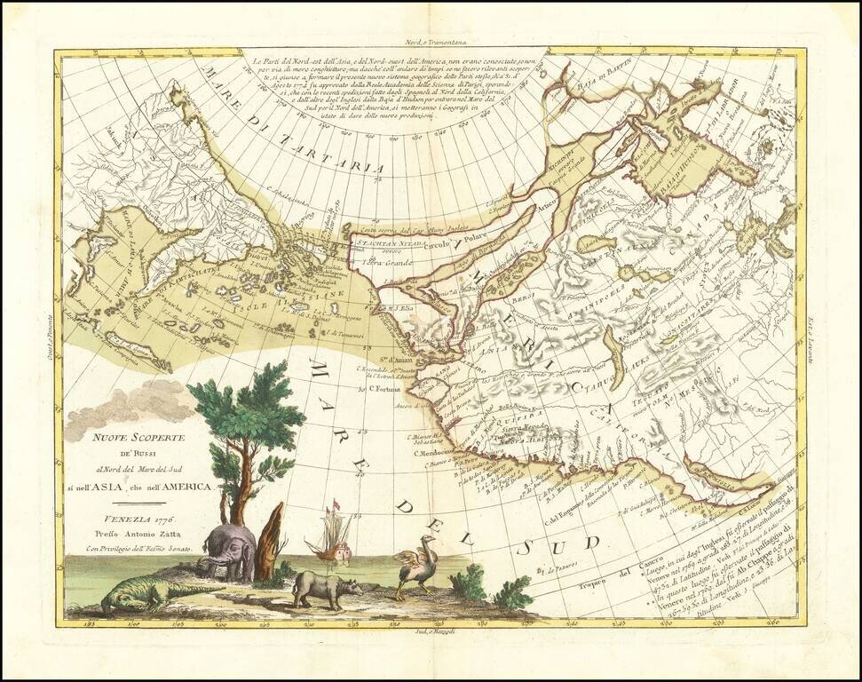
An Ostrich, An Elephant and the Northwest Passage! Striking example of Zatta's map of the northern Pacific Coastal regions and one of the best illustrations of a late rendition of the Northwest Passage, here illustrating two wide passages from the...
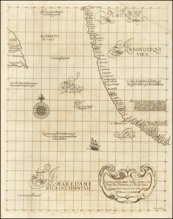
"The First Printed Sea Chart of the Northwest Coast of North America" (San Francisco to Vancouver Island) Rare early sea chart of the Pacific Northwest, from Sir Robert Dudley's Dell'Arcano del Mare. The chart shows all of the American Pacific coast...
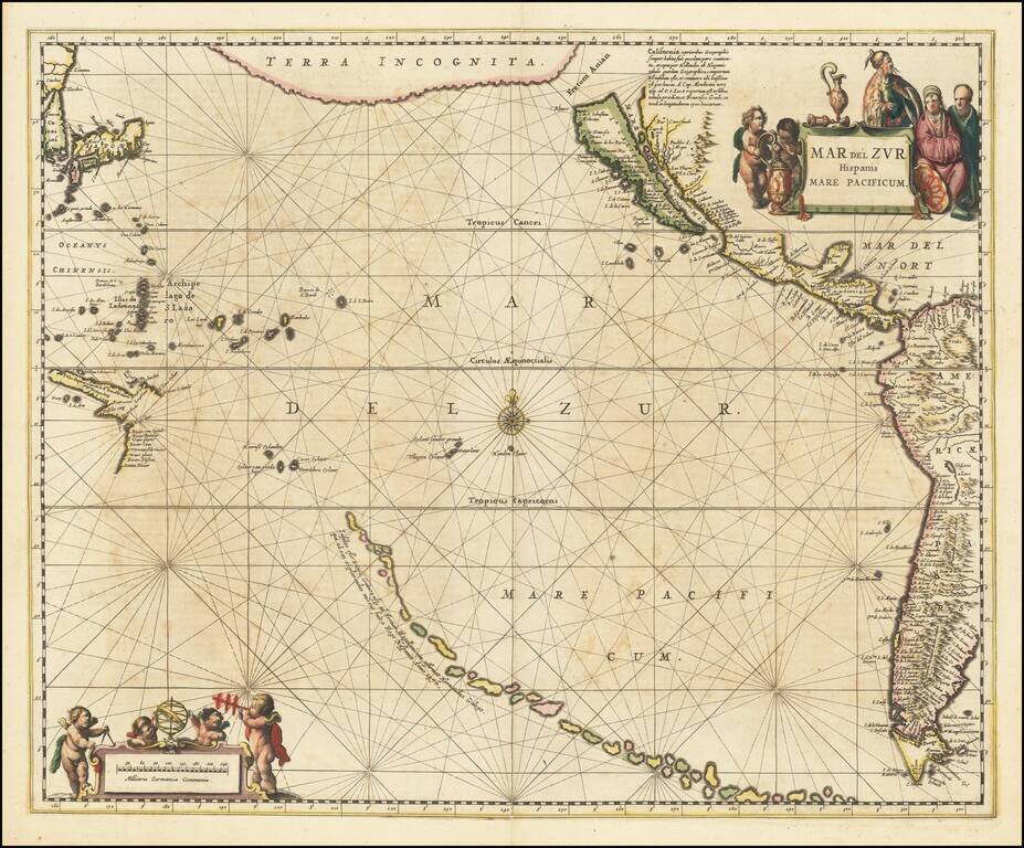
A fine example of Jansson's sea chart of the Pacific, the first chart of the Pacific to show California as an island and the earliest sea chart of the Pacific to appear in a Dutch Atlas. A long chain of islands appears in the South Pacific, which are...
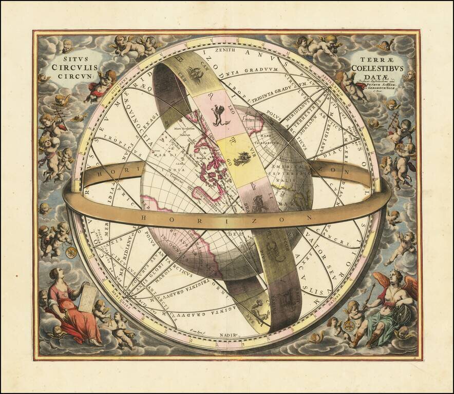
Striking original hand-color celestial chart, showing a Ptolemaic model of the Universe, with the earth in its relation to the plane of the ecliptic, from the 1708 Valk & Schenk edition of Andreas Cellarius' Harmonia Macrocosmica seu Atlas...

Fine example of Johannes Van Loons' sea chart of the Pacific Ocean, extending from Australia, New Zealand and Japan to California. Van Loon's chart is among the earliest regional maps to focus on the Dutch discoveries in New Zealand and Australia. Van...
![[Pacific Whaling] A New Chart of The Pacific Ocean, Exhibiting The Western Coast of America from Cape Horn to Beerings Strait, The Eastern Shores of Asia Including Japan, China . . . according the most Modern Surveys . . . Additions to 1836 (Large Insets](/map/small/56007.jpg)
With Manuscript Tracks Showing the Course of An American Whaler in the Pacific. Fine example of Norie's monumental sea chart of the Pacific Ocean. The chart is noteworthy for the large insets maps of San Francisco, San Diego, Hawaii, Honolulu and...
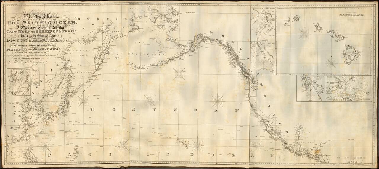
Fine example of Norie's monumental sea chart of the northern part of the Pacific Ocean. The chart is noteworthy for the large inset views of San Francisco, San Diego, Hawaii, Honolulu and Karakakoa Bay in Hawaii. Issued with revisions up to 1844,...
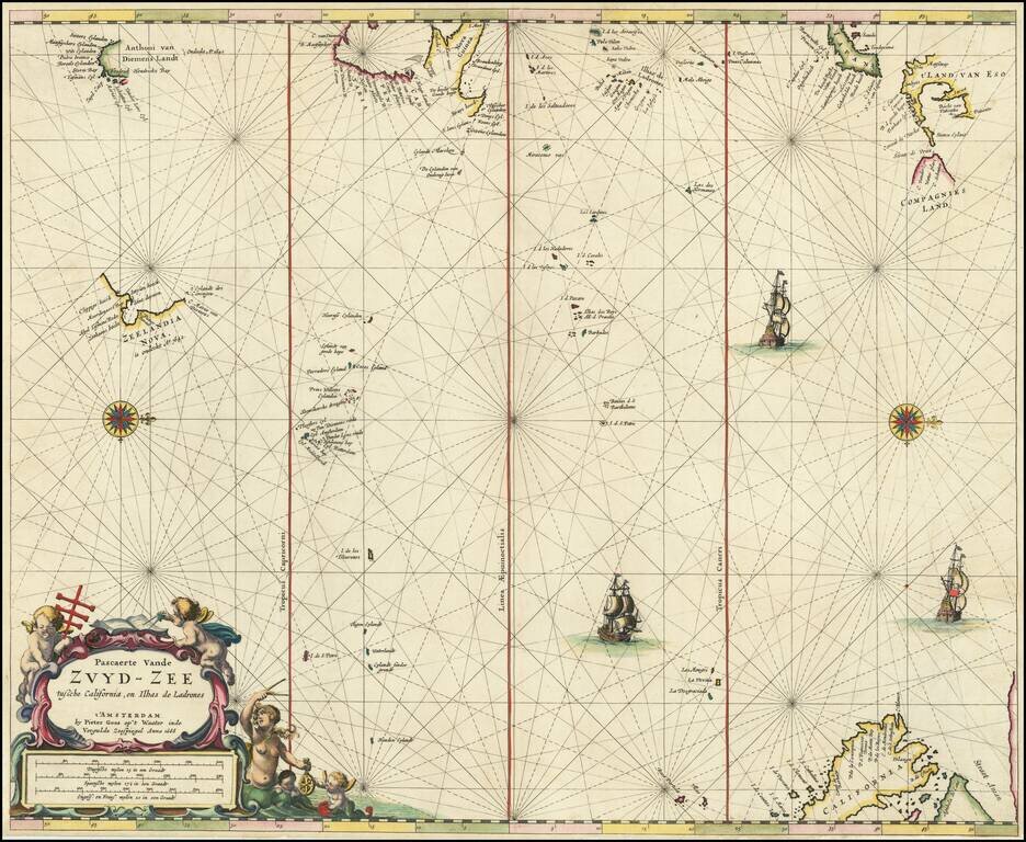
Rare Dutch Sea Chart of the Pacific Fine old color example of Pieter Goos' sea chart of the Pacific Ocean, extending from Australia, New Zealand and Japan to California. Oriented with west at the top, Goos's chart is among the earliest regional maps...
![A Chart of the South Sea [1st English Map of the Pacific Ocean]](/map/small/47376.jpg)
Unrecorded state of John Seller's map of the Pacific Ocean, the first English map of the Pacific. John Seller's map of the Pacific Ocean is the first English map of the Pacific. First issued in 1675, it is a map of exceptional rarity and importance...
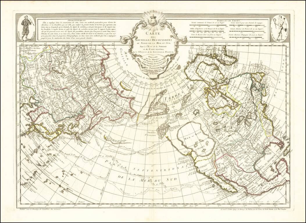
A Cartographic Landmark - The Most Complete Map of the North Pacific to Date and the Beginning of the Scientific Debate of the Sea of the West and Northwest Passage This is a fine example of a first edition of the landmark De L'Isle-Buache map of the...