
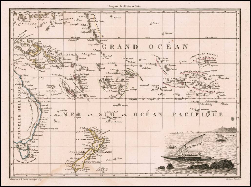
Decorative antique engraved map of the Eastern Pacific, from the Carolines, Eastern Australia, and Tasmania to the Marquesas, including all of New Zealand. Malte Brun's maps were extremely well researched, utilizing the most up to date information....
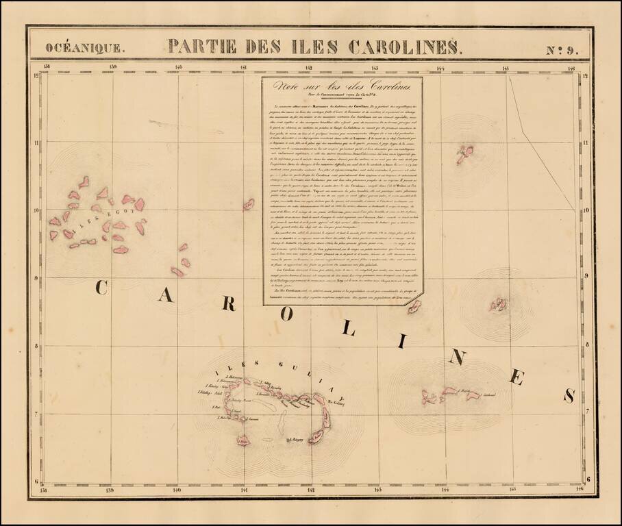
Highly detailed map of a portion of the Carolines, including Iles Guliay and Iles Egoy. Large text note included. Nice detail, especially for the period.
![[Micronesia- Marianas - Marshall Islands - Gilbert Islands] Carte de l'Archipel des Iles Carolines](/map/small/69190.jpg)
Large detailed map of the archipelago of the Caroline Islands located in Micronesia, engraved by Ambroise Tardieu and included in the official account of the Commander Duperrey during the expedition of the corvette La Coquille . The map also covers...
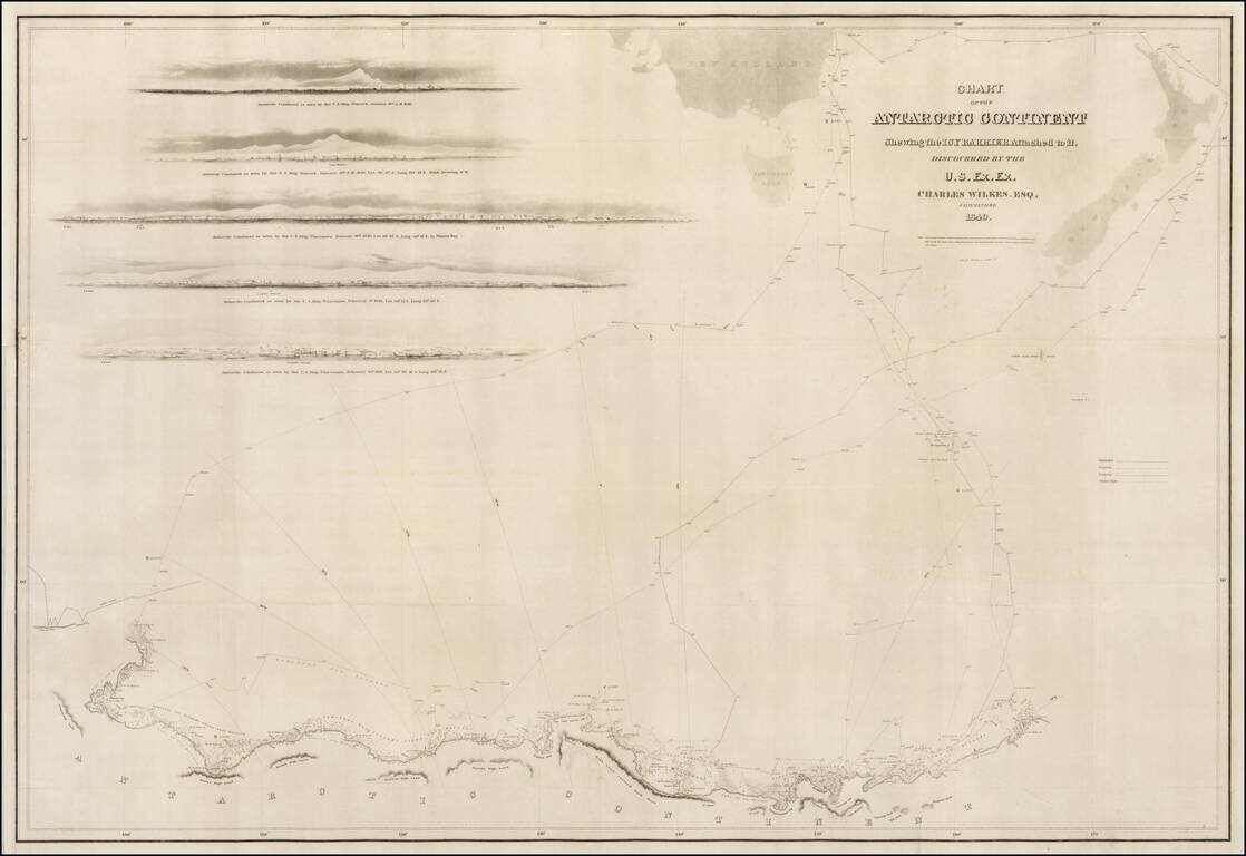
A good example of the Wilkes map of the Antarctic Regions, which accompanied the official account of Wilkes Expedition. The map includes the tracks of Wilkes' expedition, 5 profile views and an outline map of New Zealand and the Southern Tip of...
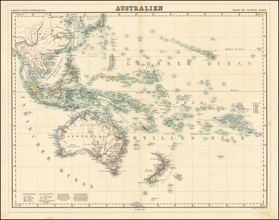
Nice example of Kiepert's fine early map of Australasia, published in 1869. The map extends from the Philippines and the China Sea to New Zealand, Hawaii, the Marquesas and the Society Islands.
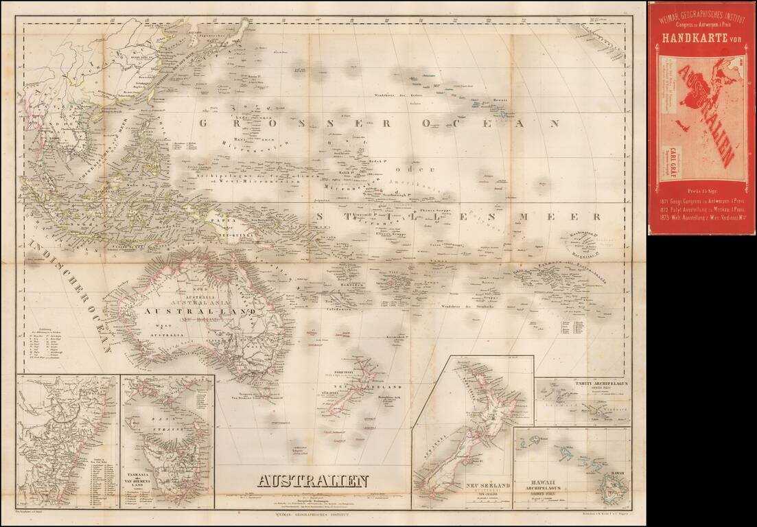
Separately published map of Oceana, bearing the imprint of Carl Graf. Includes inset maps of Hawaii, New Zealand, Oceana, Tahiti, Van Diemens Land and New South Wales.
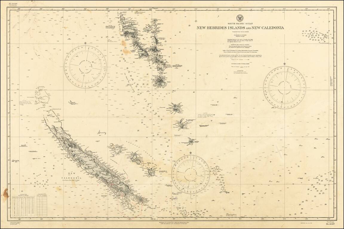
World War II chart of the New Hebrides Islands and New Caledonia, published by the U.S. Secretary of the Navy on the 4th of June 1943. The chart was originally published in December 1902, this is an updated version.
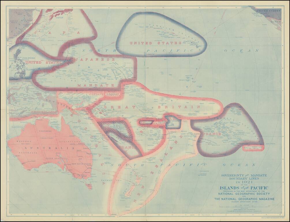
Fine map of the Pacific Ocean subsequent to the settlements agreed on territorial claims at the Peace Treaties after World War I. The best contemporary Pacific map of its era with the Island groups reflecting the loss of the German possessions of...