
![[Australia, Phiippines, New Zealand, Hawaii] Oceanica 1828](/map/small/61780.jpg)
Rare Italian Map of the South Pacific, extending from Australia and the Philippines in the east to Hawaii and the Marquesas in the west, The map illustrates the recent discoveries in Australia and provides good detail in Australia and a good sense of...

Fine example of Johannes Van Loons' sea chart of the Pacific Ocean, extending from Australia, New Zealand and Japan to California. Van Loon's chart is among the earliest regional maps to focus on the Dutch discoveries in New Zealand and Australia. Van...
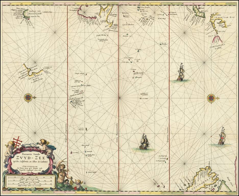
Rare Dutch Sea Chart of the Pacific Fine old color example of Pieter Goos' sea chart of the Pacific Ocean, extending from Australia, New Zealand and Japan to California. Oriented with west at the top, Goos's chart is among the earliest regional maps...
![A Chart of the South Sea [1st English Map of the Pacific Ocean]](/map/small/47376.jpg)
Unrecorded state of John Seller's map of the Pacific Ocean, the first English map of the Pacific. John Seller's map of the Pacific Ocean is the first English map of the Pacific. First issued in 1675, it is a map of exceptional rarity and importance...
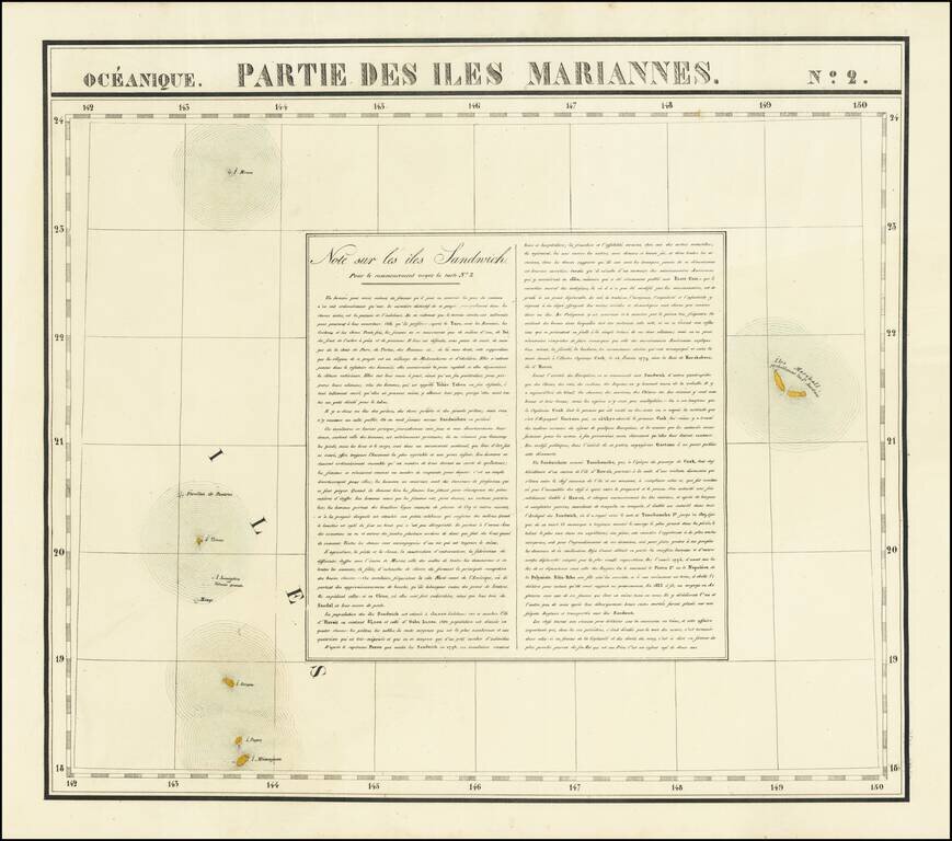
Interesting antique hand-colored lithographed map of the Marshall Islands, with a detailed description of Hawaii ("Note sur les iles Sandwich"). The map shows two "Iles Marshall" and speculates that they are probably the Jardine islands. The islands...
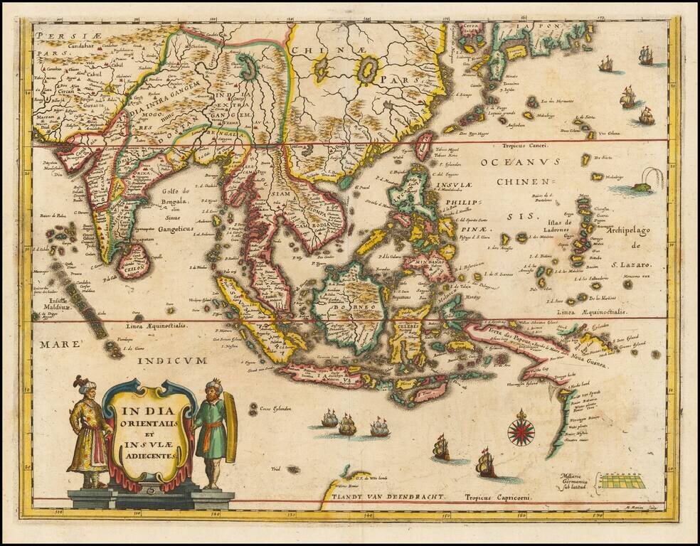
Southeast Asia with an Early Depiction of Northwestern Australia Based on Gerrit Frederikszoon de Witt's Discoveries in 1628 Scarce decorative map of Southeast Asia, China, India, the Philippines and western Oceana, along with the newly discovered...
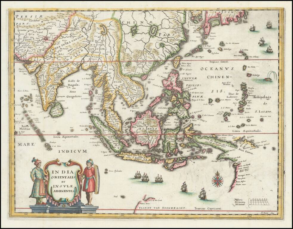
Southeast Asia with an Early Depiction of Northwestern Australia Based on Gerrit Frederikszoon de Witt's Discoveries in 1628 This is a scarce decorative map of Southeast Asia, China, India, the Philippines, and western Oceania. Perhaps the most...
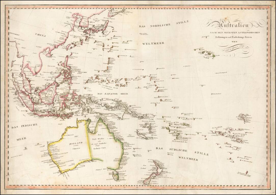
Fine early map of Oceana and Southeast Asia, published in Vienna by Tranquillo Mollo. Mollo's map includes a marvelous early depiction of Neu Holland vormals Ulimaroa. The coastline of Australia is still incomplete andther is no detail in the...
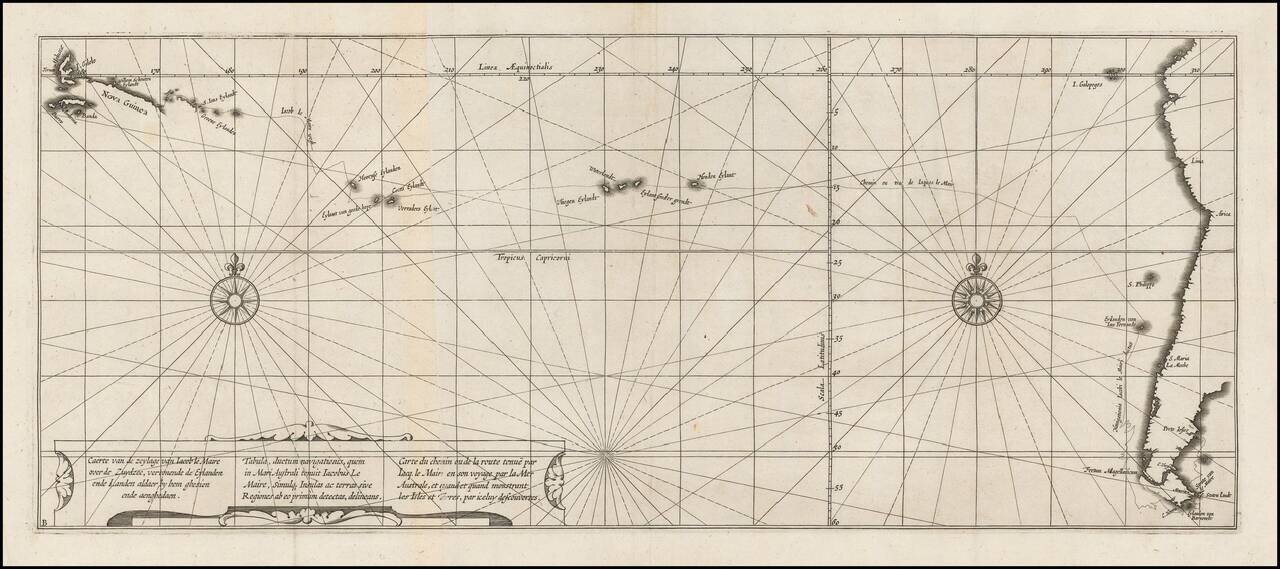
Nice example of the map illustrating the route of Wilhelm Schouten and Jacob Le Maire through the Straits of Le Maire and across the Pacific to the area northeast of Australia. Willem Cornelisz Schouten (1567-1625) was a navigator for the Dutch East...
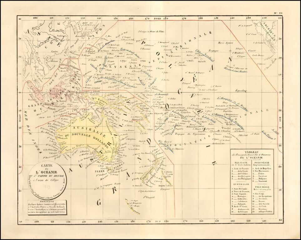
Rare large format map of Oceania and the Pacific which was apparently prepared for instructional purposes. An early example of lithography on French maps, perhaps the earliest we have ever seen. This is the first time we have offered this map.
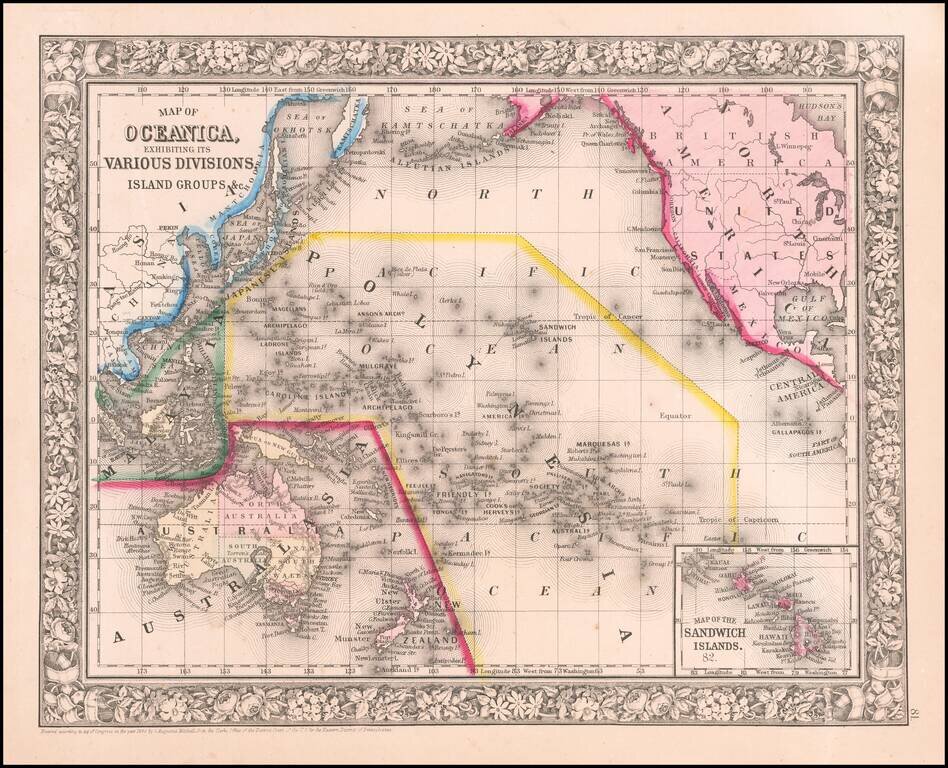
Attractive map of islands showing inset of the Sandwich Islands [Hawaiian Islands]. An excellent Civil War vintage map. Includes a decorative floral border. SA Mitchell Jr. acquired his father's former business from DeSilver in 1860 and relaunched a...

Cook’s Map of the Southern Hemisphere, Highlighting Historic Exploration toward Antarctica--French Edition French edition of Cook’s highly-detailed, large-format map of the Southern Hemisphere, showing the tracks of major voyages of exploration in...
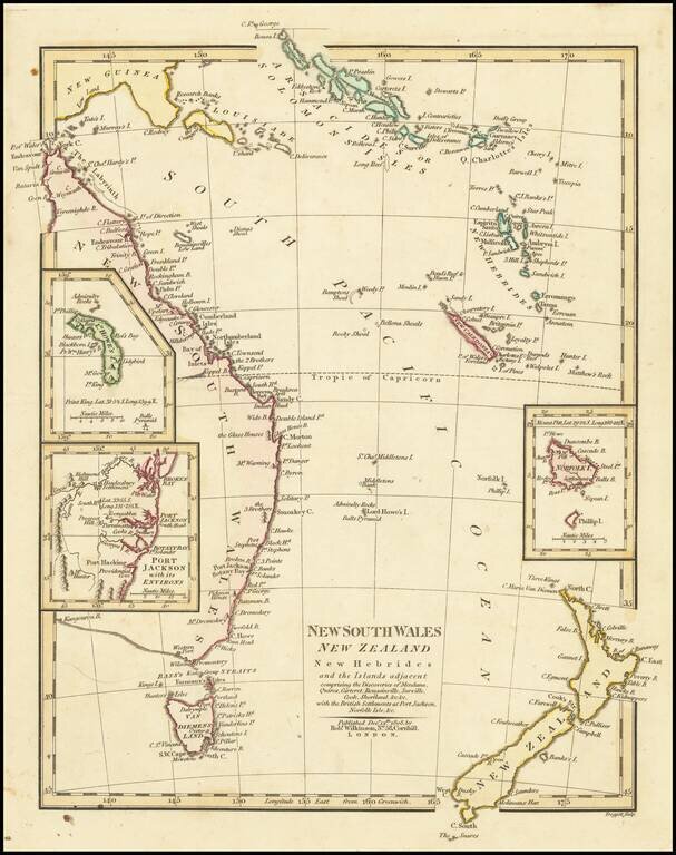
Interesting regional map of Eastern Australia and New Zealand, published by Robert Wilkinson. The map extends from the Solomon and Queen Charlotte Island in the North to New South Wales and New Zealand. Includes large insets of L. Howes and Norfolk...
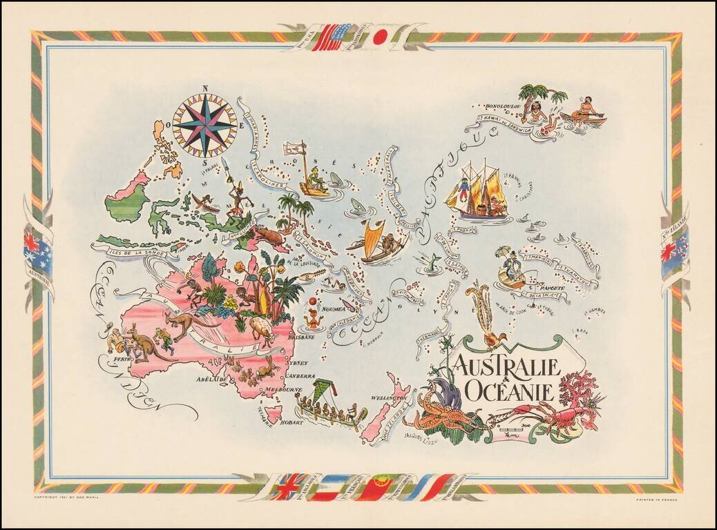
Decorative map of Australia, the Philippines, New Guinea, New Zealand and the South Pacific, published by Jacques Lizou. Lizou published a number of maps in this style in 1951, including maps of the French provinces, etc.
![[The Spanish fleet in the Ladrone Islands]](/map/small/48713.jpg)
Antique engraving of the Spanish fleet interacting with Polynesian outriggers and sailing vessels in the vicinity of Guam. The engraving was page 475 from Newe Welt und Americanische Historien by Johann Ludwig Gottfried, published by Mattaeus Merian,...