
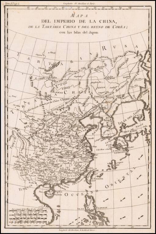
18th Century Spanish Map of China, &c. Rare Spanish map of China, Tartary and Korea, published by the Duke of Almodovar in Madrid. The map appeared in Volume 5 of Historia politica de los establecimientos ultramarinos de la nacionales Europeas,...
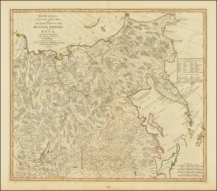
Highly detailed map of the Russian Empire in Asia, from a scarce atlas by Bowles & Carver.
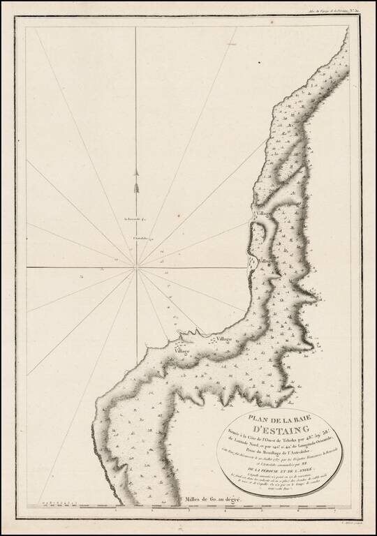
Detailed plan of the Uglegorsk Region, from first official account of the Voyage of La Perouse.
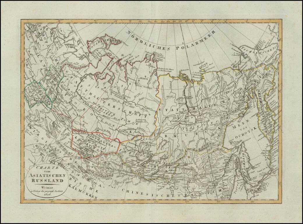
Scarce map of Russian Asia, published in Weimar in 1806.
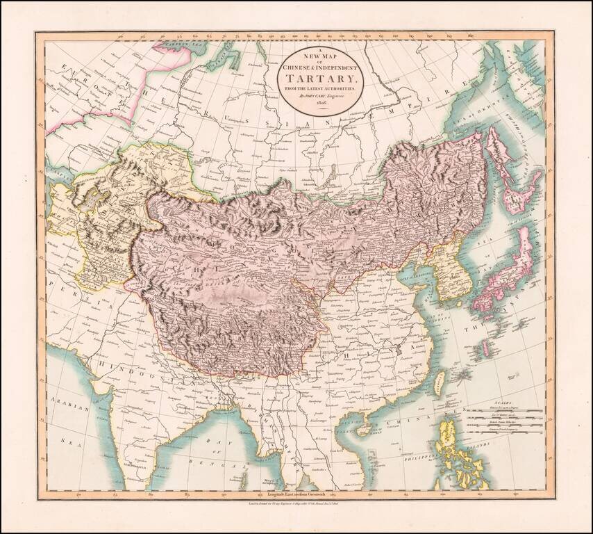
Antique Map of Central and Eastern Asia, from the Caspian Sea to China A marvelous map of Chinese Tartary, Corea and Japan. Includes nice detail and notes in the interior of Mongolia. Shows towns, rivers, mountains, lakes and other features.
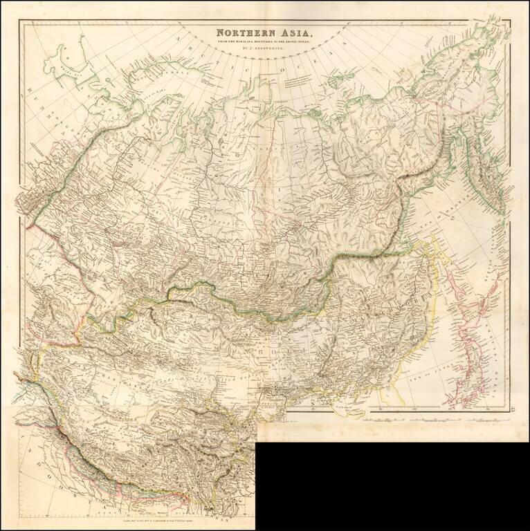
Striking example of Arrowsmith's rare map the region North of the Himalayas. A highly detailed map of Northern Asia, taking in Mongolia, Tibet, Bhutan, Tartary, Siberia and Manchuria. Part of Japan engraved also. The map provides a highly detailed...
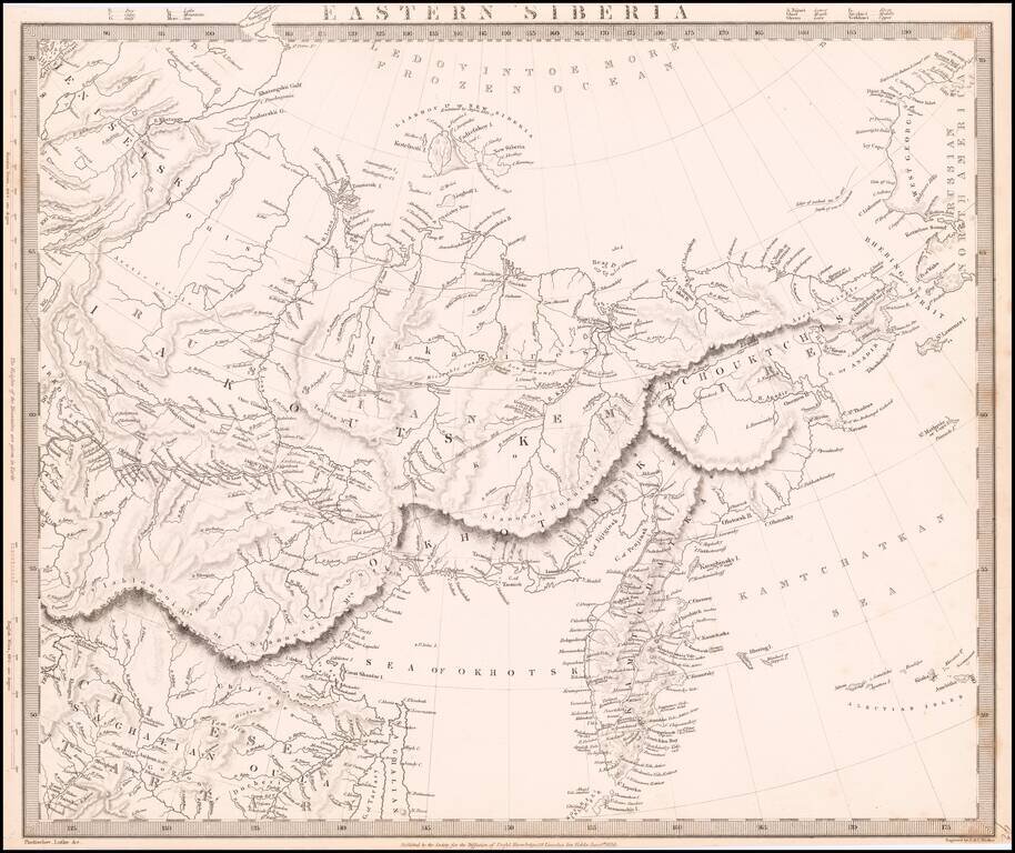
Detailed map of the Eastern Part of Siberia, issued by the Society for the Diffusion of Useful Knowledge (SDUK).
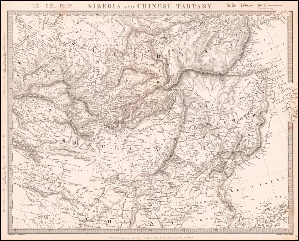
Detailed map of Siberia, Mongolia, Manchuria, etc., issued by the Society for the Diffusion of Useful Knowledge (SDUK).
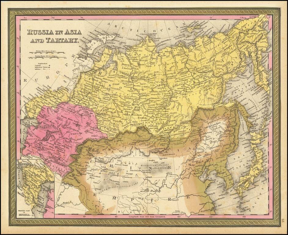
Detailed map of Russia, Tartaria and China, extending to Corea and Japan. Decorative border. An excellent map from the leading American mapmaker of the mid-19th Century.
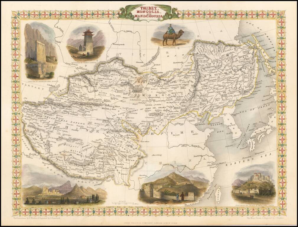
Striking full color example of this marvelous regional map. Extends to Nepal and Lake Balkach. Decorative vignettes of Dwelling of Tessaling Lama, Shigatei, Mausoleum At Teshoo Loom Boo, a Mongol Noble riding a camel, Fortress and Palace of the Dalai...
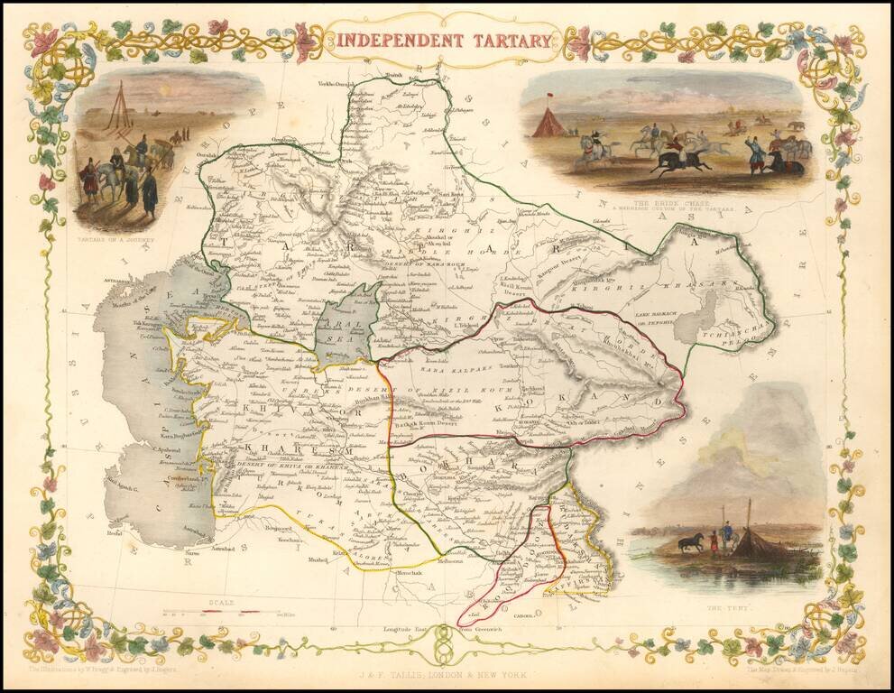
Striking full color map of Tartary, with vignettes of the Bride Chase, Tartars on the journey, and the Tent of those days. Engraved for R. Montgomery Martin's Illustrated Atlas. Tallis was one of the last great decorative map makers. His maps are...
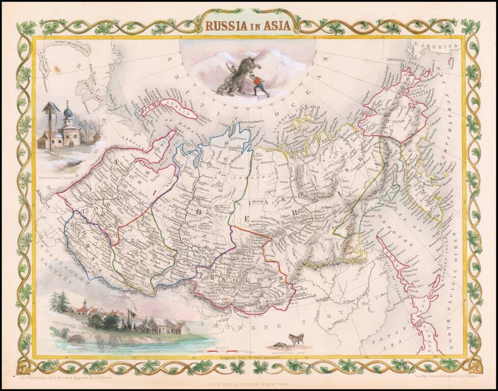
Decorative full color example of Tallis' decorative map of Russian Asia, with large vignettes of a polar hunting scene, Skorskarskoi Pagost, Troitsk and Kamchatkan Dogs. Engraved for R. Montgomery Martin's Illustrated Atlas. Tallis was one of the last...
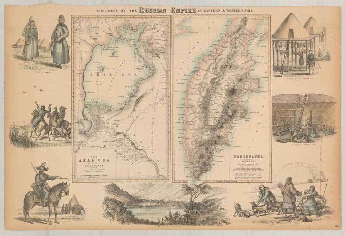
Decorative pair of maps on a single sheet, with the right sheet showing Kamtschatka according to Erman and the left sheet showing the Aral Sea according to Khanikoff. Large view at the bottom showing Petropaulovski. Decorative vignettes showing local...
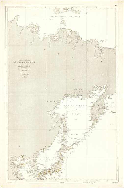
Rare Spanish Sea Chart of the Northeast Coast of Asia, published by the Spanish Hydrographical Department. The chart extends from Korea and the Yellow River to Kamtchatka.
Finely detailed map of Asian Russia and Western Siberia, illustrating Russian Exploration in the reigon. The map is based upon earlier maps by Faden and other mapmakers, and illustrates the explorations and routes of the following explorers of the...
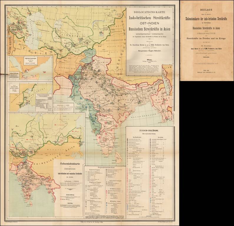
A Comprehensive Map of the Great Game. 4to, original ½ calf over blue paper boards, with original paper title label onlaid. Title, folding table, and large color-lithographed, German-language folding map covering central Asia and India, focusing on...