Map size in jpg-format: 1.67505MiB
Click to open in high resolution (open in new tab).
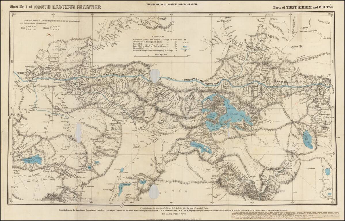
Rare Map of Northern India From the Trigonometrical Survey of India
Highly detailed map of parts of Tibet, Sikhim and Bhutan, from the Trigonometrical Survey of India, printed in Dehraban in February of 1885.
The map was part of the survey of the Nepal Border.
At the bottom right, a note is pasted on, describing two important trading routes in the region.
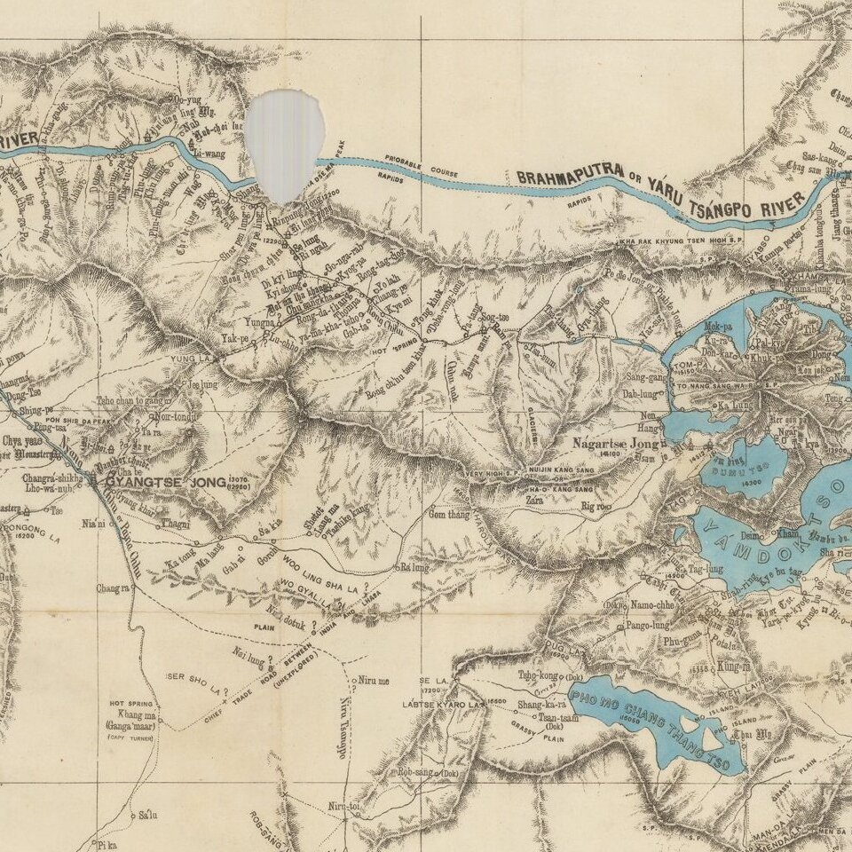
The map is centered on the Yamdoktso or Lake Palti (Yamhzo Yumco) and extends to just north of the Yarlang Zangbo River, with the city of Lhasa shown at the top right, Shigatse at the top left and Gyangtse-Jong at center left.
The key identifies:
If you are a student, write to us in telegram: @antiquemaps and indicate what material you need and for what work you need a map in high detail. We are ready to provide material on special terms. For students only!

![Il Disegno Della Terza Parte Dell' Asia [Gastaldi's Wall Map of SE Asia with extra panels!]](/map/small/30554hbp.jpg)
