Map size in jpg-format: 724350B
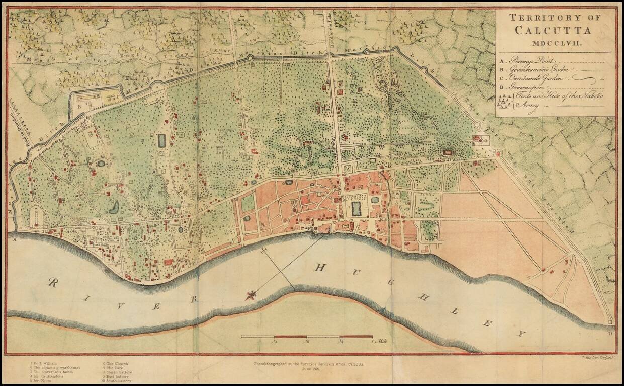
Scarce photo-lithograph of Thomas Kitchin's map of Calcutta, first issued in 1763.
The map provides a plan of the territory ceded to the East India Company by the Nawab of Bengal after the Battle of Plassey in June 1757. The Company acquired all the land within the Maratha Ditch (marked here) and 600 yards beyond it. After the British victory at the Battle of Plassey, Robert Clive, immediately set about building a stronger Fort William with modern defenses, and created the Maidan (the Parade Ground, now Calcutta's largest urban park) with the rest of the land.
The present example is a photo-lithographic reproduction of Kitchin's map, created in the office of the Surveyor General in Calcutta in 1868.
Both the original and this later printing are very rare. This is the first time we have ever offered the map and the first lithographic map we have handled produced in Calcutta by the Surveyor General of India.
If you are a student, write to us in telegram: @antiquemaps and indicate what material you need and for what work you need a map in high detail. We are ready to provide material on special terms. For students only!

![Il Disegno Della Terza Parte Dell' Asia [Gastaldi's Wall Map of SE Asia with extra panels!]](/map/small/30554hbp.jpg)
