
![Tabula VIII Asiae [Central Asia] (Title on Verso)](/map/small/31320.jpg)
Gorgeous Ptolemaic map of Central Asia and Tartary and Western China, from Lorenz Fries' edition of Ptolemy's Geographia. This map is largely based on the 1513 map by Waldseemuller. Lorenz (Laurent) Fries was born in Alsace in about 1490. He studied...
![Chinae, olim Sinarum regionis nova descriptio auctore Ludovico Georgio . . . 1584 [First State]](/map/small/71224.jpg)
First State of Ortelius' Map of China Old color example of the scarce first state of Ortelius' map of China, the first western map of China. Ortelius' map of China is taken directly from reports of the Portuguese mapmaker Luis Jorge de Barbuda...
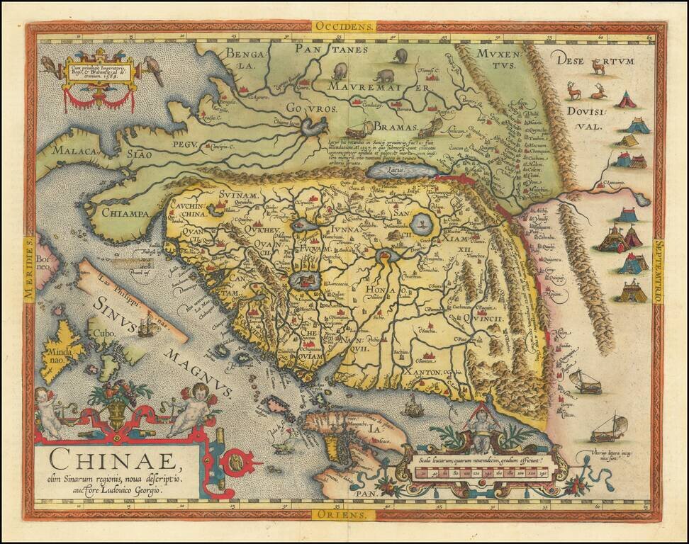
Fine example of the second state of Ortelius' map of China, the first western map of China. Ortelius' map of China is taken directly from reports of the Portuguese mapmaker Luis Jorge de Barbuda (Ludovicus Georgius), who made a manuscript map of China...
Fine old color example of Gerard De Jode's map of Eastern Asia, published in 1593, Engraved by Joannes and Lucas van Deutecum, who's signature is in the lower left part. De Jode's map is drawn directly from the first (northern) two sheets of Giacomo...
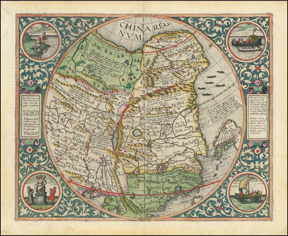
The Rarest and Most Coveted Map of China Published in the Sixteenth Century Striking example of De Jode's map of China, one of the earliest maps of China printed in Europe and the first map to begin to show the emergence of Korea on a printed map....
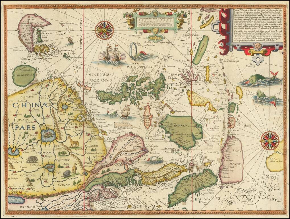
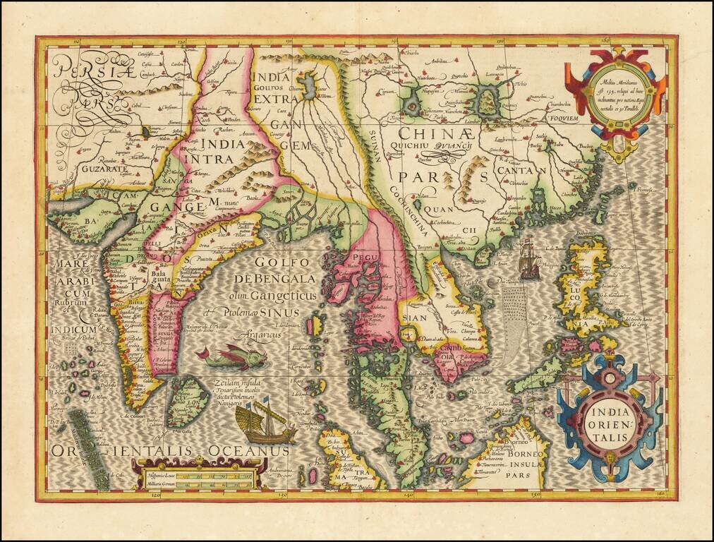
Linschoten's Important Regional Map of China and Southeast Asia Splendid, ornate, sixteenth-century map of China, Japan, Korea, Southeast Asia, the Philippines, the Straits of Malacca, Borneo, Java, and Beach, engraved by Henricus Van Langren for...
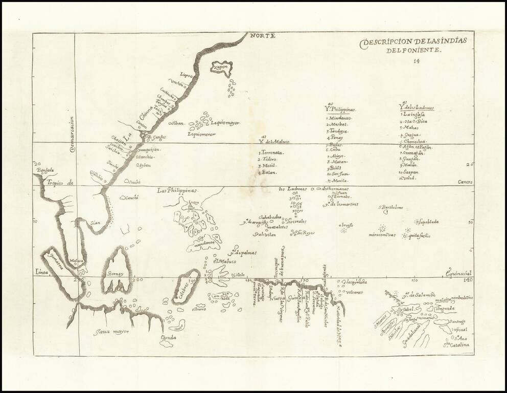
The First Spanish Map of Southeast Asia and The Philippines Fine example of this rare map of China, Southeast Asia, the Philippines, etc., which first appeared in Herrera's Descripcion de las Indias Ocidentales, first published in Madrid in 1601. The...
Fine example of Hondius' map of China and Southeast Asia, from a French edition of the Mercator-Hondius Atlas. One of the finest early Dutch maps of the region, first published in 1606 as one of the 37 new maps engraved for Jodocus Hondius' expanded...
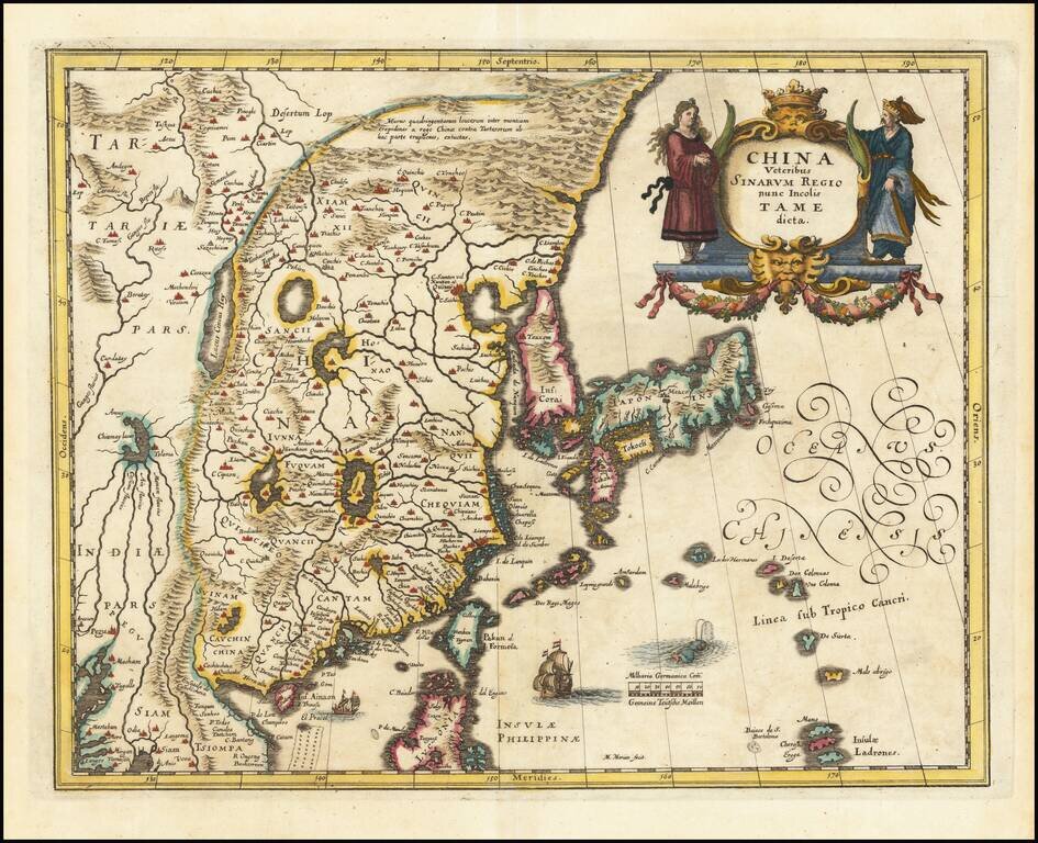
Decorative map of China, Japan and Korea and includes the north portion of the Philippines from Jansson's Novus Atlas. The map depicts the eastern part of China (bounded in the west by the Great Wall), Korea as an island and the three main islands of...
Decorative map of China, Japan, the Island of Korea, and the northern part of Luzon. Notes Pakan al I. Formosa Sailing ships and decorative cartouche. A very detailed and highly decorative map, based upon Blaeu's map of the same title.
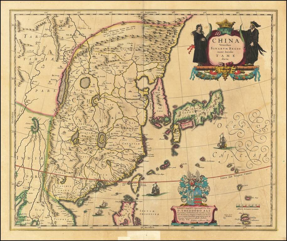
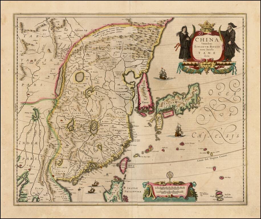
Blaeu's First Map of China Decorative map of China, Japan, Korea and including the north portion of the Philippines. The map depicts the eastern part of China (bounded in the west by the Great Wall), Korea as an island, and the three main islands of...
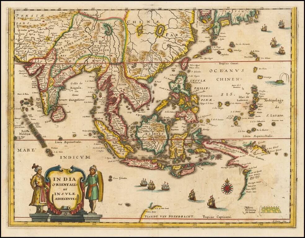
Southeast Asia with an Early Depiction of Northwestern Australia Based on Gerrit Frederikszoon de Witt's Discoveries in 1628 Scarce decorative map of Southeast Asia, China, India, the Philippines and western Oceana, along with the newly discovered...
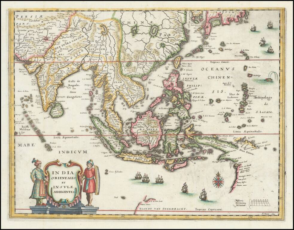
Southeast Asia with an Early Depiction of Northwestern Australia Based on Gerrit Frederikszoon de Witt's Discoveries in 1628 This is a scarce decorative map of Southeast Asia, China, India, the Philippines, and western Oceania. Perhaps the most...
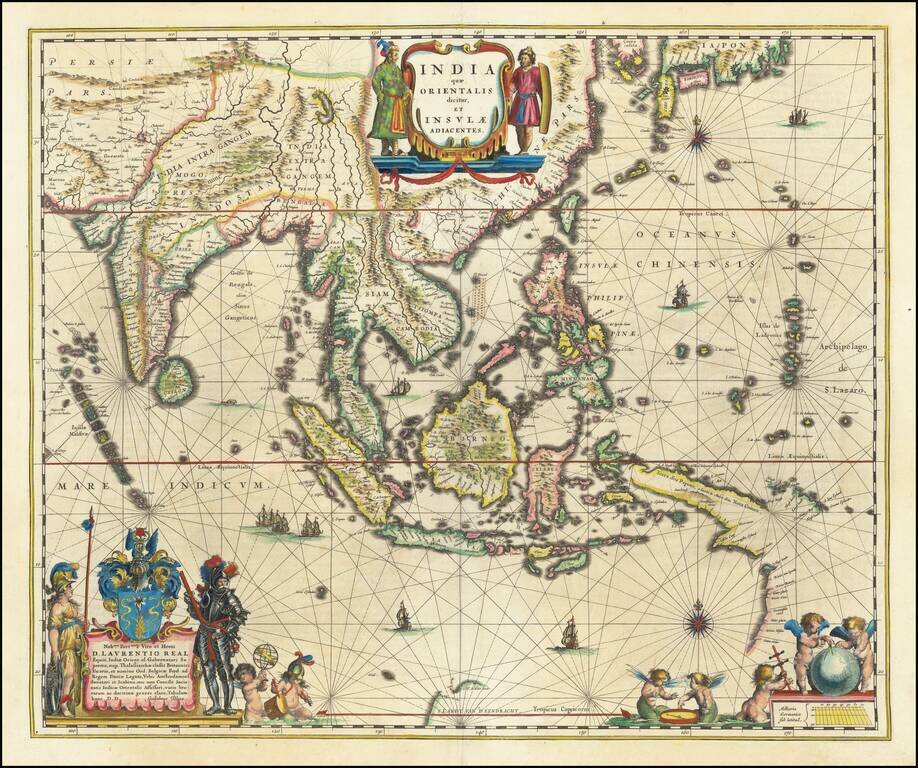
Blaeu's Detailed Map of Southeast Asia Showing Earliest Dutch Voyages to Encounter Australia Wide margined, old color example of Blaeu's map of Southeast Asia, extending from India to Tibet to Japan to New Guinea. The map is richly embellished and is...
![[Hangchow] Xuntien alias Quinzay](/map/small/69890.jpg)
Scarce early and unusual plan of the Chinese city of Quinzay [Hangchow], based upon the magnificent account given by Venetian Marco Polo in the late 12th Century of the great city of Quinzay. Quinzay is derived from the Chinese name King-sze meaning...
![Les Isles Philippines Molucques et de la Sonde . . . 1654 [Includes Taiwan & Singpore]](/map/small/50422.jpg)
Sanson's Map of the Philippines, &c. Early map of the region bounded by Taiwan in the north, Cambodia, the Straits of Malaca, Sumatra the Northwest Coast of Australia and the Ladrones, centered on the Philippines. One of the earliest maps of the...